Eagan, Tennessee | |
|---|---|
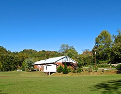 Clearfork Community Institute | |
 Eagan  Eagan | |
| Coordinates: 36°33′07″N83°58′37″W / 36.55194°N 83.97694°W | |
| Country | United States |
| State | Tennessee |
| County | Claiborne Campbell |
| Elevation | 1,089 ft (332 m) |
| Time zone | UTC-5 (Eastern (EST)) |
| • Summer (DST) | UTC-4 (EDT) |
| ZIP code | 37730 |
| Area code | 423 |
| GNIS feature ID | 1283282 [1] |
Eagan is an unincorporated community in Claiborne County and Campbell County, Tennessee, in the Cumberland Mountains of the southeastern United States. [1] It lies along State Route 90 just west of Clairfield in the Clearfork Valley. A former coal mining town, Eagan was likely named for either a mining company official or a minister. [2] The Eagan Mountain (King Mountain) surface coal mine, operated by Mountainside Coal Company, is located in Claiborne County near Eagan. [3]
Eagan is home to several small business, churches, and a community center, the Clearfork Community Institute. [4] It also has its own post office, with ZIP code 37730. [5]

