Caryville, Tennessee

Last updated

Caryville, Tennessee
Caryville-Main-Street-tn1.jpg
Main Street in Caryville
Campbell County Tennessee Incorporated and Unincorporated areas Caryville Highlighted 4711360.svg
Location of Caryville in Campbell County, Tennessee.
Coordinates: 36°19′12″N84°12′58″W / 36.32000°N 84.21611°W / 36.32000; -84.21611
Country United States
State Tennessee
County Campbell
Area
[1]
  Total5.83 sq mi (15.10 km2)
  Land5.56 sq mi (14.39 km2)
  Water0.27 sq mi (0.71 km2)
Elevation
1,093 ft (333 m)
Population
 (2020) [2]
  Total2,212
  Density398.06/sq mi (153.70/km2)
Time zone UTC-5 (Eastern (EST))
  Summer (DST) UTC-4 (EDT)
ZIP code
37714, 37756, 37847
Area code 423
FIPS code 47-11360 [3]
GNIS feature ID1279837 [4]
Website Official website

Caryville is a town in Campbell County, Tennessee, United States. The population was 2,297 at the 2010 census.

Contents

History

Originally known as Wheeler's Station, the town was renamed in honor of Judge William Carey, a prominent local landowner, in 1866. [5]

Geography

Caryville is situated in a valley between Cross Mountain to the west and a series of rugged hills to the east. Cove Lake State Park lies immediately north of the town, and includes an artificial lake created by the impoundment of Cove Creek by Caryville Dam. Two major federal highways, Interstate 75 and U.S. Route 25W, intersect in Caryville.

According to the United States Census Bureau, the town has a total area of 5.5 square miles (14 km2), of which, 5.2 square miles (13 km2) of it is land and 0.2 square miles (0.52 km2) of it (4.58%) is water. [6]

Demographics

Historical population
CensusPop.Note
1880 212
1970 648
1980 2,039214.7%
1990 1,751−14.1%
2000 2,24328.1%
2010 2,2972.4%
2020 2,212−3.7%
Sources: [7] [8] [2]

2020 census

Caryville racial composition [9]
RaceNumberPercentage
White (non-Hispanic)2,09194.53%
Black or African American (non-Hispanic)30.14%
Native American 50.23%
Asian 70.32%
Other/Mixed 763.44%
Hispanic or Latino 301.36%

As of the 2020 United States census, there were 2,212 people, 925 households, and 653 families residing in the town.

2000 census

As of the census [3] of 2000, there were 2,243 people, 897 households, and 644 families residing in the town. The population density was 431.0 inhabitants per square mile (166.4/km2). There were 999 housing units at an average density of 192.0 per square mile (74.1/km2). The racial makeup of the town was 97.15% White, 0.27% African American, 0.53% Native American, 0.27% Asian, 0.18% Pacific Islander, 0.76% from other races, and 0.85% from two or more races. Hispanic or Latino of any race were 2.50% of the population.

There were 897 households, out of which 33.2% had children under the age of 18 living with them, 54.7% were married couples living together, 12.8% had a female householder with no husband present, and 28.2% were non-families. 24.5% of all households were made up of individuals, and 11.5% had someone living alone who was 65 years of age or older. The average household size was 2.50 and the average family size was 2.95.

In the town, the population was spread out, with 24.5% under the age of 18, 9.1% from 18 to 24, 31.1% from 25 to 44, 22.5% from 45 to 64, and 12.8% who were 65 years of age or older. The median age was 35 years. For every 100 females, there were 96.1 males. For every 100 females age 18 and over, there were 94.5 males.

The median income for a household in the town was $28,307, and the median income for a family was $32,604. Males had a median income of $25,094 versus $19,500 for females. The per capita income for the town was $14,452. About 14.6% of families and 17.0% of the population were below the poverty line, including 23.7% of those under age 18 and 14.7% of those age 65 or over.

Economy

Caryville's economy consists mostly of restaurants, hotels and motels along the town's two exits (134 and 141) of Interstate 75.

Cove Lake State Park located in the town limits also provides revenue for the town.

Related Research Articles

<span class="mw-page-title-main">Campbell County, Tennessee</span> County in Tennessee, United States

Campbell County is a county in the U.S. state of Tennessee. It is located on the state's northern border in East Tennessee. As of the 2020 census, its population was 39,272. Its county seat is Jacksboro. Campbell County is included in the Knoxville metropolitan statistical area.

<span class="mw-page-title-main">Old Saybrook Center, Connecticut</span> Census-designated place in Connecticut, United States of America

Old Saybrook Center is the primary village and a census-designated place (CDP) in the town of Old Saybrook, Middlesex County, Connecticut, United States. The population was 2,278 at the 2020 census, out of 10,481 in the entire town of Old Saybrook. The CDP includes the traditional town center and the peninsula known as Saybrook Point.

<span class="mw-page-title-main">Westville, Florida</span> Town in the state of Florida, United States

Westville is a town in Holmes County, Florida, United States. The Town of Westville is part of the Florida Panhandle in North Florida. As of the 2020 census, the town had a population of 261, down from 289 at the 2010 census. From 2010 to 2020, Westville's population growth percentage was -9.7%.

<span class="mw-page-title-main">Caryville, Florida</span> Town in the state of Florida, United States

Caryville is a town in Washington County, Florida, United States located along the Choctawhatchee River. The Town of Caryville is part of the Florida Panhandle in North Florida. The population was 301 at the 2020 census.

<span class="mw-page-title-main">Markle, Indiana</span> Town in Indiana, United States

Markle is a town in Huntington and Wells counties, in the U.S. state of Indiana. The population was 1,071 at the 2020 census. It lies along Interstate 69, U.S. Route 224, State Road 116 and State Road 3.

<span class="mw-page-title-main">Seneca, Kansas</span> City in Nemaha County, Kansas

Seneca is a city in and the county seat of Nemaha County, Kansas, United States. As of the 2020 census, the population of the city was 2,139.

<span class="mw-page-title-main">Beaver Cove, Maine</span> Town in the state of Maine, United States

Beaver Cove is a town in Piscataquis County, Maine, United States. The population was 133 at the 2020 census.

<span class="mw-page-title-main">Walnut Cove, North Carolina</span> Town in North Carolina, United States

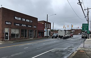
Walnut Cove is a town in Stokes County, North Carolina, United States. The population was 1,536 at the 2020 census.

<span class="mw-page-title-main">Bentleyville, Ohio</span> Village in Ohio, United States

Bentleyville is a village in Cuyahoga County, Ohio, United States. The population was 897 at the 2020 census. A suburb of Cleveland, it is a part of the Cleveland metropolitan area.

<span class="mw-page-title-main">Carey, Ohio</span> Village in Ohio, United States

Carey is a village in Wyandot County, Ohio, United States. The population was 3,565 at the 2020 census.

<span class="mw-page-title-main">Woodbury, Pennsylvania</span> Borough in Pennsylvania, United States

Woodbury is a borough in Bedford County, Pennsylvania, United States. The population was 286 at the 2020 census.

<span class="mw-page-title-main">Jacksboro, Tennessee</span> Town in Tennessee, United States

Jacksboro is a town in Campbell County, Tennessee, United States. The population was 2,306 at the 2020 census. It is the county seat of Campbell County.

<span class="mw-page-title-main">Sylvester, West Virginia</span> Town in West Virginia, United States

Sylvester is a town in Boone County, West Virginia, United States, along the Big Coal River. The population was 166 at the 2020 census. Sylvester was incorporated on April 11, 1952 by the Boone County Circuit Court. Sylvester bears the name of a family of settlers.

<span class="mw-page-title-main">Reedy, West Virginia</span> Town in West Virginia, United States

Reedy is a town in Roane County, West Virginia, United States. The population was 152 at the 2020 census.

<span class="mw-page-title-main">Rock Creek, Wisconsin</span> Town in Wisconsin, United States

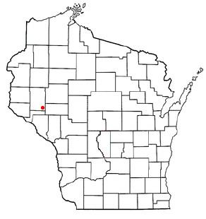
Rock Creek is a town in Dunn County, Wisconsin, United States. The population was 793 at the 2000 census. The unincorporated communities of Caryville and Rock Falls are located within the town. Located near Eau Claire the town has seen a great deal of recent suburban development in the corridor between the Chippewa River and Wis. 85.

<span class="mw-page-title-main">Alban, Wisconsin</span> Town in Wisconsin, United States

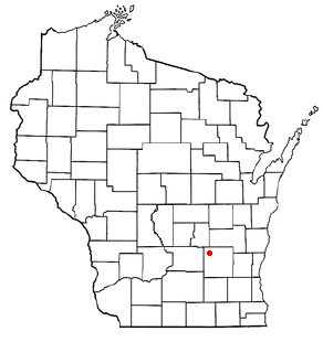
Alban is a town in Portage County, Wisconsin, United States. The population was 897 at the 2000 census. The unincorporated community of Alban is located within the town. The town was named after Civil War Colonel James S. Alban, a state senator in the early 1850s lost in the Battle of Shiloh. The Township is Town 25 North, Range 10 East, 4th Principal Meridian.

<span class="mw-page-title-main">Evant, Texas</span> Town in Texas, United States

Evant is a town in Coryell and Hamilton counties in central Texas, United States. The population was 426 at the 2010 census. The Coryell County portion of Evant is part of the Killeen–Temple–Fort Hood Metropolitan Statistical Area.

<span class="mw-page-title-main">Oakfield (village), New York</span> Village in New York, United States

Oakfield is a village in Genesee County, New York, United States. As of the 2010 census, the village population was 1,813. The village lies within the town of Oakfield in northern Genesee County. The village is at the intersection of Route 63 and Route 262. It is northwest of Batavia.

<span class="mw-page-title-main">Oakfield, New York</span> Town in New York, United States

Oakfield is a town in Genesee County, New York, United States. The population was 3,250 at the 2010 census. The name of the town is derived from a number of trees, including the oak. The town is on the northern border of Genesee County. Within the town is a village also named Oakfield.

<span class="mw-page-title-main">Fox Lake (town), Wisconsin</span> Town in Wisconsin, United States

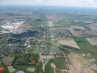
Fox Lake is a town in Dodge County, Wisconsin, United States. The population was 2,402 at the 2000 census. The City of Fox Lake is located within the town. The unincorporated communities of Delbern Acres, Fox Lake Junction, and Lyndon Dale are also located in the town.

References

  1. "ArcGIS REST Services Directory". United States Census Bureau. Retrieved October 15, 2022.
  2. 1 2 "Census Population API". United States Census Bureau. Retrieved October 15, 2022.
  3. 1 2 "U.S. Census website". United States Census Bureau . Retrieved January 31, 2008.
  4. "US Board on Geographic Names". United States Geological Survey. October 25, 2007. Retrieved January 31, 2008.
  5. Dallas Bogan, "Careyville Got Its Name From William Carey, Land Owner, County Judge, Freight Line Operator," TNGenWeb.org. Originally published in the LaFollette Press.
  6. "Caryville, TN Profile: Facts & Data".
  7. "Census of Population and Housing: Decennial Censuses". United States Census Bureau . Retrieved March 4, 2012.
  8. "Incorporated Places and Minor Civil Divisions Datasets: Subcounty Resident Population Estimates: April 1, 2010 to July 1, 2012". Population Estimates. U.S. Census Bureau. Archived from the original on June 11, 2013. Retrieved December 11, 2013.
  9. "Explore Census Data". data.census.gov. Retrieved December 27, 2021.

36°19′12″N84°12′58″W / 36.319933°N 84.21604°W / 36.319933; -84.21604