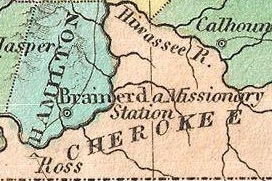
The Cherokee are one of the indigenous people of the Southeastern Woodlands. Prior to the 18th century, they were concentrated in southwestern North Carolina, southeastern Tennessee, and the tips of western South Carolina and northeastern Georgia.

The Trail of Tears was a series of forced relocations of Native Americans in the United States from their ancestral homelands in the Southeastern United States, to areas to the west that had been designated as Indian Territory. The forced relocations were carried out by government authorities following the passage of the Indian Removal Act in 1830. The relocated peoples suffered from exposure, disease, and starvation while en route to their new designated reserve, and many died before reaching their destinations. The forced removals included members of the Cherokee, Muscogee (Creek), Seminole, Chickasaw, Choctaw, and Ponca nations, as well as their African slaves. The phrase "Trail of Tears" originates from a description of the removal of many Native American tribes, including the infamous Cherokee Nation relocation in 1838.

Monroe County is a county located in the U.S. state of Tennessee. As of the 2010 census, the population was 44,519. Its county seat is Madisonville.

Carter County is a county located in the U.S. state of Tennessee. As of the 2010 census, the population was 57,424. Its county seat is Elizabethton. The county is named in honor of Landon Carter (1760-1800), an early settler active in the "Lost State of Franklin" 1784-1788 secession from the State of North Carolina.

Ducktown is a city in Polk County, Tennessee, United States. The population was 427 at the 2000 census and 475 at the 2010 census. It is included in the Cleveland Metropolitan Statistical Area.

The State of Franklin was an unrecognized and autonomous territory located in what is today Eastern Tennessee, United States. Franklin was created in 1784 from part of the territory west of the Appalachian Mountains that had been offered by North Carolina as a cession to Congress to help pay off debts related to the American War for Independence. It was founded with the intent of becoming the fourteenth state of the new United States.

The Holston River is a 136-mile (219 km) river that flows from Kingsport, Tennessee, to Knoxville, Tennessee. Along with its three major forks, it comprises a major river system that drains much of northeastern Tennessee, southwestern Virginia, and northwestern North Carolina. The Holston's confluence with the French Broad River at Knoxville marks the beginning of the Tennessee River.

The Cherokee National Forest is a large National Forest created on June 14, 1920 and managed by the U.S. Forest Service and encompassing some 655,598 acres (2,653.11 km2).
Dragging Canoe was a Cherokee war chief who led a band of disaffected Cherokee against colonists and United States settlers in the Upper South.

The Clinch River rises near Tazewell, Virginia, and flows southwest for more than 300 miles (480 km) through the Great Appalachian Valley, gathering various tributaries, including the Powell River, before joining the Tennessee River in Kingston, Tennessee.

Tellico Dam is a dam built by the Tennessee Valley Authority (TVA) in Loudon County, Tennessee on the Little Tennessee River just above the main stem of the Tennessee River. It impounds the Tellico Reservoir.

Chota is a historic Overhill Cherokee town site in Monroe County, Tennessee, in the southeastern United States. Developing after nearby Tanasi, from the late 1740s until 1788 Chota was the most important of the Overhill towns, replacing Tanasi as the de facto capital of the Cherokee people.

The Unaka Range is a mountain range on the border of Tennessee and North Carolina, in the southeastern United States. It is a subrange of the Appalachian Mountains and is part of the Blue Ridge Mountains physiographic province. The Unakas stretch approximately from the Nolichucky River to the south to the Watauga River to the north. The Unakas include the prominent Roan Highlands, where several summits rise above 6,000 feet. The Iron Mountains border the Unakas to the north, and the Bald Mountains border the Unakas opposite the Nolichucky to the south. The name unaka is rooted in the Cherokee term unega, meaning "white".

Standing Stone State Park is a state park in Overton County, Tennessee, in the southeastern United States. The park consists of 855 acres (3.46 km2) along the shoreline of the man-made 69-acre (0.28 km2) Standing Stone Lake. The 11,000-acre (45 km2) Standing Stone State Forest surrounds the park.

Cherokee Comprehensive High School is a secondary school within the Hawkins County School System near Rogersville, Tennessee, United States.
The Treaty With The Cherokee, 1798, also known as the First Treaty of Tellico, was signed on October 2, 1798, in the Overhill Cherokee settlement of Great Tellico near Tellico Blockhouse in Tennessee. This treaty served as an addendum to the Treaty of Holston and was the only treaty between the United States and Native Americans executed during the administration of President John Adams. The treaty was signed by Thomas Butler and George Walton, commissioners of the United States, and some thirty-nine Cherokee chiefs and warriors, in the presence of Silas Dinsmoor, Agent of the United States among the Cherokee, and thirteen other witnesses including Charles R. Hicks, who served as interpreter.
The Battle of Hightower in 1793 was part of the Cherokee–American wars, in which the Cherokee sought to defend their territory from illegal immigration by white settlers. This particular battle took place at the Cherokee village of High Town (Itawayi), overlooking Downtown Rome, GA in the modern Floyd County, Georgia, resulting in the defeat of the Cherokee by a force led by John Sevier, future Governor of Tennessee.
This timeline (present) events in the history of the Cherokee Nation, from its earliest appearance in historical records to modern court cases in the United States. Some basic content about the removal of other southeastern tribes to lands west of the Mississippi River is included. In a series of treaties, these tribes ceded land to the United States.

Cherokee removal, part of the Trail of Tears, refers to the forced relocation between 1836 and 1839 of the Cherokee Nation from their lands in Georgia, South Carolina, North Carolina, Tennessee, Texas, and Alabama to the Indian Territory in the then Western United States, and the resultant deaths along the way and at the end of the movement of an estimated 4,000 Cherokee.


