Related Research Articles

Sevier County is a county of the U.S. state of Tennessee. As of the 2020 census, the population was 98,380. Its county seat and largest city is Sevierville. Sevier County comprises the Sevierville, TN Micropolitan Statistical Area, which is included in the Knoxville-Morristown-Sevierville, TN Combined Statistical Area.

Jefferson County is an exurban county located in the U.S. state of Tennessee. As of the 2020 census, the population was 54,683. Its county seat is Dandridge. Jefferson County is part of the Morristown Metropolitan Statistical Area with neighboring Grainger and Hamblen counties. The county, along with the Morristown MSA, is included in the Knoxville-Morristown-Sevierville Combined Statistical Area.
The Foothills Parkway is a national parkway which traverses the foothills of the northern Great Smoky Mountains in East Tennessee, located in the southeastern United States. The 72.1-mile (114 km) parkway will connect U.S. Route 129 along the Little Tennessee River in the west with Interstate 40 (I-40) along the Pigeon River in the east.
Burchfiel Grove and Arboretum is an arboretum located on Hardin Lane, Sevierville, Tennessee. It is open daily without charge.
Alder Branch is an unincorporated community in Sevier County, Tennessee, United States. It is accessible via State Route 338, outside of the city of Sevierville. The area is named for the Alder Branch Baptist Church founded in 1836, which itself is named for the Alder Branch stream which flows through the area.


The Gatlinburg Arts and Crafts Community, also known as the Great Smoky Arts and Crafts Community, is a series of shops and galleries along an 8-mile two-laned loop in Sevier County, Tennessee east of Gatlinburg. It is set in a traditional setting of rural Appalachia, away from the town's activity, where artisans create their crafts and sell them.

Wears Valley is an unincorporated community in Sevier County, Tennessee that was formerly treated by the U.S. Census Bureau as a census county division. As of the 2000 Census, the population of Wears Valley was 6,486.

Kodak is an unincorporated community and a neighborhood of Sevierville in Sevier County, Tennessee, United States. It is located along State Highway 139 and State Highway 66, and just south of I-40 and Knoxville, Tennessee. The elevation of Kodak is about 896 feet above sea level.
Laurel is an unincorporated community, in Sevier County, Tennessee, on State Route 416 (Tennessee), north of U.S. Route 321, in the Great Smoky Mountains.

Wear Cove is a valley in southwestern Sevier County, Tennessee. It runs parallel to the Great Smoky Mountains National Park just to its south. Like other park border regions, the history and economy of the valley are intertwined with that of the Smokies. The primary community is Wears Valley.

The Alex Cole Cabin is a historic house in Sevier County, Tennessee, United States, along Roaring Fork within the Great Smoky Mountains National Park. The last remaining building of the community of Sugarlands, it was built by Albert Alexander "Alex" Cole (1870–1958). The cabin was originally located at 35°40′0″N83°31′17″W, across the Little Pigeon River from what is now the "Quiet Walkway" opposite the Huskey Gap Trailhead, just off Newfound Gap Road. After being placed on the National Register of Historic Places in the 1970s, the cabin was moved to the Jim Bales Place along the Roaring Fork Motor Nature Trail.

South Knoxville is the section of Knoxville, Tennessee, United States, that lies south of the Tennessee River. It is concentrated along Chapman Highway, Alcoa Highway, Maryville Pike, Sevierville Pike, and adjacent roads, and includes the neighborhoods of Lindbergh Forest, Island Home Park, Old Sevier, South Haven, Vestal, Lake Forest, South Woodlawn and Colonial Village. South Knoxville is connected to Downtown Knoxville via four vehicle bridges: the James C. Ford Memorial Bridge, the Gay Street Bridge, the Henley Bridge, by some incorrectly called the Henley Street Bridge, and the J. E. "Buck" Karnes Bridge. Parts of South Knoxville were annexed by Knoxville in 1917.
Engine Creek is a stream in Sevier County, Tennessee, in the United States. It is a tributary of the Little Pigeon River and lies wholly within Great Smoky Mountains National Park.
Bonny Kate is an unincorporated community in Knox County, in the U.S. state of Tennessee.
Styx Branch is a stream in Sevier County, Tennessee in the United States.
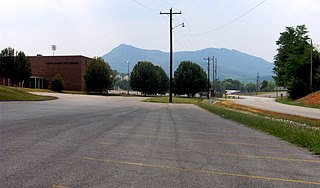
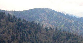
English Mountain is a mountain located in the western foothills of the Great Smoky Mountains region of East Tennessee. Rising to a peak of 3,629 feet, it is known for offering scenic fall colors within a convenient drive from Knoxville.
Richardson Cove is an unincorporated community in Sevier County, in the U.S. state of Tennessee.
References
- ↑ U.S. Geological Survey Geographic Names Information System: Oldham, Tennessee
- ↑ Jim Matheny, Why do they call it that? Boogertown in Sevier County, WBIR-TV, September 24, 2010
- ↑ Miller, Larry L. (2001). Tennessee Place-names. Indiana University Press. p. 155. ISBN 0-253-21478-5.
35°46′34″N83°28′56″W / 35.7762033°N 83.4821078°W
Municipalities and communities of Sevier County, Tennessee, United States | ||
|---|---|---|
| Cities |  | |
| Town | ||
| CDPs | ||
| Other communities | ||
| Footnotes | ‡This populated place also has portions in an adjacent county or counties | |