Kodak, Tennessee

Last updated

Kodak, Tennessee
Kodak
Kodak-Trade-Center-tn1.jpg
Intersection of Douglas Dam Road (TN-139) and Kodak Road in Kodak
USA Tennessee location map.svg
Red pog.svg
Kodak, Tennessee
Location within the State of Tennessee
Usa edcp location map.svg
Red pog.svg
Kodak, Tennessee
Kodak, Tennessee (the United States)
Coordinates: 35°58′28″N83°37′37″W / 35.97444°N 83.62694°W / 35.97444; -83.62694
Country United States
State Tennessee
County Sevier
City Sevierville
Elevation
896 ft (273 m)
Time zone UTC-5 (Eastern Time Zone)
  Summer (DST) UTC-4 (EDT)
ZIP code
37764
Area code 865
GNIS feature ID1290403 [1]

Kodak is an unincorporated community and a neighborhood of Sevierville [2] in Sevier County, Tennessee, United States. It is located along State Highway 139 and State Highway 66, and just south of I-40 and Knoxville, Tennessee. The elevation of Kodak is about 896 feet (273 meters) above sea level.

Contents

Kodak is included in Sevierville's urban growth boundary for future annexation. [3]

History

Kodak was named in 1892 when the local postmaster, Harvey N. Underwood, learned of the new "Kodak" brand of camera. Underwood decided that this was a name that was easy to remember and spell, hence he sought permission from the founder of Eastman Kodak, George Eastman, to use this name for his village and its post office. Eastman granted this permission. [4] In 1989, a new post office building was constructed on Highway 66. [5]

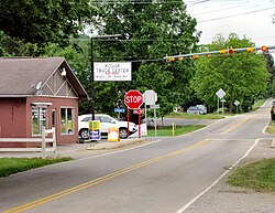
A large portion of Kodak along State Highway 66 and I-40 exit 407 has been annexed into the City of Sevierville since the 1990s. [6]

The Treaty of Dumplin Creek

The Treaty of Dumplin Creek was signed at Maj. Hugh Henry's fort, in the area that would become Kodak, on June 10, 1785, between the proposed, never-recognized State of Franklin and the Cherokee tribe of Native Americans. [7] [8] The precise location of the treaty signing is not known and has been subject of archaeological investigation. [8] According to a state historical marker placed at one site thought to be the location of the signing, commissioners involved in the treaty from the State of Franklin were John Sevier (namesake of the county in which Kodak sits), Alexander Outlaw and Daniel Kennedy. The marker identifies the Cherokee signers as "the King of the Cherokee, Ancoo of Chota, Abraham of Chilhowee, The Sturgeon of Tallassee, the Bard of the Valley Towns and some thirty others." [7] The treaty's effect was to open the East Tennessee counties of Blount, Hamblen, Jefferson, Knox and Sevier to white settlers and homesteaders without Native resistance. [8] [9] The historical marker incorrectly identifies this as the only treaty made by the State of Franklin, though there was at least one other (the Treaty of Coyatee, also with the Cherokee). [7]

Commerce

Exit 407 on Interstate 40 has many restaurants and several stores including national and various local shops. A Buc-ee's opened in 2023 and it claims to be the world's largest convenience store. [10] [11]

Education

Schools in Kodak are a part of Sevier County Schools.

Library

Points of interest

Related Research Articles

<span class="mw-page-title-main">Sevier County, Tennessee</span> County in Tennessee, United States

Sevier County is a county of the U.S. state of Tennessee. As of the 2020 census, the population was 98,380. Its county seat and largest city is Sevierville. Sevier County comprises the Sevierville, TN Micropolitan Statistical Area, which is included in the Knoxville-Morristown-Sevierville, TN Combined Statistical Area.

<span class="mw-page-title-main">Pigeon Forge, Tennessee</span> City in Tennessee, United States

Pigeon Forge is a mountain resort city in Sevier County, Tennessee, United States. As of the 2020 census, the city had a total population of 6,343. Situated just 5 miles (8 km) north of Great Smoky Mountains National Park, Pigeon Forge is a tourist destination that caters primarily to Southern culture and country music fans. The city's attractions include Dollywood and Dollywood's Splash Country, WonderWorks, Alcatraz East Crime Museum, as well as numerous gift shops, outlet malls, amusement rides, and musical theaters.

<span class="mw-page-title-main">Pittman Center, Tennessee</span> Town in Tennessee, United States

Pittman Center is a town in Sevier County, Tennessee, United States. The population was 454 at the 2020 census and 502 at the 2010 census. The town borders Gatlinburg and the Great Smoky Mountains National Park. U.S. 321 passes through the town.

<span class="mw-page-title-main">Sevierville, Tennessee</span> City in Tennessee, United States

Sevierville is a city in and the county seat of Sevier County, Tennessee, United States, located in eastern Tennessee. The population was 17,889 at the 2020 United States Census.

<span class="mw-page-title-main">Seymour, Tennessee</span> CDP in Tennessee, United States

Seymour is a census-designated place (CDP) and unincorporated community in Blount and Sevier counties in the U.S. state of Tennessee. The CDP population was 14,705 at the 2020 U.S. census. It is included in the Knoxville, Tennessee Metropolitan Statistical Area.

The State of Franklin was an unrecognized proposed state located in present-day East Tennessee, in the United States. Franklin was created in 1784 from part of the territory west of the Appalachian Mountains that had been offered by North Carolina as a cession to Congress to help pay off debts related to the American War for Independence. It was founded with the intent of becoming the 14th state of the new United States.

<span class="mw-page-title-main">John Sevier</span> Soldier, frontiersman and politician (1745-1815)

John Sevier was an American soldier, frontiersman, and politician, and one of the founding fathers of the State of Tennessee. A member of the Democratic-Republican Party, he played a leading role in Tennessee's pre-statehood period, both militarily and politically, and he was elected the state's first governor in 1796. He served as a colonel of the Washington District Regiment in the Battle of Kings Mountain in 1780, and he commanded the frontier militia in dozens of battles against the Cherokee in the 1780s and 1790s.

<span class="mw-page-title-main">French Broad River</span> River in North Carolina and Tennessee, United States

The French Broad River is a river in the U.S. states of North Carolina and Tennessee. It flows 218 miles (351 km) from near the town of Rosman in Transylvania County, North Carolina, into Tennessee, where its confluence with the Holston River at Knoxville forms the beginning of the Tennessee River. The river flows through the counties of Transylvania, Buncombe, Henderson, and Madison in North Carolina, and Cocke, Jefferson, Sevier, and Knox in Tennessee. It drains large portions of the Pisgah National Forest and the Cherokee National Forest.

<span class="mw-page-title-main">U.S. Route 411</span> Numbered U.S. Highway in Alabama, Georgia, and Tennessee in the United States

U.S. Route 411 (US 411) is an alternate parallel-highway associated with US 11. It extends for about 309.7 miles (498.4 km) from US 78 in Leeds, Alabama, to US 25W/US 70 in Newport, Tennessee. US 411 travels through northeastern Alabama, northwestern Georgia, and southeastern Tennessee. It is signed north-south, as with most highways that have odd numbers, but the route runs primarily in a northeast-southwest direction, and covers a more east-west mileage than it does north-south. Notable towns and cities along its route include Gadsden, Alabama; Rome, Georgia; Cartersville, Georgia; Maryville, Tennessee; Sevierville, Tennessee, and Newport, Tennessee.

The Great Smoky Mountains Parkway is a highway that travels 23.4 miles (37.7 km) between the Great Smoky Mountains National Park and Interstate 40 (I-40) in Kodak, Tennessee, in East Tennessee. It serves as the main thoroughfare for Gatlinburg, Pigeon Forge, and Sevierville, and includes a 4.3-mile (6.9 km) spur of the Foothills Parkway. It is composed of sections of a number of numbered highways, including U.S. Route 441 (US 441) and US 321 and State Route 66 (SR 66) and SR 448.

<span class="mw-page-title-main">Cherokee–American wars</span> Indian wars in the Old Southwest

The Cherokee–American wars, also known as the Chickamauga Wars, were a series of raids, campaigns, ambushes, minor skirmishes, and several full-scale frontier battles in the Old Southwest from 1776 to 1794 between the Cherokee and American settlers on the frontier. Most of the events took place in the Upper South region. While the fighting stretched across the entire period, there were extended periods with little or no action.

<span class="mw-page-title-main">Tennessee State Route 338</span> State highway in Tennessee, United States

State Route 338 is a secondary highway located entirely within Sevier County in East Tennessee. The road runs generally south–north although like most roads in East Tennessee it has numerous winding turns.

<span class="mw-page-title-main">Tennessee State Route 66</span> State highway in Tennessee, United States

State Route 66 is a state-maintained highway in eastern Tennessee, including a six-lane divided highway known as Winfield Dunn Parkway in Sevier County, a four-lane expressway in Hamblen and Jefferson counties and a two-lane rural collector through mountainous terrain continuing to the northeast terminus in Hancock County.

<span class="mw-page-title-main">Strawberry Plains, Tennessee</span> CDP in Tennessee, United States

Strawberry Plains is an unincorporated community and census-designated place (CDP) in Jefferson, Knox, and Sevier counties in the State of Tennessee, United States. Before 2010, it was treated by the United States Census Bureau as a census county division. It is included in both the Knoxville Metropolitan Statistical Area and the Morristown Metropolitan Statistical Area.

<span class="mw-page-title-main">WSEV-FM</span> Radio station in Gatlinburg, Tennessee

WSEV-FM operates as Sevier County's only local FM radio station. While other stations are licensed to Sevierville, their studios are based in Knoxville, Tennessee.

The Cherokee have participated in over forty treaties in the past three hundred years.

<span class="mw-page-title-main">Wheatlands (Sevierville, Tennessee)</span> Historic house in Tennessee, United States

Wheatlands is an antebellum plantation in Sevier County, in the U.S. state of Tennessee. The plantation's surviving structures— which include the plantation house, a storage shed, and smokehouse— have been placed on the National Register of Historic Places. The plantation house has been called "the best example of a Federal-style building remaining in Sevier County."

<span class="mw-page-title-main">Brabson's Ferry Plantation</span> Historic house in Tennessee, United States

Brabson's Ferry Plantation is a Pioneer Century farm and former antebellum plantation near the U.S. city of Sevierville, Tennessee. Located at what was once a strategic crossing of the French Broad River, by 1860 the plantation had become one of the largest in East Tennessee, and one of the few in the region that rivalled the large plantations of the Deep South in size and influence. The farm remains in operation, and several of its historic structures— including two plantation houses and an 18th-century plank house— have been added to the National Register of Historic Places.

Samuel Wear was an American War of Independence soldier who fought at the Battle of Kings Mountain. He was one of the early inhabitants of, and a founder of, the "Lost State of Franklin". He later helped draft the Constitution of the State of Tennessee.

Robert Hatton Hodsden was an American physician, planter, and politician who served three terms in the Tennessee House of Representatives. He worked as a government physician on the Cherokee removal in 1838, and served as president of the East Tennessee Medical Society in the mid-1850s. A Southern Unionist during the Civil War, Hodsden represented Sevier County at the East Tennessee Convention in 1861, and was later arrested by Confederate authorities.

References

  1. "Kodak, Tennessee". Geographic Names Information System . United States Geological Survey, United States Department of the Interior.
  2. "Neighborhood". Kodak Crossing. Retrieved February 14, 2021.
  3. "Urban Growth Plan - Sevier County" (PDF). Tennessee Advisory Commission on Intergovernmental Relations . State of Tennessee. February 2001. Retrieved February 14, 2021.
  4. Ancestorsafari: "Naming of Kodak Tennessee", May 7, 2011.
  5. [Historical Cookbook-Kodak Centennial sponsored by: Jake L. Gilreath page 3]
  6. "Annexation Growth". City of Sevierville . Retrieved September 2, 2020.
  7. 1 2 3 "Treaty of Dumplin Creek Historical Marker". www.hmdb.org. Retrieved July 19, 2021.
  8. 1 2 3 Collins, Katie (April 30, 2008). "Developer says Dumplin Creek not treaty site". www.knoxnews.com. Retrieved July 19, 2021.
  9. [Historical Cookbook-Kodak Centennial sponsored by: Annice Thomas page 49]
  10. https://www.wvlt.tv/2023/06/26/largest-buc-ees-country-opens-sevierville/
  11. https://www.thesmokies.com/bucees-sevierville/