White Pine, Tennessee

Last updated

White Pine
White Pine Tennessee 25E.jpg
S. State St./US 25E, facing north
Town of White Pine, TN Seal.webp
Motto: 
"Deeply Rooted in Heritage & Proudly Growing Toward the Future" [1]
Jefferson County Tennessee Incorporated and Unincorporated areas White Pine Highlighted 4780360.svg
Location of White Pine in Jefferson and Hamblen counties in Tennessee
Coordinates: 36°6′31″N83°17′31″W / 36.10861°N 83.29194°W / 36.10861; -83.29194
Country United States
State Tennessee
Counties Jefferson, Hamblen
Settled1780s [2]
Founded1870 [2]
Incorporated1915 [3]
Named for Eastern White Pine tree once prominently located in town's center [2]
Government
[4]
  Type Mayor-aldermanic
   Mayor Fred Taylor
  Aldermen
List of Aldermen
Area
[5]
  Total2.87 sq mi (7.44 km2)
  Land2.87 sq mi (7.44 km2)
  Water0.00 sq mi (0.00 km2)
Elevation
[6]
1,148 ft (350 m)
Population
 (2020) [7]
  Total2,471
  Density860.38/sq mi (332.16/km2)
Time zone UTC-5 (Eastern (EST))
  Summer (DST) UTC-4 (EDT)
ZIP code
37890
Area code 865
FIPS code 47-80360 [8]
GNIS feature ID2406879 [6] [9]
Website whitepinetn.gov

White Pine is a town in Jefferson and Hamblen counties in Tennessee, United States. [6] It is part of the Morristown metropolitan area. The population was 2,471 at the 2020 census. [10]

Contents

History

Before the settlement of the area by European settlers, the White Pine area was inhabited by an early group of Woodland Indians. The area was used by the group as a site for several large burial grounds and a trail used later by settlers of the community. [11]

European settlers first arrived in present day White Pine during the final years of the American Revolutionary War. The community was originally known as "Dandridge Crossing", based on its proximity to the Jefferson County seat, Dandridge. [11] After the American Civil War, a railroad route was constructed in the area, crossing a prominent stagecoach path. [11] The town was later founded in 1870 due to the growth of the area. [11] The town was renamed to White Pine in 1873, after a large pine tree that once stood along Main Street. [2] Twenty years later, White Pine was officially incorporated. [11]

In 1905, a major portion of the town's downtown district was lost in a major fire, leading to the later dissolution of the town, [12] [11] In 1915, White Pine incorporated once again into a town after the completion of rebuilding efforts in the central business district. [11] During the 19th and early 20th century, several businesses were established in the downtown area, including a medical clinic, a pharmacy, a hardware store, and a grocery store. [11]

In 1926, White Pine High School was built in the town. It remained operational until 1976. [11]

In 1963, construction began on Interstate 81 in White Pine. The later completion of I-81 prompted the relocation of businesses from White Pine's central business district to along the exits of I-81. [11]

Geography

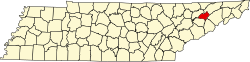
White Pine is located in northeastern Jefferson County at 36°6′31″N83°17′31″W / 36.10861°N 83.29194°W / 36.10861; -83.29194 (36.108500, -83.291869). [13] The town limits extend north to the Hamblen County line, crossing into Hamblen County at Interstate 81 exit 8.

According to the United States Census Bureau, the town has a total area of 2.6 square miles (6.8 km2), all land. [10]

It is about 40 miles (64 km) east of Knoxville. [14] The Southern and Southeastern border of White Pine runs along the Douglas Lake.

Demographics

Historical population
CensusPop.Note
1920 421
1930 51622.6%
1940 497−3.7%
1950 78056.9%
1960 1,03532.7%
1970 1,53248.0%
1980 1,90024.0%
1990 1,771−6.8%
2000 1,99712.8%
2010 2,19610.0%
2020 2,47112.5%
Sources: [15] [16] [7]

2020 census

White Pine racial composition [17]
RaceNumberPercentage
White (non-Hispanic)1,99880.86%
Black or African American (non-Hispanic)311.25%
Native American 40.16%
Asian 210.85%
Pacific Islander 80.32%
Other/Mixed 973.93%
Hispanic or Latino 31212.63%

As of the 2020 United States census, there were 2,471 people, 852 households, and 509 families residing in the town.

2000 census

As of the census [8] of 2000, there were 1,997 people, 828 households, and 579 families residing in the town. The population density was 786.7 inhabitants per square mile (303.7/km2). There were 886 housing units at an average density of 349.0 per square mile (134.7/km2). The racial makeup of the town was 95.74% White, 0.90% African American, 0.20% Native American, 0.20% Asian, 2.20% from other races, and 0.75% from two or more races. Hispanic or Latino of any race were 2.50% of the population.

In the town, the population was spread out, with 24.2% under the age of 18, 8.7% from 18 to 24, 27.8% from 25 to 44, 23.8% from 45 to 64, and 15.5% who were 65 years of age or older. The median age was 37 years. For every 100 females, there were 89.5 males. For every 100 females age 18 and over, there were 83.8 males.

The median income for a household in the town was $25,078, and the median income for a family was $31,464. Males had a median income of $26,944 versus $22,989 for females. The per capita income for the town was $12,605. About 14.7% of families and 19.0% of the population were below the poverty line, including 22.4% of those under age 18 and 20.1% of those age 65 or over.

Economy

Old Dominion Freight Line operates a regional logistics center in White Pine near exit 4 on I-81. [18]

White Pine is also home to the Walters State Community College Great Smokies Mountain Expo Center. The Expo Center includes a 98,000 square-foot pavilion with a 300' x 150' show ring, seating for 3,900. Opened in 1996, the Expo Center hosts over 60 events each year, including horse and livestock shows, BMX racing, boat and RV shows, concerts, high school and college graduation ceremonies and rodeos. [19]

Arts and culture

From 2019 to 2022, the town hosted the annual Lakeside of the Smokies Balloonfest, a hot air balloon festival dedicated to promoting the sport of hot air ballooning and the area's significant agriculture and heritage. [20] It is considered to be the largest hot air balloon festival in Tennessee. [21] Beginning in 2023 it moved to Dandridge. [22]

Education

Public school

White Pine School (K-8) in White Pine is operated by the Jefferson County Schools District. White Pine high school students attend Jefferson County High School in neighboring Dandridge along with other students in the Jefferson County Schools District. [23]

Private school

White Pine is also the location of Lakeway Christian Academy, a private Christian academy for students in grades 6-12. It opened in the summer of 2020. [24]

Transportation

White Pine has two exits on Interstate 81 (Exits 4 and 8). I-81 leads northeast 73 miles (117 km) to Bristol and southwest 6 miles (10 km) to its southern terminus at Interstate 40. Via I-81 and I-40, Knoxville is 41 miles (66 km) southwest of White Pine. [11]

Tennessee State Route 113 is White Pine's Main Street, runs northeast to US 25E and southwest 10 miles (16 km) to Dandridge. Tennessee State Route 341 (also known as White Pine Road, Roy Messer Highway and Old Airport Road) runs west to east through the western and southern parts of the town, connecting I-81 at Exit 4 with US 25E.

U.S. Route 25E/Tennessee State Route 32 runs south to north through the town and is known as State Street. US 25E leads north 8 miles (13 km) to Morristown and south 12 miles (19 km) to Newport. Tennessee State Route 66 runs through the a small portion of the western part of the town.

Media

Related Research Articles

<span class="mw-page-title-main">Jefferson County, Tennessee</span> County in Tennessee, United States

Jefferson County is an exurban county located in the U.S. state of Tennessee. As of the 2020 census, the population was 54,683. Its county seat is Dandridge. Jefferson County is part of the Morristown Metropolitan Statistical Area with neighboring Grainger and Hamblen counties. The county, along with the Morristown MSA, is included in the Knoxville-Morristown-Sevierville Combined Statistical Area.

<span class="mw-page-title-main">Hamblen County, Tennessee</span> County in Tennessee, United States

Hamblen County is a county located in the U.S. state of Tennessee. As of the 2020 census, the population was 64,499. Its county seat and only incorporated city is Morristown. Hamblen County is the core county of the Morristown, Tennessee Metropolitan Statistical Area, which includes Hamblen, Jefferson, and Grainger counties. The county and the Morristown MSA are included in the Knoxville-Morristown-Sevierville, TN Combined Statistical Area.

<span class="mw-page-title-main">Cocke County, Tennessee</span> County in Tennessee, United States

Cocke County is a county on the eastern border of the U.S. state of Tennessee. As of the 2020 census, the population was 35,999. Its county seat is Newport. Cocke County comprises the Newport, TN Micropolitan Statistical Area, which is part of the Knoxville-Morristown-Sevierville, Tennessee Combined Statistical Area.

<span class="mw-page-title-main">Jefferson County, Arkansas</span> County in Arkansas, United States

Jefferson County, Arkansas is a county located in the U.S. state of Arkansas in the area known as the Arkansas Delta that extends west of the Mississippi River. Jefferson County consists of five cities, two towns, and 20 townships. The county is bisected by the Arkansas River, which was critical to its development and long the chief transportation byway. In 2020, Jefferson County's population was estimated at 67,260. Its county seat and largest city is Pine Bluff. Jefferson County is included in the Pine Bluff metropolitan statistical area. The county seat and the most populous city is Pine Bluff.

<span class="mw-page-title-main">Dandridge, Tennessee</span> County seat of Jefferson County, Tennessee, United States

Dandridge is a town in and the county seat of Jefferson County, Tennessee. It had a population of 3,344 at the 2020 census. The town is part of the Morristown, Tennessee Metropolitan Statistical Area, which consists of Jefferson, Hamblen, and Grainger counties.

<span class="mw-page-title-main">Jefferson City, Tennessee</span> City in Jefferson County, Tennessee, United States

Jefferson City is a city in Jefferson County, Tennessee, United States. It is part of the Morristown Metropolitan Statistical Area. As of the 2020 census the population was 8,419.

<span class="mw-page-title-main">Corbin, Kentucky</span> City in Kentucky, United States

Corbin is a home rule-class city in Whitley, Knox and Laurel counties in the southeastern portion of the U.S. state of Kentucky. As of the 2020 census, the city population was 7,856.

<span class="mw-page-title-main">North Corbin, Kentucky</span> Census-designated place in Kentucky, United States

North Corbin is a census-designated place (CDP) in Laurel and Knox counties in the U.S. state of Kentucky. The population was 1,727 at the 2020 census down from 1,773 at the 2010 census. The census bureau also lists the Laurel County portion of North Corbin as a CCD with a population of 10,729.

<span class="mw-page-title-main">Morristown, Tennessee</span> Largest city and county seat of Hamblen County, Tennessee, United States

Morristown is a city in and the county seat of Hamblen County, Tennessee, United States. Morristown also extends into Jefferson County on the western and southern ends. The city lies within the Ridge and Valley of the Appalachians. The city's population was recorded to be 30,431 at the 2020 United States census. It is the principal city of the Morristown Metropolitan Statistical Area, which encompasses all of Grainger, Hamblen, and Jefferson counties. The Morristown metropolitan area is also part of the Knoxville-Morristown-Sevierville Combined Statistical Area.

<span class="mw-page-title-main">Bean Station, Tennessee</span> Lakeside town in Grainger and Hawkins counties, Tennessee

Bean Station is a town in Grainger and Hawkins of Tennessee, United States. As of the 2020 census, the population was 2,967. It is part of the Kingsport, Knoxville, and Morristown metropolitan statistical areas.

<span class="mw-page-title-main">U.S. Route 25E</span> Highway in Tennessee and Kentucky, United States

U.S. Route 25E (US 25E) is the eastern branch of US 25 from Newport, Tennessee, where US 25 splits into US 25E and US 25W, to North Corbin, Kentucky, where the two highways rejoin. The highway, however, continues as US 25E for roughly two miles (3.2 km) until it joins Interstate 75 (I-75) in the Laurel County community of North Corbin at exit 29. The highway serves the Appalachia regions of Kentucky's Cumberland Plateau and the Ridge-and-Valley section of East Tennessee, including the urbanized areas of Corbin and Middlesboro in Kentucky and Morristown in Tennessee.

<span class="mw-page-title-main">Interstate 81 in Tennessee</span> Section of Interstate Highway in Tennessee, United States

Interstate 81 (I-81) is part of the Interstate Highway System that runs 855.02 miles (1,376.02 km) northward from Dandridge, Tennessee, to the Thousand Islands Bridge at the Canadian border near Fishers Landing, New York. In Tennessee, I-81 serves the northeastern part of the state, running 75.66 miles (121.76 km) from its southern terminus with I-40 in Dandridge to the Virginia state line in Bristol. The route serves the Tri-Cities region of the state and the eastern parts of the Knoxville metropolitan area, terminating about 35 miles (56 km) east of Knoxville. I-81 bypasses most cities that it serves, instead providing access via interchanges with state and federal routes. It remains in the Ridge-and-Valley topographic region of the Appalachian Mountains for its entire length in Tennessee, and runs in a northeast to southwest direction.

<span class="mw-page-title-main">Tennessee State Route 66</span> State highway in Tennessee, United States

State Route 66 is a state-maintained highway in eastern Tennessee, including a six-lane divided highway known as Winfield Dunn Parkway in Sevier County, a four-lane expressway in Hamblen and Jefferson counties and a two-lane rural collector through mountainous terrain continuing to the northeast terminus in Hancock County.

<span class="mw-page-title-main">Knoxville metropolitan area</span> Metropolitan area in Tennessee, United States

The Knoxville metropolitan area, commonly known as Greater Knoxville, is a metropolitan statistical area (MSA) centered on Knoxville, Tennessee, the third largest city in Tennessee and the largest city in East Tennessee. It is the third largest metropolitan area in Tennessee. In 2020, the Knoxville metro area had a population of 879,773, and a population of 903,300 including Grainger County. The Knoxville–Morristown–Sevierville Combined Statistical Area (CSA) had a population of 1,156,861 according to the census bureau in 2020.

<span class="mw-page-title-main">Morristown metropolitan area</span> Metropolitan area based in Morristown, Tennessee, United States

The Morristown Metropolitan Statistical Area, commonly known as the Lakeway Area, as defined by the United States Census Bureau, is an area consisting of three counties - Grainger, Hamblen, and Jefferson - in eastern Tennessee, anchored by the city of Morristown. Grainger County is both in the Knoxville and Morristown Metropolitans. Including Grainger County, the 2020 census showed that the MSA had a population of 142,709.

<span class="mw-page-title-main">Tennessee State Route 32</span> State unsigned highway in Tennessee

State Route 32 is a state highway in East Tennessee. For most of its route, it is an unsigned companion route concurrent with U.S. Route 25E. The highway stretches 89 miles from the North Carolina state line to the Tennessee-Kentucky state line near the town of Cumberland Gap.

<span class="mw-page-title-main">Tennessee State Route 113</span> State highway in Tennessee, United States

State Route 113 is a north–south state highway in East Tennessee.

<span class="mw-page-title-main">Tennessee State Route 341</span> State highway in Tennessee, United States

State Route 341 is a 10.4-mile-long (16.7 km) state highway that travels within portions of Hamblen and Jefferson counties in the eastern portion of the U.S. state of Tennessee. It connects Talbott with White Pine.

<span class="mw-page-title-main">Tennessee State Route 343</span> State highway in Tennessee, United States

State Route 343 is a state highway in Morristown, Hamblen County in the U.S. state of Tennessee. It serves as connector from US 25E into downtown Morristown.

<span class="mw-page-title-main">East Tennessee Crossing Byway</span> National Scenic Byway in East Tennessee

The East Tennessee Crossing Byway is a 83-mile (134 km) National Scenic Byway in the U.S. state of Tennessee. Established in 2009, it is one of the newest byways in the National Scenic Byway system. The scenic byway traverses mostly along an unsigned concurrency of U.S. Route 25E/State Route 32 (US 25E/SR 32) in East Tennessee.

References

  1. "Homepage". Town of White Pine. Retrieved August 29, 2020.
  2. 1 2 3 4 David Noonkesser, "White Pine History Archived 2012-06-06 at the Wayback Machine ," Town of White Pine website. Retrieved: March 1, 2013.
  3. Tennessee Blue Book , 2005-2006, pp. 618-625.
  4. "White Pine". Municipal Technical Advisory Service. Retrieved August 4, 2020.
  5. "ArcGIS REST Services Directory". United States Census Bureau. Retrieved October 15, 2022.
  6. 1 2 3 "Town of White Pine". Geographic Names Information System . United States Geological Survey . Retrieved September 12, 2020.
  7. 1 2 "Census Population API". United States Census Bureau. Retrieved October 15, 2022.
  8. 1 2 "U.S. Census website". United States Census Bureau . Retrieved January 31, 2008.
  9. "US Board on Geographic Names". United States Geological Survey. October 25, 2007. Retrieved January 31, 2008.
  10. 1 2 "Geographic Identifiers: 2010 Census Summary File 1 (G001): White Pine town, Tennessee". American Factfinder. U.S. Census Bureau. Archived from the original on February 13, 2020. Retrieved January 26, 2018.
  11. 1 2 3 4 5 6 7 8 9 10 11 "White Pine, TN: Then and Now". Town of White Pine. January 14, 2020. Retrieved August 29, 2020.
  12. "History". Town of White Pine.
  13. "US Gazetteer files: 2010, 2000, and 1990". United States Census Bureau. February 12, 2011. Retrieved April 23, 2011.
  14. Botelho, Greg and Victor Blackwell. "Boy accused of fatally shooting girl after she wouldn't let him play with puppy." CNN . October 7, 2015. Retrieved on October 9, 2015.
  15. "Census of Population and Housing: Decennial Censuses". United States Census Bureau . Retrieved March 4, 2012.
  16. "Incorporated Places and Minor Civil Divisions Datasets: Subcounty Resident Population Estimates: April 1, 2010 to July 1, 2012". Population Estimates. U.S. Census Bureau. Retrieved December 11, 2013.
  17. "Explore Census Data". data.census.gov. Retrieved December 27, 2021.
  18. "Business". Town of White Pine. Retrieved August 29, 2020.
  19. "About -- Expo Center -- Walters State Community College".
  20. "About the Festival". Lakeside of the Smokies Balloonfest. Retrieved August 5, 2020.
  21. "Smokey Bear Balloon coming to White Pine balloon fest". Citizen Tribune. October 7, 2019. Retrieved August 5, 2020.
  22. https://www.lotsballoonfest.com/schedule-of-events/
  23. "Jefferson County School District". jc-tn.net. Retrieved June 25, 2020.
  24. Inman, Katie (July 26, 2020). "'It's been quite a challenge." Lakeway Christian Academy starts first school year during pandemic". WBIR-TV . Retrieved August 4, 2020.