National Register of Historic Places listings in Iowa

Last updated

Iowa counties (clickable) Iowa counties map.pngAdair CountyAdams CountyAllamakee CountyAppanoose CountyAudubon CountyBenton CountyBlawk Hawk CountyBoone CountyBremer CountyBuena Vista CountyBuchanan CountyCalhoun CountyCarroll CountyCass CountyCedar CountyCerro Gordo CountyCherokee CountyChicksaw CountyClarke CountyClay CountyClayton CountyClinton CountyCrawford CountyDallas CountyDavis CountyDecatur CountyDelaware CountyDes Moines CountyDickinson CountyDubuque CountyEmmet CountyFayette CountyFloyd CountyFranklin CountyFremont CountyGreene CountyGrundy CountyGuthrie CountyHamilton CountyHancock CountyHardin CountyHarrison CountyHenry CountyHoward CountyHumboldt CountyIda CountyIowa CountyJackson CountyJasper CountyJefferson CountyJohnson CountyJones CountyKeokuk CountyKossuth CountyLee CountyLinn CountyLouisa CountyLucas CountyLyon CountyMadison CountyMahaska CountyMarion CountyMarshall CountyMills CountyMitchell CountyMonona CountyMonroe CountyMontgomery CountyMuscatine CountyO'Brien CountyOsceola CountyPage CountyPalo Alto CountyPlymouth CountyPocahontas CountyPolk CountyPottawattamie CountyPoweshiek CountyButler CountyRinggold CountySac CountyScott CountyShelby CountySioux CountyStory CountyTama CountyTaylor CountyUnion CountyVan Buren CountyWapello CountyWarren CountyWashington CountyWayne CountyWebster CountyWinnebago CountyWinneshiek CountyWoodbury CountyWorth CountyWright County
Iowa counties (clickable)
Map all coordinates using: OpenStreetMap

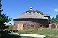
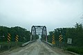
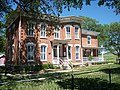
This is a list of properties and historic districts in Iowa that are listed on the National Register of Historic Places. There are listings in all of Iowa's 99 counties, adding up to over 2,300 total.

Contents

Contents: Counties in Iowa   (links in italic lead to a new page)
Adair | Adams | Allamakee | Appanoose | Audubon | Benton | Black Hawk | Boone | Bremer | Buchanan | Buena Vista | Butler | Calhoun | Carroll | Cass | Cedar | Cerro Gordo | Cherokee | Chickasaw | Clarke | Clay | Clayton | Clinton | Crawford | Dallas | Davis | Decatur | Delaware | Des Moines | Dickinson | Dubuque | Emmet | Fayette | Floyd | Franklin | Fremont | Greene | Grundy | Guthrie | Hamilton | Hancock | Hardin | Harrison | Henry | Howard | Humboldt | Ida | Iowa | Jackson | Jasper | Jefferson | Johnson | Jones | Keokuk | Kossuth | Lee | Linn | Louisa | Lucas | Lyon | Madison | Mahaska | Marion | Marshall | Mills | Mitchell | Monona | Monroe | Montgomery | Muscatine | O'Brien | Osceola | Page | Palo Alto | Plymouth | Pocahontas | Polk | Pottawattamie | Poweshiek | Ringgold | Sac | Scott | Shelby | Sioux | Story | Tama | Taylor | Union | Van Buren | Wapello | Warren | Washington | Wayne | Webster | Winnebago | Winneshiek | Woodbury | Worth | Wright


    This National Park Service list is complete through NPS recent listings posted January 12, 2024. [1]

Current listings by county

The following are approximate tallies of current listings by county. These counts are based on entries in the National Register Information Database as of April 24, 2008 [2] and new weekly listings posted since then on the National Register of Historic Places web site. [3] There are frequent additions to the listings and occasional delistings and the counts here are approximate and not official. New entries are added to the official Register on a weekly basis. [4] Also, the counts in this table exclude boundary increase and decrease listings which modify the area covered by an existing property or district and which carry a separate National Register reference number. The numbers of NRHP listings in each county are documented by tables in each of the individual county list-articles.

Phil Hoffman House, in Mahaska County Phil Hoffman House.jpg
Phil Hoffman House, in Mahaska County
Snake Alley, in Des Moines County SnakeAlley BurlingtonIA.jpg
Snake Alley, in Des Moines County
Lock and Dam No. 14 Historic District, in Scott County Mississippi River Lock and Dam number 14.jpg
Lock and Dam No. 14 Historic District, in Scott County
Grotto of the Redemption, in Palo Alto County Grotto of the Redemption.jpg
Grotto of the Redemption, in Palo Alto County
Merchants' National Bank in Poweshiek County, designed by Louis Sullivan LSGrinnell7.jpg
Merchants' National Bank in Poweshiek County, designed by Louis Sullivan
Howes Building, in Clinton County Howes Building.JPG
Howes Building, in Clinton County
Fourth Street Historic District, in Woodbury County 091607-SiouxCity-Historic4th.jpg
Fourth Street Historic District, in Woodbury County
County# of Sites
1 Adair 9
2 Adams 4
3 Allamakee 22
4 Appanoose 13
5 Audubon 15
6 Benton 16
7 Black Hawk 50
8 Boone 17
9 Bremer 12
10 Buchanan 20
11 Buena Vista 10
12 Butler 7
13 Calhoun 13
14 Carroll 17
15 Cass 11
16 Cedar 18
17 Cerro Gordo 47
18 Cherokee 12
19 Chickasaw 3
20 Clarke 8
21 Clay 9
22 Clayton 54
23 Clinton 30
24 Crawford 13
25 Dallas 18
26 Davis 12
27 Decatur 7
28 Delaware 14
29 Des Moines 34
30 Dickinson 12
31 Dubuque 85
32 Emmet 3
33 Fayette 29
34 Floyd 20
35 Franklin 12
36 Fremont 9
37 Greene 17
38 Grundy 3
39 Guthrie 8
40 Hamilton 8
41 Hancock 9
42 Hardin 35
43 Harrison 13
44 Henry 53
45 Howard 7
46 Humboldt 6
47 Ida 5
48 Iowa 11
49 Jackson 76
50 Jasper 16
51 Jefferson 29
52 Johnson 94
53 Jones 29
54 Keokuk 10
55 Kossuth 6
56 Lee 47
57 Linn 123
58 Louisa 9
59 Lucas 16
60 Lyon 10
61 Madison 53
62 Mahaska 48
63 Marion 28
64 Marshall 16
65 Mills 6
66 Mitchell 11
67 Monona 11
68 Monroe 11
69 Montgomery 19
70 Muscatine 40
71 O'Brien 3
72 Osceola 1
73 Page 9
74 Palo Alto 4
75 Plymouth 11
76 Pocahontas 3
77.1 Polk: Des Moines 186
77.2 Polk: Other 15
77.3Polk: Total201
78 Pottawattamie 41
79 Poweshiek 25
80 Ringgold 5
81 Sac 13
82.1 Scott: Davenport: Downtown 56
82.2 Scott: Davenport: East 91
82.3 Scott: Davenport: West 110
82.4Scott: Davenport: Duplicates(2) [5]
82.5 Scott: Other 31
82.6Scott: Total286
83 Shelby 13
84 Sioux 4
85 Story 37
86 Tama 13
87 Taylor 7
88 Union 6
89 Van Buren 20
90 Wapello 31
91 Warren 12
92 Washington 19
93 Wayne 4
94 Webster 15
95 Winnebago 3
96 Winneshiek 34
97 Woodbury 60
98 Worth 6
99 Wright 8
(duplicates)(4) [6]
Total:2,458

Adair County

Adams County

[7] Name on the RegisterImageDate listed [8] Location City or townDescription
1 Adams County Jail
Adams County Jail Adams County Jail - NRHP 91000119 - Corning - Adams County - Iowa -10-23-2016--5463.jpg
Adams County Jail
February 28, 1991
(#91000119)
1000 Benton Ave.
40°59′32″N94°44′04″W / 40.992222°N 94.734444°W / 40.992222; -94.734444 (Adams County Jail)
Corning
2 Corning Commercial Historic District
Corning Commercial Historic District Main Street Corning, Iowa.jpg
Corning Commercial Historic District
May 31, 2012
(#12000318)
513-824 Davis Ave., 701-829 Benton Ave. & cross streets
40°59′21″N94°44′05″W / 40.989066°N 94.734809°W / 40.989066; -94.734809 (Corning Commercial Historic District)
Corning
3 Corning Opera House September 21, 1993
(#93000954)
800 Davis Ave.
40°59′25″N94°44′01″W / 40.990278°N 94.733611°W / 40.990278; -94.733611 (Corning Opera House)
Corning
4 Snider Bridge
Snider Bridge Snider Bridge NRHP98000774 - Nodaway - Adams County - Iowa -10-23-2016-5542.jpg
Snider Bridge
June 25, 1998
(#98000774)
220th St. over an unnamed stream
40°59′28″N94°36′38″W / 40.991111°N 94.610556°W / 40.991111; -94.610556 (Snider Bridge)
Corning

Former listing

[7] Name on the RegisterImageDate listedDate removedLocationCity or townDescription
1 Noah Odell House
Noah Odell House Noah Odell House and Stagecoach Inn near Nodaway - NRHP00000917- Adams County - Iowa -10-23-2016--5508.jpg
Noah Odell House
November 30, 2000
(#00000917)
January 24, 20221245 240th St.
40°57′35″N94°50′45″W / 40.959722°N 94.845833°W / 40.959722; -94.845833 (Noah Odell House)
Nodaway

Allamakee County

Appanoose County

Audubon County

Benton County

Black Hawk County

Boone County

Bremer County

Buchanan County

Buena Vista County

Butler County

[7] Name on the RegisterImageDate listed [8] Location City or townDescription
1 Cherry Street Bridge
Cherry Street Bridge Cherry Street Bridge over tributary of Shell Rock River.jpg
Cherry Street Bridge
June 25, 1998
(#98000753)
Cherry St. over a tributary of the Shell Rock River
42°42′28″N92°35′08″W / 42.707778°N 92.585556°W / 42.707778; -92.585556 (Cherry Street Bridge)
Shell Rock
2 Coldwater Church of the Brethren July 13, 1979
(#79000883)
100 block of N. High St.
42°53′31″N92°48′32″W / 42.891944°N 92.808889°W / 42.891944; -92.808889 (Coldwater Church of the Brethren)
Greene
3 Charles H. & Theresa H. McBride Bungalow
Charles H. & Theresa H. McBride Bungalow McBride Bungalow at 127 E. Adair Street.jpg
Charles H. & Theresa H. McBride Bungalow
February 7, 2011
(#10001205)
127 E. Adair St.
42°53′31″N92°48′32″W / 42.891944°N 92.808889°W / 42.891944; -92.808889 (Charles H. & Theresa H. McBride Bungalow)
Shell Rock
4 Netcott-Pfeiffer House April 24, 2007
(#07000347)
206 Buswell St.
42°34′43″N92°47′28″W / 42.578611°N 92.791111°W / 42.578611; -92.791111 (Netcott-Pfeiffer House)
Parkersburg
5 Renke and Wubke Renken House January 15, 2014
(#13001075)
401 Coates St.
42°34′38″N92°47′20″W / 42.577289°N 92.788802°W / 42.577289; -92.788802 (Renke and Wubke Renken House)
Parkersburg
6 Shell Rock Bridge
Shell Rock Bridge Cherry Street Bridge over Shell Rock River.jpg
Shell Rock Bridge
March 12, 1999
(#99000307)
Cherry St. over the Shell Rock River
42°42′40″N92°34′53″W / 42.711111°N 92.581389°W / 42.711111; -92.581389 (Shell Rock Bridge)
Shell Rock
7 Charles Wolf House October 1, 1979
(#79000884)
401 5th St.
42°34′32″N92°47′17″W / 42.575556°N 92.788056°W / 42.575556; -92.788056 (Charles Wolf House)
Parkersburg

Calhoun County

Carroll County

Cass County

Cedar County

Cerro Gordo County

Cherokee County

Chickasaw County

[7] Name on the RegisterImageDate listed [8] Location City or townDescription
1 Chickasaw County Courthouse
Chickasaw County Courthouse 2009-0528-NewHampton-ChickasawCtycourthouse.jpg
Chickasaw County Courthouse
July 2, 1981
(#81000228)
Prospect St. at Locust Ave.
43°09′36″N92°18′49″W / 43.16°N 92.313611°W / 43.16; -92.313611 (Chickasaw County Courthouse)
New Hampton
2 Chickasaw Octagon House July 17, 1979
(#79000888)
Court St.
43°02′11″N92°29′58″W / 43.036389°N 92.499444°W / 43.036389; -92.499444 (Chickasaw Octagon House)
Chickasaw Township
3 John Foley House April 16, 1979
(#79000889)
511 N. Locust St.
43°03′52″N92°18′49″W / 43.064444°N 92.313611°W / 43.064444; -92.313611 (John Foley House)
New Hampton

Former listing

[7] Name on the RegisterImageDate listedDate removedLocationCity or townDescription
1 George Darrow Round Barn June 30, 1986
(#86001421)
September 8, 2022County Road T76
43°09′52″N92°29′46″W / 43.164444°N 92.496111°W / 43.164444; -92.496111 (George Darrow Round Barn)
Alta Vista

Clarke County

[7] Name on the RegisterImageDate listed [8] Location City or townDescription
1 J.V. Banta House
J.V. Banta House The J.V. Banta House.jpg
J.V. Banta House
July 14, 1983
(#83000348)
222 McLane St.
41°01′49″N93°46′08″W / 41.030319°N 93.768862°W / 41.030319; -93.768862 (J.V. Banta House)
Osceola
2 Chicago, Burlington and Quincy Depot
Chicago, Burlington and Quincy Depot Osceola Amtrak Station.jpg
Chicago, Burlington and Quincy Depot
January 8, 2009
(#08001283)
215 N. Main St.
41°02′12″N93°45′56″W / 41.03663°N 93.76566°W / 41.03663; -93.76566 (Chicago, Burlington and Quincy Depot)
Osceola Part of the Advent & Development of Railroads in Iowa Multiple Property Submission
3 George H. and Alice Spaulding Cowles House
George H. and Alice Spaulding Cowles House The George H. And Alice Spaulding Cowles House.jpg
George H. and Alice Spaulding Cowles House
December 20, 2006
(#06001161)
229 W. Cass St.
41°02′03″N93°46′09″W / 41.034167°N 93.769167°W / 41.034167; -93.769167 (George H. and Alice Spaulding Cowles House)
Osceola
4 John and Mary Jane Kyte Farmstead District
John and Mary Jane Kyte Farmstead District The John and Mary Jane Kyte Farmstead District.jpg
John and Mary Jane Kyte Farmstead District
September 14, 2000
(#00001074)
2875 Mormon Trail Rd.
40°56′09″N93°39′22″W / 40.935833°N 93.656111°W / 40.935833; -93.656111 (John and Mary Jane Kyte Farmstead District)
Weldon
5 Osceola Masonic Block
Osceola Masonic Block Masonic Bldg Osceola Iowa.jpg
Osceola Masonic Block
July 6, 2010
(#10000421)
101-103 South Main St.
41°02′05″N93°45′55″W / 41.034722°N 93.765278°W / 41.034722; -93.765278 (Osceola Masonic Block)
Osceola
6 Marcellus Luther and Julia Protzman Temple House
Marcellus Luther and Julia Protzman Temple House Marcellus Luther and Julia Protzman Temple House NRHP 96000361 - Osceola - Clarke County - Iowa -10-30-2016-5614.jpg
Marcellus Luther and Julia Protzman Temple House
April 4, 1996
(#96000361)
502 S. Main St.
41°01′46″N93°45′57″W / 41.029444°N 93.765833°W / 41.029444; -93.765833 (Marcellus Luther and Julia Protzman Temple House)
Osceola
7 Osceola Commercial Historic District
Osceola Commercial Historic District 20160614 168 Osceola, Iowa.jpg
Osceola Commercial Historic District
January 19, 2018
(#100001971)
S Fillmore, N & S Main, E & W Jefferson & E & W Washington Sts.
41°02′04″N93°45′59″W / 41.034346°N 93.766523°W / 41.034346; -93.766523 (Osceola Commercial Historic District)
Osceola
8 Dickinson Webster House
Dickinson Webster House The Dickinson Webster House.jpg
Dickinson Webster House
July 20, 1977
(#77000501)
609 W. Jefferson St.
41°02′12″N93°46′02″W / 41.036667°N 93.767222°W / 41.036667; -93.767222 (Dickinson Webster House)
Osceola

Former listing

[7] Name on the RegisterImageDate listedDate removedLocationCity or townDescription
1 Brady-Bolibaugh House January 3, 1985
(#85000003)
May 12, 2009217 W. Washington
41°02′12″N93°45′45″W / 41.036667°N 93.7625°W / 41.036667; -93.7625 (Brady-Bolibaugh House)
Osceola Demolished in 2008

Clay County

Clayton County

Clinton County

Crawford County

Dallas County

Davis County

Decatur County

[7] Name on the RegisterImageDate listed [8] Location City or townDescription
1 Decatur County Courthouse
Decatur County Courthouse Decatur County Courthouse - 27684816662.jpg
Decatur County Courthouse
July 2, 1981
(#81000233)
9th St.
40°44′26″N93°44′46″W / 40.740556°N 93.746111°W / 40.740556; -93.746111 (Decatur County Courthouse)
Leon
2 Grand River Bridge
Grand River Bridge Grand River Bridge.jpg
Grand River Bridge
June 25, 1998
(#98000794)
County road over the Grand River
40°43′18″N93°52′33″W / 40.721667°N 93.875833°W / 40.721667; -93.875833 (Grand River Bridge)
Leon
3 Liberty Hall
Liberty Hall The Liberty Hall Lamont, Iowa.jpg
Liberty Hall
September 29, 1983
(#83000350)
Main St.
40°37′30″N93°57′07″W / 40.625°N 93.951944°W / 40.625; -93.951944 (Liberty Hall)
Lamoni
4 J.J. McClung House
J.J. McClung House The J.J. McClung House.jpg
J.J. McClung House
December 6, 1990
(#90001856)
Junction of Main and Vine Sts.
40°49′38″N93°36′36″W / 40.827222°N 93.61°W / 40.827222; -93.61 (J.J. McClung House)
Garden Grove
5 Missouri, Iowa & Nebraska Railway Co. Depot-Weldon
Missouri, Iowa & Nebraska Railway Co. Depot-Weldon Missouri, Iowa, & Nebraska Railway Co. Depot.jpg
Missouri, Iowa & Nebraska Railway Co. Depot-Weldon
December 13, 1991
(#91001827)
N. Main St. at the Decatur County line
40°53′57″N93°44′01″W / 40.899167°N 93.733611°W / 40.899167; -93.733611 (Missouri, Iowa & Nebraska Railway Co. Depot-Weldon)
Weldon
6 C.S. Stearns House
C.S. Stearns House The C.S. swear she House.jpg
C.S. Stearns House
November 28, 1978
(#78001214)
Main St.
40°49′36″N93°36′10″W / 40.826667°N 93.602778°W / 40.826667; -93.602778 (C.S. Stearns House)
Garden Grove
7 Union Church
Union Church The Union Church Davis City, Iowa.jpg
Union Church
December 12, 1976
(#76000759)
Clark at Sycamore St.
40°38′21″N93°48′23″W / 40.639167°N 93.806389°W / 40.639167; -93.806389 (Union Church)
Davis City

Delaware County

Des Moines County

Dickinson County

Dubuque County

Emmet County

[7] Name on the RegisterImageDate listed [8] Location City or townDescription
1 Brugjeld-Peterson Family Farmstead District
Brugjeld-Peterson Family Farmstead District PetersonFarm.JPG
Brugjeld-Peterson Family Farmstead District
April 6, 2000
(#00000326)
2349 450th Ave.
43°18′17″N94°42′02″W / 43.304722°N 94.700556°W / 43.304722; -94.700556 (Brugjeld-Peterson Family Farmstead District)
Wallingford
2 Ellsworth Ranch Bridge
Ellsworth Ranch Bridge Ellsworth Ranch Bridge.jpg
Ellsworth Ranch Bridge
July 15, 1998
(#98000869)
130th St. over the East Fork of the Des Moines River
43°27′36″N94°34′49″W / 43.46°N 94.580278°W / 43.46; -94.580278 (Ellsworth Ranch Bridge)
Armstrong
3 Thomsen Round Barn June 30, 1986
(#86001426)
Off Iowa Highway 15
43°20′46″N94°29′52″W / 43.346111°N 94.497778°W / 43.346111; -94.497778 (Thomsen Round Barn)
Armstrong

Fayette County

Floyd County

Franklin County

Fremont County

Greene County

Grundy County

[7] Name on the RegisterImageDate listed [8] Location City or townDescription
1 Grundy Center High School
Grundy Center High School Old Grundy Center High School.jpg
Grundy Center High School
September 18, 2020
(#100005565)
1001 8th St.
42°21′30″N92°46′26″W / 42.3584°N 92.7740°W / 42.3584; -92.7740 (Grundy Center High School)
Grundy Center Not the current high school.
2 Grundy County Courthouse
Grundy County Courthouse Grundy County Courthouse.jpg
Grundy County Courthouse
July 2, 1981
(#81000239)
Grundy Ave.
42°21′31″N92°46′18″W / 42.3586°N 92.7717°W / 42.3586; -92.7717 (Grundy County Courthouse)
Grundy Center
3 Chris Neessen House January 12, 1984
(#84001253)
601 E. 4th
42°26′04″N92°55′29″W / 42.4344°N 92.9247°W / 42.4344; -92.9247 (Chris Neessen House)
Wellsburg

Guthrie County

[7] Name on the RegisterImageDate listed [8] Location City or townDescription
1 All Saints Catholic Church
All Saints Catholic Church Historic All Saints Catholic Church Stuart Iowa.jpg
All Saints Catholic Church
December 7, 2000
(#00001478)
420 N. Fremont
41°30′25″N94°19′02″W / 41.506944°N 94.317222°W / 41.506944; -94.317222 (All Saints Catholic Church)
Stuart
2 John Cretsinger House October 7, 1998
(#98001206)
1363 Burl Ln.
41°48′46″N94°42′52″W / 41.812778°N 94.714444°W / 41.812778; -94.714444 (John Cretsinger House)
Coon Rapids
3 Roswell and Elizabeth Garst Farmstead Historic District August 12, 2009
(#09000610)
1390 Iowa Highway 141
41°50′55″N94°38′43″W / 41.848544°N 94.64515°W / 41.848544; -94.64515 (Roswell and Elizabeth Garst Farmstead Historic District)
Coon Rapids
4 Masonic Temple Building
Masonic Temple Building Masonic Temple, Stuart, Iowa.jpg
Masonic Temple Building
April 12, 1996
(#96000400)
1311 N. 2nd St.
41°30′18″N94°19′07″W / 41.505°N 94.318611°W / 41.505; -94.318611 (Masonic Temple Building)
Stuart
5 Octagon Barn, Richland Township June 30, 1986
(#86001433)
Off Iowa Highway 141
41°49′24″N94°20′10″W / 41.823333°N 94.336111°W / 41.823333; -94.336111 (Octagon Barn, Richland Township)
Richland Township
6 Sexton Hotel
Sexton Hotel Hotel Stuart, Stuart, Iowa.jpg
Sexton Hotel
December 18, 2013
(#13000924)
203 E. Front Street
41°30′14″N94°19′00″W / 41.503832°N 94.316748°W / 41.503832; -94.316748 (Sexton Hotel)
Stuart
7 Springbrook State Park, Civilian Conservation Corps Area
Springbrook State Park, Civilian Conservation Corps Area Springbrook State Park.jpg
Springbrook State Park, Civilian Conservation Corps Area
November 15, 1990
(#90001671)
Junction of Iowa Highway 384 and County Highway F25
41°46′38″N94°27′54″W / 41.777222°N 94.465°W / 41.777222; -94.465 (Springbrook State Park, Civilian Conservation Corps Area)
Guthrie Center
8 Yale High School Gymnasium December 28, 2018
(#100003261)
414 Lincoln St.
41°46′28″N94°21′26″W / 41.774408°N 94.357173°W / 41.774408; -94.357173 (Yale High School Gymnasium)
Yale

Former listings

[7] Name on the RegisterImageDate listedDate removedLocationCity or townDescription
1 Panora-Linden High School July 23, 1974
(#74000786)
May 22, 1998Bounded by Main, Market, 1st, and 2nd Sts.
Panora Torn down in 1991 [9]

Hamilton County

[7] Name on the RegisterImageDate listed [8] Location City or townDescription
1 Albright Bridge
Albright Bridge Albright Bridge, Hamilton County, Iowa, side view, facing northeast.JPG
Albright Bridge
June 25, 1998
(#98000776)
130th St. at 510th Ave. over the Boone River
42°24′20″N93°48′36″W / 42.405556°N 93.81°W / 42.405556; -93.81 (Albright Bridge)
Webster City
2 Kendall Young Public Library
Kendall Young Public Library Kendall Young Public Library, side view, Webster City, Iowa.JPG
Kendall Young Public Library
May 23, 1983
(#83000361)
1201 Willson Ave.
42°27′30″N93°50′12″W / 42.458333°N 93.836667°W / 42.458333; -93.836667 (Kendall Young Public Library)
Webster City
3 William Oakland Round Barn
William Oakland Round Barn William Oakland Round Barn, 210th Street, Blairsburg, Iowa.JPG
William Oakland Round Barn
June 30, 1986
(#86001434)
Off U.S. Route 69
42°29′11″N93°38′00″W / 42.486389°N 93.633333°W / 42.486389; -93.633333 (William Oakland Round Barn)
Blairsburg
4 Schultz Brothers Drug Store
Schultz Brothers Drug Store Schultz Brothers Drug Store building, Williams, Iowa.JPG
Schultz Brothers Drug Store
May 16, 1996
(#96000518)
116 Main St.
42°29′19″N93°32′38″W / 42.488611°N 93.543889°W / 42.488611; -93.543889 (Schultz Brothers Drug Store)
Williams
5 State Bank of Stratford
State Bank of Stratford State Bank of Stratford Building, Stratford, Iowa.JPG
State Bank of Stratford
July 7, 1983
(#83000362)
801 Shakespeare St.
42°16′14″N93°55′01″W / 42.270556°N 93.916944°W / 42.270556; -93.916944 (State Bank of Stratford)
Stratford
6 Tremaine Bridge
Tremaine Bridge Tremaine Bridge, Hamilton County, Iowa, side view, facing south.JPG
Tremaine Bridge
May 15, 1998
(#98000519)
280th St. over the Boone River
42°23′12″N93°48′31″W / 42.386667°N 93.808611°W / 42.386667; -93.808611 (Tremaine Bridge)
Webster City
7 Webster City Post Office
Webster City Post Office Webster City Post Office building, Webster City, Iowa.JPG
Webster City Post Office
July 6, 1982
(#82002619)
801 Willson Ave.
42°28′06″N93°49′09″W / 42.468333°N 93.819167°W / 42.468333; -93.819167 (Webster City Post Office)
Webster City
8 William J. and Hattie J. Zitterell House
William J. and Hattie J. Zitterell House William J. and Hattie J. Zitterell House, Webster City, Iowa.JPG
William J. and Hattie J. Zitterell House
February 16, 1996
(#96000057)
821 Division St.
42°28′04″N93°49′28″W / 42.467778°N 93.824444°W / 42.467778; -93.824444 (William J. and Hattie J. Zitterell House)
Webster City

Hancock County

Hardin County

Harrison County

Henry County

Howard County

[7] Name on the RegisterImageDate listed [8] Location City or townDescription
1 Bohemian Savings Bank
Bohemian Savings Bank Bohemian Savngs Bank 2 NRHP 88002806 Howard County, IA.jpg
Bohemian Savings Bank
September 13, 1990
(#88002806)
Main St.
43°13′05″N92°05′26″W / 43.218056°N 92.090556°W / 43.218056; -92.090556 (Bohemian Savings Bank)
Protivin
2 Cresco Opera House
Cresco Opera House Cresco Opera House NRHP 81000245 Howard County, IA.jpg
Cresco Opera House
August 27, 1981
(#81000245)
115 W. 2nd Ave.
43°21′12″N92°08′04″W / 43.353333°N 92.134444°W / 43.353333; -92.134444 (Cresco Opera House)
Cresco
3 James C. Fellows House
James C. Fellows House James C Fellows House2 NRHP 82002621 Howard County, IA.jpg
James C. Fellows House
June 21, 1982
(#82002621)
Main St.
43°22′02″N92°33′05″W / 43.367222°N 92.551389°W / 43.367222; -92.551389 (James C. Fellows House)
Riceville
4 Howard County Courthouse
Howard County Courthouse HowardCountyCourthouseCrescoIowa.jpg
Howard County Courthouse
July 2, 1981
(#81000246)
Elm St.
43°22′26″N92°07′03″W / 43.373889°N 92.1175°W / 43.373889; -92.1175 (Howard County Courthouse)
Cresco
5 Kellow House
Kellow House Kellow House NRHP 77000517 Howard County, IA.jpg
Kellow House
November 22, 1977
(#77000517)
324 4th Ave., W.
43°22′33″N92°07′16″W / 43.375833°N 92.121111°W / 43.375833; -92.121111 (Kellow House)
Cresco
6 Lime Springs Mill Complex
Lime Springs Mill Complex Lidtke mill iowa.jpg
Lime Springs Mill Complex
April 11, 1977
(#77000518)
Former Iowa Highway 157
43°27′54″N92°16′45″W / 43.465°N 92.279167°W / 43.465; -92.279167 (Lime Springs Mill Complex)
Lime Springs
7 Polygonal Barn, New Oregon Township June 30, 1986
(#86001437)
Off Iowa Highway 39
43°13′32″N92°07′38″W / 43.225556°N 92.127222°W / 43.225556; -92.127222 (Polygonal Barn, New Oregon Township)
New Oregon Township

Former listing

[7] Name on the RegisterImageDate listedDate removedLocationCity or townDescription
1 South Ward School
South Ward School South Ward School NRHP 82000408 Howard County, IA.jpg
South Ward School
November 10, 1982
(#82000408)
September 19, 2019500 S. Elm St.
43°22′03″N92°07′02″W / 43.3675°N 92.117222°W / 43.3675; -92.117222 (South Ward School)
Cresco

Humboldt County

[7] Name on the RegisterImageDate listed [8] Location City or townDescription
1 Berkhimer Bridge
Berkhimer Bridge Berkhimer Bridge.jpg
Berkhimer Bridge
May 15, 1998
(#98000523)
245th St. over the Des Moines River
42°44′21″N94°15′11″W / 42.739167°N 94.253056°W / 42.739167; -94.253056 (Berkhimer Bridge)
Humboldt
2 Corydon Brown House
Corydon Brown House Corydon Brown House.jpg
Corydon Brown House
November 14, 1978
(#78001223)
East of Dakota City off Iowa Highway 3
42°43′28″N94°11′27″W / 42.724444°N 94.190833°W / 42.724444; -94.190833 (Corydon Brown House)
Dakota City
3 Humboldt County Court House
Humboldt County Court House Humboldt County Courthouse (Dakota City, IA).jpg
Humboldt County Court House
August 28, 2003
(#03000823)
203 Main St.
42°43′21″N94°12′58″W / 42.7225°N 94.216111°W / 42.7225; -94.216111 (Humboldt County Court House)
Dakota City
4 Humboldt Free Public Library
Humboldt Free Public Library Humboldt Public Library.jpg
Humboldt Free Public Library
May 23, 1983
(#83000368)
30 6th St., N.
42°43′16″N94°13′10″W / 42.721111°N 94.219444°W / 42.721111; -94.219444 (Humboldt Free Public Library)
Humboldt
5 Renwick Generating Plant
Renwick Generating Plant Renwick Generating Plant.jpg
Renwick Generating Plant
February 17, 1995
(#95000099)
103 N. Field St.
42°49′43″N93°58′42″W / 42.828611°N 93.978333°W / 42.828611; -93.978333 (Renwick Generating Plant)
Renwick
6 Stephen Harris Taft House
Stephen Harris Taft House Stephen Harris Taft House.jpg
Stephen Harris Taft House
December 27, 2002
(#02001601)
809 1st Ave., N.
42°43′20″N94°13′11″W / 42.722222°N 94.219722°W / 42.722222; -94.219722 (Stephen Harris Taft House)
Humboldt

Former listing

[7] Name on the RegisterImageDate listedDate removedLocationCity or townDescription
1 Des Moines River Bridge May 15, 1998
(#98000522)
September 19, 2019 Iowa Highway 3 over the West Fork of the Des Moines River
42°43′55″N94°15′30″W / 42.731944°N 94.258333°W / 42.731944; -94.258333 (Des Moines River Bridge)
Humboldt Replaced in 2010

Ida County

[7] Name on the RegisterImageDate listed [8] Location City or townDescription
1 Alvin Bushnell Bell House
Alvin Bushnell Bell House IdaGroveIA AlvinBushnellBellHouse.jpg
Alvin Bushnell Bell House
January 27, 1983
(#83000369)
310 Quimby St.
42°20′37″N95°28′27″W / 42.343611°N 95.474167°W / 42.343611; -95.474167 (Alvin Bushnell Bell House)
Ida Grove Designed by architect George Franklin Barber
2 Ida County Courthouse
Ida County Courthouse Ida County IA Courthouse.jpg
Ida County Courthouse
March 15, 1974
(#74000787)
401 Moorehead St.
42°20′31″N95°28′04″W / 42.342023°N 95.467650°W / 42.342023; -95.467650 (Ida County Courthouse)
Ida Grove
3 Moorehead Stagecoach Inn
Moorehead Stagecoach Inn IdaGroveIA MooreheadStagecoachInn.jpg
Moorehead Stagecoach Inn
August 27, 1974
(#74000788)
Off U.S. Route 59
42°21′15″N95°28′44″W / 42.354167°N 95.478889°W / 42.354167; -95.478889 (Moorehead Stagecoach Inn)
Ida Grove
4 Dr. Francis B. Warnock House October 13, 1988
(#88001945)
201 Maple St.
42°18′57″N95°36′02″W / 42.315806°N 95.600637°W / 42.315806; -95.600637 (Dr. Francis B. Warnock House)
Battle Creek Designed by architect George Franklin Barber
5 Waveland Round Barn June 30, 1986
(#86001438)
Off U.S. Route 20
42°29′46″N95°42′09″W / 42.496111°N 95.7025°W / 42.496111; -95.7025 (Waveland Round Barn)
Cushing

Former listings

[7] Name on the RegisterImageDate listedDate removedLocationCity or townDescription
1 Turner Hall January 22, 1975
(#75000691)
June 21, 2007SE corner of Keil and 2nd Streets
Holstein Demolished in March, 1975 [10]

Iowa County

Jackson County

Jasper County

Jefferson County

Johnson County

Jones County

Keokuk County

Kossuth County

[7] Name on the RegisterImageDate listed [8] Location City or townDescription
1 Algona Junior and Senior High School Building and High School Building Annex December 10, 2014
(#14001006)
213 and 301 S. Harlan St.
43°04′03″N94°14′01″W / 43.067375°N 94.233652°W / 43.067375; -94.233652 (Algona Junior and Senior High School Building and High School Building Annex)
Algona
2 William C. and Hertha Dau House July 29, 1993
(#93000654)
315 S. Dodge St.
43°03′58″N94°14′10″W / 43.066111°N 94.236111°W / 43.066111; -94.236111 (William C. and Hertha Dau House)
Algona
3 Des Moines River Bridge May 15, 1998
(#98000535)
County Road P14 over the East Fork of the Des Moines River
43°20′42″N94°26′33″W / 43.345°N 94.4425°W / 43.345; -94.4425 (Des Moines River Bridge)
Swea City
4 G.A.R. Memorial Hall January 15, 2014
(#13001077)
122 S. Dodge St.
43°04′07″N94°14′12″W / 43.068636°N 94.236727°W / 43.068636; -94.236727 (G.A.R. Memorial Hall)
Algona
5 Land and Loan Office Building
Land and Loan Office Building LSAdamsBuilding0use.jpg
Land and Loan Office Building
March 19, 1998
(#98000250)
123 E. State St.
43°04′08″N94°14′08″W / 43.068889°N 94.235556°W / 43.068889; -94.235556 (Land and Loan Office Building)
Algona Also known as the Henry Adams Building
6 Lu Verne City Jail
Lu Verne City Jail Lu Verne, Iowa City Jail NRHP.jpg
Lu Verne City Jail
December 18, 1992
(#92001662)
307 3rd St.
42°54′39″N94°05′00″W / 42.910833°N 94.083333°W / 42.910833; -94.083333 (Lu Verne City Jail)
Lu Verne

Former listings

[7] Name on the RegisterImageDate listedDate removedLocationCity or townDescription
1 Longbottom Polygonal Barn June 30, 1986
(#86001456)
August 26, 2005Off Iowa Highway 226
Titonka Destroyed by fire in June 2003

Lee County

Linn County

Louisa County

[7] Name on the RegisterImageDate listed [8] Location City or townDescription
1 Bethel Church
Bethel Church Bethel Church - Morning Sun Iowa.jpg
Bethel Church
February 22, 1979
(#79003698)
Northeast of Morning Sun, off U.S. Route 61
41°06′37″N91°11′14″W / 41.11035833°N 91.18711389°W / 41.11035833; -91.18711389 (Bethel Church)
Morning Sun
2 Community Building
Community Building Columbus Junction School.jpg
Community Building
August 14, 1973
(#73000735)
122 E. Maple St.
41°16′36″N91°21′37″W / 41.276667°N 91.360278°W / 41.276667; -91.360278 (Community Building)
Columbus Junction
3 Fairview Church and Cemetery November 28, 2023
(#100009486)
11501 Co Rd H22
41°05′15″N91°09′00″W / 41.0875°N 91.1501°W / 41.0875; -91.1501 (Fairview Church and Cemetery)
Wapello vicinity
4 Commercial Hotel
Commercial Hotel Hotel Wapello.jpg
Commercial Hotel
August 30, 2001
(#01000912)
227 N. Main St.
41°10′52″N91°11′13″W / 41.181111°N 91.186944°W / 41.181111; -91.186944 (Commercial Hotel)
Wapello
5 County Line Bridge
County Line Bridge County Line Bridge west of Columbus Grove.jpg
County Line Bridge
May 15, 1998
(#98000513)
140th block of County Line Rd. over Long Creek
41°16′01″N91°29′07″W / 41.266944°N 91.485139°W / 41.266944; -91.485139 (County Line Bridge)
Columbus Junction Extends into Washington County
6 Florence-Council On The Iowa Site
Florence-Council On The Iowa Site Council on the Iowa Site at Florence.jpg
Florence-Council On The Iowa Site
December 27, 1978
(#78001243)
At the site of the now-gone village of Florence [11]
41°06′29″N91°06′57″W / 41.108056°N 91.115833°W / 41.108056; -91.115833 (Florence-Council On The Iowa Site)
Oakville
7 Gipple's Quarry Bridge
Gipple's Quarry Bridge Avenue V southwest of Columbus Junction.jpg
Gipple's Quarry Bridge
May 15, 1998
(#98000512)
100 block of V Ave. over Buffington Creek
41°12′17″N91°24′31″W / 41.204722°N 91.408611°W / 41.204722; -91.408611 (Gipple's Quarry Bridge)
Columbus Junction
8 Louisa County Courthouse
Louisa County Courthouse Louisa County Courthouse, Wapello.jpg
Louisa County Courthouse
July 2, 1981
(#81000253)
Main St.
41°10′43″N91°11′10″W / 41.178611°N 91.186111°W / 41.178611; -91.186111 (Louisa County Courthouse)
Wapello
9 Toolesboro Mound Group
Toolesboro Mound Group Toolesboro mounds.jpg
Toolesboro Mound Group
October 15, 1966
(#66000337)
6568 Toolesboro Rd. [12]
41°08′34″N91°03′50″W / 41.142778°N 91.063889°W / 41.142778; -91.063889 (Toolesboro Mound Group)
Toolesboro

Former listing

[7] Name on the RegisterImageDate listedDate removedLocationCity or townDescription
1 Judge Francis Springer House January 27, 1983
(#83000388)
September 5, 2000South of Columbus City
Columbus City Burned by owner in October 1997. [13] [14]

Lucas County

Lyon County

Madison County

Mahaska County

Marion County

Marshall County

Mills County

[7] Name on the RegisterImageDate listed [8] Location City or townDescription
1 Davis Oriole Earthlodge Site
Davis Oriole Earthlodge Site DavisOrioleLodge.jpg
Davis Oriole Earthlodge Site
October 16, 2012
(#12001018)
in Pony Creek Park
41°04′15″N95°47′17″W / 41.070780°N 95.787957°W / 41.070780; -95.787957 (Davis Oriole Earthlodge Site)
Glenwood vicinity
2 Glenwood Archeological District
Glenwood Archeological District Glenwood earthlodge.jpg
Glenwood Archeological District
May 22, 2013
(#13000296)
Address Restricted
Glenwood part of the Archeological Resources of the Central Plains Tradition in the Loess Hills Region of Iowa MPS
3 Nishnabotna River Bridge May 15, 1998
(#98000496)
County Road M16 over the Nishnabotna River north of Henderson
41°05′21″N95°28′49″W / 41.089167°N 95.480278°W / 41.089167; -95.480278 (Nishnabotna River Bridge)
Anderson Township
4 Plattsmouth Bridge
Plattsmouth Bridge Plattsmouth US34 x Missouri R. 1929 bridge from E 2.JPG
Plattsmouth Bridge
April 15, 1993
(#92000755)
U.S. Route 34 over the Missouri River southwest of Pacific Junction
41°00′03″N95°52′01″W / 41.00096°N 95.866836°W / 41.00096; -95.866836 (Plattsmouth Bridge)
Plattville Township Extends into Cass County, Nebraska
5 Pony Creek Park
Pony Creek Park DavisOrioleLodge.jpg
Pony Creek Park
July 30, 1971
(#71000299)
Northwest of Glenwood
41°04′16″N95°47′12″W / 41.071111°N 95.786667°W / 41.071111; -95.786667 (Pony Creek Park)
Oak Township
6 West Oak Forest Earthlodge Site
West Oak Forest Earthlodge Site Earth Lodge entrance.jpg
West Oak Forest Earthlodge Site
June 11, 2010
(#10000342)
Address Restricted
Glenwood part of the Archeological Resources of the Central Plains Tradition in the Loess Hills Region of Iowa MPS

Mitchell County

Monona County

Monroe County

Montgomery County

Muscatine County

O'Brien County

[7] Name on the RegisterImageDate listed [8] Location City or townDescription
1 Carnegie Library
Carnegie Library Carnegie Library - Sheldon, Iowa.jpg
Carnegie Library
April 11, 1977
(#77001504)
321 10th St.
43°10′47″N95°51′14″W / 43.179722°N 95.853889°W / 43.179722; -95.853889 (Carnegie Library)
Sheldon
2 Indian Village Site
Indian Village Site Indian Village Site Witrock Area.jpg
Indian Village Site
October 15, 1966
(#66000888)
Left bank of Waterman Creek, east of Sutherland [15]
42°58′50″N95°25′22″W / 42.980556°N 95.422778°W / 42.980556; -95.422778 (Indian Village Site)
Sutherland
3 O'Brien County Courthouse
O'Brien County Courthouse O'Brien County IA Courthouse.jpg
O'Brien County Courthouse
July 2, 1981
(#81000656)
Fir Ave.
43°05′12″N95°37′38″W / 43.086667°N 95.627222°W / 43.086667; -95.627222 (O'Brien County Courthouse)
Primghar

Osceola County

[7] Name on the RegisterImageDate listed [8] Location City or townDescription
1 Osceola County Courthouse
Osceola County Courthouse Osceola County Courthouse (Iowa).JPG
Osceola County Courthouse
July 2, 1981
(#81000261)
3rd Ave. and 8th St.
43°24′07″N95°44′51″W / 43.401944°N 95.7475°W / 43.401944; -95.7475 (Osceola County Courthouse)
Sibley

Page County

Palo Alto County

[7] Name on the RegisterImageDate listed [8] Location City or townDescription
1 Emmetsburg Public Library
Emmetsburg Public Library EmmetsburgCarnegieLibrary.jpg
Emmetsburg Public Library
May 23, 1983
(#83000397)
10th St. on Courthouse Sq.
43°05′19″N94°41′52″W / 43.088611°N 94.697778°W / 43.088611; -94.697778 (Emmetsburg Public Library)
Emmetsburg
2 First Presbyterian Church May 24, 2010
(#10000276)
101 1st Ave. SW
42°57′35″N94°26′47″W / 42.959683°N 94.446417°W / 42.959683; -94.446417 (First Presbyterian Church)
West Bend
3 Grotto of the Redemption
Grotto of the Redemption Grotto of the Redemption.jpg
Grotto of the Redemption
February 23, 2001
(#00001679)
300 N. Broadway
42°57′50″N94°26′44″W / 42.963889°N 94.445556°W / 42.963889; -94.445556 (Grotto of the Redemption)
West Bend
4 Ormsby-Kelly House July 29, 1977
(#77000545)
2403 W. 7th St.
43°06′46″N94°41′02″W / 43.112778°N 94.683889°W / 43.112778; -94.683889 (Ormsby-Kelly House)
Emmetsburg

Plymouth County

Pocahontas County

[7] Name on the RegisterImageDate listed [8] Location City or townDescription
1 Laurens Carnegie Free Library
Laurens Carnegie Free Library LaurensCarnegieFreeLib (2).png
Laurens Carnegie Free Library
November 5, 1974
(#74000804)
263 N. 3rd St.
42°50′54″N94°50′56″W / 42.848333°N 94.848889°W / 42.848333; -94.848889 (Laurens Carnegie Free Library)
Laurens
2 Pocahontas County Courthouse
Pocahontas County Courthouse Pocahontas County Courthouse.JPG
Pocahontas County Courthouse
July 2, 1981
(#81000264)
Court Sq.
42°44′14″N94°40′07″W / 42.737222°N 94.668611°W / 42.737222; -94.668611 (Pocahontas County Courthouse)
Pocahontas
3 Saints Peter and Paul Catholic Church
Saints Peter and Paul Catholic Church Saints Peter and Paul Catholic - Church Pocahontas, Iowa.JPG
Saints Peter and Paul Catholic Church
March 1, 1994
(#94000086)
16 2nd Ave., NW.
42°44′05″N94°40′15″W / 42.734722°N 94.670833°W / 42.734722; -94.670833 (Saints Peter and Paul Catholic Church)
Pocahontas

Polk County

Pottawattamie County

Poweshiek County

Ringgold County

[7] Name on the RegisterImageDate listed [8] Location City or townDescription
1 Beaconsfield Supply Store
Beaconsfield Supply Store BeaconsfieldSupplyStore.NRPH-07000451.Beaconsfield.Iowa.20170409-6194.jpg
Beaconsfield Supply Store
May 24, 2007
(#07000451)
1621 Main St.
40°48′27″N94°03′01″W / 40.8076°N 94.0504°W / 40.8076; -94.0504 (Beaconsfield Supply Store)
Beaconsfield 1916 one-story brick building which was the birthplace of the Hy-Vee chain of stores and later served as a telephone office, city hall, and community center.
2 Middlefork Methodist Episcopal Church
Middlefork Methodist Episcopal Church Middlefork Church near Redding, Iowa in 2017.jpg
Middlefork Methodist Episcopal Church
November 29, 1990
(#90001801)
South of U.S. Route 169 on the eastern side of the Middle Fork Grand River
40°35′47″N94°19′03″W / 40.596389°N 94.3175°W / 40.596389; -94.3175 (Middlefork Methodist Episcopal Church)
Redding
3 Ringgold County Courthouse
Ringgold County Courthouse Ringgold County IA Courthouse.jpg
Ringgold County Courthouse
July 2, 1981
(#81000267)
Madison St.
40°42′46″N94°14′26″W / 40.712778°N 94.240556°W / 40.712778; -94.240556 (Ringgold County Courthouse)
Mount Ayr
4 Ringgold County Jail
Ringgold County Jail Ringgold County Jail in Mount Ayr, Iowa in 2017.jpg
Ringgold County Jail
June 19, 1979
(#79000939)
201 E. Monroe St.
40°42′43″N94°14′09″W / 40.711944°N 94.235833°W / 40.711944; -94.235833 (Ringgold County Jail)
Mount Ayr
5 Lee Shay Farmhouse
Lee Shay Farmhouse Lee Shay Farmhouse near Maloy, Iowa in 2017.jpg
Lee Shay Farmhouse
November 6, 1986
(#86003172)
Off County Road P27
40°41′13″N94°22′57″W / 40.686944°N 94.3825°W / 40.686944; -94.3825 (Lee Shay Farmhouse)
Maloy

Former listings

[7] Name on the RegisterImageDate listedDate removedLocationCity or townDescription
1 W.J. Buck Polygonal Barn June 30, 1986
(#86001471)
September 8, 2022Off U.S. Route 169
40°46′57″N94°15′25″W / 40.7825°N 94.256944°W / 40.7825; -94.256944 (W.J. Buck Polygonal Barn)
Diagonal

Sac County

Scott County

Shelby County

Sioux County

[7] Name on the RegisterImageDate listed [8] Location City or townDescription
1 Charles M. and Emma M. Fischer Fleshman House
Charles M. and Emma M. Fischer Fleshman House HawardenIA FleshmanHouse.jpg
Charles M. and Emma M. Fischer Fleshman House
January 7, 1993
(#92001743)
919 9th St.
42°59′44″N96°28′52″W / 42.995556°N 96.481111°W / 42.995556; -96.481111 (Charles M. and Emma M. Fischer Fleshman House)
Hawarden
2 Hawarden City Hall, Fire Station and Auditorium
Hawarden City Hall, Fire Station and Auditorium HawardenIA CityHall.jpg
Hawarden City Hall, Fire Station and Auditorium
March 10, 2009
(#09000107)
715 Central Ave.
42°59′39″N96°29′08″W / 42.994167°N 96.485556°W / 42.994167; -96.485556 (Hawarden City Hall, Fire Station and Auditorium)
Hawarden
3 Sioux County Courthouse
Sioux County Courthouse Sioux county ia courthouse 2.jpg
Sioux County Courthouse
April 11, 1977
(#77000559)
Off Iowa Highway 10
43°00′16″N96°03′32″W / 43.004557°N 96.058889°W / 43.004557; -96.058889 (Sioux County Courthouse)
Orange City
4 Zwemer Hall, Northwestern College
Zwemer Hall, Northwestern College Zwemer Hall.jpg
Zwemer Hall, Northwestern College
May 28, 1975
(#75000698)
101 7th St., SW.
42°59′53″N96°03′30″W / 42.997963°N 96.058306°W / 42.997963; -96.058306 (Zwemer Hall, Northwestern College)
Orange City

Story County

Tama County

Taylor County

[7] Name on the RegisterImageDate listed [8] Location City or townDescription
1 Bedford Commercial Historic District
Bedford Commercial Historic District 407 Main Street.jpg
Bedford Commercial Historic District
September 12, 2002
(#02001032)
200-500 blocks of Main St., the 500 and 600 blocks of Court, and the 500 block of Central
40°40′01″N94°43′07″W / 40.666944°N 94.718611°W / 40.666944; -94.718611 (Bedford Commercial Historic District)
Bedford
2 Bedford House
Bedford House Bedford House in Bedford, IA.jpg
Bedford House
June 14, 1977
(#77000560)
306 Main St.
40°40′04″N94°43′13″W / 40.667778°N 94.720278°W / 40.667778; -94.720278 (Bedford House)
Bedford
3 Bedford Oil Company Station
Bedford Oil Company Station Bedford Oil Company Station.jpg
Bedford Oil Company Station
July 15, 1999
(#99000831)
601 Madison
40°40′02″N94°43′15″W / 40.667222°N 94.720833°W / 40.667222; -94.720833 (Bedford Oil Company Station)
Bedford
4 Bedford Public Library
Bedford Public Library Bedford Public Library.jpg
Bedford Public Library
May 23, 1983
(#83000405)
Jefferson St.
40°36′29″N94°44′53″W / 40.608056°N 94.748056°W / 40.608056; -94.748056 (Bedford Public Library)
Bedford
5 Lenox Hotel
Lenox Hotel Lenox Hotel (Lenox, Iowa).jpg
Lenox Hotel
December 20, 2002
(#02001538)
114 S. Main St.
40°52′52″N94°33′33″W / 40.881111°N 94.559167°W / 40.881111; -94.559167 (Lenox Hotel)
Lenox
6 Lenox Round Barn
Lenox Round Barn Lenox Round Barn.jpg
Lenox Round Barn
May 5, 1999
(#99000490)
1001 Pollock Boulevard
40°40′39″N94°43′45″W / 40.6775°N 94.729167°W / 40.6775; -94.729167 (Lenox Round Barn)
Bedford
7 Taylor County Courthouse
Taylor County Courthouse TAYLOR COUNTY COURTHOUSE.jpg
Taylor County Courthouse
July 2, 1981
(#81000271)
Court Ave.
40°40′01″N94°43′08″W / 40.666944°N 94.718889°W / 40.666944; -94.718889 (Taylor County Courthouse)
Bedford

Union County

[7] Name on the RegisterImageDate listed [8] Location City or townDescription
1 Chicago, Burlington and Quincy Railroad-Creston Station
Chicago, Burlington and Quincy Railroad-Creston Station Chicago, Burlington and Quincy Railroad-Creston Station.jpg
Chicago, Burlington and Quincy Railroad-Creston Station
August 15, 1973
(#73000739)
200 W. Adams St.
41°03′25″N94°21′45″W / 41.056944°N 94.3625°W / 41.056944; -94.3625 (Chicago, Burlington and Quincy Railroad-Creston Station)
Creston
2 Grand River Bridge May 15, 1998
(#98000479)
230th St. over the Grand River
40°57′48″N94°02′20″W / 40.963333°N 94.038889°W / 40.963333; -94.038889 (Grand River Bridge)
Arispe
3 Iowana Hotel
Iowana Hotel Iowana Hotel 2012-09-30 09-00-59.jpg
Iowana Hotel
May 12, 2009
(#09000298)
203 W. Montgomery St.
41°03′31″N94°21′47″W / 41.058611°N 94.363056°W / 41.058611; -94.363056 (Iowana Hotel)
Creston
4 Jefferson Elementary School
Jefferson Elementary School Jefferson Elementary School 2012-09-30 19-12-25.jpg
Jefferson Elementary School
October 24, 2002
(#02001223)
501 North Cherry
41°03′45″N94°21′23″W / 41.0625°N 94.356389°W / 41.0625; -94.356389 (Jefferson Elementary School)
Creston
5 Odd Fellows Block
Odd Fellows Block Odd Fellows Block, Afton, IA.jpg
Odd Fellows Block
January 15, 2014
(#13001079)
175 E. Kansas St.
41°01′42″N94°11′49″W / 41.028224°N 94.196845°W / 41.028224; -94.196845 (Odd Fellows Block)
Afton
6 U.S. Post Office
U.S. Post Office U-S- Post Office 2012-09-30 09-15-11.jpg
U.S. Post Office
December 8, 1978
(#78001264)
Maple St.
41°03′34″N94°21′46″W / 41.059444°N 94.362778°W / 41.059444; -94.362778 (U.S. Post Office)
Creston

Van Buren County

Wapello County

Warren County

Washington County

Wayne County

[7] Name on the RegisterImageDate listed [8] Location City or townDescription
1 Hotel Rea May 8, 2020
(#100004426)
207 W. State St.
40°45′29″N93°19′10″W / 40.757968°N 93.319468°W / 40.757968; -93.319468 (Hotel Rea)
Corydon
2 Nelson Round Barn
Nelson Round Barn Nelson Round Barn, Allerton, IA.jpg
Nelson Round Barn
November 19, 1986
(#86003189)
County Road J46
40°42′24″N93°20′44″W / 40.706667°N 93.345556°W / 40.706667; -93.345556 (Nelson Round Barn)
Allerton
3 Pleasant Hill School May 28, 1975
(#75000701)
3 miles north of Lineville on U.S. Route 65
40°37′26″N93°29′48″W / 40.623889°N 93.496667°W / 40.623889; -93.496667 (Pleasant Hill School)
Lineville
4 W.H. Tedford House
W.H. Tedford House W.H. Tedford House, Corydon, IA.jpg
W.H. Tedford House
March 26, 1979
(#79000947)
312 S. West St.
40°45′25″N93°19′24″W / 40.756944°N 93.323333°W / 40.756944; -93.323333 (W.H. Tedford House)
Corydon

Webster County

Winnebago County

[7] Name on the RegisterImageDate listed [8] Location City or townDescription
1 Round Barn, Norway Township February 27, 1987
(#87000507)
Off County Road R60
43°29′22″N93°35′51″W / 43.489444°N 93.5975°W / 43.489444; -93.5975 (Round Barn, Norway Township)
Norway Township
2 Charles J. Thompson House
Charles J. Thompson House Charles J. Thompson House, Forest City, Iowa.JPG
Charles J. Thompson House
November 30, 1978
(#78001271)
336 N. Clark St.
43°15′58″N93°38′18″W / 43.266111°N 93.638333°W / 43.266111; -93.638333 (Charles J. Thompson House)
Forest City
3 Winnebago County Courthouse
Winnebago County Courthouse Winnebago County Courthouse, Forest City, Iowa.JPG
Winnebago County Courthouse
July 2, 1981
(#81000275)
J St.
43°15′47″N93°38′19″W / 43.263056°N 93.638611°W / 43.263056; -93.638611 (Winnebago County Courthouse)
Forest City

Former listings

[7] Name on the RegisterImageDate listedDate removedLocationCity or townDescription
1 Forest City Public Library April 5, 1984
(#84001609)
March 7, 2016E. I St. and Clark
43°15′56″N93°38′15″W / 43.265556°N 93.6375°W / 43.265556; -93.6375 (Forest City Public Library)
Forest City

Winneshiek County

Woodbury County

Worth County

[7] Name on the RegisterImageDate listed [8] Location City or townDescription
1 Chicago, Milwaukee, and St. Paul Railroad-Grafton Station
Chicago, Milwaukee, and St. Paul Railroad-Grafton Station Grafton Iowa Depot.jpg
Chicago, Milwaukee, and St. Paul Railroad-Grafton Station
June 23, 1976
(#76000815)
Iowa Highway 337
43°19′33″N93°04′13″W / 43.325833°N 93.070278°W / 43.325833; -93.070278 (Chicago, Milwaukee, and St. Paul Railroad-Grafton Station)
Grafton
2 First Methodist Episcopal Church
First Methodist Episcopal Church KensettMethodist.jpg
First Methodist Episcopal Church
August 16, 2000
(#00000985)
401 Second Street
43°21′07″N93°12′40″W / 43.351944°N 93.211111°W / 43.351944; -93.211111 (First Methodist Episcopal Church)
Kensett
3 Northwood Central Avenue Historic District
Northwood Central Avenue Historic District Northwood IA.jpg
Northwood Central Avenue Historic District
September 19, 2006
(#06000857)
Roughly Central Avenue, W. near 5th St. to 9th St. on the east
43°26′46″N93°13′22″W / 43.446111°N 93.222778°W / 43.446111; -93.222778 (Northwood Central Avenue Historic District)
Northwood
4 Old Worth County Courthouse
Old Worth County Courthouse WorthCountyIowaMuseum.jpg
Old Worth County Courthouse
July 2, 1981
(#81000276)
921 Central Avenue
43°26′38″N93°13′07″W / 43.443889°N 93.218611°W / 43.443889; -93.218611 (Old Worth County Courthouse)
Northwood
5 Rhodes Mill
Rhodes Mill Rhodes Mill-Fertile.jpg
Rhodes Mill
November 24, 1978
(#78001274)
Main Street
43°15′50″N93°25′16″W / 43.263889°N 93.421111°W / 43.263889; -93.421111 (Rhodes Mill)
Fertile
6 Worth County Courthouse
Worth County Courthouse Worth County Courthouse, Northwood.jpg
Worth County Courthouse
July 2, 1981
(#81000705)
Central Avenue between 10th and 11th Streets
43°26′40″N93°13′03″W / 43.444444°N 93.2175°W / 43.444444; -93.2175 (Worth County Courthouse)
Northwood

Wright County

See also

Related Research Articles

<span class="mw-page-title-main">National Register of Historic Places listings in Florida</span>

There are more than 1,800 properties and districts listed on the National Register of Historic Places in Florida. They are distributed through 66 of the state's 67 counties. Of these, 42 are National Historic Landmarks.
     This National Park Service list is complete through NPS recent listings posted January 12, 2024.

<span class="mw-page-title-main">National Register of Historic Places listings in Colorado</span> List of National Register of Historic Places in the U.S. State of Colorado

There are more than 1,500 properties and historic districts in the U.S. State of Colorado listed on the National Register of Historic Places. They are distributed over 63 of Colorado's 64 counties; only the City and County of Broomfield currently has none.

<span class="mw-page-title-main">National Register of Historic Places listings in Connecticut</span>

This is a list of properties and districts listed on the National Register of Historic Places in Connecticut. There are more than 1,500 listed sites in Connecticut. All 8 counties in Connecticut have listings on the National Register.

<span class="mw-page-title-main">National Register of Historic Places listings in Indiana</span>

This is a list of properties and districts in Indiana that are listed on the National Register of Historic Places. There are over 2,000 in total. Of these, 44 are National Historic Landmarks. Each of Indiana's 92 counties has at least two listings.

<span class="mw-page-title-main">National Register of Historic Places listings in Kansas</span>

There are over 1,600 buildings, sites, districts, and objects in Kansas listed on the National Register of Historic Places in Kansas. NRHP listings appear in 101 of the state's 105 counties.

<span class="mw-page-title-main">National Register of Historic Places listings in New Hampshire</span>

This is a directory of properties and districts listed on the National Register of Historic Places in New Hampshire. There are more than 800 listed sites in New Hampshire. Each of the 10 counties in New Hampshire has at least 30 listings on the National Register.

<span class="mw-page-title-main">National Register of Historic Places listings in North Dakota</span>

There are 459 properties and historic districts listed on the National Register of Historic Places in North Dakota. There are listings in 52 of North Dakota's 53 counties.

<span class="mw-page-title-main">National Register of Historic Places listings in Pennsylvania</span>

This is a list of properties and districts listed on the National Register of Historic Places in Pennsylvania. As of 2015, there are over 3,000 listed sites in Pennsylvania. All 67 counties in Pennsylvania have listings on the National Register.

This is a list of properties on the National Register of Historic Places in the U.S. state of Vermont.

<span class="mw-page-title-main">National Register of Historic Places listings in Missouri</span>

This is a list of properties and historic districts in Missouri on the National Register of Historic Places. There are NRHP listings in all of Missouri's 114 counties and the one independent city of St. Louis.

<span class="mw-page-title-main">National Register of Historic Places listings in Scott County, Iowa</span>

This is intended to be a complete list of the properties and districts on the National Register of Historic Places in Scott County, Iowa, United States. Latitude and longitude coordinates are provided for many National Register properties and districts; these locations may be seen together in a map.

<span class="mw-page-title-main">National Register of Historic Places listings in Henry County, Iowa</span>

This is a list of the National Register of Historic Places listings in Henry County, Iowa.

<span class="mw-page-title-main">National Register of Historic Places listings in Lyon County, Iowa</span>

This is a list of the National Register of Historic Places listings in Lyon County, Iowa.

<span class="mw-page-title-main">National Register of Historic Places listings in Muscatine County, Iowa</span>

This is a list of the National Register of Historic Places listings in Muscatine County, Iowa.

<span class="mw-page-title-main">National Register of Historic Places listings in Washington County, Iowa</span>

This is a list of the National Register of Historic Places listings in Washington County, Iowa.

<span class="mw-page-title-main">National Register of Historic Places listings in Woodbury County, Iowa</span>

This is a list of the National Register of Historic Places listings in Woodbury County, Iowa.

<span class="mw-page-title-main">National Register of Historic Places listings in east Davenport, Iowa</span> Historic places in Davenport, Iowa

This is a list of the National Register of Historic Places listings in east Davenport, Iowa. This is intended to be a complete list of the properties and districts on the National Register of Historic Places in east Davenport, Iowa, United States. Eastern Davenport is defined as being all of the city east of Brady Street and north of 5th Street. The locations of National Register properties and districts may be seen in an online map.

<span class="mw-page-title-main">National Register of Historic Places listings in west Davenport, Iowa</span>

This is a list of the National Register of Historic Places listings in west Davenport, Iowa. This is intended to be a complete list of the properties and districts on the National Register of Historic Places in west Davenport, Iowa, United States. West Davenport is defined as being all of the city west of Marquette Street and between Marquette and Brady Streets (U.S. Route 61 and north of 5th Street. The locations of National Register properties and districts may be seen in an online map.

<span class="mw-page-title-main">National Register of Historic Places listings in Davenport, Iowa</span>

This is a list of the National Register of Historic Places listings in Davenport, Iowa. This is intended to be a complete list of the properties and districts on the National Register of Historic Places in Davenport, Iowa, United States. Latitude and longitude coordinates are provided for many National Register properties and districts; these locations may be seen together in an online map.

<span class="mw-page-title-main">National Register of Historic Places listings in Buena Vista County, Iowa</span>

This is a list of the National Register of Historic Places listings in Buena Vista County, Iowa.

References

  1. National Park Service, United States Department of the Interior, "National Register of Historic Places: Weekly List Actions", retrieved January 12, 2024.
  2. "National Register Information System". National Register of Historic Places . National Park Service. April 24, 2008.
  3. "National Register of Historic Places: Weekly List Actions". National Park Service. Retrieved January 2, 2009.
  4. Weekly List Actions, National Register of Historic Places website
  5. The Vander Veer Park Historic District is split between east and west Davenport. The Davenport Downtown Commercial Historic District is split between downtown and west Davenport.
  6. Effigy Mounds National Monument is split between Allamakee and Clayton counties; Le Grand Bridge (1896) is split between Marshall and Tama counties; County Line Bridge is split between Louisa and Washington counties; Bridgeport Bridge is split between Des Moines and Lee counties
  7. 1 2 3 4 5 6 7 8 9 10 11 12 13 14 15 16 17 18 19 20 21 22 23 24 25 26 27 28 29 30 31 32 33 34 35 36 37 Numbers represent an alphabetical ordering by significant words. Various colorings, defined here, differentiate National Historic Landmarks and historic districts from other NRHP buildings, structures, sites or objects.
  8. 1 2 3 4 5 6 7 8 9 10 11 12 13 14 15 16 17 18 19 20 21 22 23 24 25 26 The eight-digit number below each date is the number assigned to each location in the National Register Information System database, which can be viewed by clicking the number.
  9. "Welcome to Panora, Iowa -- Home to Beautiful Lake Panorama and the Raccoon River Valley Trail!!". Archived from the original on February 7, 2012. Retrieved January 9, 2012.
  10. "Turner Hall Now Only a Memory". The Sioux City Journal . March 3, 1975. p. A2. Retrieved June 25, 2022 via Newspapers.com.
  11. Springer, Arthur. History of Louisa County Iowa From Its Earliest Settlement to 1912 . Vol. 1. Chicago: Clarke, 1912, 13.
  12. Address derived from this Louisa County Conservation Board page; the NRIS lists the site as "Address Restricted".
  13. "The Springer House". www.louisacountyhistory.com. Archived from the original on December 8, 2012. Retrieved January 15, 2022.
  14. "Slipping away". Muscatine Journal . September 27, 1997. p. 9. Retrieved June 26, 2022 via Newspapers.com.
  15. Vis, Robert B., and Dale R. Henning. "A Local Sequence for Mill Creek Sites in the Little Sioux River Valley". Plains Anthropologist 14.46 (1969): 253-271: 254.