Florence-Council On The Iowa Site

Last updated
Florence-Council On The Iowa Site
Council on the Iowa Site at Florence.jpg
USA Iowa location map.svg
Red pog.svg
Usa edcp location map.svg
Red pog.svg
LocationAt the site of the now-gone village of Florence
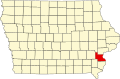
Nearest city Oakville, Iowa
Coordinates 41°06′29″N91°06′57″W / 41.10806°N 91.11583°W / 41.10806; -91.11583 Coordinates: 41°06′29″N91°06′57″W / 41.10806°N 91.11583°W / 41.10806; -91.11583
NRHP reference No. 78001243 [1]
Added to NRHPDecember 27, 1978

Florence-Council On The Iowa Site is a former town site and Native American village site located near Oakville, Iowa, United States in Louisa County. The site has been listed on the National Register of Historic Places since 1978. [1]

Florence was a settlement along the Iowa River that existed from 1836 to 1846. Prior to that, it was the village site of the Sauk people and home to Black Hawk and Keokuk, who debated here retaking the tribal lands in Illinois. It was at this place where the followers of Black Hawk rallied before they crossed into Illinois to reclaim their lands, which led to the Black Hawk War of 1832. [2] In the treaty that followed the hostilities, the area was known as "Keokuk's Principal Village." Florence developed after the Native Americans left the area in 1836. There is no record of the village having ever been platted, but it did contain a tavern, at least one retail establishment and a ferry service. A post office was established on July 5, 1839, with John Deihl, a merchant, as postmaster. It was discontinued on February 11, 1846. [2]

Related Research Articles

Sauk people Group of federally-recognized Native American tribes of the Eastern Woodlands

The Sauk or Sac are a group of Native Americans of the Eastern Woodlands culture group, who lived primarily in the region of what is now Green Bay, Wisconsin, when first encountered by the French in 1667. Their autonym is oθaakiiwaki, and their exonym is Ozaagii(-wag) in Ojibwe. The latter name was transliterated into French and English by colonists of those cultures. Today they have three federally recognized tribes, together with the Meskwaki (Fox), located in Iowa, Oklahoma and Kansas.

Black Hawk War 1832 conflict between the United States and Native Americans

The Black Hawk War was a conflict between the United States and Native Americans led by Black Hawk, a Sauk leader. The war erupted after Black Hawk and a group of Sauks, Meskwakis (Fox), and Kickapoos, known as the "British Band", crossed the Mississippi River, into the U.S. state of Illinois, from Iowa Indian Territory in April 1832. Black Hawk's motives were ambiguous, but he was apparently hoping to reclaim land sold to the United States in the disputed 1804 Treaty of St. Louis.

Lee County, Iowa U.S. county in Iowa

Lee County is the southernmost county in the U.S. state of Iowa. As of the 2020 census, the population was 33,555. The county seats are Fort Madison and Keokuk.

Keokuk County, Iowa U.S. county in Iowa

Keokuk County is a county located in the U.S. state of Iowa. As of the 2020 census, the population was 10,033. The county seat is Sigourney.

Keokuk (Sauk leader)

Keokuk was a chief of the Sauk tribe in central North America, and for decades was one of the most recognized Native American leaders and noted for his accommodation with the U.S. government. Keokuk moved his tribe several times and always acted as an ardent friend of the Americans. His policies were contrary to fellow Sauk chief Black Hawk, who led part of their band to defeat in the Black Hawk War, was later returned by U.S. forces to Keokuk's custody, and who died a decade before Keokuk.

Black Hawk (Sauk leader) American Indian tribal leader (1767–1838)

Black Hawk, born Ma-ka-tai-me-she-kia-kiak, was a Sauk leader and warrior who lived in what is now the Midwestern United States. Although he had inherited an important historic sacred bundle from his father, he was not a hereditary civil chief. Black Hawk earned his status as a war chief or captain by his actions: leading raiding and war parties as a young man and then a band of Sauk warriors during the Black Hawk War of 1832.

Black Hawk Purchase

The Black Hawk Purchase, which can sometimes be called the Forty-Mile Strip or Scott's Purchase, extended along the West side of the Mississippi River from the north boundary of Missouri North to the Upper Iowa River in the northeast corner of Iowa. It was fifty miles wide at the ends, and forty in the middle, and is sometimes called the "Forty-Mile Strip". The land, originally owned by the Sauk, Meskwaki (Fox), and Ho-Chunk (Winnebago) Native American people, was acquired by treaty following their defeat by the United States in the Black Hawk War. After being defeated the Sauk and Mesquakie were forced to relinquish another 2.5 million hectares or and give up their rights to plant, hunt, or fish on the land. The purchase was made for $640,000 on September 21, 1832 and was named for the chief Black Hawk, who was held prisoner at the time the purchase was completed. The Black Hawk Purchase contained an area of 6 million acres (24,000 km²), and the price was equivalent to 11 cents/acre. The region is bounded on the East by the Mississippi River and includes Dubuque, Fort Madison, and present-day Davenport.

Battle of Kelloggs Grove 1832, Black Hawk War, Illinois

The Battle of Kellogg's Grove is either of two minor battles, or skirmishes, fought during the Black Hawk War in the U.S. state of Illinois, in present-day Stephenson County at and near Kellogg's Grove. In the first skirmish, also known as the Battle of Burr Oak Grove, on June 16, 1832, Illinois militia forces fought against a band of at least 80 Native Americans. During the battle, three militia men under the command of Adam W. Snyder were killed in action. The second battle occurred nine days later when a larger Sauk and Fox band, under the command of Black Hawk, attacked Major John Dement's detachment and killed five militia men.

National Register of Historic Places listings in Iowa

This is a list of properties and historic districts in Iowa that are listed on the National Register of Historic Places. There are listings in all of Iowa's 99 counties, adding up to over 2,300 total.

Black Hawk State Historic Site

The Black Hawk State Historic Site, in Rock Island, Illinois, occupies much of the historic site of the village of Saukenuk, the home of a band of Native Americans of the Sauk nation. It includes the John Hauberg Museum of Native American Life. The state park is located on a 150 feet (50 m) bluff overlooking the Rock River in western Illinois. It is most famous for being the birthplace of the Sauk warrior Black Hawk. The disputed cession of this area to the U.S. Government was the catalyst for the Black Hawk War.

Mitchigamea or Michigamea or Michigamie were a tribe in the Illinois Confederation. Not much is known about them and their origin is uncertain. Originally they were said to be from Lake Michigan, perhaps the Chicago area. Mitchie Precinct, Monroe County in Southwestern Illinois takes its name from their transient presence nearby, north of the French Fort de Chartres in the American Bottom along the Mississippi. One of their villages in the American Bottom, inhabited from 1730 until 1752, is one of the region's premier archaeological sites; it is known as the "Kolmer Site".

Toolesboro Mound Group United States historic place

The Toolesboro Mound Group, a National Historic Landmark, is a group of Havana Hopewell culture earthworks on the north bank of the Iowa River near its discharge into the Mississippi. The mounds are owned and displayed to the public by the State Historical Society of Iowa. The mound group is located east of Wapello, Iowa, near the unincorporated community of Toolesboro.

The Sinsinawa Mound raid occurred on June 29, 1832, near the Sinsinawa mining settlement in Michigan Territory. This incident, part of the Black Hawk War, resulted in the deaths of two men; a third man survived by seeking cover in a nearby blockhouse. In the aftermath of the raid, Captain James W. Stephenson set out to pursue the attackers—a straggling band of Sauk Native Americans—but lost their trail at the Mississippi River. The attack occurred in the same week as other skirmishes and raids, and as a result helped contribute to the growing fear in the region. The raid caused the residents of nearby Platteville to consider fleeing their settlement.

The Plum River raid was a bloodless skirmish that occurred at present-day Savanna, Illinois, on May 21, 1832, as part of the Black Hawk War. Most of the settlement's inhabitants, except for a few defenders, had fled for Galena, Illinois, before the raid happened. A small band of Native Americans, either Sauk or Fox, attacked the settlement while only three of the six defenders were present. The men who were present fell back to the blockhouse and a firefight ensued for about one hour, after which the attackers withdrew. No one was killed or injured during the attack, but in its aftermath Colonel James M. Strode dispatched a detachment of militia to Savanna. They returned to Galena without incident and the settlement at Savanna was temporarily abandoned.

Wisconsin Heights Battlefield United States historic place

The Wisconsin Heights Battlefield is an area in Dane County, Wisconsin where the penultimate battle of the 1832 Black Hawk War occurred. The conflict was fought between the Illinois and Michigan Territory militias and Sauk chief Black Hawk and his band of warriors, who were fleeing their homeland following the Fox Wars. The Wisconsin Heights Battlefield is the only intact battle site from the Indian Wars in the U.S. Midwest. Today, the battlefield is managed and preserved by the state of Wisconsin as part of the Lower Wisconsin State Riverway. In 2002, it was listed on the U.S. National Register of Historic Places.

British Band

The British Band was a mixed-nation group of Native Americans commanded by the Sauk leader Black Hawk, which fought against Illinois and Michigan Territory militias during the 1832 Black Hawk War. The band was composed of about 1,500 men, women, and children from the Sauk, Meskwaki, Fox, Kickapoo, Potawatomi, Ho-Chunk, and Ottawa nations; about 500 of that number were warriors. Black Hawk had an alliance with the British that dated from the War of 1812, giving them their colloquial name. The band crossed the Mississippi River from Iowa into Illinois in an attempt to reclaim their homeland and in violation of several treaties. Subsequently, both the Illinois and Michigan Territory militia were called up and the Black Hawk War ensued.

Antoine Le Claire

Antoine Le Claire was a US Army interpreter, landowner in Scott County, Iowa, and Rock Island County, Illinois, businessman, philanthropist and principal founder of Davenport, Iowa.

Keokuks Reserve

Keokuk's Reserve was a parcel of land in the present-day U.S. state of Iowa that was retained by the Sauk and Fox tribes in 1832 in the aftermath of the Black Hawk War. The tribes stayed on the reservation only until 1836 when the land was ceded to the United States, and the Native Americans were moved to a new reservation.

Black Hawk Museum and Lodge United States historic place

Black Hawk Museum and Lodge is a historic building located in the Black Hawk State Historic Site in Rock Island, Illinois, United States. The lodge was listed on the National Register of Historic Places in 1985. It is a part of the Illinois State Park Lodges and Cabins Thematic Resources.

The New Purchase of 1842 is a treaty between the United States and the Sauk and Meskwaki tribes, referred to as the Sac and Fox in the treaty. The Native American tribes ceded land in Iowa west of the Mississippi River and north of the Missouri border.

References

  1. 1 2 "National Register Information System". National Register of Historic Places . National Park Service. July 9, 2010.
  2. 1 2 Springer, Arthur. History of Louisa County Iowa From Its Earliest Settlement to 1912 . Vol. 1. Chicago: Clarke, 1912, 13.