Pocahontas County, Iowa

Last updated

Pocahontas County
Pocahontas County Courthouse.JPG
County Courthouse
Map of Iowa highlighting Pocahontas County.svg
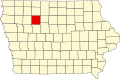
Location within the U.S. state of Iowa
Iowa in United States.svg
Iowa's location within the U.S.
Coordinates: 42°44′04″N94°40′39″W / 42.734444444444°N 94.6775°W / 42.734444444444; -94.6775
CountryFlag of the United States.svg United States
StateFlag of Iowa.svg  Iowa
Founded1851
Named for Pocahontas
Seat Pocahontas
Largest cityPocahontas
Area
  Total579 sq mi (1,500 km2)
  Land577 sq mi (1,490 km2)
  Water1.4 sq mi (4 km2)  0.2%
Population
 (2020)
  Total7,078
  Density12/sq mi (4.7/km2)
Time zone UTC−6 (Central)
  Summer (DST) UTC−5 (CDT)
Congressional district 4th
Website pocahontascounty.iowa.gov

Pocahontas County is a county located in Iowa, United States. As of the 2020 census the population was 7,078, making it the state's ninth-least populous county. [1] The county seat is Pocahontas. [2] The county was formed in 1851. [3]

Contents

The county is named in honor of Pocahontas, the famous Native American woman from Jamestown, Virginia. A colossal statue of her stands in the city of Pocahontas. [3]

Geography

According to the U.S. Census Bureau, the county has a total area of 579 square miles (1,500 km2), of which 577 square miles (1,490 km2) is land and 1.4 square miles (3.6 km2) (0.2%) is water. [4]

Major highways

Adjacent counties

Demographics

Historical population
CensusPop.Note
1860 103
1870 1,4461,303.9%
1880 3,713156.8%
1890 9,553157.3%
1900 15,33960.6%
1910 14,808−3.5%
1920 15,6025.4%
1930 15,6870.5%
1940 16,2663.7%
1950 15,496−4.7%
1960 14,234−8.1%
1970 12,729−10.6%
1980 11,369−10.7%
1990 9,525−16.2%
2000 8,662−9.1%
2010 7,310−15.6%
2020 7,078−3.2%
2023 (est.)6,976 [5] −1.4%
U.S. Decennial Census [6]
1790-1960 [7] 1900-1990 [8]
1990-2000 [9] 2010-2018 [10]
Population of Pocahontas County from US census data PocahontasCountyIowaPop.png
Population of Pocahontas County from US census data

2020 census

2022 US Census Age Pyramid for Pocahontas County from ACS 5-year estimates PocahontasCountyIA2022PopPyr.png
2022 US Census Age Pyramid for Pocahontas County from ACS 5-year estimates

The 2020 census recorded a population of 7,078 in the county, with a population density of

Pocahontas County Racial Composition [11]
RaceNum.Perc.
White (NH)6,38390.2%
Black or African American (NH)660.9%
Native American (NH)100.14%
Asian (NH)290.41%
Pacific Islander (NH)230.32%
Other/Mixed (NH)2133%
Hispanic or Latino 3545%

2010 census

The 2010 census recorded a population of 7,310 in the county, with a population density of

2000 census

As of the census [13] of 2000, there were 8,662 people, 3,617 households, and 2,430 families residing in the county. The population density was 15 people per square mile (5.8 people/km2). There were 3,988 housing units at an average density of 7 units per square mile (2.7 units/km2). The racial makeup of the county was 98.49% White, 0.24% Black or African American, 0.17% Native American, 0.17% Asian, 0.01% Pacific Islander, 0.30% from other races, and 0.61% from two or more races. 0.89% of the population were Hispanic or Latino of any race.

There were 3,617 households, out of which 29.50% had children under the age of 18 living with them, 58.30% were married couples living together, 5.90% had a female householder with no husband present, and 32.80% were non-families. 30.20% of all households were made up of individuals, and 17.80% had someone living alone who was 65 years of age or older. The average household size was 2.35 and the average family size was 2.91.

In the county, the population was spread out, with 25.40% under the age of 18, 5.30% from 18 to 24, 23.40% from 25 to 44, 24.10% from 45 to 64, and 21.70% who were 65 years of age or older. The median age was 42 years. For every 100 females there were 96.60 males. For every 100 females age 18 and over, there were 93.20 males.

The median income for a household in the county was $33,362, and the median income for a family was $40,568. Males had a median income of $27,929 versus $20,515 for females. The per capita income for the county was $17,006. About 6.60% of families and 9.10% of the population were below the poverty line, including 12.30% of those under age 18 and 6.50% of those age 65 or over.

Communities

Cities

Unincorporated communities

Townships

Population ranking

The population ranking of the following table is based on the 2020 census of Pocahontas County. [1]

county seat

RankCity/Town/etc.Municipal typePopulation (2020 Census)
1 Pocahontas City1,867
2 Laurens City1,264
3 Fonda City636
4 Rolfe City509
5 Gilmore City (partially in Humboldt County )City217 (487 total)
6 Palmer City138
7 Havelock City130
8 Varina City68
9 Plover City50

Politics

Between 1928 and 2004, Pocahontas County was a reliable bellwether county, backing the nationwide winner in every election except for 1960 (by only 37 votes) and 1988. The county has taken a rightward turn in the 21st century. After backing George W. Bush in 2000 and 2004, John McCain in 2008, and Mitt Romney in 2012 by sizable but not huge margins, Pocahontas County swung even further right in 2016. Donald Trump took nearly 70% of the vote share in the county and won the county by an astounding 45% margin. Trump further increased these numbers in 2020, winning almost 74% of the county's vote and increasing his margin of victory to just under 50%, both records for Pocahontas County for any candidate since the beginning of the 20th century.

United States presidential election results for Pocahontas County, Iowa [14]
Year Republican Democratic Third party
No.%No.%No.%
2020 2,82673.92%93324.40%641.67%
2016 2,70269.91%96324.92%2005.17%
2012 2,39659.42%1,52337.77%1132.80%
2008 2,13853.29%1,80044.87%741.84%
2004 2,44156.60%1,82242.24%501.16%
2000 2,24254.14%1,73641.92%1633.94%
1996 1,70740.50%1,98147.00%52712.50%
1992 1,74337.33%1,91941.10%1,00721.57%
1988 1,87140.22%2,72258.51%591.27%
1984 2,62750.64%2,48147.82%801.54%
1980 3,19456.17%1,95934.45%5339.37%
1976 2,70045.85%3,05551.88%1342.28%
1972 3,13857.19%2,24140.84%1081.97%
1968 2,94052.56%2,36442.26%2905.18%
1964 2,07934.24%3,98865.68%50.08%
1960 3,44550.23%3,40849.69%60.09%
1956 3,60652.89%3,20146.95%110.16%
1952 4,47261.73%2,51734.74%2563.53%
1948 2,39739.61%3,50057.84%1542.55%
1944 2,60041.94%3,57757.70%220.35%
1940 2,98541.92%4,11857.83%180.25%
1936 2,27733.39%4,35763.89%1852.71%
1932 1,80028.48%4,24567.16%2764.37%
1928 3,32253.75%2,82445.70%340.55%
1924 2,53739.65%81912.80%3,04247.55%
1920 4,04670.07%1,63928.39%891.54%
1916 1,80851.29%1,65847.04%591.67%
1912 76022.95%1,17635.52%1,37541.53%
1908 1,85757.42%1,31540.66%621.92%
1904 2,17566.09%97629.66%1404.25%
1900 2,17661.84%1,28736.57%561.59%
1896 1,86656.82%1,37741.93%411.25%

See also

Related Research Articles

<span class="mw-page-title-main">Shelby County, Iowa</span> County in Iowa, United States

Shelby County is a county located in the U.S. state of Iowa. As of the 2020 census, the population was 11,746. The county seat is Harlan. Its name is in honor of Isaac Shelby, the first Governor of Kentucky.

<span class="mw-page-title-main">Pocahontas County, West Virginia</span> County in West Virginia, United States

Pocahontas County is a county located in the eastern part of the U.S. state of West Virginia. As of the 2020 census, the population was 7,869. Its county seat is Marlinton. The county was established in 1821. It is named after the daughter of the Powhatan chief of the Native Americans in the United States who came from Jamestown, Virginia. She married an English settler, and their children became ancestors of many of the First Families of Virginia.

<span class="mw-page-title-main">Cass County, Nebraska</span> County in Nebraska, United States

Cass County is a county in the U.S. state of Nebraska. As of the 2020 United States Census, the population was 26,598. Its county seat and largest city is Plattsmouth. The county was formed in 1855, and was named for General Lewis Cass, an American military officer, politician, and statesman.

<span class="mw-page-title-main">Webster County, Iowa</span> County in Iowa, United States

Webster County is a county in the U.S. state of Iowa. As of the 2020 census, the population was 36,999. The county seat is Fort Dodge. The county was established in January 1851, one of 43 counties established by a legislative package. This county was named after Daniel Webster, an American statesman noted for his moving oratory.

<span class="mw-page-title-main">Taylor County, Iowa</span> County in Iowa, United States

Taylor County is a county located in the U.S. state of Iowa. As of the 2020 census, the population was 5,896, making it the fourth-least populous county in Iowa. The county seat is Bedford. The county was formed in 1847 and named after General and President Zachary Taylor.

<span class="mw-page-title-main">Palo Alto County, Iowa</span> County in Iowa, United States

Palo Alto County is a county located in the U.S. state of Iowa. As of the 2020 census, the population was 8,996. The county seat is Emmetsburg. It is named after the Battle of Palo Alto, the first major battle of the Mexican–American War.

<span class="mw-page-title-main">Page County, Iowa</span> County in Iowa, United States

Page County is a county located in the U.S. state of Iowa. As of the 2020 census, the population was 15,211. The county seat is Clarinda. The county is named in honor of Captain John Page of the 4th U.S. Infantry, who was mortally wounded in the Battle of Palo Alto.

<span class="mw-page-title-main">Marion County, Iowa</span> County in Iowa, United States

Marion County is a county in the U.S. state of Iowa. As of the 2020 census, the population was 33,414. The county seat is Knoxville. It is named for Francis Marion, a brigadier general from South Carolina in the American Revolutionary War.

<span class="mw-page-title-main">Lucas County, Iowa</span> County in Iowa, United States

Lucas County is a county located in the U.S. state of Iowa. As of the 2020 census, the population was 8,634. The county seat is Chariton. The county was formed in 1846 and was named for Robert Lucas, a Governor of the Territory.

<span class="mw-page-title-main">Keokuk County, Iowa</span> County in Iowa, United States

Keokuk County is a county located in the U.S. state of Iowa. As of the 2020 United States Census, the population was 10,033. The county seat is Sigourney.

<span class="mw-page-title-main">Grundy County, Iowa</span> County in Iowa, United States

Grundy County is a county located in the U.S. state of Iowa. At the 2020 census, the population was 12,329. The county seat is Grundy Center. The county is named for Felix Grundy, former U.S. Attorney General.

<span class="mw-page-title-main">Emmet County, Iowa</span> County in Iowa, United States

Emmet County is a county located in the U.S. state of Iowa. As of the 2020 census, the population was 9,388. The county seat is Estherville.

<span class="mw-page-title-main">Clarke County, Iowa</span> County in Iowa, United States

Clarke County is a county located in the U.S. state of Iowa. As of the 2020 census, the population was 9,748. The county seat is Osceola. The county was formed in January 1846, one of twelve counties established by legislative action in a comprehensive act. It was named for James Clarke, a Governor of the Iowa Territory.

<span class="mw-page-title-main">Carroll County, Iowa</span> County in Iowa, United States

Carroll County is a county located in the U.S. state of Iowa. As of the 2020 census, the population was 20,760. Its county seat is Carroll. The county is named in honor of Charles Carroll of Carrollton, signer of the Declaration of Independence.

<span class="mw-page-title-main">Pulaski, Iowa</span> City in Iowa, United States

Pulaski is a city in Davis County, Iowa, United States. The population was 264 at the time of the 2020 census.

<span class="mw-page-title-main">Coulter, Iowa</span> City in Iowa, United States

Coulter is a city in Franklin County, Iowa, United States. The population was 219 at the 2020 census.

<span class="mw-page-title-main">Laurens, Iowa</span> City in Iowa, United States

Laurens is a city in Pocahontas County, Iowa, United States. Its population was 1,264 at the 2020 census.

<span class="mw-page-title-main">Rolfe, Iowa</span> City in Iowa, United States

Rolfe is a city in Pocahontas County, Iowa, United States. The population was 509 at the time of the 2020 census.

<span class="mw-page-title-main">Varina, Iowa</span> City in Iowa, United States

Varina is an incorporated small, rural village in Pocahontas County, Iowa, United States. The population was 68 at the time of the 2020 census.

<span class="mw-page-title-main">Bevington, Iowa</span> City in Iowa, United States

Bevington is a city in Madison and Warren Counties in the U.S. state of Iowa. The population was 57 at the 2020 census. It is part of the Des Moines–West Des Moines Metropolitan Statistical Area.

References

  1. 1 2 3 "2020 Census State Redistricting Data". census.gov. United states Census Bureau. Retrieved August 12, 2021.
  2. "Find a County". National Association of Counties. Retrieved June 7, 2011.
  3. 1 2 History Archived October 21, 2010, at the Wayback Machine , Pocahontas County Economic Development.
  4. "US Gazetteer files: 2010, 2000, and 1990". United States Census Bureau. February 12, 2011. Retrieved April 23, 2011.
  5. "Annual Estimates of the Resident Population for Counties: April 1, 2020 to July 1, 2023". United States Census Bureau. Retrieved April 2, 2024.
  6. "U.S. Decennial Census". United States Census Bureau. Retrieved July 20, 2014.
  7. "Historical Census Browser". University of Virginia Library. Retrieved July 20, 2014.
  8. "Population of Counties by Decennial Census: 1900 to 1990". United States Census Bureau. Retrieved July 20, 2014.
  9. "Census 2000 PHC-T-4. Ranking Tables for Counties: 1990 and 2000" (PDF). United States Census Bureau. Archived (PDF) from the original on March 27, 2010. Retrieved July 20, 2014.
  10. "State & County QuickFacts". United States Census Bureau. Archived from the original on November 29, 2015. Retrieved July 20, 2014.
  11. "P2 HISPANIC OR LATINO, AND NOT HISPANIC OR LATINO BY RACE – 2020: DEC Redistricting Data (PL 94-171) – Pocahontas County, Iowa".
  12. "Iowa:2010 Population & Housing Occupancy Status" (PDF). United States Census Bureau. Archived (PDF) from the original on October 16, 2020. Retrieved August 15, 2022.
  13. "U.S. Census website". United States Census Bureau . Retrieved January 31, 2008.
  14. Leip, David. "Dave Leip's Atlas of U.S. Presidential Elections". uselectionatlas.org. Retrieved August 15, 2022.

42°44′04″N94°40′39″W / 42.73444°N 94.67750°W / 42.73444; -94.67750