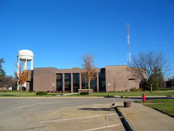
Butler County was formed on January 15, 1851, from open land. It was named after Kentucky native William Orlando Butler, a general and hero of the Mexican–American War, who ran as Vice President of the United States in 1848. Until 1854, the county was governed by other counties. Only at this time did it have enough inhabitants to establish its own local government. The first court proceedings were conducted in a small log cabin of a settler. In 1858, the first courthouse was completed in Clarksville. After it was sold shortly thereafter to the local school district, it was used as a schoolhouse from 1863 until 1903.
Clarksville was the first county seat, from 1854 to 1860, after which Butler Center became the seat. Because locals became disenchanted with Butler Center (partially because of its inaccessibility during the winter), Allison was made the county seat on January 10, 1881, after the tracks of the Dubuque and Dakota Railroad had been laid there.
Butler County is the only county in Iowa that does not have any four-lane roads (US Highway or interstate), a hospital, or a movie theatre. There are also no national fast-food chains in Butler county. As well as one of the only counties in Iowa without a stoplight.
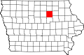
Geography
According to the U.S. Census Bureau, the county has a total area of 582 square miles (1,510km2), of which 580 square miles (1,500km2) is land and 1.6 square miles (4.1km2) (0.3%) is water.[4]
The 2020 census recorded a population of 14,334 in the county, with a population density of 24.5860/sqmi (9.4927/km2). 97.49% of the population reported being of one race. 95.19% were non-Hispanic White, 0.18% were Black, 1.28% were Hispanic, 0.17% were Native American, 0.20% were Asian, 0.00% were Native Hawaiian or Pacific Islander and 2.99% were some other race or more than one race. There were 6,536 housing units of which 5,992 were occupied.[1]
2010 census
The 2010 census recorded a population of 14,867 in the county, with a population density of 25.63/sqmi (9.90/km2). There were 6,682 housing units, of which 6,120 were occupied.[11]
2000 census
As of the census[12] of 2000, there were 15,305 people, 6,175 households, and 4,470 families residing in the county. The population density was 26 peopleper square mile (10 people/km2). There were 6,578 housing units at an average density of 11 unitsper square mile (4.2 units/km2). The racial makeup of the county was 98.95% White, 0.08% Black or African American, 0.05% Native American, 0.20% Asian, 0.02% Pacific Islander, 0.16% from other races, and 0.53% from two or more races. 0.58% of the population were Hispanic or Latino of any race.
There were 6,175 households, out of which 30.90% had children under the age of 18 living with them, 62.80% were married couples living together, 6.30% had a female householder with no husband present, and 27.60% were non-families. 25.00% of all households were made up of individuals, and 14.50% had someone living alone who was 65 years of age or older. The average household size was 2.43 and the average family size was 2.90.
In the county, the population was spread out, with 24.40% under the age of 18, 6.40% from 18 to 24, 24.90% from 25 to 44, 24.20% from 45 to 64, and 20.10% who were 65 years of age or older. The median age was 41 years. For every 100 females, there were 96.20 males. For every 100 females age 18 and over, there were 93.70 males.
The median income for a household in the county was $35,883, and the median income for a family was $42,209. Males had a median income of $30,356 versus $20,864 for females. The per capita income for the county was $17,036. About 6.50% of families and 8.00% of the population were below the poverty line, including 9.80% of those under age 18 and 9.40% of those age 65 or over.
Butler County has long been consistently Republican. Since the county's founding in 1851, it has only favored candidates of another party four times. The first occasion was in 1912, when former Republican Theodore Roosevelt won the county as the Progressive candidate. The next two times were during two landslide victories for Franklin D. Roosevelt in 1932 and 1936. Finally, the most recent occurrence was in 1996, when incumbent Bill Clinton won the county with a plurality, aided in part by a strong third party performance by Ross Perot; furthermore, Clinton only defeated Republican candidate Bob Dole in Butler County by just 25 votes and a slim margin of 0.38%. No Democrat has ever received more than 57% of the vote in the county's history.
United States presidential election results for Butler County, Iowa[13]
This page is based on this Wikipedia article Text is available under the CC BY-SA 4.0 license; additional terms may apply. Images, videos and audio are available under their respective licenses.