Eleanor, Iowa | |
|---|---|
 Eleanor, Iowa | |
| Coordinates: 42°36′51″N92°50′58″W / 42.61417°N 92.84944°W | |
| Country | United States |
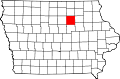
| State | Iowa |
| County | Butler |
| Elevation | 968 ft (295 m) |
| Time zone | UTC-6 (Central (CST)) |
| • Summer (DST) | UTC-5 (CDT) |
| Area code | 319 |
| GNIS feature ID | 464533 [1] |
Eleanor is an unincorporated community in Butler County, in the U.S. state of Iowa. [1]