Sinclair, Iowa

Last updated

Sinclair
Sinclair, Iowa
USA Iowa location map.svg
Red pog.svg
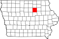
Sinclair
Location within the state of Iowa
Coordinates: 42°30′0″N92°43′55″W / 42.50000°N 92.73194°W / 42.50000; -92.73194
Country United States
State Iowa
County Butler
Population
 (2000)
  Total12
Time zone UTC-6 (Central (CST))
  Summer (DST) UTC-5 (CDT)
GNIS feature ID464746

Sinclair is an unincorporated community in Butler County, Iowa, United States. [1]

History

Sinclair was a frequent stop for the Underground Railroad during and before the Civil War. Prior to the establishment of the town, it was nothing more than a railroad stop. Throughout its history, the town has had periods of expansion and periods of struggle. During the Great Depression, the town of Sinclair and the small population suffered greatly. Sinclair's population was 12 in 1925. [2]

On May 25, 2008, an EF5 tornado ripped through southern Butler County, and destroyed the Sinclair grain elevator, ripping apart grain bins and throwing anhydrous ammonia tanks into fields.

Related Research Articles

<span class="mw-page-title-main">Cedar, Iowa</span> Unincorporated community in Iowa, United States

Cedar is an unincorporated community in southeastern Mahaska County, Iowa, United States. It lies along Iowa Highway 23 southeast of the city of Oskaloosa, the county seat of Mahaska County.

Sperry is an unincorporated community in central Des Moines County, Iowa, United States. It lies along local roads north of the city of Burlington, the county seat of Des Moines County. Its elevation is 751 feet (229 m). Although Sperry is unincorporated, it has a post office with the ZIP code of 52650, which opened on 5 February 1870.

<span class="mw-page-title-main">Austinville, Iowa</span> Unincorporated community in Iowa, United States

Austinville is an unincorporated community in southwestern Butler County, Iowa, United States. It lies along Iowa Highway 57 southwest of the city of Allison, the county seat of Butler County. Its elevation is 1,001 feet (305 m). Although Austinville is unincorporated, it has a post office with the ZIP code of 50608, which opened on 3 October 1892. In 2022, the population was 100 in town and the surrounding area.

Green Mountain is a rural unincorporated community and census-designated place (CDP) in Marshall County, Iowa, United States. It is located in Marion Township. As of the 2020 census the population of Green Mountain was 113.

<span class="mw-page-title-main">California Junction, Iowa</span> Census-designated place in Iowa, United States

California Junction is an unincorporated community and census-designated place (CDP) in Harrison County, Iowa, United States. It lies just east of the junction between the east–west and north–south lines of the former Sioux City and Pacific Railroad. In the 2010 census it had a population of 85 inhabitants and a population density of 184.38 people per square mile.

Folletts is an unincorporated community in Clinton County, Iowa, United States. It is located at the intersections of 292nd Street and County Highway Z36 on the north bank of the Wapsipinicon River. It is one mile west of Shaffton and three miles east of McCausland, at 41.750099N, -90.354990W.

Ardon is a former townsite and unincorporated community in Muscatine County, Iowa, United States. It is located at the intersection of 250th Street and Jasper Avenue, four miles east of Cranston, at 41.366543N, -94.317809W.

Stennett is an unincorporated community in Montgomery County, Iowa, United States. Stennett is located at the junction of County Highways H20 and M55, 5.7 miles (9.2 km) north-northeast of Red Oak.

Dunbar is an unincorporated community and former railroad depot village in Green Castle Township, Marshall County, Iowa, United States.

<span class="mw-page-title-main">Downey, Iowa</span> Unincorporated community in Iowa, United States

Downey is an unincorporated community in Cedar County, Iowa.

Gridley is an unincorporated community in Emmet County, Iowa, United States.

Wightman is an unincorporated community in Calhoun County, Iowa, in the United States. It has a population of less than 500 individuals.

Sedan is an unincorporated community in Appanoose County, Iowa, United States.

Cleves, Iowa, is a small town in north central Iowa with a bank, a repair shop, and a grain elevator. Cleves is in Hardin County, Iowa.

Carnes is an unincorporated rural small hamlet in Sioux County, in the U.S. state of Iowa. Presently, the hamlet consists of a grain elevator and a pizza restaurant.

<span class="mw-page-title-main">Edna, Iowa</span> Unincorporated community in Iowa, United States

Edna is an unincorporated town in Lyon County, Iowa, United States. Edna is located on the western border of Liberal Township in Lyon County. It is located 6 miles (10 km) southeast of Rock Rapids, the county seat.

Vandalia is an unincorporated community in Jasper County, in the U.S. state of Iowa.

Ulmer is an unincorporated community in Sac County, in the U.S. state of Iowa.

Clarkson was an unincorporated community in Warren County, Iowa, United States. It was located two miles east of Carlisle, near the Des Moines River. Its elevation was 935 feet.

Astor was an unincorporated community in Crawford County, in the U.S. state of Iowa.

References

  1. U.S. Geological Survey Geographic Names Information System: Sinclair, Iowa
  2. Company, Rand McNally and (1925). Premier Atlas of the World: Containing Maps of All Countries of the World, with the Most Recent Boundary Decisions, and Maps of All the States,territories, and Possessions of the United States with Population Figures from the Latest Official Census Reports, Also Data of Interest Concerning International and Domestic Political Questions. Rand McNally & Company. p. 190.