West Point Township, Butler County | |
|---|---|
 | |
| Coordinates: 42°46′16″N092°50′57″W / 42.77111°N 92.84917°W | |
| Country | |
| State | |
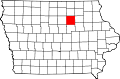
| County | Butler |
| Area | |
• Total | 36.11 sq mi (93.53 km2) |
| • Land | 36.11 sq mi (93.53 km2) |
| • Water | 0 sq mi (0 km2) |
| Elevation | 1,007 ft (307 m) |
| Population (2020) | |
• Total | 1,330 |
| • Density | 37/sq mi (14.2/km2) |
| FIPS code | 19-94692 [2] |
| GNIS feature ID | 0468985 |
West Point Township is one of sixteen townships in Butler County, Iowa, United States. As of the 2020 census, its population was 1,330. [3]