Vilmar, Iowa

Last updated

Vilmar, Iowa
USA Iowa location map.svg
Red pog.svg
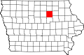
Vilmar, Iowa
Location within the state of Iowa
Usa edcp location map.svg
Red pog.svg
Vilmar, Iowa
Vilmar, Iowa (the United States)
Coordinates: 42°49′05″N92°49′46″W / 42.81806°N 92.82944°W / 42.81806; -92.82944
Country United States
State Iowa
County Butler
Elevation1,053 ft (321 m)
Time zone UTC-6 (Central (CST))
  Summer (DST) UTC-5 (CDT)

Vilmar, also known as Wilmar, is an unincorporated community in Butler County, Iowa, United States. It lies west of Iowa Highway 14 5.5 miles southwest of the community of Greene.

History

Vilmar was founded by German families. The German Evangelical Lutheran St. Johannes Church was built in 1883, [1] the grounds included a parsonage and confirmation school. [2] St. John's Lutheran Church - Vilmar still operates in the community. [3]

Vilmar's population was 21 in 1915, [4] and 15 in 1925. [5]

References

  1. "Church Will Celebrate 60th Anniversary". Globe-Gazette from Mason City, Iowa on November 25, 1939 · Page 10. Retrieved June 29, 2021.
  2. "History". St. John's - Vilmar. Retrieved June 29, 2021.
  3. "St. John's - Vilmar". St. John's - Vilmar. Retrieved June 29, 2021.
  4. Atlas of Johnson County, Iowa, 1917 :: Iowa Counties Historic Atlases. pp. 63–66.[ permanent dead link ]
  5. Premier Atlas of the World: Containing Maps of All Countries of the World, with the Most Recent Boundary Decisions, and Maps of All the States, territories, and Possessions of the United States with Population Figures from the Latest Official Census Reports, Also Data of Interest Concerning International and Domestic Political Questions. Rand McNally & Company. 1925. p. 190.