Kesley, Iowa

Last updated

Kesley, Iowa
USA Iowa location map.svg
Red pog.svg
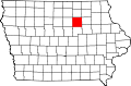
Kesley, Iowa
Location within the state of Iowa
Usa edcp location map.svg
Red pog.svg
Kesley, Iowa
Kesley, Iowa (the United States)
Coordinates: 42°39′45″N92°54′37″W / 42.66250°N 92.91028°W / 42.66250; -92.91028
Country United States
State Iowa
County Butler
Elevation
[1]
1,004 ft (306 m)
Time zone UTC-6 (Central (CST))
  Summer (DST) UTC-5 (CDT)
ZIP codes
50649
GNIS feature ID458060 [1]

Kesley is an unincorporated community in southwestern Butler County, Iowa, United States. It lies along local roads southwest of the city of Allison, the county seat of Butler County. [2] Although Kesley is unincorporated, it has a post office with the ZIP code of 50649. [3]

History

A post office has been in operation in Kesley since 1900. [4] The community was named for Kesley Green, a local farmer. [5]

Kesley's population in 1915 was 52. [6] The population was 127 in 1940. [7]

References

  1. 1 2 U.S. Geological Survey Geographic Names Information System: Kesley, Iowa
  2. Rand McNally. The Road Atlas '08. Chicago: Rand McNally, 2008, p. 39.
  3. Zip Code Lookup
  4. "Butler County". Jim Forte Postal History. Retrieved March 21, 2015.
  5. Chicago and North Western Railway Company (1908). A History of the Origin of the Place Names Connected with the Chicago & North Western and Chicago, St. Paul, Minneapolis & Omaha Railways. p. 89.
  6. Atlas of Johnson County, Iowa, 1917 :: Iowa Counties Historic Atlases. pp. 63–66.[ permanent dead link ]
  7. The Attorneys List. United States Fidelity and Guaranty Company, Attorney List Department. 1940. p. 303.