Muscatine County was formed in December 1836 as a part of Wisconsin Territory, partitioned from Des Moines County, which had been organized two years previously.[3] One history suggests that the county was named for Muscatine Island in the Mississippi River. The island lies opposite Muscatine County and was believed to be named after the Mascouten tribe, Algonquian-speaking Native Americans who lived in the area before being driven west by settler encroachment and other tribes.[4]
Colonel George Davenport of Illinois sent three representatives into the territory in 1833 to establish a trade post. They were the first European Americans to settle there. In the same year, James W. Casey and John Vanatta came to the area. They opened a supply depot for steamboats on June 1, 1833, and named it Casey's Woodpile (since steamboats used wood as fuel). Muscatine County became part of Iowa Territory on July 4, 1838, when it was established by partitioning the area from Wisconsin Territory.[3] The first public land sale was held in November 1838. One year later, officials began construction of the first courthouse and associated jail. A second jail, known as the "Old Jail", was built in 1857.[5]
The first courthouse was destroyed by fire on December 23, 1864. By 1866 a replacement stood on the same site. The present courthouse opened on September 26, 1907.[6]
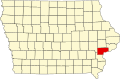
Geography
According to the US Census Bureau, the county has a total area of 449 square miles (1,160km2), of which 437 square miles (1,130km2) is land and 12 square miles (31km2) (2.6%) is water.[7]
U.S. Highway 6 – enters from Cedar County, west of Wilton, runs south two miles, then continues west and west-northwest to the northwest corner of the county, exiting into Johnson County.
Iowa Highway 22 – begins at an intersection with Iowa 70, three miles east of Nichols. Runs east and southeast to an intersection with US 61, west of Muscatine.
Iowa Highway 38 – begins at an intersection with US 6, three miles south of Wilton. Runs south to an intersection with US 61, north of Muscatine.
Iowa Highway 70 – enters from Louisa County at the southwest corner of Muscatine County. Runs north, northeast and east to Cedar County, passing Nichols and West Liberty.
Iowa Highway 92 - enters Muscatine County (and state of Iowa), running northwest across the historic Norbert F. Beckey Bridge into central Muscatine. Runs southwest along the Mississippi River to intersection with US 61, southwest of Muscatine.[8]
Other roadway designations
Great River Road - system of roadways marking north–south routes across the conterminous US, and generally passing through Iowa.
As of the 2020 census, the county had a population of 43,235, a population density of 96.5/sqmi (37.3/km2), and 92.12% of residents reported being of one race. There were 18,366 housing units, of which 16,908 were occupied.[15]
The median age was 39.5 years; 24.2% of residents were under the age of 18 and 17.9% were 65 years of age or older. For every 100 females there were 98.8 males, and for every 100 females age 18 and over there were 98.1 males age 18 and over.[15]
58.2% of residents lived in urban areas, while 41.8% lived in rural areas.[16]
There were 16,908 households in the county, of which 31.4% had children under the age of 18 living in them; 49.5% were married-couple households, 18.4% were households with a male householder and no spouse or partner present, and 23.8% were households with a female householder and no spouse or partner present. About 27.0% of all households were made up of individuals and 12.1% had someone living alone who was 65 years of age or older.[15]
Among the 18,366 housing units, 7.9% were vacant. Owner-occupied units made up 72.3% of occupied housing units and renter-occupied units made up 27.7%; the homeowner vacancy rate was 1.3% and the rental vacancy rate was 8.5%.[15]
The racial makeup of the county was 80.0% White, 2.6% Black or African American, 0.5% American Indian and Alaska Native, 0.9% Asian, less than 0.1% Native Hawaiian and Pacific Islander, 8.0% some other race, and 7.9% two or more races, while Hispanic or Latino residents of any race comprised 18.0% of the population, with the detailed breakdown shown in the table below.[17]
The 2010 census recorded a population of 42,745 in the county, with a population density of 99.7/sqmi (38.5/km2). There were 17,910 housing units, of which 16,412 were occupied.[18]
2000 census
As of the census[19] of 2000, there were 41,722 people, 15,847 households, and 11,283 families residing in the county. The population density was 95 inhabitants per square mile (37/km2). There were 16,786 housing units at an average density of 38 per square mile (15/km2). The racial makeup of the county was 90.72% White, 0.70% Black or African American, 0.31% Native American, 0.83% Asian, 0.02% Pacific Islander, 6.05% from other races, and 1.37% from two or more races. 11.92% of the population were Hispanic or Latino of any race.
There were 15,847 households, out of which 34.80% had children under the age of 18 living with them, 57.90% were married couples living together, 9.30% had a female householder with no husband present, and 28.80% were non-families. 24.10% of all households were made up of individuals, and 9.90% had someone living alone who was 65 years of age or older. The average household size was 2.59 and the average family size was 3.07.
In the county, the population was spread out, with 26.90% under the age of 18, 8.60% from 18 to 24, 28.80% from 25 to 44, 22.80% from 45 to 64, and 12.90% who were 65 years of age or older. The median age was 36 years. For every 100 females, there were 98.10 males. For every 100 females age 18 and over, there were 94.90 males.
The median income for a household in the county was $41,803, and the median income for a family was $48,373. Males had a median income of $36,329 versus $24,793 for females. The per capita income for the county was $19,625. About 6.30% of families and 8.90% of the population were below the poverty line, including 10.70% of those under age 18 and 7.70% of those age 65 or over.
This page is based on this Wikipedia article Text is available under the CC BY-SA 4.0 license; additional terms may apply. Images, videos and audio are available under their respective licenses.