Hampton, Illinois

Last updated

Hampton
St Mary's Church - Hampton, Illinois.jpg
St. Mary's Catholic Church
Rock Island County Illinois Incorporated and Unincorporated areas Hampton Highlighted.svg
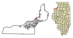
Location of Hampton in Rock Island County, Illinois.
Illinois in United States (US48).svg
Location of Illinois in the United States
Coordinates: 41°33′27″N90°24′29″W / 41.55750°N 90.40806°W / 41.55750; -90.40806
CountryUnited States
StateIllinois
County Rock Island
Area
[1]
  Total1.49 sq mi (3.85 km2)
  Land1.46 sq mi (3.78 km2)
  Water0.03 sq mi (0.07 km2)
Population
 (2020)
  Total1,779
  Density1,217.66/sq mi (470.03/km2)
Time zone UTC-6 (CST)
  Summer (DST) UTC-5 (CDT)
ZIP Code(s)
61256
Area code 309
FIPS code 17-32564
Wikimedia CommonsHampton, Illinois
Website hamptonil.org

Hampton is a village in Rock Island County, Illinois, United States. The population was 1,779 at the time of the 2020 census. down from 1,863 at the 2010 census.

Contents

History

The village was originally in territory claimed by the Sauk and Meskwaki Native Americans, and several Woodland era Native mounds are located in the village limits, and in the adjacent Illiniwek Forest Preserve. The village in 1834 was platted as "Milan" (not the village 13 miles south-southwest in Illinois—see Milan, Illinois for more). The "paper town" did not sell initially because of the swampy riverfront, and being adjacent to the north end of the Rock Island Rapids. However, settlers drained the swamps by the end of the 19th century, and the village was founded by 1900 as Hampton— the original name of Milan, Illinois. Black's Store, which is listed on the National Register of Historic Places, was the first mercantile store to open in Northwest Illinois. [2]

Geography

Hampton is located at 41°33′27″N90°24′29″W / 41.55750°N 90.40806°W / 41.55750; -90.40806 (41.557583, -90.407993). [3]

According to the 2010 census, Hampton has a total area of 1.65 square miles (4.27 km2), all land. [4]

Demographics

Historical population
CensusPop.Note
1880 576
1890 341−40.8%
1900 3749.7%
1910 348−7.0%
1920 46032.2%
1930 4855.4%
1940 5329.7%
1950 70632.7%
1960 7425.1%
1970 1,612117.3%
1980 1,87316.2%
1990 1,601−14.5%
2000 1,6261.6%
2010 1,86314.6%
2020 1,779−4.5%
U.S. Decennial Census [5]

As of the census [6] of 2000, there were 1,626 people, 631 households, and 480 families residing in the village. The population density was 1,028.8 inhabitants per square mile (397.2/km2). There were 661 housing units at an average density of 418.2 per square mile (161.5/km2). The racial makeup of the village was 95.57% White, 0.25% African American, 0.86% Native American, 0.12% Asian, 2.21% from other races, and 0.98% from two or more races. Hispanic or Latino of any race were 4.92% of the population.

There were 631 households, out of which 28.5% had children under the age of 18 living with them, 66.6% were married couples living together, 7.1% had a female householder with no husband present, and 23.9% were non-families. 20.3% of all households were made up of individuals, and 11.1% had someone living alone who was 65 years of age or older. The average household size was 2.56 and the average family size was 2.95.

In the village, the population was spread out, with 23.1% under the age of 18, 7.1% from 18 to 24, 25.5% from 25 to 44, 30.8% from 45 to 64, and 13.5% who were 65 years of age or older. The median age was 41 years. For every 100 females, there were 94.0 males. For every 100 females age 18 and over, there were 94.1 males.

The median income for a household in the village was $48,438, and the median income for a family was $59,375. Males had a median income of $42,134 versus $25,063 for females. The per capita income for the village was $22,492. About 5.4% of families and 7.3% of the population were below the poverty line, including 10.0% of those under age 18 and 9.7% of those age 65 or over.

Transportation

Quad Cities MetroLINK provides bus service on Route 10 connecting Hampton to destinations across the Quad Cities. [7]

Related Research Articles

<span class="mw-page-title-main">Rock Island County, Illinois</span> County in Illinois, United States

Rock Island County is a county located in the U.S. state of Illinois, bounded on the west by the Mississippi River. According to the 2020 census, it had a population of 144,672. Its county seat is Rock Island; its largest city is neighboring Moline. Rock Island County is one of the four counties that make up the Davenport-Moline-Rock Island, IA-IL Metropolitan Statistical Area.

<span class="mw-page-title-main">Thornton, Illinois</span> Village in Illinois, United States

Thornton is a village in Cook County, Illinois, United States and a south suburb of Chicago. The population was 2,386 at the 2020 census. Thornton is home to the Thornton Quarry, one of the largest quarries in the world.

<span class="mw-page-title-main">Carrollton, Illinois</span> City in Illinois, United States

Carrollton is a city in and the county seat of Greene County, Illinois, United States. The population was 2,484 as of the 2010 census.

<span class="mw-page-title-main">Cleveland, Illinois</span> Village in Illinois, United States

Cleveland is a village in Henry County, Illinois, United States. The population was 188 at the 2010 census, down from 253 in 2000.

<span class="mw-page-title-main">Colona, Illinois</span> City in Illinois, United States

Colona is a city in Henry County, Illinois, along the Green River. It is part of the Quad Cities metropolitan area. The population was 5,307 at the 2020 census, up from 5,099 at the 2010 census.

<span class="mw-page-title-main">Brighton, Illinois</span> Village in Illinois, United States

Brighton is a village located mostly in Macoupin County and partially in Jersey County, Illinois, United States. As of the 2020 census, the village had a population of 2,221. The village's current mayor is Matthew P. Kasten.

<span class="mw-page-title-main">Joy, Illinois</span> Village in Illinois, United States

Joy is a village in Mercer County, Illinois, United States. The population was 372 as of the 2020 census.

<span class="mw-page-title-main">Matherville, Illinois</span> Village in Illinois, United States

Matherville is a village in Mercer County, Illinois, United States. The population was 707 at the 2020 census.

<span class="mw-page-title-main">North Henderson, Illinois</span> Village in Illinois, United States

North Henderson is a village in Mercer County, Illinois, United States. The population was 162 at the 2020 census.

<span class="mw-page-title-main">Reynolds, Illinois</span> Village in Illinois, United States

Reynolds is a village mainly in Rock Island County in the U.S. state of Illinois. The population was 498 at the 2020 census. A small portion on the south side is in Mercer County. The village was founded in 1876.

<span class="mw-page-title-main">Sherrard, Illinois</span> Village in Illinois, United States

Sherrard is a village in Mercer County, Illinois, United States. The population was 692 at the 2020 census.

<span class="mw-page-title-main">Andalusia, Illinois</span> Village in Illinois, United States

Andalusia is a village in Rock Island County, Illinois, United States. The population was 1,184 at the 2020 census, up from 1,178 at the 2010 census.

<span class="mw-page-title-main">Carbon Cliff, Illinois</span> Village in Illinois, United States

Carbon Cliff is a village in Rock Island County, Illinois, United States. The population was 1,846 at the 2020 census, down from 2,134 at the 2010 census. It lies in the south part of Hampton Township.

<span class="mw-page-title-main">East Moline, Illinois</span> City in Illinois, United States

East Moline is a city in Rock Island County, Illinois, United States. The population was 21,374 at the 2020 census. East Moline is part of the Quad Cities, along with the cities of Rock Island, Moline, and the Iowa city of Davenport. As of 2011, the Quad Cities has a population estimate of 381,342.

<span class="mw-page-title-main">Hillsdale, Illinois</span> Village in Illinois, United States

Hillsdale is a village in Rock Island County, Illinois, United States. The population was 531 at the time of the 2020 census, up from 523 at the 2010 census.

<span class="mw-page-title-main">Milan, Illinois</span> Village in Illinois, United States

Milan is a village in Rock Island County, Illinois, United States. The population was 5,097 at the time of the 2020 census; down from 5,099 at the 2010 census.

<span class="mw-page-title-main">Oak Grove, Illinois</span> Village in Illinois, United States

Oak Grove is a village in Rock Island County, Illinois, United States. The population was 476 at the time of the 2020 census; up from 396 at the 2010 census.

<span class="mw-page-title-main">Port Byron, Illinois</span> Village in Illinois, United States

Port Byron is a village in Rock Island County, Illinois, United States and part of the Quad Cities Metropolitan Area. The population was 1,668 at the time of the 2020 census; up from 1,647 at the 2010 census.

Rock Island Arsenal is a census-designated place (CDP) in Rock Island County, Illinois, United States. The population was 149 at the 2010 census. The island contains the Rock Island National Cemetery.

<span class="mw-page-title-main">Riverdale, Iowa</span> City in Iowa, United States

Riverdale is a city in Scott County, Iowa, United States. The population was 379 at the time of the 2020 census.

References

  1. "2020 U.S. Gazetteer Files". United States Census Bureau. Retrieved March 15, 2022.
  2. "Hampton to host Apple Festival Sept. 27". QC Online. Retrieved March 28, 2011.
  3. "US Gazetteer files: 2010, 2000, and 1990". United States Census Bureau. February 12, 2011. Retrieved April 23, 2011.
  4. "G001 - Geographic Identifiers - 2010 Census Summary File 1". United States Census Bureau. Archived from the original on February 13, 2020. Retrieved August 3, 2015.
  5. "Census of Population and Housing". Census.gov. Retrieved June 4, 2015.
  6. "U.S. Census website". United States Census Bureau . Retrieved January 31, 2008.
  7. "Metro Monday-Friday Schedules" . Retrieved January 28, 2024.