Montpelier, Iowa | |
|---|---|
 Montpelier, Iowa in 2023 | |
 Montpelier  Montpelier | |
| Coordinates: 41°27′41″N90°48′41″W / 41.46139°N 90.81139°W [1] | |
| Country | United States |
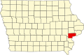
| State | Iowa |
| County | Scott, Muscatine |
| Area | |
• Total | 0.49 sq mi (1.27 km2) |
| • Land | 0.49 sq mi (1.27 km2) |
| • Water | 0.00 sq mi (0.00 km2) |
| Elevation | 600 ft (200 m) |
| Population | |
• Total | 186 |
| • Density | 379.59/sq mi (146.54/km2) |
| Time zone | UTC-6 (Central (CST)) |
| • Summer (DST) | UTC-5 (CDT) |
| ZIP code | 52759 |
| Area code | 563 |
| FIPS code | 19-53715 |
| GNIS feature ID | 2806528 [1] |
Montpelier is an unincorporated community and census-designated place (CDP) in Muscatine County, Iowa, United States. As of the 2020 census, the population was 186. [3] The community is part of the Muscatine Micropolitan Statistical Area.