Port Allen, Iowa | |
|---|---|
 Port Allen  Port Allen | |
| Coordinates: 41°20′16″N91°21′12″W / 41.33778°N 91.35333°W [1] | |
| Country | United States |
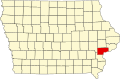
| State | Iowa |
| County | Muscatine |
| Elevation | 607 ft (185 m) |
| Time zone | UTC-6 (Central (CST)) |
| • Summer (DST) | UTC-5 (CDT) |
| Area code | 319 |
| GNIS feature ID | 465523 [1] |
Port Allen is an unincorporated community in Iowa, United States, located along the Louisa-Muscatine County line on Iowa Highway 70. It was formerly a thriving town, but today is merely a housing sub-division.