Dubuque County, Iowa

Last updated

Dubuque County
Dubuque County Courthouse.jpg
DubuqueCountySeal.png
Map of Iowa highlighting Dubuque County.svg
Location within the U.S. state of Iowa
Iowa in United States.svg
Iowa's location within the U.S.
Coordinates: 42°28′15″N90°52′42″W / 42.47083°N 90.87833°W / 42.47083; -90.87833
CountryFlag of the United States.svg United States
StateFlag of Iowa.svg  Iowa
Founded1834
Named for Julien Dubuque
Seat Dubuque
Largest cityDubuque
Area
  Total617 sq mi (1,600 km2)
  Land608 sq mi (1,570 km2)
  Water8.3 sq mi (21 km2)  1.4%
Population
 (2020)
  Total99,266
  Density160/sq mi (62/km2)
Time zone UTC−6 (Central)
  Summer (DST) UTC−5 (CDT)
Congressional district 1st
Website www.dubuquecountyiowa.gov

Dubuque County is a county located in the U.S. state of Iowa. As of the 2020 census, the population was 99,266, [1] making it the eighth-most populous county in Iowa. The county seat is Dubuque. [2] The county is named for Julien Dubuque, the first European settler of Iowa.

Contents

Dubuque County comprises the Dubuque, IA Metropolitan Statistical Area. [3]

History

Early history

Dubuque County is named for French trader Julien Dubuque, [4] the first European settler of Iowa, and an early lead mining pioneer in what is now Dubuque County. Dubuque was French Canadian, and had (by most accounts) a friendly relationship with the local Fox tribe of Native Americans. He and other early pioneers established a lucrative mining and trading industry in the area. When lead deposits began becoming exhausted, the pioneers developed boat building, lumber yards, milling, brewing, and machinery manufacturing to take its place.

The city of Dubuque was chartered in 1833 as the first city in Iowa. [5] The establishment of the City of Dubuque in 1833 led to large-scale settlement of the surrounding area. This was greatly encouraged by the Roman Catholic Church, which sent priests, bishops, and nuns to establish churches in the unpopulated countryside. Primarily, Irish and German (many of whom were Catholic) immigrants came to the region.

At an extra session of the Sixth Legislative Assembly of Michigan Territory held in September 1834, the Iowa District was divided into two counties by running a line due west from the lower end of Rock Island in the Mississippi River. The territory north of this line (which started just south of the present-day Davenport) was named Dubuque County, and all south of it was Demoine County [sic]. Thus, at that time Dubuque County nominally included not only much of what is now the state of Minnesota but portions of what are now North Dakota and South Dakota.

Dubuque County became part of Wisconsin Territory once it was split off from Michigan Territory on July 3, 1836. A massive reorganization and reduction of the county's size was executed on December 21, 1837, when its original area was separated into 13 named new counties and a "non-county area". The land in present day Minnesota and the Dakotas was transferred to the newly created Fayette County in this action. Dubuque County became a part of Iowa Territory upon its creation on July 4, 1838. [6]

In 1858, Saint Francis Catholic Church was established in Dubuque County.

Middle history

In the 1980s, the farm crisis set in, and devastated large sections of the Midwest, including Dubuque County. Since the area was heavily dependent on agriculture-related industries like Deere and Company and the Dubuque Packing Company, unemployment soared. In one month of 1982, Dubuque County had 23% unemployment, the highest in the nation. The county experienced huge population losses during this time, as workers left the area. It would not fully recover from this until the late 1990s, when the economy diversified, shifting away from manufacturing, and toward various service-related establishments.

Modern history

Since the 1990s, the area has become much more prosperous. Today, the county boasts record employment levels and a growing population. The surging economy can especially be seen in the West Side of the City of Dubuque, and in neighboring Peosta and Asbury. These areas have expanded so much that concerns now lie with trying to manage the growth, a sharp change from just 20 years ago.

It is one of Iowa's two original counties along with Des Moines County; both were organized by the Michigan Territorial legislature in 1834.

In 2021, the Dubuque County Minutemen baseball team advanced to the American Legion World Series semi-finals, the first team from Iowa to advance that far since Cedar Rapids, IA in 1975.

Government

Dubuque County is governed by a three-member Board of Supervisors elected at large. Current supervisors include Ann McDonough, Wayne Kenniker and Harley Pothoff (chairperson). They meet the 1st and 3rd Monday of each month at 9:00 a.m. in the Dubuque County Courthouse.

The current county attorney is Scott Nelson, who succeeded C.J. May in 2023.

The current county auditor is Kevin Dragotto, who succeeded Denise Dolan in 2021.

The current county treasurer is Michael Clasen, who succeeded Eric Steirman in 2022

Law enforcement

Dubuque County Sheriff's Office
IA, Dubuque County Sheriff.jpg
AbbreviationDCSO
Jurisdictional structure
Operations jurisdictionDubuque, Iowa, USA
Map of Iowa highlighting Dubuque County.svg
Map of Dubuque County Sheriff's Office's jurisdiction
Size617 square miles (1,600 km2)
Population92,359 (2006)
General nature
Operational structure
Headquarters770 Iowa Street, Dubuque, Iowa
Sheriff responsible
  • Joe Kennedy (since 2016) [7]
Website
Official website

The county sheriff's office provides law enforcement services for unincorporated areas of Dubuque County, as well as providing courthouse security, operating the county jail, and performing civil procedures. The Sheriff's Department is located at the Dubuque City/County Law Enforcement Center. The department shares facilities and other resources with the Dubuque Police Department.

Geography

Geographic features

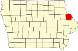
The county borders on Illinois and Wisconsin, and is bounded on the northeast by the Mississippi River. [8] According to the U.S. Census Bureau, the county has a total area of 617 square miles (1,600 km2), of which 608 square miles (1,570 km2) is land and 8.3 square miles (21 km2) (1.4%) is water. [9] The county is drained by north and south forks of the Maquoketa River. [8]

The county seat is Dubuque, Iowa, which is located along the Mississippi River in the east-central portion of the county. Eastern Dubuque County is markedly different from the western portion in that its topography is very uneven. The city of Dubuque and surrounding areas adjacent to the Mississippi River have many steep hills, bluffs, and ravines. Also, the eastern portion is more heavily wooded than the west, which is mostly rolling farmland.

Dubuque County is widely known for its impressive bluffs along the Mississippi River, which run along the entire length of the county's riverbanks. These form part of Iowa's Coulee Region, otherwise known as the Driftless Area. During the last ice age, much of the Mississippi Valley near Dubuque County was bypassed by glacial flows, which flattened the surrounding land in eastern Illinois, Wisconsin, and western Iowa, leaving the Driftless Area unusually rugged.

Major parks

The Iowa Department of Natural Resources administers 3 park and preserve areas in the county:

The Dubuque County Conservation Board administers 11 park and recreation areas in the county:

  • Bankston Park
  • Fillmore Recreation Area & Fairways
  • Finley's Landing Park
  • Heritage Trail & Pond
  • Interstate Power Forest Preserve
  • Massey Marina Park
  • Mud Lake Park
  • New Wine Park
  • Pohlman Prairie Preserve
  • Swiss Valley Nature Park & Preserve
  • Whitewater Canyon Park

The City of Dubuque and other towns in the county also operate public park systems of their own. (see Parks in Dubuque, Iowa)

Major highways

Transit

Adjacent counties

National protected areas

Demographics

Historical population
CensusPop.Note
1840 3,059
1850 10,841254.4%
1860 31,164187.5%
1870 38,96925.0%
1880 42,99610.3%
1890 49,84815.9%
1900 56,40313.1%
1910 57,4501.9%
1920 58,2621.4%
1930 61,2145.1%
1940 63,7684.2%
1950 71,33711.9%
1960 80,04812.2%
1970 90,60913.2%
1980 93,7453.5%
1990 86,403−7.8%
2000 89,1433.2%
2010 93,6535.1%
2020 99,2666.0%
2023 (est.)98,887 [10] −0.4%
U.S. Decennial Census [11]
1790-1960 [12] 1900-1990 [13]
1990-2000 [14] 2010-2019 [15]
Population of Dubuque County from US census data DubuqueCountyIowaPop2020.png
Population of Dubuque County from US census data

2020 census

2022 US Census population pyramid for Dubuque County from ACS 5-year estimates DubuqueCountyIA2022PopPyr.png
2022 US Census population pyramid for Dubuque County from ACS 5-year estimates

The 2020 census recorded a population of 99,266 in the county, with a population density of

Dubuque County Racial Composition [17]
RaceNum.Perc.
White (NH)87,34988%
Black or African American (NH)4,0354.1%
Native American (NH)1310.13%
Asian (NH)1,0181.02%
Pacific Islander (NH)8130.82%
Other/Mixed (NH)2,9433%
Hispanic or Latino 2,9773%

2010 census

The 2010 census recorded a population of 93,653 in the county, with a population density of

2000 census

At the 2000 census, [19] there were 89,143 people, 33,690 households and 23,111 families residing in the county. The population density was 147 per square mile (57/km2). There were 35,505 housing units at an average density of 58 per square mile (22/km2). The racial makeup of the county was 97.07% White, 0.86% Black or African American, 0.15% Native American, 0.58% Asian, 0.09% Pacific Islander, 0.50% from other races, and 0.76% from two or more races. 1.19% of the population were Hispanic or Latino of any race.

2005 estimates by the census indicated that Dubuque had a population that identified itself as being 95.5% non-Hispanic white, 1.3% African American, 0.7% Asian and 1.5% Latino. [20]

There were 33,690 households, of which 33.10% had children under the age of 18 living with them, 56.80% were married couples living together, 8.70% had a female householder with no husband present, and 31.40% were non-families. 26.70% of all households were made up of individuals, and 10.80% had someone living alone who was 65 years of age or older. The average household size was 2.51 and the average family size was 3.07.

25.60% of the population were under the age of 18, 10.20% from 18 to 24, 27.20% from 25 to 44, 22.30% from 45 to 64, and 14.70% who were 65 years of age or older. The median age was 36 years. For every 100 females there were 94.40 males. For every 100 females age 18 and over, there were 91.30 males.

The median household income was $39,582 and the median family income was $48,742. Males had a median income of $31,977 versus $22,309 for females. The per capita income for the county was $19,600. About 4.90% of families and 7.80% of the population were below the poverty line, including 7.80% of those under age 18 and 11.00% of those age 65 or over.

Economy

Historically, Dubuque County's economy was driven by heavy industry, including, among others, Deere and Company, and the now-defunct Dubuque Packing Company. However, within the last 20 years, and especially within the last 10 years, the economy has diversified a great deal. Now, alongside manufacturing, which still employs thousands of workers, many county residents work in the tourism/gaming, health care, education, publishing, and financial service sectors.

The county's economy is largely centered around business and industry within the City of Dubuque. With the exception of industrial areas in Cascade, Dyersville, and Peosta, almost all of the rest of the county is rural and agriculturally driven. Some of the key industries in Dubuque County include: Deere and Company, Eagle Window & Door Co., Flexsteel Industries, Mi-T-M Corp., A.Y. McDonald Mfg. Co., Klauer Mfg., Georgia-Pacific, and Swiss Valley Farms, among others. [21] Besides industry, large numbers of people work for the Dubuque Community School District, Mercy Medical Center - Dubuque, Medical Associates, Finley Hospital, Prudential Financial, the City of Dubuque, and Cottingham & Butler.

Growth

Dubuque County has, in recent years, enjoyed job growth, low unemployment, and the rapid expansion of business and commerce. Alongside these positives, the county is beginning to see a growing population, as well. Up from a recent low of 86,403 in 1990, the population is now about 97,000 and growing. This can be seen especially in the West Side of the City of Dubuque, and in nearby Asbury and Peosta. This fact is especially significant, considering that all of the counties surrounding Dubuque County have fewer people now than they did in 1900, with the exception of Grant County, Wisconsin.

Politics

United States presidential election results for Dubuque County, Iowa [22]
Year Republican Democratic Third party
No.%No.%No.%
2020 27,21450.47%25,65747.58%1,0551.96%
2016 23,46047.18%22,85045.96%3,4116.86%
2012 21,28041.81%28,76856.53%8461.66%
2008 18,65138.89%28,61159.65%7011.46%
2004 20,10042.73%26,56156.46%3820.81%
2000 16,46240.83%22,34155.41%1,5203.77%
1996 13,39135.19%20,83954.77%3,82110.04%
1992 14,00732.60%20,53947.80%8,42219.60%
1988 14,53037.69%23,79761.74%2200.57%
1984 19,23946.37%21,87652.72%3760.91%
1980 18,64944.90%18,68944.99%4,20110.11%
1976 17,45944.71%20,54852.62%1,0422.67%
1972 17,27247.29%18,41750.43%8322.28%
1968 14,19740.72%18,66453.54%2,0025.74%
1964 10,10429.87%23,69570.06%240.07%
1960 12,74036.64%22,00763.30%190.05%
1956 17,92357.36%13,17442.16%1500.48%
1952 18,07555.03%14,54244.27%2280.69%
1948 10,11139.02%15,52159.90%2811.08%
1944 12,50249.11%12,86750.54%890.35%
1940 14,59051.30%13,80548.54%460.16%
1936 8,27530.22%16,29159.50%2,81210.27%
1932 6,74724.99%19,21071.15%1,0423.86%
1928 9,74433.30%19,43766.42%810.28%
1924 8,28032.77%5,71822.63%11,26944.60%
1920 12,43659.22%7,63636.36%9284.42%
1916 5,77247.22%6,06349.60%3883.17%
1912 1,62013.82%6,23753.20%3,86732.98%
1908 4,70839.71%6,64556.05%5024.23%
1904 5,48548.31%4,91343.27%9558.41%
1900 4,75241.09%6,65557.55%1571.36%
1896 5,20343.73%6,51054.72%1851.55%

Dubuque County was historically Democratic and supported every Democratic Party Presidential candidate from John F. Kennedy to Barack Obama, with President Obama winning the county by over 20 points in 2008. [23] In 2016, it was narrowly won by Donald Trump, who became the first Republican to win the county since President Eisenhower in 1956. [24] Trump won the county again in 2020, by a larger margin. In the 2022 elections, the county continued to trend rightward, with Republican governor Kim Reynolds winning reelection by a margin of over 16 points. [25] The county additionally voted for Republican Chuck Grassley in U.S. Senate election and for Republican Ashley Hinson in the election for U.S. House of Representatives for Iowa's 1st congressional district.

Education

Tertiary education:

K-12 school districts include: [26]

Religion

As of 2022, Dubuque County has a large percentage of Catholic residents. [27]

Communities

Cities

Unincorporated communities

Townships

Dubuque County is divided into eighteen townships:

Population ranking

List of Cities in Dubuque County ranked by population
Recorded by the United States Census Bureau
'county seat'
RankCity2020 City Population2010 City PopulationChange
1 Dubuque 59,66757,637+3.52%
2 Asbury 5,9434,170+42.52%
3 Dyersville (partially in Delaware County )4,4774,058+10.33%
4 Cascade (partially in Jones County )2,3862,159+10.51%
5 Epworth 2,0231,860+8.76%
6 Peosta 1,9081,377+38.56%
7 Farley 1,7661,537+14.90%
8 New Vienna 382407−6.14%
9 Worthington 382401−4.74%
10 Holy Cross 356374−4.81%
11 Luxemburg 245240+2.08%
12 Rickardsville 202182+10.99%
13 Sherrill 189177+6.78%
14 Centralia 116134−13.43%
15 Bernard 114112+1.79%
16 Sageville 95122−22.13%
17 Zwingle (partially in Jackson County )8491−7.69%
18 Balltown 7968+16.18%
19 Bankston 2325−8.00%
20 Durango 2022−9.09%

See also

Related Research Articles

<span class="mw-page-title-main">Dubuque, Iowa</span> City in Iowa, United States

Dubuque is a city in and the county seat of Dubuque County, Iowa, United States, located along the Mississippi River. At the time of the 2020 census, the population of Dubuque was 59,667. The city lies at the junction of Iowa, Illinois, and Wisconsin, a region locally known as the Tri-State Area. It serves as the main commercial, industrial, educational, and cultural center for the area. Geographically, it is part of the Driftless Area, a portion of North America that escaped all three phases of the Wisconsin Glaciation.

<span class="mw-page-title-main">Jones County, Iowa</span> County in Iowa, United States

Jones County is a county in the U.S. state of Iowa. As of the 2020 census the population was 20,646. The county seat is Anamosa. The county was founded in 1837 and named after George Wallace Jones, a United States senator and member of Congress.

<span class="mw-page-title-main">Jackson County, Iowa</span> County in Iowa, United States

Jackson County is a county located in the U.S. state of Iowa. As of the 2020 census, the population was 19,485. The county seat is Maquoketa.

<span class="mw-page-title-main">Clayton County, Iowa</span> County in Iowa, United States

Clayton County is a county located in the U.S. state of Iowa. As of the 2020 census, the population was 17,043. Its county seat is Elkader. The county was established in 1837 and was named in honor of John M. Clayton, United States Senator from Delaware and later Secretary of State under President Zachary Taylor.

<span class="mw-page-title-main">Allamakee County, Iowa</span> County in Iowa, United States

Allamakee County is the northeasternmost county in the U.S. state of Iowa. As of the 2020 census, the population was 14,061. Its county seat is Waukon.

<span class="mw-page-title-main">Rock Island County, Illinois</span> County in Illinois, United States

Rock Island County is a county located in the U.S. state of Illinois, bounded on the west by the Mississippi River. According to the 2020 census, it had a population of 144,672. Its county seat is Rock Island; its largest city is neighboring Moline. Rock Island County is one of the four counties that make up the Davenport-Moline-Rock Island, IA-IL Metropolitan Statistical Area.

<span class="mw-page-title-main">Jo Daviess County, Illinois</span> County in Illinois, United States

Jo Daviess County is the northwesternmost county in the U.S. state of Illinois. According to the 2020 census, it had a population of 22,035. Its county seat is Galena.

<span class="mw-page-title-main">East Dubuque, Illinois</span> City in Illinois, United States

East Dubuque is a city in Jo Daviess County, Illinois, United States. The population was 1,505 at the 2020 census, down from 1,704 in 2010. East Dubuque is located alongside the Mississippi River. Across the river is the city of Dubuque, Iowa. The city limits extend along the river to the Illinois – Wisconsin border.

<span class="mw-page-title-main">Dyersville, Iowa</span> City in Iowa, United States

Dyersville is a city in eastern Delaware County and western Dubuque County in the U.S. state of Iowa. It is part of the Dubuque, Iowa, Metropolitan Statistical Area. The population was 4,477 at the time of the 2020 census, up from 4,035 in 2000.

<span class="mw-page-title-main">Manchester, Iowa</span> City in Iowa, United States

Manchester is a city in Delaware Township and the county seat of Delaware County, Iowa, United States. The population was 5,065 at the time of the 2020 census. Manchester is located at the intersection of U.S. Route 20 and State Highway 13 and is the largest community in Delaware County.

<span class="mw-page-title-main">Cascade, Iowa</span> City in Iowa, United States

Cascade is a city in Dubuque and Jones counties, Iowa, United States. The Dubuque County portion is part of Dubuque Metropolitan Statistical Area, while the Jones County section is part of Cedar Rapids Metropolitan Statistical Area. The population was 2,386 at the 2020 census, up from 1,958 in 2000. The city is located within southwestern of Dubuque County and north-central Jones County.

<span class="mw-page-title-main">Centralia, Iowa</span> City in Iowa, United States

Centralia is a city in Dubuque County, Iowa, United States. It is part of the Dubuque, Iowa Metropolitan Statistical Area. The population was 116 at the 2020 census, up 15 persons since the 2000 census and down 18 from the 2010.

<span class="mw-page-title-main">Farley, Iowa</span> City in Iowa, United States

Farley is a city in Dubuque County, Iowa, United States. It is part of the Dubuque, Iowa Metropolitan Statistical Area. The population was 1,766 at the time of the 2020 census, up from 1,334 in 2000. Farley is the seventh-largest town in Dubuque County, recently passed by Peosta, Iowa.

<span class="mw-page-title-main">Peosta, Iowa</span> City in Iowa, United States

Peosta is a city in Dubuque County, Iowa, United States, and an exurb of the city of Dubuque. It is part of the Dubuque, Iowa Metropolitan Statistical Area. The population was 1,908 in the 2020 census, an increase of 193% from 651 in 2000. Peosta experienced a 70% increase in population (estimated) from 2000 to 2007, making it the state's 10th fastest-growing city during that period. Peosta is currently the sixth-largest city in Dubuque County, but it will likely soon pass Epworth (pop. 1,860) to become the fifth-largest. The community is home to the 2015 ASA D Northern Nationals Men's Slow Pitch Champions, Kass & Company, a large industrial park, the largest campus of Northeast Iowa Community College, and a handful of new commercial businesses. However, the city is increasingly becoming a bedroom community, much like nearby Asbury, made up of suburban subdivisions.

<span class="mw-page-title-main">Bellevue, Iowa</span> City in Iowa, United States

Bellevue is a city in eastern Jackson County, Iowa, United States. The city lies along the Mississippi River and next to Bellevue State Park. In 2020 its population was 2,363; up from a count of 2,191 at the 2010 Census, making it the second-largest and only growing city in Jackson County.

<span class="mw-page-title-main">Maquoketa, Iowa</span> City in Iowa, United States

Maquoketa is a city in Jackson County, Iowa, United States. Located on the Maquoketa River, it is the county seat of Jackson County.

<span class="mw-page-title-main">Maquoketa River</span> River in Iowa, United States

The Maquoketa River is a tributary of the Mississippi River, approximately 150 miles (240 km) long, in northeastern Iowa in the United States. Its watershed covers 1,694 square miles (4,387 km2) within a rural region of rolling hills and farmland southwest of Dubuque. It is not to be confused with the Little Maquoketa River, another distinct direct tributary of the Upper Mississippi River meeting the Big River north of Dubuque. The river and its tributaries mark the border of the Driftless Area of Iowa, with the areas east of it not having been covered by ice during the last ice age. Its name derives from Maquaw-Autaw, which means "Bear River" in Meskwaki.

<span class="mw-page-title-main">Iowa Highway 62</span> State highway in Iowa, United States

Iowa Highway 62 (Iowa 62) is a 19-mile-long (31 km) state highway in eastern Iowa. The highway begins in Maquoketa at Iowa 64, goes through Andrew, and ends in Bellevue at U.S. Highway 52 a few yards (meters) from the Mississippi River. The route has been on the primary highway system since the network was created in 1920. The road was graveled in the late 1920s and paved some 30 years later. It is called the Ansel Briggs Highway in honor of the first governor of Iowa who lived in Andrew during his term in office.

The Dubuque area is the general area encompassing Dubuque, Iowa. The official population of the Dubuque metro was 92,384 as of the 2005 population estimates. Although, if the unofficial counties are included, the area's population is near 190,000.

The Little Maquoketa River Mounds State Preserve is an Iowa state owned archaeological site and natural area located within the city of Sageville, just north of Dubuque, on U.S. Highway 52.

References

  1. "2020 Census State Redistricting Data". census.gov. United states Census Bureau. Retrieved August 11, 2020.
  2. "Find a County". National Association of Counties. Archived from the original on July 4, 2012. Retrieved June 7, 2011.
  3. "Metropolitan Statistical Area Definitions" (PDF). Archived from the original (PDF) on October 1, 2006. Retrieved January 17, 2007.
  4. Gannett, Henry (1905). The Origin of Certain Place Names in the United States. Govt. Print. Off. pp.  109.
  5. "City of Dubuque History: Founding, Timeline, and Milestones". www.zippia.com. August 27, 2020. Retrieved November 2, 2022.
  6. "WI: Individual County Chronologies". publications.newberry.org. Archived from the original on April 14, 2017. Retrieved September 28, 2016.
  7. "DUBUQUE COUNTY SHERIFFS". Encyclopedia Dubuque. Retrieved April 10, 2022.
  8. 1 2 Ripley, George; Dana, Charles A., eds. (1879). "Dubuque"  . The American Cyclopædia .
  9. "US Gazetteer files: 2010, 2000, and 1990". United States Census Bureau. February 12, 2011. Retrieved April 23, 2011.
  10. "Annual Estimates of the Resident Population for Counties: April 1, 2020 to July 1, 2023". United States Census Bureau. Retrieved April 2, 2024.
  11. "U.S. Decennial Census". United States Census Bureau. Retrieved July 16, 2014.
  12. "Historical Census Browser". University of Virginia Library. Retrieved July 16, 2014.
  13. "Population of Counties by Decennial Census: 1900 to 1990". United States Census Bureau. Retrieved July 16, 2014.
  14. "Census 2000 PHC-T-4. Ranking Tables for Counties: 1990 and 2000" (PDF). United States Census Bureau. Archived (PDF) from the original on March 27, 2010. Retrieved July 16, 2014.
  15. "State & County QuickFacts". United States Census Bureau. Archived from the original on June 7, 2011. Retrieved July 16, 2014.
  16. "2020 Census State Redistricting Data". census.gov. United states Census Bureau. Retrieved August 12, 2021.
  17. "P2 HISPANIC OR LATINO, AND NOT HISPANIC OR LATINO BY RACE – 2020: DEC Redistricting Data (PL 94-171) – Dubuque County, Iowa".
  18. "Population & Housing Occupancy Status 2010" (PDF). United States Census Bureau American FactFinder. Archived (PDF) from the original on October 16, 2020. Retrieved August 15, 2022.
  19. "U.S. Census website". United States Census Bureau . Retrieved January 31, 2008.
  20. Dubuque County QuickFacts from the US Census Bureau Archived June 7, 2011, at the Wayback Machine
  21. www.goldenshovelagency.com, -Golden Shovel Agency. "Major Employers". www.greaterdubuque.org. Retrieved November 10, 2022.
  22. Leip, David. "Dave Leip's Atlas of U.S. Presidential Elections". uselectionatlas.org. Retrieved April 7, 2018.
  23. "David Leip's Presidential Atlas (Maps for Iowa by election)". uselectionatlas.org. Retrieved April 7, 2018.
  24. "Democrats' Task: Rebuild the Blue Political Wall in Midwest". fortune.com. Retrieved April 7, 2018.
  25. "Iowa Governor election results". Politico.
  26. "2020 CENSUS - SCHOOL DISTRICT REFERENCE MAP: Dubuque County, IA" (PDF). U.S. Census Bureau . Retrieved May 31, 2023. - Text list, 2010 map and 2010 text list
  27. Jacobs, Ben (June 28, 2022). "How Iowa Fell in Love With the Republican Party". The New Republic . Retrieved May 28, 2023.