Holy Cross, Iowa

Last updated
Holy Cross, Iowa
Holy Cross, Iowa.jpg
Dubuque County Iowa Incorporated and Unincorporated areas Holy Cross Highlighted.svg
Location of Holy Cross, Iowa
Coordinates: 42°36′1″N90°59′40″W / 42.60028°N 90.99444°W / 42.60028; -90.99444 Coordinates: 42°36′1″N90°59′40″W / 42.60028°N 90.99444°W / 42.60028; -90.99444
Country Flag of the United States.svg  United States
State Flag of Iowa.svg  Iowa
County Dubuque
Area
[1]
  Total0.33 sq mi (0.85 km2)
  Land0.33 sq mi (0.85 km2)
  Water0.00 sq mi (0.00 km2)
Elevation
1,211 ft (369 m)
Population
 (2020)
  Total356
  Density1,085.37/sq mi (419.31/km2)
Time zone UTC-6 (Central (CST))
  Summer (DST) UTC-5 (CDT)
ZIP code
52053
Area code 563
FIPS code 19-36885
GNIS feature ID0457572

Holy Cross is a city in Dubuque County, Iowa, United States. It is part of the Dubuque, Iowa Metropolitan Statistical Area. The population was 356 at the time of the 2020 census, down from 399 in 2000. [2]

Contents

Geography

Holy Cross is located at 42°36′1″N90°59′40″W / 42.60028°N 90.99444°W / 42.60028; -90.99444 (42.600334, -90.994557). [3]

According to the United States Census Bureau, the city has a total area of 0.34 square miles (0.88 km2), all land. [4]

The city is located approximately four miles east of Luxemburg and about 25 miles northwest of Dubuque.

History

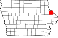
Originally the community was settled by Irish and German immigrants in the early 19th century. The settlement became known as Pin Oak in 1844, the name originating from the many pin oak trees native to the area and after the rural post office located near there.

In 1855 the settlement's name changed again, to Georgetown. This name honored George Gallon, who offered to donate part of his land to build a town. In 1898 the name was once again changed to Holy Cross.

On May 17, 2004 several buildings in town were either damaged or destroyed when major storms ripped through the area. One notable casualty was the Holy Cross Catholic Church. The church suffered serious damage when part of its roof was ripped off in the storm. The interior of the church suffered water damage from the rain. Following the storm, a new roof was placed on the church building, and the interior was also repaired.

Demographics

Historical populations
YearPop.±%
1900 115    
1910 143+24.3%
1920 98−31.5%
1930 111+13.3%
1940 123+10.8%
1950 139+13.0%
1960 157+12.9%
1970 290+84.7%
1980 310+6.9%
1990 293−5.5%
2000 339+15.7%
2010 374+10.3%
2020 356−4.8%
Source: "U.S. Census website". United States Census Bureau . Retrieved 2020-03-29. and Iowa Data Center
Source:
U.S. Decennial Census [5] [2]
The population of Holy Cross, Iowa from US census data Holy CrossIowaPopPlot.png
The population of Holy Cross, Iowa from US census data

2010 census

As of the census [6] of 2010, there were 374 people, 151 households, and 107 families residing in the city. The population density was 1,100.0 inhabitants per square mile (424.7/km2). There were 158 housing units at an average density of 464.7 per square mile (179.4/km2). The racial makeup of the city was 99.5% White and 0.5% from two or more races. Hispanic or Latino of any race were 1.1% of the population.

There were 151 households, of which 37.1% had children under the age of 18 living with them, 58.3% were married couples living together, 10.6% had a female householder with no husband present, 2.0% had a male householder with no wife present, and 29.1% were non-families. 25.8% of all households were made up of individuals, and 8.6% had someone living alone who was 65 years of age or older. The average household size was 2.48 and the average family size was 3.02.

The median age in the city was 35 years. 28.1% of residents were under the age of 18; 8.5% were between the ages of 18 and 24; 24.6% were from 25 to 44; 22.7% were from 45 to 64; and 16% were 65 years of age or older. The gender makeup of the city was 49.5% male and 50.5% female.

2000 census

As of the census [7] of 2000, there were 339 people, 132 households, and 97 families residing in the city. The population density was 1,191.8 inhabitants per square mile (460.2/km2). There were 139 housing units at an average density of 488.7 per square mile (188.7/km2). The racial makeup of the city was 100.00% White.

Holy Cross Catholic Church HolyCrossDubuqueCtyChurchDmg051904.jpg
Holy Cross Catholic Church

There were 132 households, out of which 36.4% had children under the age of 18 living with them, 64.4% were married couples living together, 8.3% had a female householder with no husband present, and 25.8% were non-families. 22.7% of all households were made up of individuals, and 9.1% had someone living alone who was 65 years of age or older. The average household size was 2.57 and the average family size was 3.06.

In the city, the population was spread out, with 28.6% under the age of 18, 6.5% from 18 to 24, 28.3% from 25 to 44, 18.0% from 45 to 64, and 18.6% who were 65 years of age or older. The median age was 37 years. For every 100 females, there were 111.9 males. For every 100 females age 18 and over, there were 103.4 males.

As of 2000 the median income for a household was $38,125, and the median income for a family was $41,136. Males had a median income of $30,694 versus $18,333 for females. The per capita income for the city was $16,629. About 6.8% of families and 8.7% of the population were below the poverty line, including 12.9% of those under age 18 and 17.8% of those age 65 or over.

Cemetery

The Holy Cross Catholic Cemetery is located just to the north of the Holy Cross Catholic Church. As of 2013, there were over 1700 buried in the cemetery. [8]

Education

Residents are within the Western Dubuque Community School District. [9] Zoned schools include Epworth Elementary School in Epworth, [10] Drexler Middle School in Farley, and Western Dubuque High School in Epworth. [11]

Related Research Articles

<span class="mw-page-title-main">East Dubuque, Illinois</span> City in Illinois, United States

East Dubuque is a city in Jo Daviess County, Illinois, United States. The population was 1,704 at the 2010 census, down from 1,995 in 2000. East Dubuque is located alongside the Mississippi River. Across the river is the city of Dubuque, Iowa. The city limits extend along the river to the Illinois – Wisconsin border.

<span class="mw-page-title-main">Newell, Iowa</span> City in Iowa, United States

Newell is a city in Buena Vista County, Iowa, United States. The population was 906 according to the 2020 census.

<span class="mw-page-title-main">Dyersville, Iowa</span> City in Iowa, United States

Dyersville is a city in eastern Delaware County and western Dubuque County in the U.S. state of Iowa. It is part of the Dubuque, Iowa, Metropolitan Statistical Area. The population was 4,477 at the time of the 2020 census, up from 4,035 in 2000.

<span class="mw-page-title-main">Asbury, Iowa</span> City in Iowa, United States

Asbury is a city in Dubuque County, Iowa, United States, and adjacent to the westside of the city of Dubuque. It is part of the Dubuque, Iowa Metropolitan Statistical Area. The population was 5,943 at the 2020 census. Asbury is the second-largest city in Dubuque County, surpassing Dyersville to become the second-largest in the 2010 U.S. Census count. The city is largely a bedroom community, made up of subdivisions whose residents work in Dubuque or Peosta.

<span class="mw-page-title-main">Balltown, Iowa</span> City in Iowa, United States

Balltown is a city in Dubuque County, Iowa, United States. It is part of the Dubuque, Iowa Metropolitan Statistical Area. The population was 79 at the 2020 census, up from 73 in 2000. Balltown is home to Breitbach's Country Dining, Iowa's oldest restaurant and bar, which was founded in 1852 and twice rebuilt by the community, following its destruction by fire in 2007 and 2008.

<span class="mw-page-title-main">Bankston, Iowa</span> City in Iowa, United States

Bankston is a city in Dubuque County, Iowa, United States. It is part of the 'Dubuque, Iowa Metropolitan Statistical Area'. The population was 23 at the 2020 census, down from 27 in 2000.

<span class="mw-page-title-main">Bernard, Iowa</span> City in Iowa, United States

Bernard is a city in Dubuque County, Iowa, United States. The population was 114 in the 2020 census, an increase from the 97 population in 2000. Bernard is part of the Dubuque, Iowa Metropolitan Statistical Area.

<span class="mw-page-title-main">Cascade, Iowa</span> City in Iowa, United States

Cascade is a city in Dubuque and Jones counties, Iowa, United States. The Dubuque County portion is part of Dubuque Metropolitan Statistical Area, while the Jones County section is part of Cedar Rapids Metropolitan Statistical Area. The population was 2,386 at the 2020 census, up from 1,958 in 2000. The city is located within southwestern of Dubuque County and north-central Jones County.

<span class="mw-page-title-main">Centralia, Iowa</span> City in Iowa, United States

Centralia is a city in Dubuque County, Iowa, United States. It is part of the Dubuque, Iowa Metropolitan Statistical Area. The population was 116 at the 2020 census, up 15 persons since the 2000 census.

<span class="mw-page-title-main">Durango, Iowa</span> City in Iowa, United States

Durango is a city in Dubuque County, Iowa, United States. It is part of the Dubuque, Iowa Metropolitan Statistical Area. The population was 20 at the time of the 2020 census, down from 24 in 2000.

<span class="mw-page-title-main">Epworth, Iowa</span> City in Iowa, United States

Epworth is a city in Dubuque County, Iowa, United States. It is part of the Dubuque, Iowa Metropolitan Statistical Area. The population was 2,023 at the 2020 census, up from 1,428 in 2000.

<span class="mw-page-title-main">Farley, Iowa</span> City in Iowa, United States

Farley is a city in Dubuque County, Iowa, United States. It is part of the Dubuque, Iowa Metropolitan Statistical Area. The population was 1,766 at the time of the 2020 census, up from 1,334 in 2000. Farley is the sixth-largest city in Dubuque County.

<span class="mw-page-title-main">Luxemburg, Iowa</span> City in Iowa, United States

Luxemburg is a city in Dubuque County, Iowa, United States. It is part of the Dubuque, Iowa Metropolitan Statistical Area. The population was 245 at the time of the 2020 census, down from 246 in 2000. The White Pine Hollow State Forest is located four miles to the northwest of Luxemburg.

<span class="mw-page-title-main">New Vienna, Iowa</span> City in Iowa, United States

New Vienna is a city in Dubuque County, Iowa, United States. It is part of the Dubuque, Iowa Metropolitan Statistical Area. The population was 382 at the time of the 2020 census, down from 400 in 2000. New Vienna is the home to the Saint Boniface Catholic Church. The city promotes itself with the slogan The eNVy of Iowa.

<span class="mw-page-title-main">Peosta, Iowa</span> City in Iowa, United States

Peosta is a city in Dubuque County, Iowa, United States, and an exurb of the city of Dubuque. It is part of the Dubuque, Iowa Metropolitan Statistical Area. The population was 1,908 in the 2020 census, an increase of 193% from 651 in 2000. Peosta experienced a 70% increase in population (estimated) from 2000 to 2007, making it the state's 10th fastest-growing city during that period. Peosta is currently the seventh-largest city in Dubuque County, but it will likely soon pass Farley (pop. 1,537) and Epworth (pop. 1,860) to become the fifth-largest. The community is home to the 2015 ASA D Northern Nationals Men's Slow Pitch Champions, Kass & Company, a large industrial park, the largest campus of Northeast Iowa Community College, and a handful of new commercial businesses. However, the city is increasingly becoming a bedroom community, much like nearby Asbury, made up of suburban subdivisions.

<span class="mw-page-title-main">Rickardsville, Iowa</span> City in Iowa, United States

Rickardsville is a city in Dubuque County, Iowa, United States. The population was 202 at the time of the 2020 census, up from 191 in 2000.

<span class="mw-page-title-main">Sherrill, Iowa</span> City in Iowa, United States

Sherrill is a city in Dubuque County, Iowa, United States. The population was 189 at the time of the 2020 census, up from 186 in 2000.

<span class="mw-page-title-main">Worthington, Iowa</span> City in Iowa, United States

Worthington is a city in Dubuque County, Iowa, United States. The population was 382 at the time of the 2020 census, up from 381 in 2000. Iowa Highway 136 passes through Worthington, which is situated north of Cascade and south of Dyersville. https://m.youtube.com/watch?v=iik25wqIuFo

<span class="mw-page-title-main">St. Donatus, Iowa</span> City in Iowa, United States

St. Donatus is a city in Jackson County, Iowa, United States. The population was 120 at the time of the 2020 census. St. Donatus is known for its status as a Luxembourger village, with historic architecture and views along U.S. Route 52. It is the home of a historic Catholic church, which is dedicated to Saint Donatus of Muenstereifel, the town's namesake. It was formerly named Tetes des Morts, which is the name of a creek that flows through the village.

<span class="mw-page-title-main">Halma, Minnesota</span> City in Minnesota, United States

Halma is a city in Kittson County, Minnesota, United States. The population was 58 at the 2020 census.

References

  1. "2020 U.S. Gazetteer Files". United States Census Bureau. Retrieved March 16, 2022.
  2. 1 2 "2020 Census State Redistricting Data". census.gov. United states Census Bureau. Retrieved 12 August 2021.
  3. "US Gazetteer files: 2010, 2000, and 1990". United States Census Bureau. 2011-02-12. Retrieved 2011-04-23.
  4. "US Gazetteer files 2010". United States Census Bureau. Archived from the original on 2012-01-25. Retrieved 2012-05-11.
  5. "Census of Population and Housing". Census.gov. Retrieved June 4, 2015.
  6. "U.S. Census website". United States Census Bureau . Retrieved 2012-05-11.
  7. "U.S. Census website". United States Census Bureau . Retrieved 2008-01-31.
  8. "Holy Cross Catholic Cemetery - Dubuque County, Iowa". Iowa Gravestone Photo Project. Retrieved 22 February 2013.
  9. "Western Dubuque." Iowa Department of Education. Retrieved on July 24, 2018.
  10. "2017 Elementary Boundaries." Western Dubuque Community School District. Retrieved on July 24, 2018. Detail on Balltown, Holy Cross, and Rickardsville
  11. "WDHS Boundary map." Western Dubuque Community School District. Retrieved on July 24, 2018.