Washington Mills, Iowa

Last updated
Washington Mills, Iowa
Unincorporated community
USA Iowa location map.svg
Red pog.svg
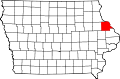
Washington Mills
Location in Iowa
Coordinates: Coordinates: 42°18′2″N90°46′56″W / 42.30056°N 90.78222°W / 42.30056; -90.78222
Country Flag of the United States.svg  United States
State Flag of Iowa.svg  Iowa
County Dubuque County
Elevation
817 ft (249 m)
Time zone UTC-6 (CST)
  Summer (DST) UTC-5 (CDT)
GNIS feature ID464793 [1]

Washington Mills is an unincorporated community in Dubuque County, Iowa, United States.

History

Washington Mills in Dubuque County, Iowa, in 1903; Washington Mills is located at the southern edge of the county. Dubuque County Iowa 1903.png
Washington Mills in Dubuque County, Iowa, in 1903; Washington Mills is located at the southern edge of the county.

Washington Mills' population was 75 in 1887, [2] and was 112 in 1902. [3]

Related Research Articles

Ira, Iowa Unincorporated community in Iowa, United States

Ira is an unincorporated community located in Independence Township, Jasper County, Iowa, United States. The population in 2010 was 29 people.

Noble, Iowa Unincorporated community in Iowa, United States

Noble is an unincorporated community in Washington County, Iowa, United States.

Fillmore, Iowa Unincorporated community in Iowa, United States

Fillmore is an unincorporated community in Dubuque County, Iowa, United States. The community is located along U.S. Route 151, 5.2 miles (8.4 km) east-northeast of Cascade.

Page Center, Iowa Unincorporated community in Iowa, United States

Page Center is an unincorporated community in Harlan Township, Page County, Iowa, United States. Page Center is located along County Highway M60, 5.2 miles (8.4 km) west-southwest of Clarinda.

Finchford, Iowa Unincorporated community in Iowa, United States

Finchford is an unincorporated community in Union Township, Black Hawk County, Iowa, United States. The community is at the intersection of county highways C55 and T71, 4.5 miles (7.2 km) west-southwest of Janesville.

Zero, Iowa former unincorporated community in Iowa, United States

Zero is a ghost town and former unincorporated community in Lucas County, in the U.S. state of Iowa. between Russell and Melrose.

Yorkshire, Iowa unincorporated community in Iowa, United States

Yorkshire is an unincorporated community in Harrison County, in the U.S. state of Iowa.

Hazel Green, Iowa former unincorporated community in Iowa, United States

Hazel Green was an unincorporated community in Delaware County, Iowa, United States. It was located at the junction of 295th Street and 212th Avenue, five miles east of Ryan and six miles west of Hopkinton.

Zenorsville, Iowa Unincorporated community in Iowa, United States

Zenorsville is an unincorporated community in Boone County, in the U.S. state of Iowa.

Union Mills, Iowa Unincorporated community in Iowa, United States

Union Mills is an unincorporated community in Mahaska County, in the U.S. state of Iowa.

Viele, Iowa Unincorporated community in Iowa, United States

Viele is an unincorporated community in northern Lee County, Iowa, United States. It lies near the junction of 235th and 240th Streets, six miles west of the city of Fort Madison. Its elevation is 541 feet (196 m).

Dahlonega, Iowa Unincorporated community in Iowa, United States

Dahlonega is an unincorporated community in Wapello County, Iowa, United States. It lies northeast of Ottumwa, near the junction of U.S. Route 63 and County Highway H-25.

Chequest, Iowa Unincorporated community in Iowa, United States

Chequest was an unincorporated community in Davis County, Iowa, United States. Its elevation is 722 feet (287 m). It was on County Road V42 near Chequest Creek.

Clarkson, Iowa former Unincorporated community in Iowa, United States

Clarkson was an unincorporated community in Warren County, Iowa, United States. It was located two miles east of Carlisle, near the Des Moines River. Its elevation was 935 feet.

Vincennes, Iowa Unincorporated community in Iowa, United States

Vincennes is an unincorporated community in the southern part of Lee County, Iowa, United States. It lies near the junction of 320th Street and Iowa Highway 27, 2.5 miles south of Argyle. Its elevation is 554 feet.

Newburg, Jasper County, Iowa Unincorporated community in Iowa, United States

Newburg is an unincorporated community in Jasper County, in the U.S. state of Iowa. Newburg lies near the junction of county highway T38 and F17.

Green Castle, Iowa Unincorporated community in Iowa, United States

Green Castle, also spelled Greencastle, is an unincorporated community in Jasper County, in the U.S. state of Iowa. Green Castle lies along the junction of North 51st Avenue W and West 112th Street N, a half mile west of Iowa Highway 117.

Clyde, Iowa Unincorporated community in Iowa, United States

Clyde is an unincorporated community in Jasper County, in the U.S. state of Iowa. Clyde lies along the junction of North 102st Avenue W and Iowa Highway 330.

Galesburg, Iowa Unincorporated community in Iowa, United States

Galesburg is an unincorporated community in Jasper County, in the U.S. state of Iowa. Galesburg lies along the junction of Main Street/Sioux Avenue and Highway T14 S.

Fairmount, Iowa Unincorporated community in Iowa, United States

Fairmount is an unincorporated community in Jasper County, in the U.S. state of Iowa. Fairmount lies along the junction of Iowa Highway 163 and West 70th Street South. The community has also been known as Fairmont.

References

  1. U.S. Geological Survey Geographic Names Information System: Washington Mills, Iowa
  2. Cram, George Franklin (1887). Cram's Universal Atlas: Geographical, Astronomical and Historical, Containing a Complete Series of Maps of Modern Geography, Illustrated by Numerous Views and Charts ; the Whole Supplemented with Valuable Statistics, Diagrams, and a Complete Gazetteer of the United States. G.F. Cram. pp. 367–369.
  3. Cram's Modern Atlas: The New Unrivaled New Census Edition. J. R. Gray & Company. 1902. pp. 203–207.