
Dubuque is a city in and the county seat of Dubuque County, Iowa, United States, located along the Mississippi River. At the time of the 2020 census, the population of Dubuque was 59,667. The city lies at the junction of Iowa, Illinois, and Wisconsin, a region locally known as the Tri-State Area. It serves as the main commercial, industrial, educational, and cultural center for the area. Geographically, it is part of the Driftless Area, a portion of North America that escaped all three phases of the Wisconsin Glaciation.

Dubuque County is a county located in the U.S. state of Iowa. As of the 2020 census, the population was 99,266, making it the eighth-most populous county in Iowa. The county seat is Dubuque. The county is named for Julien Dubuque, the first European settler of Iowa.

Dyersville is a city in eastern Delaware County and western Dubuque County in the U.S. state of Iowa. It is part of the Dubuque, Iowa, Metropolitan Statistical Area. The population was 4,477 at the time of the 2020 census, up from 4,035 in 2000.

Cascade is a city in Dubuque and Jones counties, Iowa, United States. The Dubuque County portion is part of Dubuque Metropolitan Statistical Area, while the Jones County section is part of Cedar Rapids Metropolitan Statistical Area. The population was 2,386 at the 2020 census, up from 1,958 in 2000. The city is located within southwestern of Dubuque County and north-central Jones County.

Centralia is a city in Dubuque County, Iowa, United States. It is part of the Dubuque, Iowa Metropolitan Statistical Area. The population was 116 at the 2020 census, up 15 persons since the 2000 census and down 18 from the 2010.
Farley is a city in Dubuque County, Iowa, United States. It is part of the Dubuque, Iowa Metropolitan Statistical Area. The population was 1,766 at the time of the 2020 census, up from 1,334 in 2000. Farley is the seventh-largest town in Dubuque County, recently passed by Peosta, Iowa.

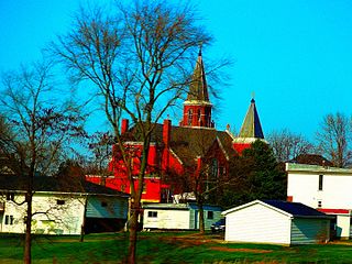
Peosta is a city in Dubuque County, Iowa, United States, and an exurb of the city of Dubuque. It is part of the Dubuque, Iowa Metropolitan Statistical Area. The population was 1,908 in the 2020 census, an increase of 193% from 651 in 2000. Peosta experienced a 70% increase in population (estimated) from 2000 to 2007, making it the state's 10th fastest-growing city during that period. Peosta is currently the sixth-largest city in Dubuque County, but it will likely soon pass Epworth (pop. 1,860) to become the fifth-largest. The community is home to the 2015 ASA D Northern Nationals Men's Slow Pitch Champions, Kass & Company, a large industrial park, the largest campus of Northeast Iowa Community College, and a handful of new commercial businesses. However, the city is increasingly becoming a bedroom community, much like nearby Asbury, made up of suburban subdivisions.
Bladensburg is a small unincorporated community in Wapello County, Iowa, United States. It lies midway between Agency and Batavia at a distance of five miles (8 km) from each, and the largest nearby city is Ottumwa, seven miles (11 km) to the west-southwest.
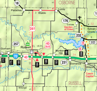
Dubuque is an unincorporated community in Barton and Russell Counties in the U.S. state of Kansas. It is approximately 10 miles (16 km) south of Dorrance.
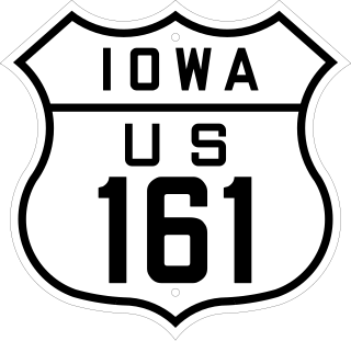
U.S. Highway 161 was a U.S. Highway in Iowa that ran from Keokuk to Dubuque by way of Cedar Rapids. It was designated in 1925 and signed in 1926 along two primary highways. The route began at the Mississippi River with US 61 southwest of Keokuk ran north through Mount Pleasant and Iowa City to Cedar Rapids. There, it turned to the northeast through Anamosa and Monticello towards Dubuque. The route ended at US 61 in Key West, a few miles west of Dubuque.
Bangor is an unincorporated community in Marshall County, Iowa, United States. It is located at the intersections of County Highway E18 and S62, five miles southwest of Liscomb and six miles south of Union. It is located near the west bank of the Iowa River, at 42.172838N, -93.089073W.
Churchville is an unincorporated community in Warren County, Iowa, United States. It is located in Jefferson Township at the intersection of Churchville Street and 30th Avenue. It is 1.5 miles (2.4 km) southwest of Prole and two miles (3.2 km) north of Martensdale at an altitude of 971 feet (296 m).
Lycurgus is a rural unincorporated community in Allamakee County, Iowa, United States.
St. Joseph is an unincorporated community and census-designated place (CDP) in Riverdale Township, Kossuth County, Iowa, United States. As of the 2010 census the population was 61.
Perkins is an unincorporated community in Sioux County, Iowa, United States. At Perkins, U.S. Route 18 and U.S. Route 75 are concurrent roadways.
Denhart is an unincorporated community in Magor Township, Hancock County, Iowa, United States. Denhart is located along County Highway R26, 4.4 miles (7.1 km) west-northwest of Kanawha.
Langdon is an unincorporated community in Meadow Township, Clay County, Iowa, United States. Langdon is located along county highways B17 and M50, 5.6 miles (9.0 km) north-northeast of Spencer.
Cornell is an unincorporated community in Herdland Township, Clay County, Iowa, United States. Cornell is located near U.S. Route 71 and is 3.6 miles (5.8 km) north of Sioux Rapids.
Fielding is an unincorporated community in Tilden Township, Cherokee County, Iowa, United States. Fielding is located along County Highway L36, 14 miles (23 km) west-southwest of Cherokee.
Waupeton is an unincorporated community in Dubuque County, Iowa, United States.

