Waupeton, Iowa | |
|---|---|
 Waupeton | |
| Coordinates: 42°40′04″N90°52′56″W / 42.66778°N 90.88222°W | |
| Country | United States |
| State | Iowa |
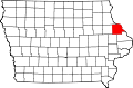
| County | Dubuque |
| Elevation | 650 ft (200 m) |
| Time zone | UTC-6 (Central (CST)) |
| • Summer (DST) | UTC-5 (CDT) |
| Area code | 563 |
| GNIS feature ID | 464796 [1] |
Waupeton is an unincorporated community in Dubuque County, Iowa, United States. [1] [2]