Fertile, Iowa

Last updated

Fertile, Iowa
Fertile iowa.jpg
Worth County Iowa Incorporated and Unincorporated areas Fertile Highlighted.svg
Location of Fertile, Iowa
Coordinates: 43°15′53″N93°25′16″W / 43.26472°N 93.42111°W / 43.26472; -93.42111
Country Flag of the United States.svg  United States
State Flag of Iowa.svg  Iowa
County Worth
Government
  TypeMayor
Area
[1]
  Total0.94 sq mi (2.44 km2)
  Land0.94 sq mi (2.44 km2)
  Water0.00 sq mi (0.00 km2)
Elevation
1,171 ft (357 m)
Population
 (2020)
  Total305
  Density324.12/sq mi (125.19/km2)
Time zone UTC-6 (Central (CST))
  Summer (DST) UTC-5 (CDT)
ZIP code
50434
Area code 641
FIPS code 19-27390
GNIS feature ID0456580
Website www.fertileiowa.us

Fertile is a city in Worth County, Iowa, United States. The population was 305 at the time of the 2020 census. [2] It is part of the Mason City Micropolitan Statistical Area.

Contents

History

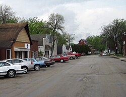
The community was first called Rhodes Mill after William Rhodes, who settled there in 1856 and built a house. A land speculator created a fictional town nearby and named it Fontanelle, though the locals called it Putsey. Fertile was established in 1877, and named for the quality of the soil in the valley it was located in. Fertile was incorporated in 1908. [3] [4]

Rhodes Mill is listed on the National Register of Historic Places.

Geography

Fertile is located at 43°15′53″N93°25′16″W / 43.26472°N 93.42111°W / 43.26472; -93.42111 (43.264704, -93.421176). [5]

According to the United States Census Bureau, the city has a total area of 0.94 square miles (2.43 km2), all land. [6]

Demographics

Historical populations
YearPop.±%
1910 207    
1920 223+7.7%
1930 238+6.7%
1940 276+16.0%
1950 397+43.8%
1960 386−2.8%
1970 394+2.1%
1980 372−5.6%
1990 382+2.7%
2000 360−5.8%
2010 370+2.8%
2020 305−17.6%
Source: "U.S. Census website". United States Census Bureau . Retrieved March 28, 2020. and Iowa Data Center
Source:
U.S. Decennial Census [7] [2]
The population of Fertile, Iowa from US census data FertileIowaPopPlot.png
The population of Fertile, Iowa from US census data

2010 census

As of the census [8] of 2010, there were 370 people, 148 households, and 111 families residing in the city. The population density was 393.6 inhabitants per square mile (152.0/km2). There were 161 housing units at an average density of 171.3 per square mile (66.1/km2). The racial makeup of the city was 97.8% White, 0.5% African American, 1.1% Native American, 0.3% Asian, and 0.3% from two or more races. Hispanic or Latino people of any race were 4.9% of the population.

There were 148 households, of which 30.4% had children under the age of 18 living with them, 64.2% were married couples living together, 4.7% had a female householder with no husband present, 6.1% had a male householder with no wife present, and 25.0% were non-families. 19.6% of all households were made up of individuals, and 8.1% had someone living alone who was 65 years of age or older. The average household size was 2.50 and the average family size was 2.88.

The median age in the city was 41 years. 23.5% of residents were under the age of 18; 5.7% were between the ages of 18 and 24; 25.5% were from 25 to 44; 27.8% were from 45 to 64; and 17.3% were 65 years of age or older. The gender makeup of the city was 51.9% male and 48.1% female.

2000 census

As of the census [9] of 2000, there were 360 people, 149 households, and 102 families residing in the city. The population density was 382.9 inhabitants per square mile (147.8/km2). There were 161 housing units at an average density of 171.3 per square mile (66.1/km2). The racial makeup of the city was 95.83% White, 0.56% African American, 0.28% Native American, 3.06% from other races, and 0.28% from two or more races. Hispanic or Latino people of any race were 2.50% of the population.

There were 149 households, out of which 32.2% had children under the age of 18 living with them, 60.4% were married couples living together, 7.4% had a female householder with no husband present, and 30.9% were non-families. 26.2% of all households were made up of individuals, and 17.4% had someone living alone who was 65 years of age or older. The average household size was 2.42 and the average family size was 2.94.

In the city, the population was spread out, with 24.2% under the age of 18, 5.8% from 18 to 24, 26.9% from 25 to 44, 25.8% from 45 to 64, and 17.2% who were 65 years of age or older. The median age was 41 years. For every 100 females, there were 90.5 males. For every 100 females age 18 and over, there were 88.3 males.

The median income for a household in the city was $33,558, and the median income for a family was $36,500. Males had a median income of $26,583 versus $20,179 for females. The per capita income for the city was $14,464. About 4.5% of families and 9.3% of the population were below the poverty line, including 17.5% of those under age 18 and 7.8% of those age 65 or over.

Education

Residents are part of the Forest City Community School District. [10]

Notable people

Leo Elthon, the 32nd Governor of Iowa, was born in Fertile.

Related Research Articles

<span class="mw-page-title-main">Worth County, Iowa</span> County in Iowa, United States

Worth County is a county located in the U.S. state of Iowa. As of the 2020 census, the population was 7,443. The county seat is Northwood. The county was founded in 1851 and named for Major General William Jenkins Worth (1794–1849), an officer in both the Seminole War and the Mexican–American War.

<span class="mw-page-title-main">New Albin, Iowa</span> City in Iowa, United States

New Albin is a city in Iowa Township, Allamakee County, Iowa, United States. It is the northeasternmost town in Iowa, located on the Mississippi River and the Minnesota border. The population was 432 at the time of the 2020 census.

<span class="mw-page-title-main">Beaver, Iowa</span> City in Iowa, United States

Beaver is a city in Amaqua Township, Boone County, Iowa, United States. The population was 46 at the 2020 census. It is part of the 'Boone, Iowa Micropolitan Statistical Area', which is a part of the larger Ames-Boone, Iowa Combined Statistical Area.

<span class="mw-page-title-main">Ventura, Iowa</span> City in Iowa, United States

Ventura is a city in Cerro Gordo County, Iowa, United States. The population was 711 at the time of the 2020 census. It is part of the Mason City Micropolitan Statistical Area. Ventura is located on the northeastern basin of Clear Lake, making it an area with many lakeside areas.

<span class="mw-page-title-main">Alta Vista, Iowa</span> City in Iowa, United States

Alta Vista is a city in Chickasaw County, Iowa, United States. The population was 227 at the 2020 census.

<span class="mw-page-title-main">Garber, Iowa</span> City in Iowa, United States

Garber is a city in Clayton County, Iowa, United States. The population was 76 at the time of the 2020 census, down from 103 in 2000.

<span class="mw-page-title-main">Monona, Iowa</span> City in Iowa, United States

Monona is a city in Clayton County, Iowa, United States. The population was 1,471 at the time of the 2020 census.

<span class="mw-page-title-main">St. Olaf, Iowa</span> City in Iowa, United States

St. Olaf is a city in Clayton County, Iowa, United States. The population was 106 at the time of the 2020 census, down from 136 in 2000. Swiss Valley has a large cheese packaging plant in St. Olaf.

<span class="mw-page-title-main">Arion, Iowa</span> City in Iowa, United States

Arion is a city in Crawford County, Iowa, United States, along the Boyer River. The population was 97 at the 2020 census.

<span class="mw-page-title-main">Gruver, Iowa</span> City in Iowa, United States

Gruver is a city in Emmet County, Iowa, United States. The population was 63 at the time of the 2020 census.

<span class="mw-page-title-main">Wallingford, Iowa</span> City in Iowa, United States

Wallingford is a city in Emmet County, Iowa, United States. The population was 197 at the 2010 census.

<span class="mw-page-title-main">St. Lucas, Iowa</span> City in Iowa, United States

St. Lucas is a city in Fayette County, Iowa, United States. The population was 167 at the time of the 2020 census.

<span class="mw-page-title-main">Rudd, Iowa</span> City in Iowa, United States

Rudd is a city in Floyd County, Iowa, United States. The population was 358 at the time of the 2020 census, a decline of 16.9% from 431 in 2000.

<span class="mw-page-title-main">Bancroft, Iowa</span> City in Iowa, United States

Bancroft is a city in Kossuth County, Iowa, United States. The population was 699 at the time of the 2020 census.

<span class="mw-page-title-main">Ledyard, Iowa</span> City in Iowa, United States

Ledyard is a city in Kossuth County, Iowa, United States. The population was 121 at the time of the 2020 census.

<span class="mw-page-title-main">Leighton, Iowa</span> City in Iowa, United States

Leighton is a city in Mahaska County, Iowa, United States. The population was 158 in the 2020 census, an increase from 153 in the 2000 census.

<span class="mw-page-title-main">Mitchell, Iowa</span> City in Iowa, United States

Mitchell is a city in Mitchell County, Iowa, United States. The population was 124 at the time of the 2020 census.

<span class="mw-page-title-main">Ashton, Iowa</span> City in Iowa, United States

Ashton is a city in Osceola County, Iowa, United States. The population was 436 at the 2020 census.

<span class="mw-page-title-main">Delphos, Iowa</span> City in Iowa, United States

Delphos is a city in Ringgold County, Iowa, United States. The population was 26 at the 2020 census.

<span class="mw-page-title-main">Sugarcreek, Pennsylvania</span> Borough in Pennsylvania, United States

Sugarcreek is a borough in Venango County, Pennsylvania, United States. The population was 4,824 at the 2020 census. It is the largest borough by total area in all Venango County.

References

  1. "2020 U.S. Gazetteer Files". United States Census Bureau. Retrieved March 16, 2022.
  2. 1 2 "2020 Census State Redistricting Data". census.gov. United states Census Bureau. Retrieved August 12, 2021.
  3. Savage, Tom (2007). A Dictionary of Iowa Place-Names. University of Iowa Press. ISBN   9781587297595.
  4. Clyde, Jefferson F. (1918). History of Mitchell and Worth Counties, Iowa, Volume 1. S.J. Clarke Publishing Company. p. 348.
  5. "US Gazetteer files: 2010, 2000, and 1990". United States Census Bureau. February 12, 2011. Retrieved April 23, 2011.
  6. "US Gazetteer files 2010". United States Census Bureau. Archived from the original on July 2, 2012. Retrieved May 11, 2012.
  7. "Census of Population and Housing". Census.gov. Retrieved June 4, 2015.
  8. "U.S. Census website". United States Census Bureau . Retrieved May 11, 2012.
  9. "U.S. Census website". United States Census Bureau . Retrieved January 31, 2008.
  10. "Forest City Archived 2018-04-27 at the Wayback Machine ." Iowa Department of Education. Retrieved on July 22, 2018.