West Bend, Iowa

Last updated

West Bend, Iowa
West Bend, Iowa 001.jpg
Motto: 
"A Rock Solid Community" [1]
Kossuth County Iowa Incorporated and Unincorporated areas West Bend Highlighted.svg
Location of West Bend, Iowa
Coordinates: 42°57′33″N94°26′45″W / 42.95917°N 94.44583°W / 42.95917; -94.44583
Country Flag of the United States (23px).png  United States
State Flag of Iowa.svg  Iowa
Counties Palo Alto, Kossuth
Area
[2]
  Total0.88 sq mi (2.27 km2)
  Land0.88 sq mi (2.27 km2)
  Water0.00 sq mi (0.00 km2)
Elevation
1,191 ft (363 m)
Population
 (2020)
  Total791
  Density901.94/sq mi (348.22/km2)
Time zone UTC-6 (Central (CST))
  Summer (DST) UTC-5 (CDT)
ZIP code
50597
Area code 515
FIPS code 19-83550
GNIS feature ID0465615
Website City of West Bend, Iowa

West Bend is a village in Kossuth and Palo Alto (originally) counties in the U.S. state of Iowa. The population was 791 at the time of the 2020 census. [3]

Contents

History

West Bend got its start in the early 1880s, following the construction of the Burlington, Cedar Rapids and Northern Railway through that territory. It was originally called Ives after the president of the railroad, but the townspeople had it changed to West Bend from the bend in the river. West Bend (aka Ives) was the first town in Palo Alto County. A special five cent tax to build a railroad station was promised to the railroad if they would create a stop when the railroad was built. The railroad did that placing the line and the new station in West Bend. [4]

Geography

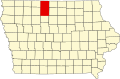
The village straddles the county line, in the southwest part of Kossuth County and the southeast part of Palo Alto County, in northwestern Iowa. But, it was first in Palo Alto County.

According to the United States Census Bureau, the city has a total area of 0.89 square miles (2.31 km2), all land. [5]

West Bend is served by a lightly-used former branch line of the Rock Island Railroad now owned by the Union Pacific Railroad. [6]

Demographics

Historical populations
YearPop.±%
1890 325    
1900 538+65.5%
1910 679+26.2%
1920 969+42.7%
1930 634−34.6%
1940 737+16.2%
1950 772+4.7%
1960 910+17.9%
1970 865−4.9%
1980 941+8.8%
1990 862−8.4%
2000 834−3.2%
2010 785−5.9%
2020 791+0.8%
Source: "U.S. Census website". United States Census Bureau . Retrieved March 29, 2020. and Iowa Data Center
Source:
U.S. Decennial Census [7] [3]

2010 census

As of the census [8] of 2010, there were 785 people, 360 households, and 213 families living in the city. The population density was 882.0 inhabitants per square mile (340.5/km2). There were 396 housing units at an average density of 444.9 per square mile (171.8/km2). The racial makeup of the city was 99.1% White, 0.1% Native American, and 0.8% from two or more races. Hispanic or Latino of any race were 1.4% of the population.

There were 360 households, of which 20.8% had children under the age of 18 living with them, 51.7% were married couples living together, 4.4% had a female householder with no husband present, 3.1% had a male householder with no wife present, and 40.8% were non-families. 38.1% of all households were made up of individuals, and 23.6% had someone living alone who was 65 years of age or older. The average household size was 2.07 and the average family size was 2.71.

The median age in the city was 51.6 years. 18.1% of residents were under the age of 18; 7.4% were between the ages of 18 and 24; 15.5% were from 25 to 44; 26.8% were from 45 to 64; and 32.2% were 65 years of age or older. The gender makeup of the city was 46.4% male and 53.6% female.

2000 census

At the 2000 census, [9] there were 834 people, 352 households and 210 families living in the city. The population density was 943.3 inhabitants per square mile (364.2/km2). There were 379 housing units at an average density of 428.7 per square mile (165.5/km2). The racial makeup of the city was 99.40% White, 0.12% Native American, 0.12% Asian, and 0.36% from two or more races. Hispanic or Latino of any race were 0.48% of the population.

There were 352 households, of which 25.0% had children under the age of 18 living with them, 54.8% were married couples living together, 3.1% had a female householder with no husband present, and 40.1% were non-families. 37.2% of all households were made up of individuals, and 24.4% had someone living alone who was 65 years of age or older. The average household size was 2.21 and the average family size was 2.95.

Age distribution was 22.1% under the age of 18, 6.0% from 18 to 24, 20.5% from 25 to 44, 20.6% from 45 to 64, and 30.8% who were 65 years of age or older. The median age was 46 years. For every 100 females, there were 86.6 males. For every 100 females age 18 and over, there were 83.6 males.

The median household income was $31,711, and the median family income was $40,455. Males had a median income of $31,083 versus $20,000 for females. The per capita income for the city was $18,804. About 4.1% of families and 6.9% of the population were below the poverty line, including 7.8% of those under age 18 and 7.2% of those age 65 or over.

Attractions

Grotto of the Redemption Grotto of the Redemption South.jpg
Grotto of the Redemption

West Bend is the site of the Grotto of the Redemption, a series of nine contiguous grottos occupying a full city block, constructed of minerals, petrifications, and semiprecious gems.

Education

West Bend is part of the West Bend–Mallard Community School District, [10] established by the merger of the West Bend and Mallard school districts in 1995. [11]

Notable person


Related Research Articles

<span class="mw-page-title-main">Ringgold County, Iowa</span> County in Iowa, United States

Ringgold County is a county located in the U.S. state of Iowa. As of the 2020 census, the population was 4,663, making it the Iowa county with the second-smallest population. The county seat is Mount Ayr. The county is named after Maj. Samuel Ringgold, a hero of the Battle of Palo Alto fought in May 1846, during the Mexican–American War. It is one of the 26 Iowa counties with a name that is unique across the nation.

<span class="mw-page-title-main">Pocahontas County, Iowa</span> County in Iowa, United States

Pocahontas County is a county located in Iowa, United States. As of the 2020 census the population was 7,078, making it the state's ninth-least populous county. The county seat is Pocahontas. The county was formed in 1851.

<span class="mw-page-title-main">Palo Alto County, Iowa</span> County in Iowa, United States

Palo Alto County is a county located in the U.S. state of Iowa. As of the 2020 census, the population was 8,996. The county seat is Emmetsburg. It is named after the Battle of Palo Alto, the first major battle of the Mexican–American War.

<span class="mw-page-title-main">Kossuth County, Iowa</span> County in Iowa, United States

Kossuth County is a county in the U.S. state of Iowa. As of the 2020 census, the population was 14,828. The county seat is Algona.

<span class="mw-page-title-main">Jasper County, Iowa</span> County in Iowa, United States

Jasper County is a county in the U.S. state of Iowa. As of the 2020 census, the population was 37,813. The county seat is Newton. The county was organized in 1846 and is named after Sergeant William Jasper, a Revolutionary War hero.

<span class="mw-page-title-main">Sheldahl, Iowa</span> City in Iowa, United States

Sheldahl is a city in Polk, Boone, and Story counties in the U.S. state of Iowa. The population was 297 at the time of the 2020 census.

<span class="mw-page-title-main">Tipton, Iowa</span> City in Iowa, United States

Tipton (/ˈtɪptən/) is a city in Cedar County, Iowa, United States. The population was 3,149 at the time of the 2020 census. It is the county seat of Cedar County.

<span class="mw-page-title-main">Mondamin, Iowa</span> City in Iowa, United States

Mondamin is a city in Harrison County, Iowa, United States. The population was 339 at the time of the 2020 census.

<span class="mw-page-title-main">Bode, Iowa</span> City in Iowa, United States

Bode is a city in Humboldt County, Iowa, United States. The population was 302 at the 2020 census.

<span class="mw-page-title-main">Palo, Iowa</span> City in Iowa, United States

Palo is a city in Linn County, Iowa, United States. The population was 1,407 at the time of the 2020 census. It is part of the Cedar Rapids Metropolitan Statistical Area.

<span class="mw-page-title-main">Ayrshire, Iowa</span> City in Iowa, United States

Ayrshire is a city in Palo Alto County, Iowa, United States. The population was 133 at the 2020 census.

<span class="mw-page-title-main">Curlew, Iowa</span> City in Iowa, United States

Curlew is a city in Palo Alto County, Iowa, United States. The population was 37 at the time of the 2020 census.

<span class="mw-page-title-main">Cylinder, Iowa</span> City in Iowa, United States

Cylinder is a city in Palo Alto County, Iowa, United States. The population was 87 at the time of the 2020 census.

<span class="mw-page-title-main">Emmetsburg, Iowa</span> City in Iowa, United States

Emmetsburg is a city in Palo Alto County, Iowa, United States. The population was 3,706 at the time of the 2020 census. It is the county seat of Palo Alto County. Emmetsburg is located around the southern bay of Five Island Lake.

<span class="mw-page-title-main">Graettinger, Iowa</span> City in Iowa, United States

Graettinger is a city in Palo Alto County, Iowa, United States. The population was 832 at the time of the 2020 census.

<span class="mw-page-title-main">Mallard, Iowa</span> City in Iowa, United States

Mallard is a city in Palo Alto County, Iowa, United States. The population was 257 at the time of the 2020 census.

<span class="mw-page-title-main">Rodman, Iowa</span> City in Iowa, United States

Rodman is a city in Palo Alto County, Iowa, United States. The population was 31 at the time of the 2020 census. Rodman is also the farthest city in Iowa from any National park, being 372 miles away from the closest National park in the United States.

<span class="mw-page-title-main">Ruthven, Iowa</span> City in Iowa, United States

Ruthven is a city in Palo Alto County, Iowa, United States. The population was 725 at the time of the 2020 census.

<span class="mw-page-title-main">Palo Alto, Pennsylvania</span> Borough in Pennsylvania, United States

Palo Alto is a borough in Schuylkill County, Pennsylvania, United States. Bacon Street is the main street of town.

<span class="mw-page-title-main">Gilmore City, Iowa</span> City in Iowa, United States

Gilmore City is a city in Humboldt and Pocahontas counties in the U.S. state of Iowa. The population was 487 at the time of the 2020 census.

References

  1. "City of West Bend, Iowa". City of West Bend, Iowa. Archived from the original on April 7, 2018. Retrieved August 31, 2012.
  2. "2020 U.S. Gazetteer Files". United States Census Bureau. Retrieved March 16, 2022.
  3. 1 2 "2020 Census State Redistricting Data". census.gov. United states Census Bureau. Retrieved August 12, 2021.
  4. McCarty, Dwight Gaylord (1910). History of Palo Alto County, Iowa. Torch Press. pp.  146.
  5. "US Gazetteer files 2010". United States Census Bureau . Retrieved May 11, 2012.
  6. Iowa Railroad Traffic Density, Iowa Department of Transportation
  7. "Census of Population and Housing". Census.gov. Retrieved June 4, 2015.
  8. "U.S. Census website". United States Census Bureau . Retrieved May 11, 2012.
  9. "U.S. Census website". United States Census Bureau . Retrieved January 31, 2008.
  10. "West Bend-Mallard" (PDF). Iowa Department of Education . Retrieved March 27, 2020.
  11. "REORGANIZATION & DISSOLUTION ACTIONS SINCE 1965-66" (PDF). Iowa Department of Education. Archived from the original (PDF) on February 9, 2019. Retrieved August 1, 2019.
  12. "Grotto of the Redemption". RoadsideAmerica.com. Retrieved July 27, 2014.