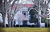
[3] Name on the Register [4] Image Date listed [5] Location City or town Description 1 Adams Street Historic District Upload image March 15, 2000 (# 00000233 1112-1400 Adams, 1251-1327 Adams St., and 304-308 Stewart St. 35°54′54″N 86°52′14″W / 35.915124°N 86.870693°W / 35.915124; -86.870693 (Adams Street Historic District ) Franklin Historic district with 37 buildings including bungalows , American Craftsman , and Victorian architecture 2 William Allison House William Allison House April 13, 1988 (# 88000288 U.S. Route 31A , 2 miles (3.2 km) south of College Grove 35°45′48″N 86°41′25″W / 35.763333°N 86.690278°W / 35.763333; -86.690278 (William Allison House ) College Grove Historic Federal -style house with a central passage plan 3 Anderson Site Upload image June 14, 1990 (# 90000913 Address Restricted Franklin 4 The Bank of College Grove The Bank of College Grove April 13, 1988 (# 88000289 U.S. Route 31A 35°47′10″N 86°40′35″W / 35.786111°N 86.676389°W / 35.786111; -86.676389 (The Bank of College Grove ) College Grove 5 Bank of Nolensville Bank of Nolensville April 13, 1988 (# 88000287 7287 Nolensville Rd 35°57′11″N 86°40′12″W / 35.953056°N 86.67°W / 35.953056; -86.67 (Bank of Nolensville ) Nolensville 6 Beasley-Parham House Beasley-Parham House April 13, 1988 (# 88000286 Lick Creek Rd., 1 mile (1.6 km) north of Natchez Trace 35°50′19″N 87°06′48″W / 35.838611°N 87.113333°W / 35.838611; -87.113333 (Beasley-Parham House ) Greenbrier 7 Bostick Female Academy Bostick Female Academy April 15, 1982 (# 82004070 8013 Horton Hwy 35°51′10″N 86°39′36″W / 35.852778°N 86.66°W / 35.852778; -86.66 (Bostick Female Academy ) College Grove 8 Boyd Mill Ruins Boyd Mill Ruins April 13, 1988 (# 88000285 Eastern bank of the West Harpeth River , 0.1 miles (0.16 km) south of Boxley Valley Rd. and Boyd Mill Pike 35°55′15″N 86°58′01″W / 35.920833°N 86.966944°W / 35.920833; -86.966944 (Boyd Mill Ruins ) Franklin 9 William Boyd House William Boyd House April 13, 1988 (# 88000284 Boyd Mill Pike, 0.1 miles (0.16 km) north of Boxley Valley Rd. 35°55′27″N 86°57′55″W / 35.924167°N 86.965278°W / 35.924167; -86.965278 (William Boyd House ) Franklin 10 Boyd-Wilson Farm Boyd-Wilson Farm July 5, 1996 (# 96000748 3209 Boxley Valley Rd. 35°54′52″N 86°58′05″W / 35.914444°N 86.968056°W / 35.914444; -86.968056 (Boyd-Wilson Farm ) Franklin 11 William S. Campbell House William S. Campbell House October 29, 1975 (# 75001798 State Route 96 35°55′27″N 86°53′08″W / 35.924167°N 86.885556°W / 35.924167; -86.885556 (William S. Campbell House ) Franklin 12 Carnton Carnton January 18, 1973 (# 73001857 Confederate Cemetery Lane 35°54′11″N 86°51′30″W / 35.903056°N 86.858333°W / 35.903056; -86.858333 (Carnton ) Franklin Part of the Franklin Battlefield [6] 13 John Henry Carothers House John Henry Carothers House November 27, 1989 (# 89002028 1343 Huffines Ridge Dr 35°55′41″N 86°49′07″W / 35.928056°N 86.818528°W / 35.928056; -86.818528 (John Henry Carothers House ) Franklin 14 Cedar Heights Farmhouse Upload image May 10, 2024 (# 100010336 704 Taylor Lane 36°12′00″N 86°33′00″W / 36.1999°N 86.5499°W / 36.1999; -86.5499 (Cedar Heights Farmhouse ) Mt. Juliet 15 Cedarmont Upload image July 12, 1984 (# 84003747 Off State Route 96 35°53′24″N 86°48′05″W / 35.89°N 86.801389°W / 35.89; -86.801389 (Cedarmont ) Franklin 16 Coats-Hines Archaeological Site Coats-Hines Archaeological Site July 12, 2011 (# 11000422 Southern side of a Spencer Creek tributary, west of the Nashville Golf and Athletic Club [7] 35°57′38″N 86°47′41″W / 35.960556°N 86.794722°W / 35.960556; -86.794722 (Coats-Hines Archaeological Site ) Franklin One of only a very few sites in Eastern North America that contains direct evidence of mastodon hunting by Paleoindians during the late Pleistocene . 17 College Grove Methodist Church College Grove Methodist Church April 13, 1988 (# 88000345 U.S. Route 31A 35°47′16″N 86°40′25″W / 35.787778°N 86.673611°W / 35.787778; -86.673611 (College Grove Methodist Church ) College Grove 18 Cox House Cox House February 28, 1980 (# 80003881 150 Franklin Rd. 35°55′43″N 86°51′54″W / 35.928611°N 86.865°W / 35.928611; -86.865 (Cox House ) Franklin 19 John Crafton House John Crafton House April 13, 1988 (# 88000347 4378 N Chapel Rd 35°52′44″N 86°46′10″W / 35.878889°N 86.769444°W / 35.878889; -86.769444 (John Crafton House ) Franklin 20 Craig-Beasley House Craig-Beasley House December 23, 2003 (# 03001342 425 Boyd Mill Ave 35°55′22″N 86°52′54″W / 35.922778°N 86.881667°W / 35.922778; -86.881667 (Craig-Beasley House ) Franklin 21 Jacob Critz House Upload image April 13, 1988 (# 88000343 1830 Evergreen Rd 35°47′56″N 86°56′44″W / 35.798889°N 86.945556°W / 35.798889; -86.945556 (Jacob Critz House ) Thompson's Station 22 Thomas L. Critz House Thomas L. Critz House April 13, 1988 (# 88000342 2677 Critz Ln 35°48′38″N 86°52′50″W / 35.810556°N 86.880556°W / 35.810556; -86.880556 (Thomas L. Critz House ) Thompson's Station 23 Andrew Crockett House Andrew Crockett House April 13, 1988 (# 88000302 1500 Volunteer Pkwy 35°59′01″N 86°47′02″W / 35.983611°N 86.783889°W / 35.983611; -86.783889 (Andrew Crockett House ) Brentwood 24 Samuel Crockett House Samuel Crockett House April 14, 1988 (# 88000296 Crockett Rd. and Wilson Pike 35°58′30″N 86°46′30″W / 35.975°N 86.775°W / 35.975; -86.775 (Samuel Crockett House ) Brentwood 25 Dortch Stove Works Dortch Stove Works November 13, 1997 (# 97001438 230 N. Franklin Rd. 35°55′58″N 86°47′36″W / 35.932778°N 86.793333°W / 35.932778; -86.793333 (Dortch Stove Works ) Franklin 26 Douglass-Reams House Douglass-Reams House April 13, 1988 (# 88000293 2435 Douglass Glenn Ln. 35°52′28″N 86°50′59″W / 35.874444°N 86.849722°W / 35.874444; -86.849722 (Douglass-Reams House ) Franklin 27 Joseph Elliston House Joseph Elliston House April 13, 1988 (# 88000291 2766 Hillsboro Rd. 36°01′34″N 86°52′39″W / 36.026103°N 86.877504°W / 36.026103; -86.877504 (Joseph Elliston House ) Brentwood c.1817 two-story frame house with large exterior end chimneys 28 Fewkes Group Archaeological Site Fewkes Group Archaeological Site April 21, 1980 (# 80003880 Located in Primm Historic Park on the grounds of Boiling Spring Academy; also 8400 Moores Ln. 35°58′00″N 86°46′35″W / 35.966789°N 86.776261°W / 35.966789; -86.776261 (Fewkes Group Archaeological Site ) Brentwood A Mississippian culture archaeological site located in the city of Brentwood. The 15-acre site consists of the remains of a mound complex and village roughly dating to 1050-1475. [8] Part of the Mississippian Cultural Resources of the Central Basin (AD 900-1450) Multiple Property Submission . Second set of boundaries represents a boundary increase of March 12, 2012 . 29 Forest Hills School Forest Hills School April 13, 1988 (# 88000290 Carters Creek Pike 0.2 miles (0.32 km) south of Bear Creek Rd. 35°51′51″N 86°57′15″W / 35.864167°N 86.954167°W / 35.864167; -86.954167 (Forest Hills School ) Franklin 30 Fort Granger Fort Granger January 8, 1973 (# 73001858 Off Liberty Pike 35°55′33″N 86°51′38″W / 35.925833°N 86.860556°W / 35.925833; -86.860556 (Fort Granger ) Franklin 31 Franklin Battlefield Franklin Battlefield October 15, 1966 (# 66000734 South of Franklin on U.S. Route 31 35°54′13″N 86°51′58″W / 35.903611°N 86.866111°W / 35.903611; -86.866111 (Franklin Battlefield ) Franklin 32 Franklin City Cemetery Franklin City Cemetery November 14, 2012 (# 12000946 N. Margin St. between 3rd & 4th Aves. N. 35°55′41″N 86°52′18″W / 35.927985°N 86.871804°W / 35.927985; -86.871804 (Franklin City Cemetery ) Franklin 33 Franklin Historic District Franklin Historic District October 5, 1972 (# 72001254 Centered around Main St. (State Route 96 ) and 3rd Ave. (U.S. Route 31 ); also 3rd Ave. S. between S. Margin St. and the railroad line; also the 300 block of 4th Ave., S. 35°55′30″N 86°52′09″W / 35.925°N 86.869167°W / 35.925; -86.869167 (Franklin Historic District ) Franklin Second and third sets of boundaries represent boundary increases of April 13, 1988 and March 15, 2000 34 John Frost House John Frost House April 13, 1988 (# 88000308 Old Smyrna Rd., 1.5 miles (2.4 km) east of Wilson Pike 36°01′06″N 86°45′27″W / 36.018333°N 86.7575°W / 36.018333; -86.7575 (John Frost House ) Brentwood 35 James Giddens House Upload image April 13, 1988 (# 88000301 Farm Ln. at the northern boundary of Thompson's Station 35°48′02″N 86°55′16″W / 35.800556°N 86.921111°W / 35.800556; -86.921111 (James Giddens House ) Thompson's Station 36 Samuel F. Glass House Upload image April 13, 1988 (# 88000309 State Route 96 at Boyd Mill Pike 35°56′13″N 86°55′39″W / 35.936944°N 86.9275°W / 35.936944; -86.9275 (Samuel F. Glass House ) Franklin 37 Glass Mounds Discontiguous Archeological District Upload image June 4, 2015 (# 15000333 4000 Golf Club Ln. 35°56′02″N 86°56′10″W / 35.9340°N 86.9361°W / 35.9340; -86.9361 (Glass Mounds Discontiguous Archeological District ) Franklin On the grounds of Westhaven Golf Club 38 Glen Echo Glen Echo November 7, 1976 (# 76001808 North of Franklin off U.S. Route 31 on Spencer Creek Rd. 35°57′00″N 86°51′29″W / 35.95°N 86.858056°W / 35.95; -86.858056 (Glen Echo ) Franklin 39 Abram Glenn House Abram Glenn House April 13, 1988 (# 88000310 McCanless Rd., 1.5 miles (2.4 km) east of U.S. Route 41A 35°53′00″N 86°38′02″W / 35.883333°N 86.633889°W / 35.883333; -86.633889 (Abram Glenn House ) Triune 40 Henry P. Gray House Henry P. Gray House April 13, 1988 (# 88000313 Old Hillsboro Rd. at Boyd Mill Rd. 35°55′30″N 86°58′21″W / 35.925°N 86.9725°W / 35.925; -86.9725 (Henry P. Gray House ) Franklin 41 Sherwood Green House Sherwood Green House April 13, 1988 (# 88000311 Rocky Fork Rd., 0.5 miles (0.80 km) east of Nolensville 35°57′12″N 86°39′30″W / 35.953333°N 86.658333°W / 35.953333; -86.658333 (Sherwood Green House ) Nolensville 42 Denny P. Hadley House Upload image April 14, 1988 (# 88000283 Off U.S. Route 31 /Franklin Rd. south of Brentwood 36°00′36″N 86°47′34″W / 36.01°N 86.792778°W / 36.01; -86.792778 (Denny P. Hadley House ) Brentwood 43 Hamilton-Brown House Hamilton-Brown House August 2, 2006 (# 06000668 845 Old Charlotte Pike 35°56′15″N 86°55′07″W / 35.9375°N 86.918611°W / 35.9375; -86.918611 (Hamilton-Brown House ) Franklin 44 Franklin Hardeman House Franklin Hardeman House April 13, 1988 (# 88000280 Lewisburg Pike, 1 mile (1.6 km) south of Goose Creek Bypass 35°50′46″N 86°50′43″W / 35.846111°N 86.845278°W / 35.846111; -86.845278 (Franklin Hardeman House ) Franklin 45 Harlinsdale Farm Harlinsdale Farm May 3, 2006 (# 06000344 239 Franklin Rd., 315 Franklin Rd. 35°56′36″N 86°51′57″W / 35.943333°N 86.865833°W / 35.943333; -86.865833 (Harlinsdale Farm ) Franklin A boundary increase was approved October 23, 2023 . 46 Harpeth Furnace (40WM83) Upload image April 11, 1988 (# 88000253 Address Restricted Fernvale 47 Harrison House Harrison House June 18, 1975 (# 75001799 South of Franklin on Columbia Pike 35°52′56″N 86°52′51″W / 35.882222°N 86.880833°W / 35.882222; -86.880833 (Harrison House ) Franklin 48 John Herbert House John Herbert House April 13, 1988 (# 88000278 3201 Herbert Dr 35°55′51″N 86°45′21″W / 35.930833°N 86.755833°W / 35.930833; -86.755833 (John Herbert House ) Franklin 49 Hincheyville Historic District Upload image April 15, 1982 (# 82004071 W. Main, Fair, 6th, 7th, 8th, 9th, and 10th Sts. 35°55′21″N 86°52′34″W / 35.9225°N 86.876111°W / 35.9225; -86.876111 (Hincheyville Historic District ) Franklin Boundary increase/decrease approved March 27, 2020. 50 Hiram Masonic Lodge No. 7 Hiram Masonic Lodge No. 7 November 7, 1973 (# 73001859 S. 2nd Ave. 35°55′32″N 86°52′14″W / 35.925556°N 86.870556°W / 35.925556; -86.870556 (Hiram Masonic Lodge No. 7 ) Franklin 51 Robert Hodge House Robert Hodge House November 9, 2005 (# 05001224 409 Madison Court 35°53′26″N 86°51′12″W / 35.890556°N 86.853333°W / 35.890556; -86.853333 (Robert Hodge House ) Franklin 52 Thomas Holt House Thomas Holt House April 14, 1988 (# 88000274 9303 Crockett Rd. 35°58′30″N 86°45′50″W / 35.975°N 86.763889°W / 35.975; -86.763889 (Thomas Holt House ) Brentwood 53 Homestead Manor Homestead Manor April 29, 1977 (# 77001300 North of Thompson's Station on U.S. Route 31 35°48′23″N 86°54′09″W / 35.806389°N 86.9025°W / 35.806389; -86.9025 (Homestead Manor ) Thompson's Station 54 Huff Store Huff Store April 13, 1988 (# 88000321 5452 Carters Creek Pike 35°48′44″N 86°58′59″W / 35.812222°N 86.983056°W / 35.812222; -86.983056 (Huff Store ) Burwood 55 John Hunter House Upload image April 13, 1988 (# 88000319 Old State Route 96 at Carl Rd. 35°52′48″N 86°58′33″W / 35.88°N 86.975833°W / 35.88; -86.975833 (John Hunter House ) Franklin 56 Hartwell B. Hyde House Upload image April 13, 1988 (# 88000318 State Route 96 , 1 mile (1.6 km) east of U.S. Route 41A 35°51′18″N 86°37′57″W / 35.855°N 86.6325°W / 35.855; -86.6325 (Hartwell B. Hyde House ) Triune 57 James P. Johnson House James P. Johnson House April 13, 1988 (# 88000316 U.S. Route 31 , 0.3 miles (0.48 km) south of W. Harpeth Rd. 35°50′29″N 86°52′58″W / 35.841389°N 86.882778°W / 35.841389; -86.882778 (James P. Johnson House ) Thompson's Station 58 William W. Johnson House William W. Johnson House April 13, 1988 (# 88000314 Farm Ln., 0.5 miles (0.80 km) south of Clovercroft Rd. and 0.5 miles (0.80 km) east of Pleasant Hill Rd. 35°55′43″N 86°42′35″W / 35.928611°N 86.709722°W / 35.928611; -86.709722 (William W. Johnson House ) Franklin 59 James Johnston House James Johnston House March 26, 1976 (# 76001807 South of Brentwood on U.S. Route 31 35°59′47″N 86°48′34″W / 35.996389°N 86.809444°W / 35.996389; -86.809444 (James Johnston House ) Brentwood 60 Newton Jordan House Newton Jordan House April 13, 1988 (# 88000298 New Rd., 1 mile (1.6 km) east of U.S. Route 41A 35°48′58″N 86°38′42″W / 35.816111°N 86.645000°W / 35.816111; -86.645000 (Newton Jordan House ) Triune 61 Jordan-Williams House Jordan-Williams House April 13, 1988 (# 88000341 Rocky Fork Rd., 2 miles (3.2 km) east of Nolensville 35°56′36″N 86°37′14″W / 35.943333°N 86.620556°W / 35.943333; -86.620556 (Jordan-Williams House ) Nolensville 62 Claiborne Kinnard House Claiborne Kinnard House April 13, 1988 (# 88000355 Carters Creek Pike, 0.5 miles (0.80 km) north of Bear Creek Rd. 35°52′20″N 86°56′31″W / 35.872222°N 86.941944°W / 35.872222; -86.941944 (Claiborne Kinnard House ) Franklin 63 Knight-Moran House Upload image April 13, 1988 (# 88000295 Off the Old Natchez Trace, 0.1 miles (0.16 km) south of Moran Rd. 36°00′55″N 86°56′18″W / 36.015278°N 86.938333°W / 36.015278; -86.938333 (Knight-Moran House ) Franklin 64 Knights of Pythias Pavilion Knights of Pythias Pavilion April 14, 1988 (# 88000292 1015 Carlisle Ln 35°55′57″N 86°54′30″W / 35.9325°N 86.908333°W / 35.9325; -86.908333 (Knights of Pythias Pavilion ) Franklin 65 William Leaton House William Leaton House April 13, 1988 (# 88000357 Hillsboro Rd./U.S. Route 431 at Manely Ln. 36°00′40″N 86°53′21″W / 36.011111°N 86.889167°W / 36.011111; -86.889167 (William Leaton House ) Franklin 66 Samuel B. Lee House Upload image April 13, 1988 (# 88000300 Duplex Rd., 0.5 miles (0.80 km) west of Lewisburg Pike; also 3085 Duplex-Spring Hill Rd. 35°44′35″N 86°50′44″W / 35.743056°N 86.845556°W / 35.743056; -86.845556 (Samuel B. Lee House ) Duplex Second address represents a boundary increase of January 12, 1993 , Maplewood Farm 67 Leipers Fork Historic District Leipers Fork Historic District July 1, 1998 (# 98000818 Roughly bounded by Joseph St., Old State Route 96 , Old Hillsboro Rd., and Sycamore St. 35°53′46″N 86°59′57″W / 35.896111°N 86.999167°W / 35.896111; -86.999167 (Leipers Fork Historic District ) Leiper's Fork 68 Lewisburg Avenue Historic District Upload image April 13, 1988 (# 88000312 Roughly bounded by S. Margin St., Lewisburg Ave., and Adams St.; also along sections of Lewisburg Ave., South Margin, and Adams Sts. 35°55′04″N 86°52′10″W / 35.917778°N 86.869444°W / 35.917778; -86.869444 (Lewisburg Avenue Historic District ) Franklin Second set of addresses represent a boundary change approved April 20, 2023 . 69 Lotz House Lotz House December 12, 1976 (# 76001809 1111 Columbia Ave. 35°55′04″N 86°52′22″W / 35.917778°N 86.872778°W / 35.917778; -86.872778 (Lotz House ) Franklin 70 Maney-Sidway House Maney-Sidway House April 13, 1988 (# 88000333 Myles Manor Ct., west of Franklin Rd./U.S. Route 31 35°56′01″N 86°51′58″W / 35.933611°N 86.866111°W / 35.933611; -86.866111 (Maney-Sidway House ) Franklin 71 William Martin House William Martin House April 13, 1988 (# 88000334 5215 Seward Rd. 36°01′34″N 86°48′23″W / 36.026111°N 86.806389°W / 36.026111; -86.806389 (William Martin House ) Brentwood 72 H. G. W. Mayberry House H. G. W. Mayberry House April 13, 1988 (# 88000363 Bear Creek Rd., 0.5 miles (0.80 km) west of Carters Creek Pike 35°52′09″N 86°58′07″W / 35.869167°N 86.968611°W / 35.869167; -86.968611 (H. G. W. Mayberry House ) Franklin 73 Henry H. Mayberry House Henry H. Mayberry House April 13, 1988 (# 88000335 151 Franklin Rd 35°55′46″N 86°52′02″W / 35.929444°N 86.867222°W / 35.929444; -86.867222 (Henry H. Mayberry House ) Franklin 74 David McEwen House Upload image April 13, 1988 (# 88000360 Off the eastern side of Franklin Rd./U.S. Route 31 , 0.2 miles (0.32 km) north of Spencer Creek Rd. 35°56′41″N 86°50′14″W / 35.944722°N 86.837222°W / 35.944722; -86.837222 (David McEwen House ) Franklin 75 McGavock-Gaines House McGavock-Gaines House April 13, 1988 (# 88000329 1008 Culpepper Ln. 35°54′01″N 86°50′25″W / 35.900278°N 86.840278°W / 35.900278; -86.840278 (McGavock-Gaines House ) Franklin 76 McLemore House McLemore House November 18, 1999 (# 99001372 447 11th Ave., N. 35°55′31″N 86°52′47″W / 35.925278°N 86.879722°W / 35.925278; -86.879722 (McLemore House ) Franklin 77 Daniel McMahan House Daniel McMahan House April 13, 1988 (# 88000331 111 Daniel McMahon Ln 35°56′42″N 86°51′37″W / 35.945°N 86.860278°W / 35.945; -86.860278 (Daniel McMahan House ) Franklin 78 Meeting-of-the-Waters Meeting-of-the-Waters August 26, 1982 (# 82004072 Northwest of Franklin on Del Rio Pike 35°58′11″N 86°55′12″W / 35.969722°N 86.92°W / 35.969722; -86.92 (Meeting-of-the-Waters ) Franklin 79 Montpier Montpier August 26, 1982 (# 82004073 Northwest of Franklin off Old Hillsboro Pike 35°58′59″N 86°56′01″W / 35.983056°N 86.933611°W / 35.983056; -86.933611 (Montpier ) Franklin 80 Mooreland Mooreland July 24, 1975 (# 75001797 Off U.S. Route 31 36°01′46″N 86°47′18″W / 36.029444°N 86.788333°W / 36.029444; -86.788333 (Mooreland ) Brentwood 81 Samuel S. Morton House Upload image April 13, 1988 (# 88000365 Carters Creek Pike, 0.3 miles (0.48 km) north of Bear Creek Rd. 35°52′19″N 86°58′30″W / 35.871944°N 86.975°W / 35.871944; -86.975 (Samuel S. Morton House ) Franklin 82 John Motheral House John Motheral House April 13, 1988 (# 88000339 Moran Rd. at the Harpeth River 36°01′01″N 86°53′56″W / 36.016944°N 86.898889°W / 36.016944; -86.898889 (John Motheral House ) Franklin 83 Mountview Mountview November 20, 1986 (# 86003293 913 Franklin Rd. 36°00′19″N 86°47′45″W / 36.005278°N 86.795833°W / 36.005278; -86.795833 (Mountview ) Brentwood 84 Natchez Street Historic District Upload image February 11, 2004 (# 04000030 Roughly bounded by Columbia Ave., Granbury St., and W. Main St. 35°55′05″N 86°52′40″W / 35.918056°N 86.877778°W / 35.918056; -86.877778 (Natchez Street Historic District ) Franklin 85 John Neely House Upload image April 13, 1988 (# 88000366 Sedberry Rd., 2 miles (3.2 km) south of W. Harpeth Rd. 35°49′07″N 86°55′00″W / 35.818611°N 86.916667°W / 35.818611; -86.916667 (John Neely House ) Thompson's Station 86 Nolensville School Nolensville School March 20, 2012 (# 12000138 7248 Nolensville Rd. 35°57′27″N 86°40′16″W / 35.957409°N 86.671166°W / 35.957409; -86.671166 (Nolensville School ) Nolensville 87 Oak Hall Oak Hall March 13, 1986 (# 86000393 1706 Wilson Pike 35°57′46″N 86°46′10″W / 35.962778°N 86.769444°W / 35.962778; -86.769444 (Oak Hall ) Brentwood 88 Dr. Hezekiah Oden House Dr. Hezekiah Oden House April 13, 1988 (# 88000322 1312 TN-106 35°51′57″N 86°50′47″W / 35.865833°N 86.846389°W / 35.865833; -86.846389 (Dr. Hezekiah Oden House ) Franklin 89 William Ogilvie House Upload image April 14, 1988 (# 88000323 Western side of U.S. Route 31A , 1 mile (1.6 km) south of College Grove 35°46′22″N 86°41′17″W / 35.772778°N 86.688056°W / 35.772778; -86.688056 (William Ogilvie House ) College Grove 90 Old Natchez Trace Old Natchez Trace May 30, 1975 (# 75002125 From the Alabama /Tennessee border to State Route 100 in Davidson County Coordinates missing Franklin Extends into Davidson , Hickman , Lawrence , Lewis , Maury , and Wayne counties 91 Old Town Old Town April 14, 1988 (# 88000324 Old Natchez Trace, 1.5 miles (2.4 km) south of Moran Rd. 35°59′37″N 86°56′10″W / 35.993611°N 86.936111°W / 35.993611; -86.936111 (Old Town ) Franklin Also known as the Thomas Brown House 92 Old Town Archeological Site (40WM2) Old Town Archeological Site (40WM2) September 16, 1989 (# 89000159 Western side of the Big Harpeth River , 6 miles (9.7 km) northwest of Franklin [9] 35°59′38″N 86°56′12″W / 35.993889°N 86.936667°W / 35.993889; -86.936667 (Old Town Archeological Site (40WM2) ) Franklin Native American village and mound complex of the Mississippian culture , an archeological site 93 Old Town Bridge Old Town Bridge April 13, 1988 (# 88000325 Over Brown's Creek just west of Old Natchez Trace Rd. 35°59′45″N 86°56′10″W / 35.995833°N 86.936111°W / 35.995833; -86.936111 (Old Town Bridge ) Franklin Site of historic bridge bringing Natchez Trace branch over the Harpeth River 94 Owen Chapel Church of Christ Owen Chapel Church of Christ October 23, 1986 (# 86002914 1101 Franklin Rd. 36°00′00″N 86°49′14″W / 36.000000°N 86.820556°W / 36.000000; -86.820556 (Owen Chapel Church of Christ ) Brentwood 95 Dr. Urban Owen House Dr. Urban Owen House April 13, 1988 (# 88000326 8740 Horton Hwy 35°47′08″N 86°40′33″W / 35.785556°N 86.675833°W / 35.785556; -86.675833 (Dr. Urban Owen House ) College Grove 96 Owen-Cox House Owen-Cox House April 13, 1988 (# 88000327 Moores Ln., 1 mile (1.6 km) east of Interstate 65 35°57′55″N 86°47′18″W / 35.965278°N 86.788333°W / 35.965278; -86.788333 (Owen-Cox House ) Brentwood 97 Owen-Primm House Owen-Primm House April 13, 1988 (# 88000328 Moores Ln. at Wilson Pike 35°58′01″N 86°46′46″W / 35.966944°N 86.779444°W / 35.966944; -86.779444 (Owen-Primm House ) Brentwood 98 Parks Place Parks Place September 27, 1984 (# 84003753 Cox Rd. 35°48′53″N 86°40′11″W / 35.814722°N 86.669722°W / 35.814722; -86.669722 (Parks Place ) College Grove 99 Nicholas Tate Perkins House Nicholas Tate Perkins House April 13, 1988 (# 88000330 Del Rio Pike, 0.2 miles (0.32 km) west of Cotton Rd. 35°57′35″N 86°54′30″W / 35.959722°N 86.908333°W / 35.959722; -86.908333 (Nicholas Tate Perkins House ) Franklin 100 George Pollard House Upload image April 13, 1988 (# 88000336 Wilson Pike, 1.2 miles (1.9 km) south of Peytonsville Rd. 35°53′36″N 86°43′46″W / 35.893333°N 86.729444°W / 35.893333; -86.729444 (George Pollard House ) Franklin 101 John Pope House John Pope House April 13, 1988 (# 88000338 Pope Chapel Rd. 35°47′56″N 86°58′41″W / 35.798889°N 86.978056°W / 35.798889; -86.978056 (John Pope House ) Burwood 102 Mordecai Puryear House Upload image April 13, 1988 (# 88000340 Lewisburg Pike, 0.2 miles (0.32 km) north of Henpeck Ln. 35°52′25″N 86°50′35″W / 35.873611°N 86.843056°W / 35.873611; -86.843056 (Mordecai Puryear House ) Franklin 103 Rainey House Rainey House July 8, 1970 (# 70000621 244 1st Ave. 35°53′23″N 86°51′55″W / 35.889722°N 86.865278°W / 35.889722; -86.865278 (Rainey House ) Franklin 104 Ravenswood Ravenswood July 7, 1983 (# 83003073 Wilson Pike 35°56′45″N 86°46′13″W / 35.945833°N 86.770278°W / 35.945833; -86.770278 (Ravenswood ) Brentwood 105 Rest Haven Cemetery Rest Haven Cemetery November 14, 2012 (# 12000947 N. Margin St. between 4th & 5th Aves. N. 35°55′38″N 86°52′23″W / 35.927351°N 86.873175°W / 35.927351; -86.873175 (Rest Haven Cemetery ) Franklin 106 Y. M. Rizer House Y. M. Rizer House April 13, 1988 (# 88000348 Del Rio Pike, 0.75 miles (1.21 km) west of Hillsboro Rd. 35°56′16″N 86°53′12″W / 35.937778°N 86.886667°W / 35.937778; -86.886667 (Y. M. Rizer House ) Franklin 107 Roper's Knob Fortifications Upload image April 6, 2000 (# 00000353 Off Liberty Pike 35°56′32″N 86°50′33″W / 35.942222°N 86.842500°W / 35.942222; -86.842500 (Roper's Knob Fortifications ) Franklin 108 St. Paul's Episcopal Church St. Paul's Episcopal Church February 23, 1972 (# 72001255 510 Main St. 35°55′25″N 86°52′21″W / 35.923611°N 86.8725°W / 35.923611; -86.8725 (St. Paul's Episcopal Church ) Franklin 109 James Scales House James Scales House April 13, 1988 (# 88000350 U.S. Route 31A 35°48′18″N 86°39′42″W / 35.805°N 86.661667°W / 35.805; -86.661667 (James Scales House ) Kirkland 110 John Seward House John Seward House April 13, 1988 (# 88000352 Liberty Pike, 0.75 miles (1.21 km) west of Wilson Pike 35°55′41″N 86°46′57″W / 35.928056°N 86.7825°W / 35.928056; -86.7825 (John Seward House ) Franklin 111 Thomas Shute House Thomas Shute House April 13, 1988 (# 88000367 370 Franklin Rd 35°57′11″N 86°51′11″W / 35.953056°N 86.853056°W / 35.953056; -86.853056 (Thomas Shute House ) Franklin 112 Alexander Smith House Alexander Smith House March 17, 2005 (# 05000186 1304 Wilson Pike 35°59′15″N 86°46′36″W / 35.9875°N 86.776667°W / 35.9875; -86.776667 (Alexander Smith House ) Brentwood 113 Nathaniel Smithson House Nathaniel Smithson House April 13, 1988 (# 88000353 Peytonsville-Bethesda Rd. 35°49′06″N 86°46′37″W / 35.818333°N 86.776944°W / 35.818333; -86.776944 (Nathaniel Smithson House ) Peytonsville 114 Smithson-McCall Farm Upload image March 15, 2007 (# 07000158 6779 Comstock Rd. 35°44′43″N 86°47′13″W / 35.745328°N 86.787053°W / 35.745328; -86.787053 (Smithson-McCall Farm ) Bethesda Working family farm with intact agricultural landscape and c.1830 farmhouse [10] 115 Constantine Sneed House Upload image April 13, 1988 (# 88000354 9135 Old Smyrna Rd. 36°00′56″N 86°46′16″W / 36.015556°N 86.771111°W / 36.015556; -86.771111 (Constantine Sneed House ) Brentwood 116 Sparkman-Skelley Farm Upload image March 27, 2000 (# 00000234 5540 Leiper's Creek Rd. 35°51′11″N 87°02′15″W / 35.853056°N 87.0375°W / 35.853056; -87.0375 (Sparkman-Skelley Farm ) Boston 117 William Steele House William Steele House April 13, 1988 (# 88000356 Bethesda-Arno Rd., 0.5 miles (0.80 km) east of Bethesda 35°46′05″N 86°47′15″W / 35.768056°N 86.7875°W / 35.768056; -86.7875 (William Steele House ) Franklin 118 Thompson Station Bank Thompson Station Bank April 13, 1988 (# 88000358 1545 Thompson's Station Rd W 35°47′59″N 86°54′36″W / 35.799722°N 86.91°W / 35.799722; -86.91 (Thompson Station Bank ) Thompson's Station 119 Beverly Toon House Beverly Toon House April 14, 1988 (# 88000361 Arno Rd., 0.5 miles (0.80 km) west of Peytonsville Rd. 35°52′21″N 86°47′17″W / 35.8725°N 86.788056°W / 35.8725; -86.788056 (Beverly Toon House ) Franklin 120 Toussaint L'Overture County Cemetery Toussaint L'Overture County Cemetery December 13, 1995 (# 95001435 Del Rio Pike at its junction with Hillsboro Rd. 35°55′50″N 86°52′37″W / 35.930556°N 86.876944°W / 35.930556; -86.876944 (Toussaint L'Overture County Cemetery ) Franklin 121 Triangle School Triangle School July 3, 2007 (# 07000663 7121 Westview Blvd 35°56′29″N 87°08′58″W / 35.941389°N 87.149444°W / 35.941389; -87.149444 (Triangle School ) Fairview 122 Trinity United Methodist Church Trinity United Methodist Church April 13, 1988 (# 88000362 2084 Wilson Pike 35°54′38″N 86°45′11″W / 35.910556°N 86.753056°W / 35.910556; -86.753056 (Trinity United Methodist Church ) Franklin 123 Triune Fortification Upload image February 5, 1999 (# 99000137 Address Restricted Arrington 124 Alpheus Truett House Alpheus Truett House April 13, 1988 (# 88000364 228 Franklin Rd 35°55′54″N 86°51′45″W / 35.931667°N 86.8625°W / 35.931667; -86.8625 (Alpheus Truett House ) Franklin 125 Andrew C. Vaughn House Andrew C. Vaughn House April 13, 1988 (# 88000368 501 Murfreesboro Rd. 35°55′09″N 86°51′36″W / 35.919167°N 86.86°W / 35.919167; -86.86 (Andrew C. Vaughn House ) Franklin 126 Warner Park Historic Park Warner Park Historic Park January 20, 1984 (# 84003528 Roughly bounded by the Little Harpeth River , Belle Meade Boulevard, State Route 100 , and Chickering Rd. 36°03′47″N 86°53′30″W / 36.063056°N 86.891667°W / 36.063056; -86.891667 (Warner Park Historic Park ) Nashville Extends into Davidson County 127 James Webb House James Webb House April 13, 1988 (# 88000369 U.S. Route 31A at Taliaferro Rd. 35°49′03″N 86°39′53″W / 35.8175°N 86.664722°W / 35.8175; -86.664722 (James Webb House ) Triune 128 James Wilhoite House James Wilhoite House April 13, 1988 (# 88000370 8991 Horton Hwy 35°45′19″N 86°40′54″W / 35.755278°N 86.681667°W / 35.755278; -86.681667 (James Wilhoite House ) Allisona 129 Winstead Hill Winstead Hill November 29, 1974 (# 74001930 2 miles (3.2 km) south of Franklin on U.S. Route 31 35°53′17″N 86°52′45″W / 35.888056°N 86.879167°W / 35.888056; -86.879167 (Winstead Hill ) Franklin Part of the Franklin Battlefield. [6] 130 Winstead House Winstead House April 18, 1979 (# 79002486 423 S Margin St 35°55′13″N 86°52′07″W / 35.920278°N 86.868611°W / 35.920278; -86.868611 (Winstead House ) Franklin 131 John M. Winstead Houses John M. Winstead Houses April 13, 1988 (# 88000373 Concord Rd., 1 mile (1.6 km) east of Edmondson Pike 35°58′44″N 86°44′09″W / 35.978889°N 86.735833°W / 35.978889; -86.735833 (John M. Winstead Houses ) Brentwood Three buildings, the oldest of which dates to c. 1800, on an area of 10.5 acres (4.2 ha). [4] Architectural plans include the single-pen and I-house forms. 132 WSM Radio Transmission Complex WSM Radio Transmission Complex March 15, 2011 (# 11000087 8012 Concord Rd. 35°59′54″N 86°47′29″W / 35.998333°N 86.791389°W / 35.998333; -86.791389 (WSM Radio Transmission Complex ) Brentwood 133 Wyatt Hall Upload image July 2, 1980 (# 80003882 U.S. Route 31 35°56′22″N 86°51′23″W / 35.939444°N 86.856389°W / 35.939444; -86.856389 (Wyatt Hall ) Franklin