\n{{jct|state=TN|NTP}}near [[Franklin,Tennessee|Franklin]]
\n{{jct|state=TN|US|31|US|431}}in Franklin
\n{{jct|state=TN|I|65}}in Franklin
\n{{jct|state=TN|US|31A|US|41A}}in [[Triune,Tennessee|Triune]]
\n{{jct|state=TN|I|24}}in [[Murfreesboro,Tennessee|Murfreesboro]]
\n{{jct|state=TN|US|41|US|70S|US|231|Sec|99}}in Murfreesboro
\n{{jct|state=TN|US|70|TN|53}}in [[Liberty,Tennessee|Liberty]]
\n{{jct|state=TN|I|40}}in [[Buffalo Valley,Putnam County,Tennessee|Buffalo Valley]]
\n{{jct|state=TN|US|70N}}in [[Gentry,Tennessee|Gentry]]"},"direction_b":{"wt":"North"},"terminus_b":{"wt":"{{jct|state=TN|Sec|53}}in [[Granville,Tennessee|Granville]]"},"counties":{"wt":"[[Dickson County,Tennessee|Dickson]],[[Williamson County,Tennessee|Williamson]],[[Davidson County,Tennessee|Davidson]],[[Rutherford County,Tennessee|Rutherford]],[[Cannon County,Tennessee|Cannon]],[[Wilson County,Tennessee|Wilson]],[[DeKalb County,Tennessee|DeKalb]],[[Putnam County,Tennessee|Putnam]],[[Smith County,Tennessee|Smith]],[[Jackson County,Tennessee|Jackson]]"},"cities":{"wt":""},"previous_type":{"wt":"SR"},"previous_route":{"wt":"95"},"next_type":{"wt":"Sec"},"next_route":{"wt":"97"}},"i":0}}]}" id="mwBA">.mw-parser-output .hlist dl,.mw-parser-output .hlist ol,.mw-parser-output .hlist ul{margin:0;padding:0}.mw-parser-output .hlist dd,.mw-parser-output .hlist dt,.mw-parser-output .hlist li{margin:0;display:inline}.mw-parser-output .hlist.inline,.mw-parser-output .hlist.inline dl,.mw-parser-output .hlist.inline ol,.mw-parser-output .hlist.inline ul,.mw-parser-output .hlist dl dl,.mw-parser-output .hlist dl ol,.mw-parser-output .hlist dl ul,.mw-parser-output .hlist ol dl,.mw-parser-output .hlist ol ol,.mw-parser-output .hlist ol ul,.mw-parser-output .hlist ul dl,.mw-parser-output .hlist ul ol,.mw-parser-output .hlist ul ul{display:inline}.mw-parser-output .hlist .mw-empty-li{display:none}.mw-parser-output .hlist dt::after{content:":"}.mw-parser-output .hlist dd::after,.mw-parser-output .hlist li::after{content:" ·";font-weight:bold}.mw-parser-output .hlist dd:last-child::after,.mw-parser-output .hlist dt:last-child::after,.mw-parser-output .hlist li:last-child::after{content:none}.mw-parser-output .hlist dd dd:first-child::before,.mw-parser-output .hlist dd dt:first-child::before,.mw-parser-output .hlist dd li:first-child::before,.mw-parser-output .hlist dt dd:first-child::before,.mw-parser-output .hlist dt dt:first-child::before,.mw-parser-output .hlist dt li:first-child::before,.mw-parser-output .hlist li dd:first-child::before,.mw-parser-output .hlist li dt:first-child::before,.mw-parser-output .hlist li li:first-child::before{content:" (";font-weight:normal}.mw-parser-output .hlist dd dd:last-child::after,.mw-parser-output .hlist dd dt:last-child::after,.mw-parser-output .hlist dd li:last-child::after,.mw-parser-output .hlist dt dd:last-child::after,.mw-parser-output .hlist dt dt:last-child::after,.mw-parser-output .hlist dt li:last-child::after,.mw-parser-output .hlist li dd:last-child::after,.mw-parser-output .hlist li dt:last-child::after,.mw-parser-output .hlist li li:last-child::after{content:")";font-weight:normal}.mw-parser-output .hlist ol{counter-reset:listitem}.mw-parser-output .hlist ol>li{counter-increment:listitem}.mw-parser-output .hlist ol>li::before{content:" "counter(listitem)"\a0 "}.mw-parser-output .hlist dd ol>li:first-child::before,.mw-parser-output .hlist dt ol>li:first-child::before,.mw-parser-output .hlist li ol>li:first-child::before{content:" ("counter(listitem)"\a0 "}
SR 96; primary in red, secondary in blue | ||||
Route information | ||||
Maintained by TDOT | ||||
Length | 126.7 mi (203.9 km) | |||
Major junctions | ||||
West end | ![]() | |||
![]()
Contents
![]() | ||||
North end | ![]() | |||
Location | ||||
Country | United States | |||
State | Tennessee | |||
Counties | Dickson, Williamson, Davidson, Rutherford, Cannon, Wilson, DeKalb, Putnam, Smith, Jackson | |||
Highway system | ||||
|
State Route 96 (SR 96) is an east–west and north–south highway in Middle Tennessee. The road begins in Dickson and ends in Granville. The current length is 126.7 mi (203.9 km). [1] Along its path it goes through 10 counties. Locals mostly refer to it as Highway 96.
SR 96 changes cardinal directions from East–West to North–South in DeKalb County after an unsigned concurrency with U.S. 70.
SR 96 begins as a primary highway in Dickson County in Dickson at an intersection with US 70/SR 1. It then goes southeast, leaving Dickson, before coming to an intersection with SR 47 in Burns. It then curves to the east and parallels I-40, passing just north of the I-40/I-840 interchange, before having an interchange with I-40 (Exit 182) just west of Fairview, just after crossing into Williamson County.
SR 96 then enters Fairview and has a trumpet interchange and become concurrent with SR 100. They then go northeast and cross over the southern part of the Highland Rim just before crossing into the southwest corner of Davidson County. SR 96 then separates from SR 100 and then turns southeast to cross back into Williamson County. Just after crossing the county line, SR 96 has an interchange with the Natchez Trace Parkway, just after passing under the Natchez Trace Parkway Bridge. It then goes through some wooded areas before having an intersection with SR 46 just before entering Franklin. SR 96 then travels through some suburban areas before intersecting and becoming concurrent with US 431/SR 106 in downtown. They first go south before SR 96 turns east at an intersection with US 31/SR 6, which is also where US 431/SR 106 split off and continue south. SR 96 then splits off from US 31/SR 6 and goes east, leaving downtown and having an intersection with SR 397 and then an interchange with I-65 (Exit 65) before leaving Franklin and continuing southeast. SR 96 then passes through some farmland before passing through Arrington and having an intersection with SR 252. It then begins paralleling I-840 just before entering Triune, where it has an intersection with US 31A/SR 11, just north of its interchange with I-840 (Exit 42). SR 96 then goes east and crosses under the interstate before crossing into Rutherford County.
It then almost immediately has an intersection with SR 102 just south of Almaville, which is also just south of its interchange with I-840 (Exit 47). SR 96 then leaves the interstate and passes through some rural countryside before entering Murfreesboro just before a partial cloverleaf interchange with I-24 (Exit 78). It then passes through a major retail district, passing by Stones River Mall and having an intersection and becoming concurrent with SR 99, before entering downtown and having an intersection with US 41/US 70S/US 231/SR 1/SR 10, with SR 96 curving to the northeast to become concurrent with US 231/SR 10 as they turn northeast at this intersection from the south. They go northeast, leaving downtown, for about a mile before SR 96 turns east onto E Clark Blvd. for a short distance before turning northeast again onto Lascassas Pike. SR 96 then has an intersection with SR 268 before it leaves Murfreesboro and continues northeast through countryside once more. It then passes through Lascassas and intersects and has a short concurrency with SR 266. SR 96 then curves to the east and passes through some more rural farmland and countryside, passing through Milton before crossing into northwest corner Cannon County.
SR 96 passes through Auburntown, where it has an intersection with the northern terminus of SR 145, before crossing into the southeast corner of Wilson County. It intersects with SR 267 just across the county line, south of Statesville, before passing through Prosperity and Cottage Home and into DeKalb County.
Coming to an intersection with US 70/SR 26/SR 53 near Liberty, SR 96 turns east along a concurrency. They enter Liberty at an intersection where SR 53 separates and turns south toward Woodbury. The routes then pass through Liberty and Dowelltown and ascend the Highland Rim before SR 96 separates from US 70/SR 26, just northwest of Smithville. It becomes signed as a north–south route along a very curvy secondary highway known as Dale Ridge Road. It makes its way northward, encountering and serving as the southern terminus of SR 264. It follows along the shoreline of Center Hill Lake before coming to an intersection with SR 141 at Center Hill Dam. The two routes become concurrent and cross overtop Center Hill Dam together before separating at the entrance to Edgar Evins State Park, with SR 96 turning north toward Putnam County.
It crosses the county line and immediately enters Buffalo Valley, where it has another interchange with I-40 (Exit 268). It then winds north through farmland, crossing briefly into the far eastern portion of Smith County before reentering Putnam County. SR 96 quickly comes to an intersection with US 70N/SR 24 east of Chestnut Mound, at which point it becomes concurrent. They go east and wind through more hilly terrain before SR 96 splits off and winds north as Shaw Branch Road, before crossing into Jackson County.
SR 96 then runs along Martin's Creek, an arm of Cordell Hull Lake/Cumberland River, before entering Granville and terminating at SR 53 in town.
County | Location | mi | km | Destinations | Notes |
---|---|---|---|---|---|
Dickson | Dickson | ||||
0.0 | 0.0 | ![]() | Western terminus; provides access to Montgomery Bell State Park | ||
Burns | 2.1 | 3.4 | ![]() | ||
Williamson | Fairview | 10.4– 10.8 | 16.7– 17.4 | ![]() | I-40 exit 182 |
15.1 | 24.3 | ![]() ![]() | Interchange; western end of SR 100 concurrency | ||
Davidson | Nashville | 20.7 | 33.3 | ![]() ![]() | Eastern end of SR 100 concurrency |
Williamson | Bingham | 24.1 | 38.8 | ![]() | Via short access road |
27.6 | 44.4 | ![]() | |||
Franklin | 32.4 | 52.1 | ![]() ![]() | Western end of US 431/SR 106 concurrency | |
32.5 | 52.3 | ![]() ![]() ![]() ![]() | Eastern end of US 431/SR 106 concurrency; western end of US 31/SR 6 concurrency | ||
32.7 | 52.6 | ![]() ![]() | Eastern end of US 31/SR 6 concurrency | ||
34.2 | 55.0 | ![]() ![]() ![]() ![]() ![]() | Partial beltway around Franklin | ||
35.3– 35.4 | 56.8– 57.0 | ![]() | I-65 exit 65 | ||
Arrington | 42.7 | 68.7 | ![]() ![]() | Southern terminus of SR 252 | |
Triune | 45.7 | 73.5 | ![]() ![]() ![]() ![]() | ||
Rutherford | Almaville | 49.9 | 80.3 | ![]() ![]() ![]() ![]() | Southern terminus of SR 102 |
Murfreesboro | 58.2– 58.5 | 93.7– 94.1 | ![]() | I-24 exit 78 | |
59.9 | 96.4 | ![]() ![]() | Western end of SR 99 concurrency | ||
60.2– 60.6 | 96.9– 97.5 | ![]() ![]() ![]() ![]() ![]() ![]() | Eastern end of SR 99 concurrency; western end of US 231/SR 10 concurrency | ||
61.4 | 98.8 | ![]() ![]() | Eastern end of US 231/SR 10 concurrency | ||
Compton | 66.6 | 107.2 | ![]() ![]() | Eastern terminus of SR 268 | |
Lascassas | 69.5 | 111.8 | ![]() ![]() | Western end of SR 266 concurrency | |
70.3 | 113.1 | ![]() ![]() | Eastern end of SR 266 concurrency | ||
Cannon | Auburntown | 80.8 | 130.0 | ![]() ![]() | Northern terminus of SR 145 |
Wilson | Prosperity | 82.9 | 133.4 | ![]() ![]() | Southern terminus of SR 267 |
DeKalb | Liberty | 87.6 | 141.0 | ![]() ![]() ![]() ![]() | Western end of unsigned concurrency with US 70/SR 26/SR 53 |
89.0 | 143.2 | ![]() ![]() | Eastern end of SR 53 concurrency | ||
Dowelltown | 94.4 | 151.9 | ![]() ![]() | Eastern end of unsigned concurrency with US 70/SR 26 | |
Temperance Hall | 99.1 | 159.5 | ![]() ![]() | Southern terminus of SR 264 | |
Laurel Hill | 105.0 | 169.0 | ![]() ![]() | Western end of SR 141 concurrency; begins to cross Center Hill Dam | |
106.1 | 170.8 | ![]() ![]() Edgar Evins State Park Road - Edgar Evins State Park | Eastern end of SR 141 concurrency; access road into state park | ||
Putnam | Buffalo Valley | 109.7– 109.8 | 176.5– 176.7 | ![]() | I-40 exit 268 |
113.3 | 182.3 | ![]() ![]() | Western end of unsigned concurrency with US 70N/SR 24 | ||
Gentry | 116.0 | 186.7 | ![]() ![]() | Eastern end of unsigned concurrency with US 70N/SR 24 | |
Jackson | Granville | 126.7 | 203.9 | ![]() | Northern terminus |
1.000 mi = 1.609 km; 1.000 km = 0.621 mi
|
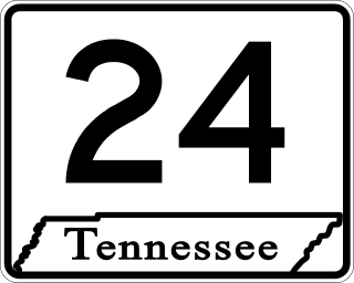
State Route 24 is an unsigned west–east state highway in Tennessee, as it coincides with U.S. Route 70 and U.S. Route 70N for its entire duration from Nashville to Crossville. The road begins in western Nashville and ends in Crossville. It runs alongside Interstate 40 for its entire length.
U.S. Route 70S is an alternative to U.S. Route 70 between the western part of Nashville and Sparta in Tennessee. It runs concurrent with US 70 for several blocks in downtown Nashville. The highway follows Murfreesboro Pike from Nashville to Murfreesboro then heads due east to McMinnville then northeast to Sparta where it ends at its junction with US 70. It was originally designated as U.S. Route 270 in 1926.
U.S. Route 70N is a northern alternate to U.S. Route 70, passing through parts of Middle Tennessee and East Tennessee. It runs 86.0 miles (138.4 km) east–west from Lebanon to Crossville, connecting the cities of Carthage, Baxter, Cookeville, and Monterey.
State Route 22 is a 172.8-mile long (278.1 km) south-to-north state highway in the western part of Tennessee, United States. It begins at the Mississippi state line in McNairy County, where the roadway continues as Mississippi Highway 2. It ends at the Kentucky state line in Lake County, when it crosses into the Kentucky Bend, a detached portion of Fulton County, Kentucky. The monument for the 1862 Battle of Island Number Ten in the American Civil War is located on SR 22, about 3 mi (4.8 km) north of Tiptonville.
State Route 66 is a state-maintained highway in eastern Tennessee, including a six-lane divided highway known as Winfield Dunn Parkway in Sevier County, a four-lane expressway in Hamblen and Jefferson counties and a two-lane rural collector through mountainous terrain continuing to the northeast terminus in Hancock County.
State Route 266 is a state highway in Middle Tennessee. The southern terminus is in a currently undeveloped section of Smyrna at an interchange with I-24. The northern terminus is in Lebanon at an intersection with US 70.
State Route 14 is a south–north route from the Mississippi border in Memphis, Tennessee to an intersection with State Route 54 in Tipton County.
State Route 9 (SR 9) is a west-to-east state highway in the U.S. state of Tennessee that is 131.33 miles (211.36 km) long. It begins in Campbell County and ends in Cocke County. SR 9 is little-known by the general public by this designation as it is overlain by U.S. Route 25W and U.S. Route 25 east of Newport; the "9" designation is seen on mileposts. The entire route is located in East Tennessee. Despite running concurrent with a North-South US Route, Route 9 is signed as east-west.
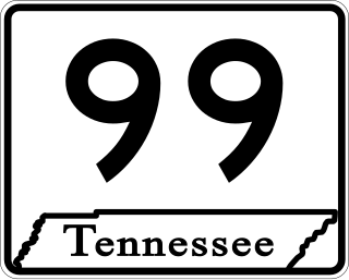
State Route 99 is a long east–west highway in Middle Tennessee. The route travels through large sections of rural areas and for most of the length is a secondary highway. The route begins near Waynesboro and ends in Bradyville after logging 126.7 mi (203.9 km) and passing through six counties.
State Route 20 (SR 20) is a 143.04-mile (230.20 km) long east–west primary state highway that begins in Dyersburg and ending near Summertown. SR 20 is unsigned and concurrent with U.S. Route 412 (US 412) for its entire length, except for a short section between Hohenwald and Summertown. Along its route, SR 20 traverses parts of both Middle Tennessee and West Tennessee.
State Route 100 is a west–east state highway in both West Tennessee and Middle Tennessee that connects Whiteville with Nashville. It is 158.31 mi (254.8 km) long.
State Route 10 is a south–north route from the Alabama state line in Lincoln County to the Kentucky state line in Macon County.
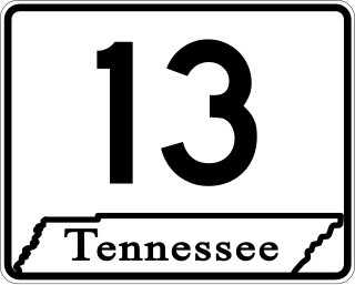
State Route 13, in the United States, is a south–north route from the Alabama border in Wayne County to the Kentucky border in Montgomery County. The entire route is located in western Middle Tennessee.
State Route 15 is a west–east route from Memphis to Monteagle. For much of its route it has an unsigned concurrency with U.S. Route 64. SR 15 does travel through the southern part of all 3 Grand Divisions of the state: West Tennessee, Middle Tennessee, and East Tennessee.
State Route 76 (SR 76) is a state highway in Tennessee, traversing the state in a northeast-southwest axis from east of Memphis to north of Nashville. SR 76 is unique in that it actually changes its cardinal directions in Clarksville at the junction with US 41A and US 41A Bypass.
In Tennessee, U.S. Route 412 stretches for 181.93 miles (292.79 km) through the farmland of West Tennessee and the hills of Middle Tennessee, starting at the Missouri state line near Dyersburg and running to an interchange between I-65 and SR 99 in Columbia.
U.S. Route 31A is a 76.94-mile-long (123.82 km) alternate route of U.S. Route 31 that exists between Nashville and Pulaski, Tennessee. It is located entirely in Middle Tennessee and except for the Lewisburg bypass, where it is concurrent with SR 106, it is entirely concurrent with unsigned State Route 11.
State Route 32 is a state highway in East Tennessee. For most of its route, it is an unsigned companion route concurrent with U.S. Route 25E. The highway stretches 89 miles from the North Carolina state line to the Tennessee-Kentucky state line near the town of Cumberland Gap.
U.S. Route 231 in Tennessee runs north–south for 121.15 miles (194.97 km), entirely in Middle Tennessee, that starts south of Fayetteville at the Alabama state line, and ends north of Westmoreland at the Kentucky state line. For the majority of its length, between the Alabama state line and Trousdale County, it is concurrent with unsigned State Route 10.
State Route 46 is a north–south state highway located in Middle Tennessee. It mainly goes on a northwest to southeast course while passing through towns and cities such as Cumberland City, Dickson, Leipers Fork, along with mainly rural areas of Stewart, Houston, Dickson, Hickman and Williamson Counties.