Tennessee State Route 397

Last updated

Tennessee 397.svg

State Route 397

Mack Hatcher Memorial Parkway
Tennessee SR 397 map.svg
Route information
Maintained by TDOT
Length9.7 mi [1]  (15.6 km)
Existed1983–present
Component
highways
Tennessee 397.svgTruck plate.svg
US 31.svg
Truck plate.svg
US 431.svg
SR 397 / US 31 Truck / US 431 Truck
Major junctions
South endUS 31.svg US 31 in Franklin
Major intersections
North endTennessee 96.svg SR 96 in Franklin
Location
Country United States
State Tennessee
Counties Williamson
Highway system
Tennessee 396.svg SR 396 Secondary Tennessee 399.svg SR 399
Template:Attached KML/Tennessee State Route 397
KML is not from Wikidata

State Route 397 (SR 397), also known as Mack Hatcher Memorial Parkway, is a primary state route that serves as a perimeter road for the city of Franklin, Tennessee. Throughout its length, SR 397 also carries the designations of U.S. Route 31 Truck (US 31 Truck) and U.S. Route 431 Truck (US 431 Truck). The route connects multiple U.S. and state routes, and serves as a bypass around the business district of Franklin, as well as a major thoroughfare.

Contents

A route to bypass Franklin was first proposed in 1963, although major work did not begin until the late 1970s. The eastern part of SR 396 was constructed in three phases between 1983 and 1989. Since Franklin has grown rapidly since the road's initial construction, it is planned to be extended to form a full circumferential loop. The first phase of the extension was completed in 2021, with the final phase planned to complete the loop. The entire route is also planned to be eventually widened to four lanes.

Route description

SR 397, most commonly referred to as Mack Hatcher Memorial Parkway or Mack Hatcher Parkway, is located entirely within the city of Franklin in Middle Tennessee, which is the second-largest suburb of Nashville and the seventh largest city in Tennessee. [2] The parkway is a part of the National Highway System, a national network of roads identified as important to the national economy, defense, and mobility. [3] [4] The route serves as both a bypass around downtown Franklin and as a major thoroughfare for traffic traveling between residential and commercial areas within the city. In 2022, annual average daily traffic counts ranged from 29,532 vehicles on the north side near US 31 (Franklin Road) to 13,610 vehicles near the southern terminus. [5]

SR 397 begins at an intersection with US 31 (Columbia Pike) south of downtown Franklin in an eastward alignment, where it also carries the US 31 Truck designation. Briefly a four-lane divided highway, it reduces to two lanes and crosses a CSX railroad mainline. It then shifts northeast, passing through residential subdivisions, before shifting east again, where it comes to an intersection with US 431 (Lewisburg Pike). Here, the US 431 Truck designation begins. The highway then crosses the Harpeth River before turning north and passing through a wooded area before widening to four lanes and reaching an intersection with SR 96 (Murfreesboro Road). Continuing northward, SR 397 passes by more subdivisions before curving to the northwest where it intersects the western terminus of Cool Springs Boulevard on the edge of the Cool Springs commercial center. Passing a golf course and wooded area, the parkway crosses Spencer Creek and the CSX railroad for a second time, before once again intersecting with US 31 (Franklin Road), where US 31 Truck ends. Next, the road proceeds westwardly, passing Battle Ground Academy before crossing the Harpeth River for a second time. It then reaches an intersection with US 431 (Hillsboro Road) for a second time, where the Truck designation for that highway ends. Entering the outskirts of Franklin, the route continues westward, reducing to two lanes and crossing the Harpeth River for a third and fourth time in short succession on a single long bridge. The highway passes through a semi-rural, but rapidly developing area still marked mostly by farmland, and curves south about one mile (1.6 km) beyond. A short distance later, SR 397 widens back to four lanes and comes to an end at an intersection with SR 96 (New Highway 96) west of downtown. [1] [6]

History

A bypass to divert through traffic around downtown Franklin was first proposed in 1963. [7] The central business district had begun to suffer from congestion due to the multiple highway spokes which intersect there and the lack of outer connections between them. [8] A study of the project was conducted in 1979, along with public hearings. [9] [10] An environmental impact statement for the project was approved by the Federal Highway Administration (FHWA) on July 31, 1981, which was referred to at the time as the Franklin Bypass. [8] Work on the first section, located between US 31 (Columbia Pike) and SR 96 (Murfreesboro Road) began in July 1983, and was completed in December 1985. The bypass was named the Mack Hatcher Memorial Parkway by an act of the Williamson County Commission on November 21, 1983, in honor of a former county commissioner and road superintendent. [11] Construction on the next section, between SR 96 and US 31 (Franklin Road) began in March 1987, and was opened to traffic on November 17, 1988. [12] The contract for construction of the third section, between US 31 (Franklin Road) and US 431 (Hillsboro Road) was let in December 1987, [13] and work was completed in November 1989. [14] This was the only stretch that was initially all four lanes, although adequate right-of-way was purchased to allow for widening of the entire route to four lanes. [8]

Since the parkway's initial construction, Franklin has become one of the fastest growing cities in the country, growing from slightly over 20,000 residents in 1990 to nearly 85,000 in 2020. This rapid growth has placed considerable stress on all of the infrastructure in the area, necessitating improvements to SR 397 and other roads. [15] Work on widening the stretch between US 31 and SR 96 began in September 2011, and was completed in May 2014. [16] The remaining two-lane portions are also planned to be widened in the future. [17] [18]

A series of transportation plans produced by the city of Franklin between 1989 and 1998 recommended that SR 397 be extended to become a full circumferential loop around the business district, and on July 1, 1999, the Board of Mayor and Aldermen requested that the Tennessee Department of Transportation (TDOT) study the feasibility of constructing this extension. [19] On March 15, 2001, TDOT provided the city of Franklin with a feasibility report, which recommended six possible alignments. [19] Some of these alignments faced intense public opposition. A draft environmental impact statement was approved for public availability by the FHWA on November 11, 2004. [19] A supplemental draft was prepared to include a seventh alignment, Alternative G, which was approved by the FHWA on August 16, 2005. [19] On December 2, 2005, TDOT announced that the preferred alignment for the Mack Hatcher Parkway Western Extension would be Alternate G, which is the shortest of the considered routes at 7.51 miles (12.09 km) long. [2] [20] Due to funding concerns, the western extension was split into two phases. Initially planned to be constructed with four lanes, most of the extension was also downgraded to two lanes, with enough right of way purchased to allow for widening to four lanes when this becomes necessary. [21]

John Schroer, who served as Franklin mayor from 2007 to 2010, advocated strongly for the extension during his tenure, but upon becoming commissioner of TDOT in 2011, deprioritized the project upon determining that it was not as much of a need as many other projects throughout the state. [18] This decision was subject to much criticism from local residents, and throughout the 2010s, many political candidates in Williamson County utilized the project as a campaign tactic. [18] The extension did not receive funding until the passage of the IMPROVE Act by the Tennessee General Assembly in 2017, which raised the state's fuel taxes and vehicle registration fees to fund a backlog of highway projects throughout the state. [22] Work began on the first segment of the extension, a length of 3.2 miles (5.1 km) between SR 96 and US 431, on December 18, 2018, [23] and was opened to traffic on November 29, 2021. [24] A dedication ceremony for the section occurred on December 13, 2021, which included the naming of the Harpeth River bridge in memory of former state representative Charles Sargent. [25]

Major intersections

The entire route is in Franklin, Williamson County.

mi [26] kmDestinationsNotes
0.00.0US 31.svg US 31 (Columbia Highway/SR 6) Franklin, Spring Hill
Begin plate.svg
Truck plate.svg
US 31.svg
US 31 Truck begins
Southern terminus of SR 397 and US 31 Truck
1.82.9US 431.svg US 431 (Lewisburg Pike/SR 106) Franklin, Lewisburg
Begin plate.svg
Truck plate.svg
US 431.svg
US 431 Truck begins
Southern terminus of US 431 Truck
2.03.2Staff Sergeant Carey Thomas Moore Memorial Bridge over the Harpeth River
3.25.1Tennessee 96.svg SR 96 (Murfreesboro Road) Franklin, Murfreesboro
4.97.9Cool Springs Boulevard
5.79.2US 31.svg US 31 (Franklin Road/SR 6) Franklin, Brentwood
End plate.svg
Truck plate.svg
US 31.svg
US 31 Truck ends
Northern terminus of US 31 Truck
6.810.9Matthew James Bergman Memorial Bridge over the Harpeth River
7.411.9US 431.svg US 431 (Hillsboro Road/SR 106) Franklin, Forest Hills
End plate.svg
Truck plate.svg
US 431.svg
US 431 Truck ends
Northern terminus of US 431 Truck
7.5–
8.0
12.1–
12.9
Charles W. Sargent Jr. Memorial Bridge over the Harpeth River
9.715.6Tennessee 96.svg SR 96 (New Highway 96) Franklin, Fairview Current northern/western terminus
Secondary Tennessee 246.svg SR 246 (Carters Creek Pike) Franklin, Burwood Part of the proposed Western Extension
1.000 mi = 1.609 km; 1.000 km = 0.621 mi

See also

Related Research Articles

<span class="mw-page-title-main">Interstate 24</span> Interstate Highway in Illinois, Kentucky, Tennessee, and Georgia

Interstate 24 (I-24) is an Interstate Highway in the Midwestern and Southeastern United States. It runs diagonally from I-57, 10 miles (16 km) south of Marion, Illinois, to Chattanooga, Tennessee, at I-75. It travels through Illinois, Kentucky, Tennessee, and Georgia. As an even-numbered Interstate, it is signed as an east–west route, though the route follows a more southeast–northwest routing, passing through Nashville, Tennessee. The numbering deviates from the standard Interstate Highway System grid, lying further north than its number would indicate west of Nashville. The short segment within Georgia bears the unsigned designation State Route 409 (SR 409).

<span class="mw-page-title-main">U.S. Route 431</span>

U.S. Route 431 (US 431) is a spur of U.S. Route 31. It currently travels for approximately 556 miles (895 km) from US 231/Alabama State Route 210 and US 231 Business and US 431 Bus. in Dothan, Alabama, to Owensboro, Kentucky, at US 60 and Kentucky Route 2831. The major cities US 431 connects to are Dothan and Huntsville, Alabama, Franklin and Nashville, Tennessee, and Owensboro, Kentucky.

<span class="mw-page-title-main">Interstate 840 (Tennessee)</span> Highway in Tennessee

Interstate 840 (I-840), formerly State Route 840 (SR 840), is a freeway that serves as an outer bypass route around Nashville, Tennessee. Built by the Tennessee Department of Transportation (TDOT), it is also designated as Tennessee National Guard Parkway. At 77.28 miles (124.37 km) long, it is the tenth-longest auxiliary Interstate Highway in the nation. The route serves the cities of Lebanon, Murfreesboro, Franklin, and Dickson, all suburbs of Nashville.

<span class="mw-page-title-main">Tennessee State Route 155</span> Highway in Tennessee

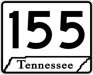
State Route 155, mostly designated as Briley Parkway, is a major freeway and parkway beltway around Nashville, Tennessee. It is 35.1 miles (56.5 km) long.

<span class="mw-page-title-main">Interstate 440 (Tennessee)</span> Highway in Nashville, Tennessee, United States

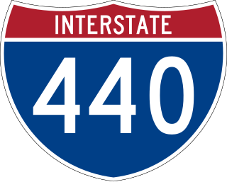
Interstate 440 (I-440) is an east–west auxiliary Interstate Highway that runs through Nashville, Tennessee. It serves as a southern bypass around downtown Nashville, and is located on average about three miles (4.8 km) from the center of the city. I-440 is also known locally as the Four-Forty Parkway, and is designated as the Debra K. Johnson Memorial Parkway. At a length of 7.64 miles (12.30 km), I-440 runs between I-40 and I-24, and connects to I-65 and multiple U.S. Routes. Combined, I-440 and Briley Parkway, a controlled-access segment of State Route 155 (SR 155), form a noncontiguous inner beltway around downtown Nashville.

<span class="mw-page-title-main">Pellissippi Parkway</span> Highway in Tennessee, United States

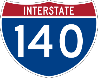
The Pellissippi Parkway is a major highway in Knox and Blount counties in the Knoxville metropolitan area in Tennessee that extends 19.75 miles (31.78 km) from State Route 62 at Solway to SR 33 in Alcoa. It provides access to the cities of Oak Ridge and Maryville from Interstates 40 and 75 in the western part of Knoxville and also serves a major corridor that includes Oak Ridge National Laboratory, Y-12 National Security Complex, and a number of science and technology firms. The central portion of the Pellissippi Parkway is included in the Interstate Highway System and is designated Interstate 140 (I-140), while the remainder is designated as State Route 162. The entire highway is part of the National Highway System, a national network of roads identified as important to the national economy, defense, and mobility. It takes its name from an older name for the Clinch River of Native American origin.

<span class="mw-page-title-main">U.S. Route 31W</span> U.S. Highway in Kentucky and Tennessee

U.S. Route 31W is the westernmost of two parallel routes for U.S. Route 31 from Nashville, Tennessee to Louisville, Kentucky.

<span class="mw-page-title-main">Tennessee State Route 396</span> State highway in Tennessee, United States

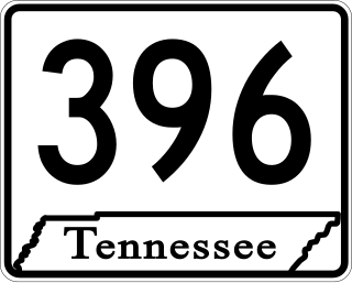
State Route 396, commonly referred to as Saturn Parkway, is a 4.47-mile-long (7.19 km) east–west primary state route located in the city of Spring Hill in the U.S. state of Tennessee. The entire route is a controlled-access highway, and provides direct access between the General Motors Spring Hill Manufacturing plant and Interstate 65, as well as the business district of Spring Hill. It takes its name from Saturn Corporation, a subsidiary of General Motors that operated the plant from 1990 to 2007 as its sole manufacturing facility.

<span class="mw-page-title-main">Interstate 40 in Tennessee</span> Interstate Highway in Tennessee, United States

Interstate 40 (I-40) is part of the Interstate Highway System that runs 2,556.61 miles (4,114.46 km) from Barstow, California, to Wilmington, North Carolina. The highway crosses Tennessee from west to east, from the Mississippi River at the Arkansas border to the Blue Ridge Mountains at the North Carolina border. At 455.28 miles (732.70 km), the Tennessee segment of I-40 is the longest of the eight states through which it passes and the state's longest Interstate Highway.

<span class="mw-page-title-main">Interstate 65 in Tennessee</span> Interstate Highway in Tennessee, United States

Interstate 65 (I-65) is part of the Interstate Highway System that runs 887.30 miles (1,427.97 km) north–south from Mobile, Alabama, to Gary, Indiana. In Tennessee, I-65 traverses the middle portion of the state, running from Ardmore at the Alabama border to the Kentucky border near Portland. The route serves the state capital and largest city of Nashville, along with many of its suburbs. Outside of urban areas, the Interstate bypasses most cities and towns that it serves, instead providing access via state and U.S. Highways. The Interstate passes through the Highland Rim and Nashville Basin physiographic regions of Tennessee, and is often used as the dividing line between the eastern and western portions of the former.

<span class="mw-page-title-main">Interstate 75 in Tennessee</span> Highway in Tennessee

Interstate 75 (I-75) in the US state of Tennessee runs from Chattanooga to Jellico by way of Knoxville. I-75 enters the East Tennessee region from Georgia, following the Tennessee Valley all the way through Knoxville to near Rocky Top, then climbs into the Cumberland Mountains before crossing over into Kentucky at Jellico.

<span class="mw-page-title-main">Special routes of U.S. Route 31</span>

Several special routes of U.S. Route 31 exist. In order from south to north they are as follows.

<span class="mw-page-title-main">U.S. Route 431 in Tennessee</span> United States Numbered Highway in Tennessee

U.S. Route 431 in Tennessee totals an estimated 116 miles (187 km) through Lincoln, Marshall, Maury, Williamson, Davidson, and Robertson counties in Middle Tennessee.

<span class="mw-page-title-main">U.S. Route 31A</span> U.S. Highway in Tennessee

U.S. Route 31A is a 76.94-mile-long (123.82 km) alternate route of U.S. Route 31 that exists between Nashville and Pulaski, Tennessee. It is located entirely in Middle Tennessee and except for the Lewisburg bypass, where it is concurrent with SR 106, it is entirely concurrent with unsigned State Route 11.

<span class="mw-page-title-main">Tennessee State Route 386</span> Highway in Tennessee

State Route 386 (SR 386) is a major east–west state route, signed north-south, located in Davidson and Sumner counties in Tennessee. It is known as Vietnam Veterans Boulevard and serves as a bypass for U.S. Highway 31E and a connector to Hendersonville and Gallatin from Nashville. A majority of the route is a four-lane controlled-access highway.

<span class="mw-page-title-main">APD-40</span> Highway in Cleveland, Tennessee, United States

APD-40 or APD 40 refers to a road composed of the U.S. Route 64 Bypass and a section of State Route 60 (SR 60) which forms a partial beltway around the business district of Cleveland, Tennessee. The route takes its name from its part of Corridor K of the Appalachian Development Highway System, and is sometimes called Appalachian Highway or simply the Cleveland Bypass. The route is also designated as Veterans Memorial Highway. The US 64 Byp. section of the road is also multiplexed with unsigned State Route 311 and US 74. The road is a four-lane divided highway its entire length and parts are controlled-access. The bypass is an east-west route and the state route is a north-south.

<span class="mw-page-title-main">U.S. Route 31 in Tennessee</span>

U.S. Route 31 (US 31) is a part of the United States Numbered Highway System that runs from Spanish Fort, Alabama, to Mackinaw City, Michigan. In the U.S. state of Tennessee, it runs concurrently with Interstate 65 (I-65) for the first mile northward from the Tennessee state line. There US 31 parallels I-65 to downtown Nashville. At Pulaski US 31 meets the southern terminus of US 31A in Tennessee. US 31 continues due north through Lynnville, Columbia, Spring Hill, Franklin and Brentwood to Nashville. The route splits into US 31E and US 31W in Nashville and go into Kentucky.

<span class="mw-page-title-main">James Robertson Parkway</span> Street in Nashville, Tennessee, United States

James Robertson Parkway is a four-lane major thoroughfare in Nashville, Tennessee. It is a bypass route within the downtown Nashville area that includes portions of the alignments of three U.S. Highways, two of them with unsigned Tennessee state highway designations. Since all parts of the street includes alignments of U.S. and state routes, the road is maintained by the Tennessee Department of Transportation (TDOT).

<span class="mw-page-title-main">Special routes of U.S. Route 431</span>

Four special routes of U.S. Route 431 exist, and three others used to exist, the majority of which have been in Alabama. In order from south to north they are as follows.

<span class="mw-page-title-main">U.S. Route 41 Alternate (Tennessee–Kentucky)</span> U.S. Highway in Tennessee and Kentucky

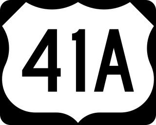
U.S. Route 41 Alternate, also signed U.S. Route 41A in Tennessee (US 41A), connects the town of Monteagle, Tennessee, with Hopkinsville, Kentucky, 10 miles (16 km) north of the Tennessee line. It serves the city of Clarksville, Tennessee, on its way to Nashville, where it briefly runs concurrently with US 41. It then separates again to serve Shelbyville, Winchester, and Tullahoma before rejoining the main route atop Monteagle Mountain. US 41A runs west of US 41 for its entire length, aside from one mile in downtown Nashville where they are concurrent. US 41A is also concurrent with U.S. Route 31A from Nashville to Triune, Tennessee, for a distance of approximately 25 miles (40 km).

References

  1. 1 2 DeLorme (2017). Tennessee Atlas & Gazetteer (Map) (2017 ed.). 1 in:2.5 mi. Yarmouth, Maine: DeLorme. ISBN   978-1946494047.
  2. 1 2 "State Route 397". Tennessee Department of Transportation. Archived from the original on August 12, 2008. Retrieved June 3, 2008.
  3. National Highway System: Nashville-Davidson, TN (PDF) (Map). Federal Highway Administration. October 1, 2012. Retrieved March 28, 2023.
  4. Natzke, Stefan; Neathery, Mike & Adderly, Kevin (August 26, 2010). "What is the National Highway System?". National Highway System. Federal Highway Administration . Retrieved December 12, 2010.
  5. Tennessee Department of Transportation. "Transportation Data Management System". ms2soft.com. MS2. Retrieved November 27, 2021.
  6. Tennessee Department of Transportation Long Range Planning Division Office of Data Visualization (2018). Williamson County (PDF) (Map). Tennessee Department of Transportation.
  7. "Late-1982 Start Seen For Franklin's Bypass". The Tennessean. Nashville. March 11, 1980. pp. 1-A, 5-A . Retrieved December 23, 2021 via Newspapers.com.
  8. 1 2 3 Federal Highway Administration; Tennessee Department of Transportation (1981). Proposed Franklin By-Pass From State Route 6 South of Franklin to State Route 106 North of Franklin, Williamson County (Report). Federal Highway Administration. Retrieved March 28, 2023 via Google Books.
  9. "Franklin Bypass Features Cited". The Tennessean. Nashville. September 25, 1979. p. 1A. Retrieved March 28, 2023 via Newspapers.com.
  10. Newkirk, Terrye (November 27, 1979). "Bypass Goes Back To Drawing Board". The Tennessean. Nashville. p. 3A. Retrieved March 28, 2023 via Newspapers.com.
  11. "Around the Region". The Tennessean. Nashville. November 22, 1983. p. 7-B. Retrieved December 23, 2021 via Newspapers.com.
  12. "Franklin bypass sector opens". The Tennessean. Nashville. November 17, 1988. p. 2-B. Retrieved December 23, 2021 via Newspapers.com.
  13. "Jackson firm gets Franklin Bypass final leg". The Tennessean. Nashville. December 5, 1987. p. 2B. Retrieved March 27, 2023 via Newspapers.com.
  14. "3rd leg of Hatcher Parkway to open". The Tennessean. Nashville. November 1, 1989. p. 2-B. Retrieved December 23, 2021 via Newspapers.com.
  15. East, Jim (October 1, 1998). "Road relief in sight". The Tennessean. Nashville. p. 1W. Retrieved March 28, 2023 via Newspapers.com.
  16. "Widening of Mack Hatcher Parkway Complete in Williamson County" (Press release). Tennessee Department of Transportation. May 16, 2014. Retrieved March 28, 2023.
  17. "Mack Hatcher Parkway Southeast Widening". City of Franklin, Tennessee. Retrieved March 28, 2023.
  18. 1 2 3 West, Emily R. (January 19, 2018). "Time has come: What it took to get Mack Hatcher extended". The Tennessean. Nashville. Retrieved March 28, 2023.
  19. 1 2 3 4 Federal Highway Administration; Tennessee Department of Transportation (2005). State Route 397 (Mack Hatcher Parkway Extension) From U.S. 31 (State Route 6, Columbia Avenue) south of Franklin to U.S. 431 (State Route 106, Hillsboro Road) north of Franklin: Franklin, Williamson County, Tennessee: Supplemental Draft Environmental Impact Statement and Supplemental Draft Section 4(F) Statement (Report). Federal Highway Administration. Retrieved March 28, 2023 via Google Books.
  20. "State Route 397 (Mack Hatcher Parkway) - Timeline Extension". Tennessee Department of Transportation. Archived from the original on January 12, 2018. Retrieved June 6, 2020.
  21. "Long-awaited MHP extension topic of local public hearing". Williamson Herald. Franklin, Tennessee. February 10, 2015. Retrieved March 28, 2023.
  22. Harmuth, Zach (May 10, 2017). "Construction to Begin on Mack Hatcher Extension Next Year". Williamson Source. Franklin, Tennessee. Retrieved March 28, 2023.
  23. Burch, Edward (December 18, 2018). "State breaks ground on Mack Hatcher Parkway extension". WSMV-TV . Nashville. Retrieved December 23, 2021.
  24. Bomar, Coleman (November 29, 2021). "Mack Hatcher northwest extension opens". Williamson Herald . Franklin, Tennessee. Retrieved December 23, 2021.
  25. McBryde, John (December 13, 2021). "Ribbon cutting gives official nod to Mack Hatcher extension, includes dedication of bridge to Sargent". Williamson Home Page. Brentwood, Tennessee. Retrieved December 23, 2021.
  26. Bureau of Transportation Statistics (June 13, 2022). "National Highway Planning Network" (Map). National Transportation Atlas Database. Washington, D.C.: United States Department of Transportation. Retrieved April 29, 2023.