Dowelltown, Tennessee

Last updated

Dowelltown, Tennessee
Dowelltown, Tennessee Sign October 2011.JPG
Sign in Dowelltown
DeKalb County Tennessee Incorporated and Unincorporated areas Dowelltown Highlighted 4721420.svg
Location of Dowelltown in DeKalb County, Tennessee.
Coordinates: 36°0′47″N85°56′35″W / 36.01306°N 85.94306°W / 36.01306; -85.94306
Country United States
State Tennessee
County DeKalb
Area
[1]
  Total0.75 sq mi (1.95 km2)
  Land0.75 sq mi (1.95 km2)
  Water0.00 sq mi (0.00 km2)
Elevation
577 ft (176 m)
Population
 (2020) [2]
  Total342
  Density454.79/sq mi (175.52/km2)
Time zone UTC-6 (Central (CST))
  Summer (DST) UTC-5 (CDT)
ZIP code
37059
Area code 615
FIPS code 47-21420 [3]
GNIS feature ID1313913 [4]

Dowelltown is a town in DeKalb County, Tennessee, United States. The population was 355 at the 2010 census.

Contents

Geography

Dowelltown is located at 36°0′47″N85°56′35″W / 36.01306°N 85.94306°W / 36.01306; -85.94306 (36.013127, -85.943054). [5]

According to the United States Census Bureau, the town has a total area of 0.8 square miles (2.1 km2), all of it land.

Demographics

Historical population
CensusPop.Note
1880 210
1890 23311.0%
1950 262
1960 2796.5%
1970 32917.9%
1980 3413.6%
1990 308−9.7%
2000 302−1.9%
2010 35517.5%
2020 342−3.7%
Sources: [6] [7] [2]

As of the census [3] of 2000, there were 302 people, 134 households, and 90 families residing in the town. The population density was 386.7 inhabitants per square mile (149.3/km2). There were 147 housing units at an average density of 188.2 per square mile (72.7/km2). The racial makeup of the town was 93.05% White, 3.31% African American, 0.33% Native American, 0.33% Pacific Islander, 1.99% from other races, and 0.99% from two or more races. Hispanic or Latino of any race were 2.32% of the population.

There were 134 households, out of which 27.6% had children under the age of 18 living with them, 50.0% were married couples living together, 11.2% had a female householder with no husband present, and 32.8% were non-families. 32.8% of all households were made up of individuals, and 17.2% had someone living alone who was 65 years of age or older. The average household size was 2.25 and the average family size was 2.86.

In the town, the population was spread out, with 24.2% under the age of 18, 7.3% from 18 to 24, 28.1% from 25 to 44, 24.8% from 45 to 64, and 15.6% who were 65 years of age or older. The median age was 39 years. For every 100 females, there were 98.7 males. For every 100 females age 18 and over, there were 84.7 males.

The median income for a household in the town was $22,273, and the median income for a family was $31,500. Males had a median income of $28,750 versus $20,469 for females. The per capita income for the town was $10,757. About 23.2% of families and 26.9% of the population were below the poverty line, including 39.8% of those under the age of eighteen and 25.0% of those 65 or over.

Related Research Articles

<span class="mw-page-title-main">Sylvania, Alabama</span> Town in Alabama, United States

Sylvania is a town in DeKalb County, Alabama, United States. It incorporated in October 1967. At the 2010 census the population was 1,837, up from 1,186 in 2000. Sylvania is located atop Sand Mountain. Sylvania was incorporated in 1967. The post office /town hall was built in 1977.

<span class="mw-page-title-main">Cottonwood, Alabama</span> Town in Alabama, United States

Cottonwood is a town in Houston County, Alabama, United States. One source said the town incorporated in 1901, although the 1910 U.S. Census stated 1903. It is part of the Dothan, Alabama Metropolitan Statistical Area. At the 2010 census the population was 1,289, up from 1,170 in 2000.

<span class="mw-page-title-main">Cowarts, Alabama</span> Town in Alabama, United States

Cowarts is a town in Houston County, Alabama, United States. The town incorporated in August 1961. It is part of the Dothan, Alabama Metropolitan Statistical Area. At the 2010 census the population was 1,871, up from 1,546 in 2000.

<span class="mw-page-title-main">Medora, Indiana</span> Town in Indiana, United States

Medora is a town in Carr Township, Jackson County, Indiana, United States. The population was 693 at the 2010 census.

<span class="mw-page-title-main">Country Club Heights, Indiana</span> Town in Indiana, United States

Country Club Heights is a town in Anderson Township, Madison County, Indiana, United States. The population was 98 at the 2020 census.

<span class="mw-page-title-main">Upton, Maine</span> Town in the state of Maine, United States

Upton is a town in Oxford County, Maine, United States. The population was 69 at the 2020 census.

Plymouth is a town in Penobscot County, Maine, United States. The population was 1,325 at the 2020 census.

Princeton is a town in Washington County, Maine, United States. The town was named after Princeton, Massachusetts. The population was 745 at the 2020 census.

<span class="mw-page-title-main">Bloomville, Ohio</span> Village in Ohio, United States

Bloomville is a village in Seneca County, Ohio, United States. The population was 867 at the 2020 census.

<span class="mw-page-title-main">Fairburn, South Dakota</span> Town in South Dakota, United States

Fairburn is a town in Custer County, South Dakota, United States. The population was 60 at the 2020 census.

<span class="mw-page-title-main">Junior, West Virginia</span> Town in West Virginia, United States

Junior is a town in Barbour County, West Virginia, United States, situated along the Tygart Valley River. The population was 384 at the 2020 census.

<span class="mw-page-title-main">Man, West Virginia</span> Town in West Virginia, United States

Man is a town in Logan County, West Virginia, United States. The population was 772 at the 2020 census. The town is located along the Guyandotte River at the mouth of Buffalo Creek, which was the site of the 1972 Buffalo Creek Flood following a dam collapse. The name of the town reportedly derives from the last syllable of the surname of Ulysses Hinchman, who was a member of the House of Delegates from Logan County between 1866 and 1869.

<span class="mw-page-title-main">Gilbert, West Virginia</span> Town in West Virginia, United States

Gilbert is a town in Mingo County, West Virginia, United States, along the Guyandotte River. The population was 333 at the 2020 census. Gilbert was incorporated in 1918 and named for Gilbert Creek, which derives its name from the name of an early traveler in the area who was killed by Native Americans. Gilbert is known nationwide for the Hatfield-McCoy ATV Trails that are located in the area. There are a number of lodges and restaurants in Gilbert.

<span class="mw-page-title-main">Durbin, West Virginia</span> Town in West Virginia, United States

Durbin is a town in Pocahontas County, West Virginia, United States. The population was 235 at the 2020 census.

<span class="mw-page-title-main">Reedy, West Virginia</span> Town in West Virginia, United States

Reedy is a town in Roane County, West Virginia, United States. The population was 152 at the 2020 census.

<span class="mw-page-title-main">Trenton, Dodge County, Wisconsin</span> Town in Wisconsin, United States

Trenton is a town in Dodge County, Wisconsin, United States. The population was 1,301 at the 2000 census.

<span class="mw-page-title-main">West Kewaunee, Wisconsin</span> Town in Wisconsin, United States

West Kewaunee is a town in Kewaunee County, Wisconsin, United States. The population was 1,296 at the 2010 census. The unincorporated communities of Birchwood, East Krok, and Krok are located in the town.

<span class="mw-page-title-main">Leon, Waushara County, Wisconsin</span> Town in Wisconsin, United States

Leon is a town in Waushara County, Wisconsin, United States. The population was 1,281 at the 2000 census. The census-designated place of Pine River is located in the town. The village of Redgranite is located adjacent to the town.

<span class="mw-page-title-main">Kenton, Tennessee</span> Town in Tennessee, United States

Kenton is a town in Gibson and Obion counties, Tennessee. The population was 1,281 at the 2010 census, a decline of 25 from 2000. The Gibson County portion of Kenton is part of the Humboldt, TN Micropolitan Statistical Area, while the Obion County portion is part of the Union City, TN–KY Micropolitan Statistical Area.

<span class="mw-page-title-main">Blue Mounds (town), Wisconsin</span> Town in Wisconsin, United States

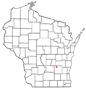
Blue Mounds is a town in Dane County, Wisconsin, United States. The population was 899 at the 2020 census. The Village of Blue Mounds is located within the town.

References

  1. "ArcGIS REST Services Directory". United States Census Bureau. Retrieved October 15, 2022.
  2. 1 2 "Census Population API". United States Census Bureau. Retrieved October 15, 2022.
  3. 1 2 "U.S. Census website". United States Census Bureau . Retrieved January 31, 2008.
  4. "US Board on Geographic Names". United States Geological Survey. October 25, 2007. Retrieved January 31, 2008.
  5. "US Gazetteer files: 2010, 2000, and 1990". United States Census Bureau. February 12, 2011. Retrieved April 23, 2011.
  6. "Census of Population and Housing: Decennial Censuses". United States Census Bureau . Retrieved March 4, 2012.
  7. "Incorporated Places and Minor Civil Divisions Datasets: Subcounty Resident Population Estimates: April 1, 2010 to July 1, 2012". Population Estimates. U.S. Census Bureau. Archived from the original on June 11, 2013. Retrieved December 11, 2013.