Archaeological site

Last updated

An archaeological site with human presence dating from 4th century BCE, Fillipovka, South Urals, Russia. This site has been interpreted as a Sarmatian Kurgan. LYablonskyFilipovkaKurganR1.jpg
An archaeological site with human presence dating from 4th century BCE, Fillipovka, South Urals, Russia. This site has been interpreted as a Sarmatian Kurgan.

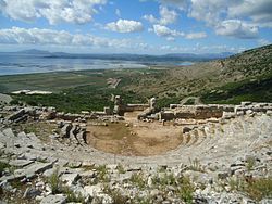
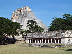
An archaeological site is a place (or group of physical sites) in which evidence of past activity is preserved (either prehistoric or historic or contemporary), and which has been, or may be, investigated using the discipline of archaeology and represents a part of the archaeological record. Sites may range from those with few or no remains visible above ground, to buildings and other structures still in use.

Contents

Beyond this, the definition and geographical extent of a "site" can vary widely, depending on the period studied and the theoretical approach of the archaeologist.

Geographical extent

It is almost invariably difficult to delimit a site. It is sometimes taken to indicate a settlement of some sort although the archaeologist must also define the limits of human activity around the settlement. Any episode of deposition such as a hoard or burial can form a site as well. Development-led archaeology undertaken as cultural resources management has the disadvantage (or the benefit) of having its sites defined by the limits of the intended development. Even in this case, however, in describing and interpreting the site, the archaeologist will have to look outside the boundaries of the building site.

According to Jess Beck in "How Do Archaeologists find sites?" [1] the areas with numerous artifacts are good targets for future excavation, while areas with a small number of artifacts are thought to reflect a lack of past human activity. Many areas have been discovered by accident. The most common person to have found artifacts are farmers who are plowing their fields or just cleaning them up often find archaeological artifacts. Many people who are out hiking and even pilots find artifacts they usually end up reporting them to archaeologists to do further investigation. When they find sites, they have to first record the area, and if they have the money and time for the site they can start digging.

Field survey

There are many ways to find sites, one example can be through surveys. Surveys involve walking around analyzing the land looking for artifacts. It can also involve digging, according to the Archaeological Institute of America, [2] "archaeologists actively search areas that were likely to support human populations, or in places where old documents and records indicate people once lived." This helps archaeologists in the future. In case there was no time, or money during the finding of the site, archaeologists can come back and visit the site for further digging to find out the extent of the site. Archaeologist can also sample randomly within a given area of land as another form of conducting surveys. Surveys are very useful, according to Jess Beck, "it can tell you where people were living at different points in the past." Geophysics is a branch of survey becoming more and more popular in archaeology, because it uses different types of instruments to investigate features below the ground surface. It is not as reliable, because although they can see what is under the surface of the ground it does not produce the best picture. Archaeologists have to still dig up the area in order to uncover the truth. There are also two most common types of geophysical survey, which is, magnetometer and ground penetrating radar. Magnetometry [3] is the technique of measuring and mapping patterns of magnetism in the soil. It uses an instrument called a magnetometer which is required to measure and map traces of soil magnetism. The ground penetrating radar [4] is a method that uses radar pulses to image the subsurface. It uses electro magnetic radiation in the microwave band of the radio spectrum, and detects the reflected signals from subsurface structures.

There are many other tools that can be used to find artifacts, but along with finding artifacts, archaeologist have to make maps. They do so by taking data from surveys, or archival research and plugging it into a Geographical Information Systems (GIS) [5] and that will contain both locational information and a combination of various information. This tool is very helpful to archaeologists who want to explore in a different area and want to see if anyone else has done research. They can use this tool to see what has already been discovered. With this information available, archaeologists can expand their research and add more to what has already been found.

Traditionally, sites are distinguished by the presence of both artifacts and features. Common features include the remains of hearths and houses. Ecofacts, biological materials (such as bones, scales, and even feces) that are the result of human activity but are not deliberately modified, are also common at many archaeological sites. In the cases of the Palaeolithic and Mesolithic eras, a mere scatter of flint flakes will also constitute a site worthy of study. Different archaeologists may see an ancient town, and its nearby cemetery as being two different sites, or as being part of the same wider site. The precepts of landscape archaeology attempt to see each discrete unit of human activity in the context of the wider environment, further distorting the concept of the site as a demarcated area. Furthermore, geoarchaeologists or environmental archaeologists would also consider a sequence of natural geological or organic deposition, in the absence of human activity, to constitute a site worthy of study.

Archaeological sites usually form through human-related processes but can be subject to natural, post-depositional factors. Cultural remnants which have been buried by sediments are in many environments more likely to be preserved than exposed cultural remnants. Natural actions resulting in sediment being deposited include alluvial (water-related) or aeolian (wind-related) natural processes. In jungles and other areas of lush plant growth, decomposed vegetative sediment can result in layers of soil deposited over remains. Colluviation, the burial of a site by sediments moved by gravity (called hillwash) can also happen at sites on slopes. Human activities (both deliberate and incidental) also often bury sites. It is common in many cultures for newer structures to be built atop the remains of older ones. Urban archaeology has developed especially to deal with these sorts of site.

Many sites are the subject of ongoing excavation or investigation. Note the difference between archaeological sites and archaeological discoveries.

See also

Related Research Articles

<span class="mw-page-title-main">Underwater archaeology</span> Archaeological techniques practiced at underwater sites

Underwater archaeology is archaeology practiced underwater. As with all other branches of archaeology, it evolved from its roots in pre-history and in the classical era to include sites from the historical and industrial eras.

<span class="mw-page-title-main">Archaeological excavation</span> Exposure, processing and recording of archaeological remains

In archaeology, excavation is the exposure, processing and recording of archaeological remains. An excavation site or "dig" is the area being studied. These locations range from one to several areas at a time during a project and can be conducted over a few weeks to several years.

<span class="mw-page-title-main">Magnetometer</span> Device that measures magnetism

A magnetometer is a device that measures magnetic field or magnetic dipole moment. Different types of magnetometers measure the direction, strength, or relative change of a magnetic field at a particular location. A compass is one such device, one that measures the direction of an ambient magnetic field, in this case, the Earth's magnetic field. Other magnetometers measure the magnetic dipole moment of a magnetic material such as a ferromagnet, for example by recording the effect of this magnetic dipole on the induced current in a coil.

<span class="mw-page-title-main">Geophysical survey (archaeology)</span> Non-invasive physical sensing techniques used for archaeological imaging or mapping

In archaeology, geophysical survey is ground-based physical sensing techniques used for archaeological imaging or mapping. Remote sensing and marine surveys are also used in archaeology, but are generally considered separate disciplines. Other terms, such as "geophysical prospection" and "archaeological geophysics" are generally synonymous.

<span class="mw-page-title-main">Artifact (archaeology)</span> Something made by humans and of archaeological interest

An artifact or artefact is a general term for an item made or given shape by humans, such as a tool or a work of art, especially an object of archaeological interest. In archaeology, the word has become a term of particular nuance and is defined as an object recovered by archaeological endeavor, which may be a cultural artifact having cultural interest.

<span class="mw-page-title-main">Stratigraphy (archaeology)</span> Study of archaeological sedimentation for dating purposes

Stratigraphy is a key concept to modern archaeological theory and practice. Modern excavation techniques are based on stratigraphic principles. The concept derives from the geological use of the idea that sedimentation takes place according to uniform principles. When archaeological finds are below the surface of the ground, the identification of the context of each find is vital in enabling the archaeologist to draw conclusions about the site and about the nature and date of its occupation. It is the archaeologist's role to attempt to discover what contexts exist and how they came to be created. Archaeological stratification or sequence is the dynamic superimposition of single units of stratigraphy, or contexts.

<span class="mw-page-title-main">Geoarchaeology</span> Archaeological sub-discipline

Geoarchaeology is a multi-disciplinary approach which uses the techniques and subject matter of geography, geology, geophysics and other Earth sciences to examine topics which inform archaeological knowledge and thought. Geoarchaeologists study the natural physical processes that affect archaeological sites such as geomorphology, the formation of sites through geological processes and the effects on buried sites and artifacts post-deposition. Geoarchaeologists' work frequently involves studying soil and sediments as well as other geographical concepts to contribute an archaeological study. Geoarchaeologists may also use computer cartography, geographic information systems (GIS) and digital elevation models (DEM) in combination with disciplines from human and social sciences and earth sciences. Geoarchaeology is important to society because it informs archaeologists about the geomorphology of the soil, sediment, and rocks on the buried sites and artifacts they are researching. By doing this, scientists are able to locate ancient cities and artifacts and estimate by the quality of soil how "prehistoric" they really are. Geoarchaeology is considered a sub-field of environmental archaeology because soil can be altered by human behavior, which archaeologists are then able to study and reconstruct past landscapes and conditions.

<span class="mw-page-title-main">Survey (archaeology)</span> Non-destructive exploration of the archaeological material in a given area

In archaeology, survey or field survey is a type of field research by which archaeologists search for archaeological sites and collect information about the location, distribution and organization of past human cultures across a large area. Archaeologists conduct surveys to search for particular archaeological sites or kinds of sites, to detect patterns in the distribution of material culture over regions, to make generalizations or test hypotheses about past cultures, and to assess the risks that development projects will have adverse impacts on archaeological heritage. The surveys may be: (a) intrusive or non-intrusive, depending on the needs of the survey team and; (b) extensive or intensive, depending on the types of research questions being asked of the landscape in question. Surveys can be a practical way to decide whether or not to carry out an excavation, but may also be ends in themselves, as they produce important information about past human activities in a regional context.

The archaeological record is the body of physical evidence about the past. It is one of the core concepts in archaeology, the academic discipline concerned with documenting and interpreting the archaeological record. Archaeological theory is used to interpret the archaeological record for a better understanding of human cultures. The archaeological record can consist of the earliest ancient findings as well as contemporary artifacts. Human activity has had a large impact on the archaeological record. Destructive human processes, such as agriculture and land development, may damage or destroy potential archaeological sites. Other threats to the archaeological record include natural phenomena and scavenging. Archaeology can be a destructive science for the finite resources of the archaeological record are lost to excavation. Therefore, archaeologists limit the amount of excavation that they do at each site and keep meticulous records of what is found. The archaeological record is the physical record of human prehistory and history, of why ancient civilizations prospered or failed and why those cultures changed and grew. It is the story of the human world.

Post-excavation analysis constitutes processes that are used to study archaeological materials after an excavation is completed. Since the advent of "New Archaeology" in the 1960s, the use of scientific techniques in archaeology has grown in importance. This trend is directly reflected in the increasing application of the scientific method to post-excavation analysis. The first step in post-excavation analysis should be to determine what one is trying to find out and what techniques can be used to provide answers. Techniques chosen will ultimately depend on what type of artifact(s) one wishes to study. This article outlines processes for analyzing different artifact classes and describes popular techniques used to analyze each class of artifact. Keep in mind that archaeologists frequently alter or add techniques in the process of analysis as observations can alter original research questions.

<span class="mw-page-title-main">Archaeology</span> Study of human activity via material culture

Archaeology or archeology is the study of human activity through the recovery and analysis of material culture. The archaeological record consists of artifacts, architecture, biofacts or ecofacts, sites, and cultural landscapes. Archaeology can be considered both a social science and a branch of the humanities. It is usually considered an independent academic discipline, but may also be classified as part of anthropology, history or geography.

Remote sensing techniques in archaeology are an increasingly important component of the technical and methodological tool set available in archaeological research. The use of remote sensing techniques allows archaeologists to uncover unique data that is unobtainable using traditional archaeological excavation techniques.

<span class="mw-page-title-main">Magnetic survey (archaeology)</span> Magnetic detection of archaeological artefacts and features

Magnetic surveying is one of a number of methods used in archaeological geophysics. Magnetic surveys record spatial variation in the Earth's magnetic field. In archaeology, magnetic surveys are used to detect and map archaeological artefacts and features. Magnetic surveys are used in both terrestrial and marine archaeology.

<span class="mw-page-title-main">Near-surface geophysics</span> Geophysics of first tens of meters below surface

Near-surface geophysics is the use of geophysical methods to investigate small-scale features in the shallow subsurface. It is closely related to applied geophysics or exploration geophysics. Methods used include seismic refraction and reflection, gravity, magnetic, electric, and electromagnetic methods. Many of these methods were developed for oil and mineral exploration but are now used for a great variety of applications, including archaeology, environmental science, forensic science, military intelligence, geotechnical investigation, treasure hunting, and hydrogeology. In addition to the practical applications, near-surface geophysics includes the study of biogeochemical cycles.

<span class="mw-page-title-main">Forensic geophysics</span> Use of geophysics tools in forensic science

Forensic geophysics is a branch of forensic science and is the study, the search, the localization and the mapping of buried objects or elements beneath the soil or the water, using geophysics tools for legal purposes. There are various geophysical techniques for forensic investigations in which the targets are buried and have different dimensions. Geophysical methods have the potential to aid the search and the recovery of these targets because they can non-destructively and rapidly investigate large areas where a suspect, illegal burial or, in general, a forensic target is hidden in the subsoil. When in the subsurface there is a contrast of physical properties between a target and the material in which it is buried, it is possible to individuate and define precisely the concealing place of the searched target. It is also possible to recognize evidences of human soil occupation or excavation, both recent and older. Forensic geophysics is an evolving technique that is gaining popularity and prestige in law enforcement.

This page is a glossary of archaeology, the study of the human past from material remains.

A disturbance is any change to an archaeological site due to events which occurred after the site was laid down. Disturbances may be caused by natural events or human activity, and may result in loss of archaeological value. In some cases, it can be difficult to distinguish between features caused by human activity in the period of interest, and features caused by later human activity or natural processes.

The Cedar Creek Earthworks Site is an earthworks site located in Essex County, Ontario. It has the Borden number of AaHq-2. This site was originally documented in Canada in the 1930s. This site has gone through several different forms of excavation throughout the years, such as remote sensing, test-pitting, and targeted test excavations. Even with these different forms of excavations and changes that have been made to the site there is still evidence of the sites cultural history.

Ian James Mathieson was a Scottish Egyptologist and Land Surveyor. He pioneered various methods of surveying and mapping of large archaeological sites avoiding the expense or intrusion of excavation.

Zilum is a settlement of the Gajiganna culture located in the Chad Basin of northeastern Nigeria, 72 km north of Maiduguri in Borno State and is dated to ca 600-400 BCE. The site itself is relatively flat, sits on a large sand ridge, and is bordered to the south by a clay depression. Zilum was discovered in 1997 by Peter Breunig and from 2000-2002, Carlos Magnavita began several test excavations at the site.

References

  1. JB (27 February 2015). "How do archaeologists find sites?". Bone Broke. Archived from the original on 13 March 2016. Retrieved 10 March 2016.
  2. "Ask the Experts: AIA Archaeology FAQ - Archaeological Institute of America". www.archaeological.org. Archived from the original on 10 March 2016. Retrieved 10 March 2016.
  3. "Learning Archaeology: Pre-Ex: Geophysics: Magnetometry". www.pastperfect.org.uk. Archived from the original on 4 December 2017. Retrieved 10 March 2016.
  4. "What is GPR: A Brief Description by GSSI". www.geophysical.com. Archived from the original on 12 March 2016. Retrieved 10 March 2016.
  5. "What is GIS". www.esri.com. Archived from the original on 10 March 2016. Retrieved 10 March 2016.

Further reading