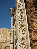
Leptis Magna

Last updated
Leptis Magna
Leptis Magna (29) (8288918733).jpg
Libya relief location map.jpg
Archaeological site icon (red).svg
Shown within Libya
Alternative nameLepcis Magna, Neapolis, Lpqy
Location Khoms, Libya
Region Tripolitania
Coordinates 32°38′21″N14°17′26″E / 32.63917°N 14.29056°E / 32.63917; 14.29056
TypeSettlement
History
Founded1000 BC [1]
Abandoned7th c. AD
Periods Iron Age to Byzantine
Cultures Carthaginian
Roman
Official nameArchaeological Site of Leptis Magna
TypeCultural
Criteriai, ii, iii
Designated1982 (6th session)
Reference no. 183
Region North Africa

Leptis or Lepcis Magna, also known by other names in antiquity, was a prominent city of the Carthaginian Empire and Roman Libya at the mouth of the Wadi Lebda in the Mediterranean.

Contents

Established as a Punic settlement prior to 500 BC, [2] the city experienced significant expansion under Roman Emperor Septimius Severus (r.193–211), who was born in the city. The 3rd Augustan Legion was stationed here to defend the city against Berber incursions. After the legion's dissolution under Gordian III in 238, the city was increasingly open to raids in the later part of the 3rd century. Diocletian reinstated the city as provincial capital, and it grew again in prosperity until it fell to the Vandals in 439. It was reincorporated into the Eastern Empire in 533 but continued to be plagued by Berber raids and never recovered its former importance. It fell to the Muslim invasion in c.647 and was subsequently abandoned.

After being abandoned, the city was remarkably preserved as it lay buried beneath layers of sand dunes. In the 1920s, the city was unearthed by Italian archaeologists during Italy's occupation of Libya. [2] Its ruins are within present-day Khoms, Libya, 130 km (81 mi) east of Tripoli. They are among the best-preserved Roman sites in the Mediterranean.

Names

The Punic name of the settlement was written LPQ (Punic : 𐤋𐤐𐤒) or LPQY (𐤋𐤐𐤒𐤉). [3] [4] [5] This has been tentatively connected to the Semitic root (present in Arabic) LFQ, meaning "to build" or "to piece together", presumably in reference to the construction of the city. [6]

This name was hellenized as Léptis (Ancient Greek : Λέπτις), [7] also known as Léptis Megálē (Λέπτις μεγάλη, "Greater Leptis") distinguishing it from the "Lesser Leptis" closer to Carthage in modern-day Tunisia. It was also known by the Greeks as Neápolis (Νεάπολις, "New Town"). The latinization of these names was Lepcis or Leptis Magna ("Greater Leptis"), which also appeared as the "Leptimagnese City" (Latin : Leptimagnensis Civitas). The Latin demonym was "Leptitan" (Leptitanus). It was also known as Ulpia Traiana as a Roman colony, [5] after Emperor Trajan of the Ulpia gens. Its Italian name is Lepti Maggiore, and in Arabic it is named Labdah (لَبْدَة). [8] [9]

History

Map of Leptis Magna LY-Leptis Magna.png
Map of Leptis Magna

Punics

The Punic city was founded in the second half of the 7th century BC. Little is known about Leptis during this time, but it appears to have been powerful enough to repel Dorieus's attempt to establish a Greek colony nearby around 515 BC. [4] Like most Punic settlements, Leptis became part of the Carthaginian Empire and fell under Rome's control with Carthage's defeat in the Punic Wars. Leptis remained highly independent for a period after about 111 BC.

Roman Republic

The Roman Republic sent some colonists together with a small garrison in order to control the city. The city prospered and was even allowed to coin its own money in silver and bronze. Reflecting its blend of cultures, its coins bore Punic inscriptions but images of Hercules and Dionysus. [5] Soon Italian merchants settled in the city and started a profitable commerce with the Libyan interior. [10] The city depended primarily on the fertility of its surrounding farmland, where many olive-presses have been excavated. By 46 BC, its olive oil production was of such an extent that the city was able to provide three million pounds of oil annually to Julius Caesar as tax. [4]

Roman Empire

Kenneth D. Matthews Jr. writes: [11]

During the reign of Augustus, Leptis Magna was classified as a civitas libera et immunis , or a free community, over which the governor had an absolute minimum of control. As such Leptis retain its two suphetes at the head of its government, with the mhzm, similar to the Roman aediles , as minor magistrates. In addition there were such sacred officials as the ʾaddir ʾararim or praefectus sacrorum, the nēquim ēlīm, and probably a sacred college of fifteen members.

The Severan Forum Forum leptis magna.JPG
The Severan Forum
Arch of Septimius Severus Arch of Septimius Severus, Leptis Magna12.jpg
Arch of Septimius Severus

Leptis Magna remained as such until the reign of the Roman emperor Tiberius, when the city and the surrounding area were formally incorporated into the empire as part of the province of Africa. It soon became one of the leading cities of Roman Africa and a major trading post. The city grew rapidly under Roman administration. During the reign of Nero, an amphitheater was constructed. The settlement was elevated to municipium in AD 64 or 65 and to colonia under Trajan (r.98–117). The first known bishop of Leptis Magna was a certain priest called Victor who became pope in 189. [12]

Leptis achieved its greatest prominence beginning in AD 193, as the hometown of emperor Septimius Severus. Septimius favored his hometown above all other provincial cities, and the buildings and wealth he lavished on it made Leptis Magna the third-most important city in Africa, rivaling Carthage and Alexandria. In AD 205, he and the imperial family visited the city and bestowed great honors. Among the changes that Severus introduced were the creation of a magnificent new forum and the rebuilding of the docks. The natural harbor had a tendency to silt up, but the Severan changes made this worse, and the eastern wharves are extremely well preserved, since they were scarcely used.

Leptis prospered through trans-Saharan trade in various valuable goods, including ivory, wild animals for the gladiatorial arena, gold dust, carbuncle, precious woods like ebony, and ostrich feathers. [2]

Leptis overextended itself during this period. During the Crisis of the 3rd Century, when trade declined precipitously, Leptis Magna's importance also fell into a decline, and by the middle of the 4th century, even before it was completely devastated by the 365 tsunami, large parts of the city had been abandoned. Ammianus Marcellinus recounts that the crisis was worsened by a corrupt Roman governor named Romanus, who demanded bribes to protect the city during a major tribal raid. The ruined city could not pay these and complained to the emperor Valentinian I. Romanus then bribed people at court and arranged for the Leptan envoys to be punished "for bringing false accusations". It enjoyed a minor renaissance beginning in the reign of the emperor Theodosius I.

Vandal Kingdom

In 439, Leptis Magna and the rest of the cities of Tripolitania fell under the control of the Vandals when their king, Gaiseric, captured Carthage from the Romans and made it his capital. Unfortunately for the future of Leptis Magna, Gaiseric ordered the city's walls demolished so as to dissuade its people from rebelling against Vandal rule. The people of Leptis and the Vandals both paid a heavy price for this in AD 523 when a group of Berber raiders sacked the city.

Byzantine Empire

Belisarius, general of Emperor Justinian I, recaptured Leptis Magna in the name of the Roman Empire ten years later, and in 533–4 it was re-incorporated into the empire. Leptis became a provincial capital of the Eastern Empire, but never recovered from the destruction wreaked upon it by the Berbers. In 544, under the prefecture of Sergius, the city came under intensified attack of Berber tribes, and after some successes, Sergius was reduced to retreating into the city, with the Leuathae tribal confederation camped outside the gate demanding payments. Sergius admitted eighty deputies into the city to present their demands, but when Sergius moved to leave the conference he was detained by the robe by one deputy and crowded by others. This provoked an officer of the prefect's guard to kill the deputy laying hands on the prefect, which resulted in a general massacre. The Berbers reacted with an all-out attack and Sergius was eventually forced to abandon Leptis and retreat to Carthage. [13]

Islamic conquest

By the 6th century, the city was fully Christianized. [14] [ failed verification ] During the decade 565–578 AD Christian missionaries from Leptis Magna even began to move once more among the Berber tribes as far south as the Fezzan in the Libyan desert and converted the Garamantes. [15] Numerous new churches were built in the 6th century, [16] but the city continued to decline, and by the time of the Arab conquest around 647 the city was mostly abandoned except for a Byzantine garrison force and a population of less than 1,000 inhabitants. By the 10th century, the city of Al-Khums had fully absorbed it. [17]

Excavation

Today, the site of Leptis Magna is the site of some of the most impressive ruins of the Roman period.

Leptis Magna ruins, in the United Kingdom, by the Virginia Water Lake Leptis Magna ruins, Virginia Water (1) (geograph 3935706).jpg
Leptis Magna ruins, in the United Kingdom, by the Virginia Water Lake

Part of an ancient temple was brought from Leptis Magna to the British Museum in 1816 and installed at the Fort Belvedere royal residence in England in 1826. It now lies in part of Windsor Great Park. [18] The ruins are located between the south shore of Virginia Water and Blacknest Road close to the junction with the A30 London Road and Wentworth Drive.

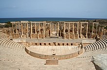
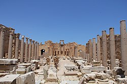
The Roman theatre Leptis Magna Theatre.jpg
The Roman theatre

When Italians conquered Italian Libya in the early 20th century, they dedicated huge efforts to the rediscovery of Leptis Magna. In the early 1930s Italian archeological research was able to show again the buried remains of nearly all the city. [19] [ page needed ] A 4th to 3rd century BC necropolis was found under the Roman theatre.

In June 2005, it was revealed that archaeologists from the University of Hamburg had been working along the coast of Libya when they uncovered a 30 ft length of five colorful mosaics created during the 1st or 2nd century. The mosaics show with exceptional clarity depictions of a warrior in combat with a deer, four young men wrestling a wild bull to the ground, and a gladiator resting in a state of fatigue and staring at his slain opponent. The mosaics decorated the walls of a cold plunge pool in a balneae within a Roman villa at Wadi Lebda in Leptis Magna. The gladiator mosaic is noted by scholars as one of the finest examples of representational mosaic art ever seen—a "masterpiece comparable in quality with the Alexander Mosaic in Pompeii." The mosaics were originally discovered in the year 2000 but were kept secret in order to avoid looting. They are currently on display in the Leptis Magna Museum. [20]

There were reports that Leptis Magna was used as a cover for tanks and military vehicles by pro-Gaddafi forces during the First Libyan Civil War in 2011. [21] When asked about the possibility of conducting an air-strike on the historic site, NATO refused to rule out the possibility of such an action saying that it had not been able to confirm the rebels' report that weapons were being hidden at the location. [22] Shortly after the war, Libyan archaeologist Hafed Walda reported that Leptis Magna, along with nearby Rasaimergib Fort and the western Tripolis of Sabratha, had "so far seen no visible loss" from either fighting on the ground or bombings conducted by international forces. [23]

In the midst of the Second Libyan Civil War and the disappearance of governmental and international support for the site, people living in the area organized to voluntarily protect and maintain Leptis Magna. [24] [25]

Climate change

Since they are located on the coast, Leptis Magna ruins are vulnerable to sea level rise. In 2022, the IPCC Sixth Assessment Report included them in the list of African cultural sites which would be threatened by flooding and coastal erosion by the end of the century, but only if climate change followed RCP 8.5, which is the scenario of high and continually increasing greenhouse gas emissions associated with the warming of over 4 °C., [26] and is no longer considered very likely. [27] [28] The other, more plausible scenarios result in lower warming levels and consequently lower sea level rise: yet, sea levels would continue to increase for about 10,000 years under all of them. [29] Even if the warming is limited to 1.5 °C, global sea level rise is still expected to exceed 2–3 m (7–10 ft) after 2000 years (and higher warming levels will see larger increases by then), consequently exceeding 2100 levels of sea level rise under RCP 8.5 (~0.75 m (2 ft) with a range of 0.5–1 m (2–3 ft)) well before the year 4000. Thus, it is a matter of time before the Leptis Magna ruins are threatened by rising water levels, unless they can be protected by adaptation efforts such as sea walls. [30]

See also

Related Research Articles

<span class="mw-page-title-main">Septimius Severus</span> Roman emperor from 193 to 211

Lucius Septimius Severus was a Roman politician who served as emperor from 193 to 211. He was born in Leptis Magna in the Roman province of Africa. As a young man he advanced through the customary succession of offices under the reigns of Marcus Aurelius and Commodus. Severus was the final contender to seize power after the death of the emperor Pertinax in 193 during the Year of the Five Emperors.

<span class="mw-page-title-main">Oea</span> Ancient city in present-day Centreville à le Souq Yafran, in Tripoli, Libya

Oea was an ancient city in present-day Tripoli, Libya. It was founded by the Phoenicians in the 7th century BC and later became a Roman–Berber colony. As part of the Roman Africa Nova province, Oea and surrounding Tripolitania were prosperous. It reached its height in the 2nd and 3rd centuries AD, when the city experienced a golden age under the Severan dynasty in nearby Leptis Magna. The city was conquered by the Rashidun Caliphate with the spread of Islam in the 7th century and came to be known as Tripoli during the 9th century.
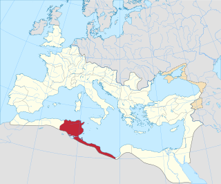
<span class="mw-page-title-main">Africa (Roman province)</span> Roman province in north Africa

Africa was a Roman province on the northern coast of the continent of Africa. It was established in 146 BC, following the Roman Republic's conquest of Carthage in the Third Punic War. It roughly comprised the territory of present-day Tunisia, the northeast of Algeria, and the coast of western Libya along the Gulf of Sidra. The territory was originally and still is inhabited by Berbers, known in Latin as the Mauri, indigenous to all of North Africa west of Egypt. In the 9th century BC, Semitic-speaking Phoenicians from West Asia built settlements along the coast of the Mediterranean Sea to facilitate shipping. Carthage, rising to prominence in the 8th century BC, became the predominant of these.

<span class="mw-page-title-main">Tripolitania</span> Historic region of Libya

Tripolitania, historically known as the Tripoli region, is a historic region and former province of Libya.

<span class="mw-page-title-main">Sabratha</span> City in Libya

Sabratha, in the Zawiya District of Libya, was the westernmost of the ancient "three cities" of Roman Tripolis, alongside Oea and Leptis Magna. From 2001 to 2007 it was the capital of the former Sabratha wa Sorman District. It lies on the Mediterranean coast about 70 km (43 mi) west of modern Tripoli. The extant archaeological site was inscribed as a UNESCO World Heritage Site in 1982.

<span class="mw-page-title-main">Utica, Tunisia</span> Ancient Phoenician and Carthaginian city

Utica was an ancient Phoenician and Carthaginian city located near the outflow of the Medjerda River into the Mediterranean, between Carthage in the south and Hippo Diarrhytus in the north. It is traditionally considered to be the first colony to have been founded by the Phoenicians in North Africa. After Carthage's loss to Rome in the Punic Wars, Utica was an important Roman colony for seven centuries.

<span class="mw-page-title-main">Punic people</span> People from Ancient Carthage

The Punic people, usually known as the Carthaginians, were a Semitic people who migrated from Phoenicia to the Western Mediterranean during the Early Iron Age. In modern scholarship, the term Punic, the Latin equivalent of the Greek-derived term Phoenician, is exclusively used to refer to Phoenicians in the western Mediterranean, following the line of the Greek East and Latin West. The largest Punic settlement was Ancient Carthage, but there were 300 other settlements along the North African coast from Leptis Magna in modern Libya to Mogador in southern Morocco, as well as western Sicily, southern Sardinia, the southern and eastern coasts of the Iberian Peninsula, Malta, and Ibiza. Their language, Punic, was a dialect of Phoenician, one of the Northwest Semitic languages originating in the Levant.
<span class="mw-page-title-main">Leptis Parva</span>

Leptis or Lepcis Parva was a Phoenician colony and Carthaginian and Roman port on Africa's Mediterranean coast, corresponding to the modern town Lemta, just south of Monastir, Tunisia. In antiquity, it was one of the wealthiest cities in the region.
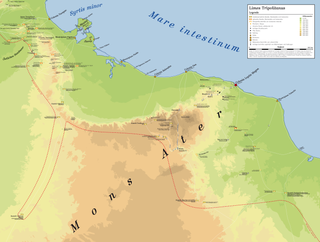
<i>Limes Tripolitanus</i>

The Limes Tripolitanus was a frontier zone of defence of the Roman Empire, built in the south of what is now Tunisia and the northwest of Libya. It was primarily intended as a protection for the tripolitanian cities of Leptis Magna, Sabratha and Oea in Roman Libya.

Publius Septimius Geta was the father of the emperor Lucius Septimius Severus, father-in-law of the Roman empress Julia Domna and the paternal grandfather of the Roman emperors Caracalla and Geta. Besides mentions in the Historia Augusta, Geta is known from several inscriptions, two of which were found in Leptis Magna, Africa.

<span class="mw-page-title-main">Icosium</span>

Icosium was a Phoenician and Punic settlement in modern-day Algeria. It was part of Numidia and later became an important Roman colony and an early medieval bishopric in the casbah area of modern Algiers.

<span class="mw-page-title-main">Tourism in Libya</span>

Tourism in Libya is an industry heavily hit by the Libyan Civil War. Before the war tourism was developing, with 149,000 tourists visiting Libya in 2004, rising to 180,000 in 2007, although this still only contributed less than 1% of the country's GDP. There were 1,000,000 day visitors in the same year. The country is best known for its ancient Greek and Roman ruins and Sahara desert landscapes.

<span class="mw-page-title-main">Al-Khums</span> Place in Tripolitania, Libya

Al-Khums or Khoms is a city, port and the de jure capital of the Murqub District on the Mediterranean coast of Libya with an estimated population of around 202,000. The population at the 1984 census was 38,174. Between 1983 and 1995 it was the administrative center of al-Khums District.

<span class="mw-page-title-main">Gerisa</span> Archeological site in Libya

Gerisa, also called Ghirza, was an ancient city of Roman Libya near the Limes Tripolitanus. It was a small village of 300 inhabitants on the pre-desert zone of Tripolitania.

<span class="mw-page-title-main">Roman Libya</span>

The area of North Africa which has been known as Libya since 1911 was under Roman domination between 146 BC and 672 AD. The Latin name Libya at the time referred to the continent of Africa in general. What is now coastal Libya was known as Tripolitania and Pentapolis, divided between the Africa province in the west, and Crete and Cyrenaica in the east. In 296 AD, the Emperor Diocletian separated the administration of Crete from Cyrenaica and in the latter formed the new provinces of "Upper Libya" and "Lower Libya", using the term Libya as a political state for the first time in history.
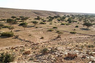
<span class="mw-page-title-main">Centenarium</span>

A centenarium is a type of Ancient Roman fortified farmhouse in the Limes Tripolitanus. It is called even in the plural centenaria, because in the Limes Tripolitanus there were more than 2000 of these "fortifications", connected to create a defensive system against desert tribe raids.

<span class="mw-page-title-main">Arch of Septimius Severus (Leptis Magna)</span> Roman triumphal arch in Libya

The Arch of Septimius Severus is a triumphal arch in the ruined Roman city of Leptis Magna, in present-day Libya. It was commissioned by the Roman Emperor Septimius Severus, who was born in the city. The arch was in ruins but was pieced back together by archaeologists after its discovery in 1928.

<span class="mw-page-title-main">Roman colonies in North Africa</span>

Roman colonies in North Africa are the cities—populated by Roman citizens—created in North Africa by the Roman Empire, mainly in the period between the reigns of Augustus and Trajan.

<span class="mw-page-title-main">Roman Africans</span> Ethnic group

The Roman Africans or African Romans were the ancient populations of Roman North Africa that had a Romanized culture, some of whom spoke their own variety of Latin as a result. They existed from the Roman conquest until their language gradually faded out after the Arab conquest of North Africa in the Early Middle Ages.
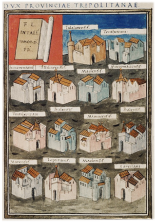
<span class="mw-page-title-main">Tripolitania (Roman province)</span> Roman province in North Africa

Tripolitania was a province of the Roman Empire. Between the 2nd century BC and the 3rd century AD it had been known as Syrtica; in the 3rd century it was renamed Tripolitania meaning "region of the three cities", referring to Oea, Sabratha and Leptis Magna.
References

Citations

  1. "Leptis Magna | Archiqoo".
  2. 1 2 3 Gates, Charles (2011). Ancient cities: the archaeology of urban life in the ancient Near East and Egypt, Greece and Rome (2nd ed.). London: Routledge. p. 406. ISBN   978-0-203-83057-4.
  3. Ghaki (2015), p. 67.
  4. 1 2 3 Brogan & Wilson (2012).
  5. 1 2 3 Head (1911).
  6. Lipiński (2004), p.  345.
  7. Strabo, Geography, §17.3.18.
  8. "لَبْدَة, Libya". National Geospatial-Intelligence Agency. 30 June 2006. Archived from the original on 2020-05-23 via Geographic.org.
  9. Leptis Magna at the Encyclopædia Britannica
  10. Bullo (2002), pp. 167–171.
  11. Matthews (1957), p. 37.
  12. Bongmba, Elias Kifon (22 December 2015). "Christianity in North Africa". Routledge Companion to Christianity in Africa. Routledge. ISBN   978-1-134-50584-5 . Retrieved 29 April 2024.
  13. Beechey & Beechey (1828), pp. 54–56.
  14. Mommsen (1909), Chapter XIII. The African Provinces.
  15. Prevost (2007), pp. 462–463.
  16. Livius.org, Photos: Lepcis Magna, Byzantine Church.
  17. Bullo (2002), pp. 185–188.
  18. The Atlantic, 10 January 2018.
  19. Musso (2010).
  20. The Times, 13 June 2005.
  21. The Times, 14 June 2011.
  22. CNN, 14 June 2011.
  23. AP, 4 November 2011.
  24. AFP, 23 December 2016.
  25. Reuters, 28 November 2017.
  26. Trisos, C.H., I.O. Adelekan, E. Totin, A. Ayanlade, J. Efitre, A. Gemeda, K. Kalaba, C. Lennard, C. Masao, Y. Mgaya, G. Ngaruiya, D. Olago, N.P. Simpson, and S. Zakieldeen 2022: Chapter 9: Africa. In Climate Change 2022: Impacts, Adaptation and Vulnerability [H.-O. Pörtner, D.C. Roberts, M. Tignor, E.S. Poloczanska, K. Mintenbeck, A. Alegría, M. Craig, S. Langsdorf, S. Löschke,V. Möller, A. Okem, B. Rama (eds.)]. Cambridge University Press, Cambridge, United Kingdom and New York, NY, US, pp. 2043–2121
  27. Hausfather, Zeke; Peters, Glen (29 January 2020). "Emissions – the 'business as usual' story is misleading". Nature. 577 (7792): 618–20. Bibcode:2020Natur.577..618H. doi: 10.1038/d41586-020-00177-3 . PMID   31996825.
  28. Hausfather, Zeke; Peters, Glen (20 October 2020). "RCP8.5 is a problematic scenario for near-term emissions". PNAS. 117 (45): 27791–27792. Bibcode:2020PNAS..11727791H. doi: 10.1073/pnas.2017124117 . PMC   7668049 . PMID   33082220.
  29. Technical Summary. In: Climate Change 2021: The Physical Science Basis. Contribution of Working Group I to the Sixth Assessment Report of the Intergovernmental Panel on Climate Change (PDF). IPCC. August 2021. p. TS14. Retrieved 12 November 2021.
  30. IPCC, 2021: Summary for Policymakers. In: Climate Change 2021: The Physical Science Basis. Contribution of Working Group I to the Sixth Assessment Report of the Intergovernmental Panel on Climate Change [Masson-Delmotte, V., P. Zhai, A. Pirani, S.L. Connors, C. Péan, S. Berger, N. Caud, Y. Chen, L. Goldfarb, M.I. Gomis, M. Huang, K. Leitzell, E. Lonnoy, J.B.R. Matthews, T.K. Maycock, T. Waterfield, O. Yelekçi, R. Yu, and B. Zhou (eds.)]. Cambridge University Press, Cambridge, United Kingdom and New York, NY, US, pp. 3−32, doi:10.1017/9781009157896.001.

Bibliography

Further reading