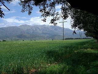
Tunisia is a country in Northern Africa, bordering the Mediterranean Sea, having a western border with Algeria (965 km) and south-eastern border with Libya (459 km) where the width of land tapers to the south-west into the Sahara. The country has north, east and complex east-to-north coasts including the curved Gulf of Gabès, which forms the western part of Africa's Gulf of Sidra. Most of this greater gulf forms the main coast of Libya including the city of Sirte which shares its root name. The country's geographic coordinates are 34°00′N9°00′E. Tunisia occupies an area of 163,610 square kilometres, of which 8,250 are water. The principal and reliable rivers rise in the north of the country with a few notable exceptions from north-east Algeria and flow through the northern plain where sufficient rainfall supports diverse plant cover and irrigated agriculture.

The Rock of Gibraltar is a monolithic limestone mountain 426 m (1,398 ft) high dominating the western entrance to the Mediterranean Sea. It is situated near the end of a narrow 9 kilometres (5.6 mi) long promontory stretching due south into the Mediterranean Sea and is located within the British territory of Gibraltar, and is 27 km north-east of Tarifa, Spain, the southwestern tip of Europe on the Iberian Peninsula. The rock serves as an impregnable fortress and contains a labyrinthine network of man-made tunnels known as the Tunnels of Gibraltar. Most of the Rock's upper area comprises a nature reserve which is home to about 300 Barbary macaques. It is a major tourist attraction.

The Barbary macaque, also known as Barbary ape, is a macaque species native to the Atlas Mountains of Algeria, Tunisia and Morocco, along with a small introduced population in Gibraltar. It is the type species of the genus Macaca. The species is of particular interest because males play an atypical role in rearing young. Because of uncertain paternity, males are integral to raising all infants. Generally, Barbary macaques of both sexes and all ages contribute in alloparental care of young.

The Rif, also called Rif Mountains, is a geographic region in northern Morocco. It is bordered on the north by the Mediterranean Sea and Spain and on the west by the Atlantic Ocean, and is the homeland of the Rifians and the Jebala people. This mountainous and fertile area is bordered by Cape Spartel and Tangier to the west, by Berkane and the Moulouya River to the east, by the Mediterranean to the north, and by the Ouergha River to the south. The Rif mountains are separated into the eastern Rif mountains and western Rif mountains.

Blida is a city in Algeria. It is the capital of Blida Province, and it is located about 45 km south-west of Algiers, the national capital. The name Blida, i.e. bulaydah, is a diminutive of the Arabic word belda, city.

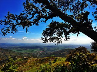
Petite Kabylie or Petite Kabylia is a natural region in the mountainous area of northern Algeria. The Petite Kabylie is part of the greater Kabylie region.

The Tell Atlas is a mountain chain over 1,500 km (932 mi) in length, belonging to the Atlas mountain ranges in North Africa, stretching mainly across northern Algeria, ending in north-eastern Morocco and north-western Tunisia.

The Middle Atlas is a mountain range in Morocco. It is part of the Atlas mountain range, a mountainous region with more than 100,000 km2, 15 percent of its landmass, rising above 2,000 metres. The Middle Atlas is the northernmost and second highest of three main Atlas Mountains chains of Morocco. To south, separated by the Moulouya and Um Er-Rbiâ rivers, lies the High Atlas. The Middle Atlas form the westernmost end of a large plateaued basin extending eastward into Algeria, also bounded by the Tell Atlas to the north and the Saharan Atlas to the south, both lying largely in Algeria. North of the Middle Atlas and separated by the Sebou River, lie the Rif mountains which are an extension of the Baetic System, which includes the Sierra Nevada in the south of Spain. The basin of the Sebou is not only the primary transportation route between Atlantic Morocco and Mediterranean Morocco but is an area, watered by the Middle Atlas range, that constitutes the principal agricultural region of the country.

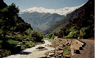
Ourika River is a river in Morocco, at 31.4°N 7.783333°W. It rises in the High Atlas and flows through the Ourika Valley, 30 km from Marrakech.

Originally from the Atlas Mountains and the Rif Mountains of Morocco, the Barbary macaque population in Gibraltar is the only wild monkey population on the European continent. Although most Barbary monkey populations in Africa are experiencing decline due to hunting and deforestation, the Gibraltar population is increasing. As of 2020, some 300 animals in five troops occupy the Upper Rock area of the Gibraltar Nature Reserve, though they make occasional forays into the town. As they are a tailless species, they are also known locally as Barbary apes or rock apes, despite being classified as monkeys. Spanish speakers simply refer to them as monos when conversing in Spanish, although English is the native language as the area is a British overseas territory.

The national park of Djurdjura is one of the national parks of Algeria. It is located in Kabylie and is named after the Djurdjura Range of the Tell Atlas.

The Taza National Park is one of the smaller national parks of Algeria. It is located in Jijel Province in the mountainous region of the Tell Atlas, and is named after the nearby city of Taza. Its total area is 3,807 hectares and it includes parts of the forested area of the Guerrouch massif. The lower parts of the park seldom experience frost and are relatively warm and dry, while the peaks may have a covering of snow in winter. The annual precipitation in the park ranges from 1,000 to 1,400 millimetres and the annual mean temperature is around 18 °C (64 °F).

The Mediterranean woodlands and forests is an ecoregion in the coastal plains, hills, and mountains bordering the Mediterranean Sea and Atlantic Ocean in North Africa. It has a Mediterranean climate, and is in the Mediterranean forests, woodlands, and scrub biome.

Mediterranean conifer and mixed forests is an ecoregion, in the temperate coniferous forest biome, which occupies the high mountain ranges of North Africa. The term is also a botanically recognized plant association in the African and Mediterranean literature.

Ifrane National Park is a national park located in the Middle Atlas mountain range of Morocco. Its territory extends over the western part of the mountains and areas within the provinces of Ifrane and Boulmane. It is one of the few remaining habitats for the Barbary macaque; a primate which prehistorically had a much broader range in North Africa, but currently survives as an endangered species in narrowly restricted and fragmented habitats.

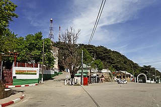
Chrea is a town in Algeria, located in Blida Province, Ouled Yaïch District, in a mountainous area named Tell Atlas, near Blida. It had a population of 783 in 2008.

Chiffa is a town and gorge in the Tell Atlas Mountains of northern Algeria. This gorge is one of the few habitat areas in Algeria that supports a sub-population of the Barbary macaque, Macaca sylvanus.
The Djebel Babor Nature Reserve is a protected area in Algeria. The reserve is within the Babor Mountains. Much of this area is forested with Mediterranean conifer and mixed forests. This reserve offers one of the few remaining disjunctive habitats for the endangered Barbary macaque, Macaca sylvanus, a primate species which prehistorically held a much wider range. The reserve is also a significant birdwatching area.

Pic des Singes is a peak in northern Algeria, northwest of the town of Béjaïa. It is located in the Cap Carbon area of the Tell Atlas range, on the Mediterranean coast.

Corniche Jjilienne is a natural region of northern Algeria characterised by rocky forested massifs rising above the coastal plain. The forested areas provide some of the last extant habitat for the endangered Barbary macaque, Macaca sylvanus; this primate prehistorically had a much wider distribution in North Africa than at present.


