Algiers was formally founded in 972 AD by Buluggin ibn Ziri, though its history goes back to between 1200 and 250 BC as a Phoenician trading settlement. Over time, it came under the control of several powers, including Numidia, the Roman Empire, and various Islamic caliphates. In 1516, it became the capital of the Ottoman Regency of Algiers, a status it held until the French invasion in 1830, after which it served as the capital of French Algeria. During World War II, it briefly functioned as the administrative center of Free France from 1942 to 1944 before returning to French colonial rule. It has remained the capital of the modern Algerian state since the Algerian Revolution in 1962.
Algiers is the main tourist destination in Algeria, known for its numerous museums, art galleries, and cultural institutions. Most notable is the historic Casbah, a UNESCO World Heritage Site featuring traditional Algerian, Ottoman, and Andalusian architecture. The city also contains a larger French-built section that showcases diverse architectural styles and trends. Commonly referred to as al bidha ("the white") for its whitewashed buildings, Algiers blends colonial and indigenous urban influences. It hosted the 1975 Mediterranean Games and various major international sporting events, and it serves as the seat of the Consultative Council of the Arab Maghreb Union. Numerous Algerian multinational companies and institutions are based in the city, such as Sonatrach Petroleum Corporation, Air Algérie, and Bank of Algeria.
Name origin
The present name of the city is the Arabic name al-Jazāʾir (الجزائر), meaning "The Islands", this name's origin is related to the 4 main islands off the western cape where people settled, looking on a map one can notice that the islands were eventually connected to the mainland in 1525 AD via a pier now named Kheireddine pier. This name is a truncated form of the name that was used first by Buluggin ibn Ziri when he established the modern city in 972 AD which was Jazaʾir Banī Mazghanna (جزائر بني مزغانة), meaning "islands of Banu Mazghanna", this term was used by the Hammadid dynasty as well as early medieval geographers such as Muhammad al-Idrisi and Yaqut al-Hamawi. Before that, from French and CatalanAlger[4] from the Arabic name, Al-Jazāʾir. The name was given by Buluggin ibn Ziri after he established the city on the ruins of the Phoenician city of Icosium in 950.[5] During Ottoman rule, the name of the capital, al-Jazā'ir, was extended over the entire country, giving it the English name Algeria derived from the French name Algérie.[6]
Algiers is also known as el-Behdja (البهجة, "The Joyous") El Mahrussa ("the good-guarded"), or "Algiers the White" (French: Alger la Blanche) for its whitewashed buildings.[8][note 1][9]
The city's history is believed to date back to 1200 BC, but it was a small settlement without any significance until around the 3rd century BC when "Ikosim" became a small port town in Carthage where Phoenicians were trading with other Mediterranean ports. After the Battle of Cirta, Numidia got a hold of the town along with its neighboring regions at around 202 BC, after which the Punic Wars started weakening the Berber nation. On 104 BC, following the capturing of Jughurta and executing him in Rome, the western half of his nation was given to Mauretania under the rule of Bocchus I. At around 42 AD, Claudius divided Mauretania into two provinces, Mauretania Caesariensis that included Icosium as one of its towns; the second province was Mauretania Tingitana and were deemed as Roman Municipiums, additionally they were given Latin rights by the emperor Vespasian. In 371-373 AD, Mauretania revolted with the help of Firmus, in hopes of establishing an independent state. Icosium was raided and damaged. Some clues show the presence of bishops in the region at this time.[10]
In 435 AD, the Vandal Kingdom took control of northern Africa along the coasts of today's Tunisia and Algeria. The Western Roman Empire that was ruling the area allowed the Vandals to settle when it became clear that they could not be defeated by Roman military forces. Though the city was damaged again due to the fighting between the two armies, the town was still slowly growing in population.
Medieval history
In 534 AD, the Vandal kingdom was subjugated by the general Belisarius of the Eastern Roman Empire, making Icosium a part of the empire. In the early 7th century, "Beni Mezghenna" who are a Berber tribe belonging to the Sanhaja as cited by Ibn Khaldoun, settled on the plains of Icosium and the surrounding areas.[11] Shortly after, in the late 7th century, the Muslim conquest of the Maghreb brought the Umayyad Caliphate into the region, but were faced with resistance from Berber forces led by Kahina and Kusaila in the 680s, who opposed the advancing Islamic armies. However, Hassan ibn al-Nu'man and Musa ibn Nusayr later defeated both Berber leaders, killing Kusaila at the Battle of Mamma (688) and killing Dihya at the Battle of Tabarka (702), leading to the subjugation of the Berber tribes, bringing Islamic rule into North Africa. The Abbasid Caliphate succeeded Umayyad Caliphate at around 750 AD. Independence movements across the Maghreb resulted in the breaking of two nations, the Idrisid dynasty and the Aghlabid Emirate but acted as agents of the Abbasids in Baghdad. Icosium fell into the hands of Aghlabids and abandoned the town. They were then overthrown by the Fatimids in 909 AD, who went on to control all of Ifriqiya by 969 AD.
The present city was re-founded in 972 AD by Buluggin ibn Ziri, who was appointed by the Faṭimid caliph al-Muʿizz as governor of al-Qayrawān and any other territory his nation, the Zirid Dynasty might reclaim from its enemies, the Zenata tribesmen. His state accordingly expanded its boundaries westward. In approximately 1014 AD, under the reign of Badis ibn al-Mansur, the dynasty was divided between the Zirids at al-Qayrawan in the east, and the Hammadid dynasty at Qal'at Bani Hammad; "Jazaʾir Banī Mazghanna", commonly known as "Algiers" as the new name of Icosium was absorbed into the Hammadid dynasty[12] who in 1067 AD relocated to Béjaïa and carried on a lively trade while most of North Africa was under a state of anarchy.[citation needed]
In 1079 AD, Ibn Tashfin, a Sanhaja leader of the Almoravid Empire sent an army of 20,000 men from Marrakesh to push towards what is now Tlemcen to attack the "Banu Ya'la", the Zenata tribe occupying the area. Led by Mazdali ibn Tilankan, the army defeated the Banu Ya'la in battle near the valley of the Moulouya River and executed their commander, the son of Tlemcen's ruler. However, Mazdali ibn Tilankan did not push to Tlemcen right away as the city of Oujda was too strong to capture. Instead, Ibn Tashfin himself returned with an army in 1081 AD that captured Oujda and then conquered Tlemcen, massacring the Maghrawa forces there and their leader; He pressed on and by 1082 AD he had captured "Jazaʾir Banī Mazghanna".
In 1151 AD, Abd al-Mu'min launched an expedition to the east, conquering Béjaïa in August 1152, the capital of the Hammadids; on their way, Beni Mezghanna did not succumb and was now under the Almohad Caliphate's control. The caliphate suffered from states breaking out of its rule, most notably, the Kingdom of Tlemcen in 1235 AD. The town once again came under the dominion of the Ziyanidsultans of the Kingdom but experienced a large measure of independence under Thaalibaamirs who settled the Mitidja plain at around 1200 AD.
Early modern history
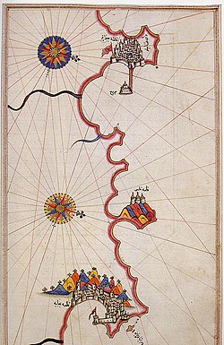
Illustration of the islets off the coast of Algiers before Pier "Kheireddine" was built.
The Kingdom of Tlemcen was the target of the Spanish Empire's and the Portuguese Empire's campaigns and conquests against its coasts, beginning in 1501 AD. However, Algiers continued to be of comparatively little importance until after the expulsion of the Moors from Spain, many of whom sought asylum in the city, after which the Spanish led by Pedro Navarro established a fortified base and garrison on one of the islets off the coast of Algiers, and named it "Peñón de Argel" or Peñón of Algiers, . By that time, Algiers had an emir, Salim al-Thumi who had to "swear obedience and loyalty" to Ferdinand II of Aragon who also imposed a levy intended to suppress the Barbary pirates.[10][13]
In 1516, the amir of Algiers, Selim b. Teumi, invited the corsair brothers Oruç Reis and Hayreddin Barbarossa to expel the Spaniards. Oruç Reis came to Algiers, ordered the assassination of Selim, and seized the town and ousted the Spanish in the Capture of Algiers (1516). Hayreddin, succeeding Oruç after the latter was killed in battle against the Spaniards in the 1518 fall of Tlemcen, was the founder of the pashaluk, which subsequently became the beylik, of Algeria. Barbarossa lost Algiers in 1524 but regained it with the 1529 Capture of Peñón of Algiers, and then formally invited the Sultan Suleiman the Magnificent to accept sovereignty over the territory and to annex Algiers to the Ottoman Empire.
Algiers from this time became the chief seat of the Barbary pirates. In October 1541 in the Algiers expedition, the King of Spain and Charles V, Holy Roman Emperor sought to capture the city, but a storm destroyed a great number of his ships, and his army of some 30,000, chiefly made up of Spaniards, was defeated by the Algerians under their pasha, Hassan.[10]
Formally part of the Ottoman Empire but essentially free from Ottoman control, starting in the 16th century Algiers turned to piracy and ransoming. Due to its location on the periphery of both the Ottoman and European economic spheres, and depending for its existence on a Mediterranean that was increasingly controlled by European shipping, backed by European navies, piracy became the primary economic activity. Repeated attempts were made by various nations to subdue the pirates that disturbed shipping in the western Mediterranean and engaged in slave raids as far north as Iceland.[14] By the 17th century, up to 40% of the city's 100,000 inhabitants were enslaved Europeans.[15] The United States fought two wars (the First and Second Barbary Wars) over Algiers' attacks on shipping.
Among the notable people held for ransom was the future Spanish novelist, Miguel de Cervantes, who was held captive in Algiers for almost five years, and wrote two plays set in Algiers of the period. The primary source for knowledge of Algiers of this period, since there are no contemporary local sources, is the Topografía e historia general de Argel (1612, but written earlier), published by Diego de Haedo, but whose authorship is disputed.[16][17] This work describes in detail the city, the behavior of its inhabitants, and its military defenses, with the unsuccessful hope of facilitating an attack by Spain so as to end the piracy.
A significant number of renegades lived in Algiers at the time, Christians converted voluntarily to Islam, many fleeing the law or other problems at home. Once converted to Islam, they were safe in Algiers. Many occupied positions of authority, such as Samson Rowlie, an Englishman who became Treasurer of Algiers.[18]
The city under Ottoman control was enclosed by a wall on all sides, including along the seafront. In this wall, five gates allowed access to the city, with five roads from each gate dividing the city and meeting in front of the Ketchaoua Mosque. In 1556, a citadel, Palace of the Dey was constructed at the highest point in the wall. A major road running north to south divided the city in two: The upper city (al-Gabal, or 'the mountain') which consisted of about fifty small quarters of Andalusian, Jewish, Moorish and Kabyle communities, and the lower city (al-Wata, or 'the plains') which was the administrative, military and commercial centre of the city, mostly inhabited by Ottoman Turkish dignitaries and other upper-class families.[19]
France and the Regency of Algiers had a commercial–political conflict called the Bakri-Busnach affair which has been bothering both nations in the 19th century. On 29 April 1827, foreign consuls and diplomatic agents gathered in the Palace of the Dey for a conference with the Regency of Algiers ruler Hussein Dey. Tensions were high because of France's failure to pay outstanding debts. In a heated moment later referred to as "fly-whisk incident", the Dey struck the French consul in the face with the handle of a fly-whisk.[21][22]
In an attempt by Charles X of France to increase his popularity amongst the French, he sought to bolster patriotic sentiment, and turn eyes away from his domestic policies, by treating the incident as a public insult and demanded an apology. Failure to respond was met by operations against the dey.[23] A naval siege on the port of Algiers by the French Navy began the following days which lasted 3 years and impacted the French and Algerian economies due to their former extensive trade treaties.
The keys of the city of Algiers, which were handed to the French Army on 5 July 1830.Bombardment of Algiers by sea on 3 July 1830
Tensions only continued rising while the French Armed Forces were preparing for the 1830 invasion of Algiers. The naval fleet departed from Toulon on 25 May 1830, and successfully reached the western coast of the Regency near what is today Sidi Fredj on 14 June 1830. The Algerian forces met their French opponents in the Battle of Staouéli on 19 June 1830, to which the Dey's forces were defeated, this enabled the colonial army to advance into the city and made Hussein Dey surrender to French General de Bourmont on 5 July 1830.
French rule
Under French rule, Algiers became the capital of French Algeria, "an integral part of the French Republic" according to a formal annexation declared on 22 June 1834.[24] Following this, interest turned into the completion of the French conquest of Algeria that shared goals with its pacification efforts; Establishing a European cultural, economic and political presence in Africa without considering the indigenous population's lifestyle or connection to their land. Plans to transform the face of the city to match French standards and architectural trends began shortly after obtaining the city. Originally, the Casbah extended to the sea, but it was pushed back to the hills above after demolishing the walls and lower half of the old city and erecting the current "Place des Martyrs",[25] constructing promenades and boulevards that circle the city or face the Mediterranean, tracing new streets and building apartments that are characterized by their "Haussmanian" Style.[26]
Settlers of European descent marked a majority of the city's population,[27] some constituted a minority of "Pieds-noirs" who were granted French citizenship and rights under the Crémieux Decree. On the other hand, Code de l'indigénat enforced inferiority of the "Arabs" and "Muslims" which were getting forcibly removed from their homes and were banned from entering various parts of "Alger" to segregate by race, religion and language.[28][29] Added to that, mosques were repurposed to churches, stables, or demolished/closed permanently, examples of this are Ketchoua Mosque and Ali Bitchin Mosque.[30]
During the 1930s, the architect Le Corbusier drew up plans for a complete redesign of the colonial city. Le Corbusier was highly critical of the urban style of Algiers, describing the European district as "nothing but crumbling walls and devastated nature, the whole a sullied blot". He also criticised the difference in living standards he perceived between the European and African residents of the city, describing a situation in which "the 'civilised' live like rats in holes" whereas "the 'barbarians' live in solitude, in well-being".[33] However, these plans were ultimately ignored by the French administration.
During World War II, Algiers was the first city to be seized from the Axis by the Allies in Operation Terminal, a part of Operation Torch.
City and harbour of Algiers, c.1921
Algerian War
The "tense truce" between Algerian rebels, French army and the OAS in 1962
Algiers also played a pivotal role in the Algerian War (1954–1962), a bloody independence struggle in which hundreds of thousands (estimates range between 350,000 and 1,500,000) died (mostly Algerians but also French and pieds-noirs). In particular, it saw the Battle of Algiers when the 10th Parachute Division of the French Army, starting on 7 January 1957, and on the orders of the French Minister of Justice François Mitterrand (who authorized any means "to eliminate the insurrectionists"[citation needed]), led attacks against the Algerian fighters for independence. Algiers remains marked by this battle, which was characterized by merciless fighting between FLN forces which carried out a guerrilla campaign against the French military and police and pro-French Algerian soldiers, and the French Army which responded with a bloody repression, torture and blanket terrorism against the native population. The demonstrations of 13 May during the crisis of 1958 provoked the fall of the Fourth Republic in France, as well as the return of General de Gaulle to power.
Independence
Algeria achieved independence on 5 July 1962, with Algiers as its capital. Since then, despite losing its entire pied-noir population, the city has expanded massively. It now has about five million inhabitants, or 10 percent of Algeria's population—and its suburbs now cover most of the surrounding Mitidja plain. Run by the FLN that had secured independence, Algiers became a member of Non-Aligned Movement during the Cold War. In October 1988, one year before the fall of the Berlin Wall, Algiers was the site of demonstrations demanding the end of the single-party system and the creation of a realdemocracy baptized the "Spring of Algiers". The demonstrators were repressed by the authorities (more than 300 dead), but the movement constituted a turning point in the political history of modern Algeria. The 1989 Algerian constitutional referendum took place and a new constitution was adopted that put an end to the one-party rule and saw the creation of more than fifty political parties, as well as official freedom of the press. The Kasbah of Algiers was enlisted as a cultural world heritage site by UNESCO in December 1992.
Crisis of the 1990s
The city became the theatre of many political demonstrations of all descriptions until 1993. In 1991, a political entity dominated by religious conservatives called the Islamic Salvation Front engaged in a political test of wills with the authorities. In the 1992 elections for the Algerian National Assembly, the Islamists garnered a large amount of support in the first round. Fearing an eventual win by the Islamists, the army canceled the election process, setting off the civil war between the State and armed religious conservatives which would last for a decade.
On 11 December 2007, two car bombs exploded in Algiers. One bomb targeted two United Nations office buildings and the other targeted a government building housing the Supreme Court of Algeria. The death toll was at least 62, with over two hundred injured in the attacks.[34] However, only 26 remained hospitalized the following day.[35]As of 2008[update], it is speculated that the attack was carried out by the Al Qaeda cell within the city.[36]
Algiers is located in the north-central part of Algeria. Relative to the Bay of Algiers, the historical center was founded and extended on the "Algiers Sahel", coastal hills of the east, though the city grew exponentially on top of the hills eventually extending as far as towns such as Aïn Bénian in the east, and Bordj El Bahri in the west, and towards the Mitidja Plain in its northern, central, and western parts.
Algiers is crossed by several rivers and waterways that are indifferently called Oued. All the rivers that cross it flow into the Mediterranean making it specific to its environment. The Bouzaréah massif, known for its rugged relief, has a very dense hydrographic network, drained by eight main waterways (Baranès, Sidi Medjber, Frais vallon, jaubert, Scotto Nadal, Chemin du Fort, Birtraria and Oued Koriche or Oued Atoun). Half of its waterways have been artificialized and channeled by buried collectors. To the west, one finds the Mazafran and Beni Messous Wadis. To the east, the El Harrach (the main Oued dividing the city into an eastern urban and historical side, and a western suburban side), El Hamiz and Réghaïa Wadis.
Considerable land reclamation along the waterfront allowed for developments such as "Marina Mall" in 2012, "Sablettes Promenade" in 2016, El kettani waterfront in 2025 and ongoing projects like the Algiers Medina, New bay of Algiers, Wadis new arrangements.
The city's downtown sits at an elevation of 2 m (at the Algiers Central Post Office), while it averages 45 m across the city's metropolitan area, and tops at 407 m on the Bouzaréah peak. Algiers Province, the administrative area that includes the city's urban and suburban centers covers 1,190 km2 (460 sq mi).
Climate
Algiers has a Mediterranean climate (Köppen climate classificationCsa). Its proximity to the Mediterranean aids in moderating the city's temperatures. As a result, Algiers usually does not see the extreme temperatures that are experienced in the adjacent interior. Algiers on average receives roughly 600 millimetres (24in) of rain per year, the bulk of which is seen between October and April. The precipitation is higher than in most of coastal Mediterranean Spain, and similar to most of coastal Mediterranean France, as opposed to the interior North African semi-arid or arid climate.
Snow is very rare; in 2012, the city received 100 millimetres (4in) of snowfall, its first snowfall in eight years.[37]
Source 2: Arab Meteorology Book (humidity and sun),[39] Meteo Climat (record highs and lows)[40]
Climate change
A 2019 paper published in PLOS One estimated that under Representative Concentration Pathway 4.5, a "moderate" scenario of climate change where global warming reaches ~2.5–3°C (4.5–5.4°F) by 2100, the climate of Algiers in the year 2050 would most closely resemble the current climate of Perth in Australia. The annual temperature would increase by 2.6°C (4.7°F), and the temperature of the warmest month by 1.9°C (3.4°F), while the temperature of the coldest month would be 3.8°C (6.8°F) higher.[41][42] According to Climate Action Tracker, the current warming trajectory appears consistent with 2.7°C (4.9°F), which closely matches Representative Concentration Pathway (RCP)4.5.[43]
Moreover, according to the 2022 IPCC Sixth Assessment Report, Algiers is one of 12 major African cities (Abidjan, Alexandria, Algiers, Cape Town, Casablanca, Dakar, Dar es Salaam, Durban, Lagos, Lomé, Luanda and Maputo) which would be the most severely affected by the future sea level rise. It estimates that they would collectively sustain cumulative damages of U$65billion under RCP4.5 and US$86.5billion for the high-emission scenario RCP 8.5 by the year 2050. Additionally, RCP8.5 combined with the hypothetical impact from marine ice sheet instability at high levels of warming would involve up to US$137.5 billion in damages, while the additional accounting for the "low-probability, high-damage events" may increase aggregate risks to $187 billion for the "moderate" RCP4.5, $206billion for RCP8.5 and $397billion under the high-end ice sheet instability scenario.[44] Since sea level rise would continue for about 10,000 years under every scenario of climate change, future costs of sea level rise would only increase, especially without adaptation measures.[45] The Casbah is on a list of 10 African World Heritage Site most threatened by sea level rise.[44]
Administration
Administrative changes over time
During French rule
In 1830, the city of Algiers was a Casbah, a fortified city built on the ruins of traders and old civilisations that inhabited the area, but after the French conquest its walls were demolished and the city was expanded into a european side which eventually unified both in 1832 into a municipality.
Following this in 1835 was the creation of 14 additional communes around Algiers,[46] the communes of El Biar and Mustapha (currently Sidi M'Hamed) were attached to it before being detached in 1870. In 1904, the commune of Mustapha was definitively integrated into the city of Algiers which was divided into 12 districts for a total area of 15.64km².
In 1959, Greater Algiers was created with the grouping of 9 municipalities (Algiers, Saint-Eugène, Bouzareah, El Biar, Dely Brahim, Birmendreis, Kouba, Hussein-Dey and Maison-Carrée). This area was divided into 10 districts and a territory of 186km², it was governed by a general administrator appointed by decree and a municipal council of 75 members, each district being governed by a deputy mayor.[47][48]
After Independence
Divisions of the city of Algiers (in red) over time (1959/1967-1977-1985) within the Wilaya of Algiers (in white).
The city was maintained until 1967[49] when the role of a general administrator was removed. In 1974, two districts were added (Bouzareah and Bir Mourad Raïs).[50] In 1977, the districts became fully-fledged municipalities, but the People's Council of the City of Algiers (CPVA) was created, bringing together the former districts to continue the prerogatives of the former municipality of Algiers. A new entity was added to the CPVA, namely Baraki, bringing the total to 13 municipalities.[51]
Following the administrative division of 1984, the city was once again reorganized in 1985, increasing to 15 communes, but the area was divided by three, increasing to 58.5km², by shedding the peripheral territories, to the east around El Harrach, to the west (Bouzareah) and to the south (Bir Mourad Raïs). It continued to be managed jointly by the communes and the CPVA, but the latter is placed under the supervision of the wilaya.[52]
Since the postponement of the municipal elections of 1989,[53] the CPVA ceased to exist. It was first replaced by a Provisional Municipal Council of the Urban Agglomeration of Algiers (CCPAUA),[54] but a few a months later, in April 1990, two new laws relating to the commune and the wilaya were adopted,[55] and the Urban Coordination Councils of the Wilaya of Algiers (CUC) was created,[56] the former municipalities forming the city of Algiers having been grouped under the name "Intercommunal Council of Algiers". From that moment on, the administration of the wilaya definitively replaced that of the city. Thus, the technical departments and services linked to the CPVA were placed under the supervision of the Wilaya before becoming Public Industrial and Commercial Establishment in Algeria (EPIC).
In 1997, after expanding to include 24 new municipalities, the Wilaya of Algiers was granted a special status and became the "Governorate of Greater Algiers" (GGA), headed by a minister-governor, in this case Cherif Rahmani. It would be organized into 28 urban communes, called urban districts, and into 29 simple communes.[57] This new status did not last long, since in 2000, the GGA was dissolved, having been deemed unconstitutional.[58]
The city of Algiers spans 10 of the 13 districts of the province, which are:
Immediate urban districts
Sidi M'Hamed, located on the eastern shores of the bay, it is the geographically smallest and most densely populated district. The district is known for its numerous architectural styles ranging from moorish and Baroque, to modern and moderne styles, emphasising that Algiers is a melting-pot for architectural experimentation. It contains the most well-known landmarks such as Maqam Echahid, Central Postal Office, Sacred Heart Cathedral, the Government Palace, El Aurassi Hotel, Aérohabitat residency, the Cultural Palace, Bardo Museum and University of Algiers 1. Sidi M'Hamed's culture is one of the more diverse in Algiers and the country due to its historical ties with western values made possible due to French occupation, and traditional Algerian values leading to this area being widely viewed and represented as the hub for liberty, expression, and change; examples of this include Battle of Algiers, the mass riots of 1988, mass protests from 1990/1991 leading up into the Algerian Civil War, a result of a political and societal crisis, Hirak Echaabi in 2019.
The district is serviced by various modes of Transport, 3 commuter rail stations, one of which is the Algiers Central Train Station "Agha", 5 Metro stations, 2 Gondola lift lines are planned, Algiers' Maritime Terminal, and the Port of Algiers (among the biggest ports of the country). Algerian Television (EPTV), the Algerian Radio, the Bank of Algeria, Algiers Financial City (AFC) (construction haulted) are based in Sidi M'Hamed.
The district houses both chambers of the Algerian parliament, the Headquarters of the Presidency of the Republic, the Headquarters of the Republican Guard, and ministries of Foreign Affairs, Culture, Environment and Quality of Life, Youth and Sports, "Knowledge Economy, Startups And Micro Entreprises", "Interior, Local Authorities and Regional Planning"; As well as the Atomic Energy Commission. As well as housing the Province's House.
Bab El Oued, located on the northern part of downtown facing the Mediterranean, it is a district associated with modest living and lively streets, and is widely seen as lower to middle-class. The historic center of the city, Casbah is a primary representation of its vibes, from Square Port-Saïd and Martyrs' Square that lead to Algiers' biggest markets and museums, which reflect the region's rich history and culture, as well as old religious diversity of Judaism, Islam and Catholic Christianity, to Landmarks that include the Roman ruins near the MetroStation and Rais' Palace, Dar Hassan Pacha, Palace of the Dey, and "Climat de France", a housing project developed by the French; the Great Synagogue of Algiers, Basilica of Our Lady of Africa, and Ketchaoua Mosque; which affirms the architectural diversity of Algiers. The district finds Chaabi and Algerian pop culture to be an integrated part of its identity and culture; Added to that are its immense contributions to the war for independance and resistance against the colonial regime that included the events of the Battle of Algiers.
This district is serviced by 2 Metro stations with 3 additional ones under construction, it also has 3 Gondola lift lines (The "Our Lady Africa" line is out of service) with an additional one planned, and access to the Port of Algiers in its historic side.
The district is also home to the MND, "DGSN", and the Public Treasury.
Hussein Dey is located east of Oued El Harrach, it administers 5 major neighbourhoods from Belouizdad to Kouba, it is the hub of the MCA and CRB football clubs, the most popular ones in the country. Belouizdad, Tripoli, and El Magharia are regarded as lower to middle-class neighbourhoods and have largely contributed to Algerian pop culture and Chaabi while Kouba, Jolie Vue, and Garidi 1/2 are more middle to upper-middle class neighbourhoods.
The district is home to the Botanical Garden Hamma, the Sablettes Promenade, National Library, Abdul Latif House, a section of El Harrach Urban Park (under construction), The Great African Museum of Algiers (Planned), the Liberty Trail (under construction), Urban Skate Park Hamma (under construction).
Hussein Dey has the main Inter-wilaya/Inter-city bus and Inter-wilaya/Inter-city taxi terminals of Algier (Kherrouba), and is serviced by 4 commuter rail stations, 6 Metro stations (1 transfer station, 8 Tramway stations (Additional station is planned according to the extension plans for Line 1), 3 Gondola lift lines (One in service, a new line is planned, modifications are planned for the out-of service line), and Sablettes' Marina and Tourism Port.
El Harrach, a suburb of Algiers, is located about 10 kilometres (6 miles) to the east of the city.
The communes of Hydra, Ben Aknoun, El-Biar and Bouzaréah form what the inhabitants of Algiers call the "Heights of Algiers". These communes shelter the majority of the foreign embassies of Algiers, of many ministries and university centres, which makes it one of the administrative and policy centres of the country.
There are many public buildings of interest, including the whole Kasbah quarter, Martyrs Square (Sahat ech-Chouhada ساحة الشهداء), the government offices (formerly the British consulate), the "Grand", "New", and Ketchaoua Mosques, the Roman Catholic cathedral of Notre Dame d'Afrique, the Bardo Museum, the old Bibliothèque Nationale d'Alger—a Moorish palace built in 1799–1800 and the new National Library, built in a style reminiscent of the British Library.
The main building in the Kasbah was begun in 1516 on the site of an older building, and served as the palace of the deys until the French conquest. A road has been cut through the centre of the building, the mosque turned into barracks, and the hall of audience allowed to fall into ruin. There still remains a minaret and some marble arches and columns. Traces exist of the vaults in which were stored the treasures of the dey.[59]
Djamaa el Kebir (Jamaa-el-Kebir الجامع الكبير) is the oldest mosque in Algiers. It was first built by Yusuf ibn Tashfin, but reconstructed many times. The pulpit (minbar منبر) bears an inscription showing that the building existed in 1097. The minaret was built by the sultan of Tlemcen, in 1324.[60] The interior of the mosque is square and is divided into aisles by columns joined by Moorish arches.[59]
The New Mosque (Jamaa-el-Jedid الجامع الجديد), dating from the 17th century, is in the form of a Greek cross, surmounted by a large white cupola, with four small cupolas at the corners. The minaret is 27 metres (89ft) high. The interior resembles that of the Grand Mosque.[59]
The church of the Holy Trinity (built in 1870) stands at the southern end of the rue d'Isly near the site of the demolished Fort Bab Azoun باب عزون. The interior is richly decorated with various coloured marbles. Many of these marbles contain memorial inscriptions relating to the British residents (voluntary and involuntary) of Algiers from the time of John Tipton, the first English consul, in 1580 (NB Some sources give 1585). One tablet records that in 1631 two Algerine pirate crews landed in Ireland, sacked Baltimore, and enslaved its inhabitants.[59]
The Ketchaoua Mosque Mosque in the City of Algiers.
The Ketchaoua Mosque (Djamaa Ketchaoua جامع كتشاوة), at the foot of the Casbah, was before independence in 1962 the cathedral of St Philippe, itself made in 1845 from a mosque dating from 1612. The principal entrance, reached by a flight of 23 steps, is ornamented with a portico supported by four black-veined marble columns. The roof of the nave is of Moorishplaster work. It rests on a series of arcades supported by white marble columns. Several of these columns belonged to the original mosque. In one of the chapels was a tomb containing the bones of Geronimo.[59] The building seems a curious blend of Moorish and Byzantine styles.
Algiers possesses a college with schools of law, medicine, science and letters. The college buildings are large and handsome. The Bardo Museum holds some of the ancient sculptures and mosaics discovered in Algeria, together with medals and Algerian money.[59]
The port of Algiers is sheltered from all winds. There are two harbours, both artificial—the old or northern harbour and the southern or Agha harbour. The northern harbour covers an area of 95 hectares (235 acres). An opening in the south jetty affords an entrance into Agha harbour, constructed in Agha Bay. Agha harbour has also an independent entrance on its southern side. The inner harbour was begun in 1518 by Khair-ad-Din Barbarossa (see History, below), who, to accommodated his pirate vessels, caused the island on which was Fort Penon to be connected with the mainland by a mole. The lighthouse which occupies the site of Fort Penon was built in 1544.[59]
Algiers was a walled city from the time of the deys until the close of the 19th century. The French, after their occupation of the city (1830), built a rampart, parapet and ditch, with two terminal forts, Bab Azoun باب عزون to the south and Bab-el-Oued اد to the north. The forts and part of the ramparts were demolished at the beginning of the 20th century, when a line of forts occupying the heights of Bouzaréah بوزريعة (at an elevation of 396 metres (1,299ft) above the sea) took their place.[59]
Notre Dame d'Afrique, a church built (1858–1872) in a mixture of the Roman and Byzantine styles, is conspicuously situated overlooking the sea, on the shoulder of the Bouzaréah hills, 3km (2mi) to the north of the city. Above the altar is a statue of the Virgin depicted as a black woman. The church also contains a solid silver statue of the archangel Michael, belonging to the confraternity of Neapolitan fishermen.[10]
Villa Abd-el-Tif, former residence of the dey, was used during the French period, to accommodate French artists, chiefly painters, and winners of the Abd-el-Tif prize, among whom Maurice Boitel, for a while of two years. Nowadays, Algerian artists are back in the villa's studios.
Monuments
Basilica of Our Lady of Africa – AlgiersThe Monument of the Martyrs (Maquam E'chahid)Grand Post Office
Notre Dame d'Afrique, accessible by one cable car, is one of the city's most outstanding monuments: located in the district of Z' will ghara, the basilica was built around 1858.
Monument des Martyrs (Marquand E' chahid): an iconic concrete monument commemorating the Algerian war for independence. The monument was opened in 1982 on the 20th anniversary of Algeria's independence. It is fashioned in the shape of three standing palm leaves which shelter the "Eternal Flame" beneath. At the edge of each palm leaf stands a statue of a soldier, each representing a stage of Algeria's struggle.
The El Jedid mosque at the Place des Martyrs
The El Jedid mosque at the Place des Martyrs near the port.
Grand Post Office (1910, by Voinot and Tondoire): construction of the neo-Moorish type which is in full centre town of Algiers.
The Jardin d'essai (Garden of Test; El-Hamma): situated in the east of Algiers, it extends over 80 hectares (198 acres) and contains exotic plants and gardens. It was created in 1832 by A. Hardy.
Villa Abd-el-Hair, with the top of the Garden of test, one of the old residences of the dey, where until 1962, were placed the artists prizes winner of Price Abd-el-Hair, and in particular Maurice Boitel and Andre Hamburg.
Citadel.
Riadh El-Feth (shopping centre and art gallery).
Ketchaoua Mosque (This mosque became the Saint-Philippe cathedral during colonization before becoming again a mosque).
National Library, is in the district of El HAMMA and was built in the 1990s.
As of 2012, Algiers has a population of about 3,335,418.[62]
The ethnic distribution is 53% from an Arabic-speaking background, 44% from a Berber-speaking background and 3% foreign-born.
Economy
Ministry of Finance of Algeria
Algiers is an important economic, commercial and financial center, with a stock exchange capitalized at 60 million euros. Algiers contributes to 20% of Algeria's GDP (51 Billions $ in 2024.) The city has the highest cost of living of any city in North Africa, as well as the 50th highest worldwide, as of March 2007, having gained one position compared to the previous year.[63]
Mohamed Ben Ali El Abbar, president of the Council of Administration of the Emirate Group EMAAR, presented five "megaprojects" to Algerian President Abdelaziz Bouteflika, during a ceremony which took place Saturday, 15 July, in the People's Palace of Algiers. These projects will transform the city of Algiers and its surroundings by equipping them with a retail area and restoration and leisure facilities.
The first project will concentrate on the reorganization and the development of the infrastructures of the railway station "Aga" located in the downtown area. The ultramodern station intended to accommodate more than 80.000 passengers per day, will become a centre of circulation in the heart of the grid system, surrounded by commercial offices and buildings and hotels intended for travellers in transit. A shopping centre and three high-rise office buildings rising with the top of the commercial zone will accompany the project.
The second project will not relate to the bay of Algiers and aims to revitalize the sea front. The development of the 44km (27mi) sea front will include marinas, channels, luxury hotels, offices, apartments of great standing, luxury stores and leisure amenities. A crescent-shaped peninsula will be set up on the open sea. The project of the bay of Algiers will also comprise six small islands, of which four of round form, connected to each other by bridges and marinas and will include tourist and residential complexes.
The third project will relate to restructuring an area of Algiers, qualified by the originators of the project of "city of wellness". El Abbar indicated to the journalists that the complex would be "agreeable for all those which will want to combine tourism and well-being or tourism and relaxation". The complex will include a university, a research center and a medical centre. It should also include a hospital complex, a care centre, a hotel zone, an urban centre and a thermal spa with villas and apartments. The university will include a medical school and a school for care male nurses which will be able to accommodate 500 students. The university campus will have the possibility of seeing setting up broad ranges of buildings of research laboratories and residences.
Another project relates to technological implantation of a campus in Sidi Abdellah, 25km (16mi) south-east from Algiers. This 90 hectares (222 acres) site will include shopping centres, residential zones with high standard apartments and a golf course surrounded by villas and hotels. Two other residential zones, including 1.800 apartments and 40 high standard villas, will be built on the surrounding hills.
The fifth project is that of the tourist complex Colonel Abbès, which will be located 25km (16mi) west from Algiers. This complex will include several retail zones, meeting places, and residential zones composed of apartments and villas with views of the sea.[64]
There is another project under construction, by the name of Algiers Medina. The first step of the project is nearly complete.
A Hewlett-Packard office for French-speaking countries in Africa is in Algiers.[65]
Panorama of the city as seen from Bologhine districtMorning view of Algiers
Some 20km (12mi) to the west of Algiers are such seaside resorts as Sidi Fredj (ex-Sidi Ferruch), Palm Beach, Douaouda, Zéralda, and the Club of the Pines (residence of State); there are tourist complexes, Algerian and other restaurants, souvenir shops, supervised beaches, and other amenities. The city is also equipped with important hotel complexes such as the hotel Hilton, El-Aurassi or El Djazair. Algiers also has the first water park in the country. The tourism of Algiers is growing but is not as developed as that of the larger cities in Morocco or Tunisia.
The presence of a large diplomatic community in Algiers prompted the creation of multiple international educational institutions. These schools include:
ETUSA (urban and suburban bus transportation for Algiers) operates bus service in Algiers and the surrounding suburbs. 54 lines are operating, with service from 5:30a.m. to 12:45a.m.
Algiers metro
Railways
Opened on 1 November 2011, Algiers Metro is the city's rapid transit system (Metro) that is currently servicing 5 districts of the city (Bab El Oued, Sidi M'Hamed, Hussein Dey, El Harrach, Bir Mourad Raïs) by Line 1 providing 19 stations with a total length of 18.5km. It has played a vital role in easing traffic congestions and transit demand and connectivity in urbansised Algiers from downtown to neighbourhoods in the western and southern areas of the city.
Coradia from SNTF
SNTF (national railroad company) operates commuter-rail lines connecting the capital to the surrounding suburbs.
Houari Boumediene Airport is located 20km (12mi) from the city. The airport serves domestics, many European cities, West Africa, the Middle East, Asia and North America. On 5 July 2006, a new international air terminal was opened for service. The terminal is managed by Aéroports de Paris.
4 urban beltways:
El Madania – Belouizdad
Notre Dame d'Afrique – Bologhine
Memorial des Martyres/Riad el Feth – Jardin d'essais
Palais de la culture – Oued Kniss
Sports
Algiers is the sporting centre of Algeria. The city has a number of professional clubs in the variety of sports, which have won national and international titles. Among the sports facilities within the city, there is an enormous sporting complex – Complex of OCO – Mohamed Boudiaf. This includes the Stade 5 Juillet 1962 (capacity 64,000), a venue for athletics, an Olympic swimming pool, a multisports room (the Cupola), an 18-hole golf course, and several tennis courts.
Stade 5 Juillet 1962
The following major sporting events have been held in Algiers (not-exhaustive list):
↑entre MIHOUB et TABLAT Histoire et des Berbères et des dynasties musulmanes de l'Afrique ... De ʻAbd al-Raḥman b. Muḥammad Ibn Khaldûn, p.8Lire en ligne
↑The Code d'Indigénat was promulgated by the French government for Algeria on 28 June 1881. It was officially abolished during 1946, but parts of it remained in force until independence during the early 1960s. The senatus consulte of 14 July 1865 implemented many of the elements of the future Code d'Indigénat in Algeria, and prior to 1887, other colonial subjects lived under similar conditions
↑"Alger Dar-el-Beida Climate Normals 1991–2020". World Meteorological Organization Climatological Standard Normals (1991–2020). National Oceanic and Atmospheric Administration. Archived from the original on 26 August 2023. Retrieved 26 August 2023.
12Trisos, C.H., I.O. Adelekan, E. Totin, A. Ayanlade, J. Efitre, A. Gemeda, K. Kalaba, C. Lennard, C. Masao, Y. Mgaya, G. Ngaruiya, D. Olago, N.P. Simpson, and S. Zakieldeen 2022: Chapter 9: AfricaArchived 6 December 2022 at the Wayback Machine . In Climate Change 2022: Impacts, Adaptation and VulnerabilityArchived 28 February 2022 at the Wayback Machine [H.-O. Pörtner, D.C. Roberts, M. Tignor, E.S. Poloczanska, K. Mintenbeck, A. Alegría, M. Craig, S. Langsdorf, S. Löschke, V. Möller, A. Okem, B. Rama (eds.)]. Cambridge University Press, Cambridge, United Kingdom and New York, USA, pp. 2043–2121
↑The rural communes of Pointe Pescade, Bouzareah, Dely Ibrahim, Mustapha, El Biar, Birmandreis, Kadouss, Birkhadem, Kouba, Birtouta, Douera, Dechioumed and Mazafran were delimited by two decrees of the Governor General on 23 April and 23 May 1835 [Lois de l'Algérie, du 5 juillet 1830 (occupation d'Alger) au 1er janvier 1841, Franque Alfred, 1944, pages 238, 339, 240, 250 et 251] [Algeria's Law, from 5 July 1830 (ocuupation of Algiers) until 1 January 1944, pages 238, 339, 240, 250, and 251].
↑Décret No.59-321 du 24 février 1959 portant organisation de la commune d'Alger - Journal officiel de la République française. (Decree 59-321 of 24 February 1959 on the organization of the commune of Algiers - Official Journal of the French Republic)
↑Les textes officiels qui régissent l'organisation municipale d'Alger (The official texts which govern the municipal organization of Algiers).
↑Décret No.67-30 du 27 janvier 1967 portant organisation administrative de la ville d'Alger - Journal officiel de la République algérienne démocratique et populaire. (Decree 67-30 of 27 January 1967 on the administrative organization of the city of Algiers - Official Journal of the People's Democratic Republic of Algeria.)
↑Décret No.74-139 du 12 juillet 1974 fixant les limites territoriales et la composition de la wilaya d'Alger - Journal officiel de la République algérienne démocratique et populaire. (Decree 74-139 of 12 July 1974 establishing the territorial boundaries and composition of the wilaya of Algiers - Official Journal of the People's Democratic Republic of Algeria.)
↑Décret No.77-08 du 19 février 1977 portant organisation administrative de la ville d'Alger - Journal officiel de la République algérienne démocratique et populaire. (Decree 77-08 of 19 February 1977 on the administrative organization of the city of Algiers - Official Journal of the People's Democratic Republic of Algeria.)
↑Décret No.85-04 du 12 janvier 1985 portant organisation administrative de la ville d'Alger - Journal officiel de la République algérienne démocratique et populaire. (Decree 85-04 of 12 January 1985 on the administrative organization of the city of Algiers - Official Journal of the People's Democratic Republic of Algeria.)
↑Loi 89-17 du 11 décembre 1989, J.O. 52 du 11 décembre 1989, page 1,185, portant report des élections pour le renouvellement des assemblées populaires communales. (Law 89-17 of 11 December 1989, J.O. 52 of 11 December 1989, page 1,185, postponing the elections for the renewal of the communal popular assemblies.)
↑Décret exécutif No.89-232 du 12 décembre 1989 fixant les modalités de désignation du conseil communal provisoire de l'agglomération urbaine d'Alger et déterminant ses prérogatives - Journal officiel de la République algérienne démocratique et populaire du 13 décembre 1989, pages 1,210 et 1,211. (Executive Decree 89-232 of 12 December 1989 setting out the terms of appointment of the Provisional Municipal Council of the Urban Agglomeration of Algiers and determining its prerogatives - Official Journal of the Democratic and Popular Republic of Algeria of 13 December 1989, pages 1,210 and 1,211.)
↑Loi No.90-08 du 7 avril 1990 Ministère de l'Intérieur, J.O. No.15 du 11 avril 1990, page 420, relative à la commune. (Law 90-08 of 7 April 1990 Ministry of the Interior, J.O. 15 of 11 April 1990, page 420, relating to the commune.)
↑Décret exécutif 90-207 du 14 juillet 1990, Ministère de l'Intérieur, J.O. 29 du 18 juillet 1990, page 823, portant organisation et fonctionnement des conseils urbains de coordination de la wilaya d'Alger. (Executive Decree 90-207 of 14 July 1990, Ministry of the Interior, J.O. 29 of 18 July 1990, page 823, relating to the organization and operation of the urban coordination councils of the wilaya of Algiers.)
↑Ordonnance 97-15 du 31 mai 1997 fixant le statut particulier du Grand Gouvernorat d'Alger - Journal officiel de la République algérienne démocratique et populaire du 4 juin 1997, page 5. (Ordinance 97-15 of 31 May 1997 establishing the special status of the Grand Governorate of Algiers - Official Journal of the Democratic and Popular Republic of Algeria of 4 June 1997, page 5.)
↑Ordonnance 2000-01 du 1 mars 2000 Présidence de la République, J.O. 9 du 2 mars 2000, page 3, relative à l'administration de la wilaya d'Alger et des communes qui en dépendent consécutivement à la décision du conseil constitutionnel 02/do/cc/2000 du 22 Dhou El Kaada 1420 correspondant au 27 février 2000 relative à la constitutionnalité de l'ordonnance 97-15 du 24 Moharram 1418 correspondant au 31 mai 1997 fixant le Statut particulier du gouvernorat du Grand-Alger. (Order 2000-01 of 1 March 2000 Presidency of the Republic, J.O. 9 of 2 March 2000, page 3, relating to the administration of the wilaya of Algiers and the municipalities which depend on it following the decision of the Constitutional Council 02/do/cc/2000 of 22 Dhou El Kaada 1420 corresponding to 27 February 2000 relating to the constitutionality of Ordinance 97-15 of 24 Moharram 1418 corresponding to 31 May 1997 establishing the Special Status of the governorate of Greater Algiers.)
↑Kobori, Iwao (Conseiller aupres del'Universite des Nations Unies). "L'Algerie et moi" ( Archived 16 January 2015 at the Wayback Machine ). Japan-Algeria Center. Retrieved on 16 January 2015.
↑"Lisboa – Geminações de Cidades e Vilas"[Lisbon – Twinning of Cities and Towns]. Associação Nacional de Municípios Portugueses [National Association of Portuguese Municipalities] (in Portuguese). Archived from the original on 1 February 2015. Retrieved 23 August 2013.
Carroll, David. Albert Camus the Algerian (Columbia University Press, 2007).
Emerson, Charles. 1913: In Search of the World Before the Great War (2013) compares Algiers to 20 major world cities; pp 267–79.
Benseddik, Nacéra (2004), "Chronique d'une Cité Antique", Alger: Lumières sur la Ville, Actes du Colloque de l'EPAU 4–6 May 2001, Algiers, pp.29–34{{citation}}: CS1 maint: location missing publisher (link). (in French)
This page is based on this Wikipedia article Text is available under the CC BY-SA 4.0 license; additional terms may apply. Images, videos and audio are available under their respective licenses.