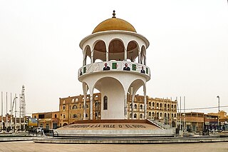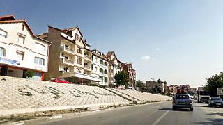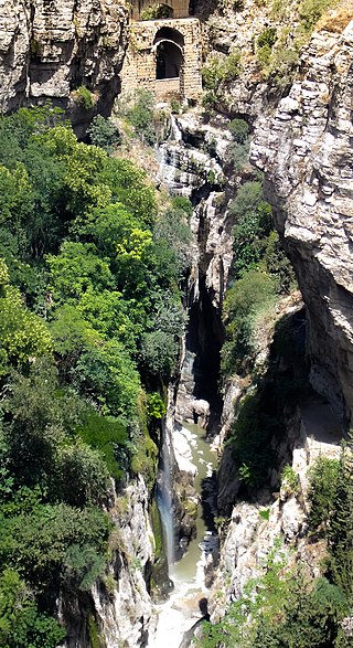
El Oued, Souf or Oued Souf is a city, and the capital of El Oued Province, in Algeria. The oasis town is watered by an underground river, hence its name is El Oued which enables date palm cultivation and the rare use of brick construction for housing. As most roofs are domed, it is known as the "City of a Thousand Domes".

Oued El Aneb is a town in north-eastern Algeria. The town of Oued El Aneb is a commune of Algeria, located in the wilaya of d'Annaba at 36° 53′ 00″n, 7° 29′ 00″ e on the Mediterranean Sea between the towns of Chetaïbi, and Annaba. The population of the town is 21088. Lake Fetzara is to the south.

Djemaa Beni Habibi is a municipality of Algeria in Jijel Province. It is located in the northeastern part of the province and close to the Mediterranean coast, 40 kilometres (25 mi) eastern of the city center of Jijel and 90 kilometres (56 mi) northwest of Constantne. It covers 48.25 square kilometres (18.63 sq mi) and is bounded by the west bank of the El-Kebir valley and Seddat mountain. The topography of Djemaa Beni Habibi mostly consists of a chain of mountains covered by forests including oaks, pines, willows, elms, and olives. The climate is temperate, warm and dry in summer, rainy and humid in winter.

Ouled El Alleug is a town and commune in Blida Province, Algeria. It is at 36.55528°N 2.79028°E. According to the 1998 census it has a population of 33,915. The population density is 383 persons per kilometer.

Ben Khéllil is a town and commune in Blida Province, Algeria.

Oued Fodda District is a district of Chlef Province, Algeria.

Beni Amrane is a town and commune in Boumerdès Province, Algeria. According to the 1998 census it has a population of 21,452.

Oued Zenati is a town and commune in Guelma Province, Algeria. According to the 1998 census it had a population of 27,254 which progressed to reach 55,000 in 2010.

Oued Harbil is a town and commune in Médéa Province, Algeria. According to the 1998 census, it has a population of 4,768.
Oued Essalem is a town and commune in Relizane Province, Algeria. According to the 2008 census, it has a population of 9319. It was previously named Henri Hoc under French colonization. The commune is located in the south-west of its province, it spans over 292.95 km2 and the Manesfa River passes through it, it is the largest commune by area of its district. It is linked by the RN23, and is a stop between the large cities of the west, Tiaret, Oran and Mostaganem, it also possesses a departemental road linking it with the town of Oued El Abtal. Located 100 km away from the Mediterranean Sea, Oued Essalem experiences a warm and dry climate, with a slight alpine tendency, its winters are often rainy, and snowfall can sometimes occur.

The Battle of Bab el Oued was a violent confrontation which occurred during the latter stages of the Algerian War (1954–1962) between the French Army and the Organisation armée secrète (OAS) which opposed Algerian independence. It took place in Bab El Oued, then a working-class European quarter of Algiers, from 23 March to 6 April 1962.
Timgharine is a village in the commune of Ksabi, in Ouled Khoudir District, Béchar Province, Algeria. The village is located on the east bank of the Oued Saoura about halfway between Ouled Khoudir to the north and Ksabi to the south. It is connected to Ouled Khoudir by a local road along the side of the river, and to the N6 national highway by a road across the river to the west.

The Oued Sejenane is a river of Tunisia and Algeria, North Africa.

The Sebaou River, or Oued Sebaou is the main river of the western Kabylie region of Algeria, which flows into the Mediterranean near the coastal town of Dellys in Boumerdès Province.

The Oued Isser is a river of Algeria. It begins in Médéa Province, is the main river, with Oued Sébaou of the Medea, which runs through the Lower Kabylie of Djurdjura Wilaya of Bouira, then flows into the Mediterranean near the coastal town of Djinet in Lower Kabylia, attached to the province of Boumerdes.

The Wadi El Harrach is an Algerian river that originates in the Bliden, Atlas Mountains near Hammam Melouane. It is 67 kilometres (42 mi) long and flows into the Mediterranean, right in the middle of the bay of Algiers.

The Rhumel River, in antiquity, the river was called Ampsaga. is the largest river in the Constantine region of Algeria. In ancient times, the river was called Ampsaga.

The Oued Meraldene or Oued Merabtene, also called Oued Bourdine, is a river of Algeria located in Kabylia within the framework of the Province of Boumerdès.

The First Battle of the Issers in May 1837, during the French conquest of Algeria, pitted the troupes coloniales under General Perrégaux and Colonel Schauenburg against the troops of Kabylia of the Igawawen.

Oued el Maleh, Oued el Malah, Wadi el Maleh, etc. is a wadi in Aïn Témouchent Province, Algeria. The name literally means "Salty Wadi". It was known in the past in Spanish as Rio Salado or "Salty River".


