Bamako | |
|---|---|
Place de la Liberté Statue in the Cité du Niger NCC Tower at the Centre International de Conférence de Bamako Western bridge entering into the Cité du Niger Tower of Africa | |
 Seal | |
 Interactive map of Bamako | |
 Bamako Location of Bamako  Bamako Bamako (Africa) | |
| Coordinates: 12°38′21″N08°00′10″W / 12.63917°N 8.00278°W | |
| Country | |
| Region | Bamako Capital District |
| Cercle | Bamako |
| Subdivisions | Communes |
| Government | |
| • Type | Capital District |
| • Mayor of District (Maire du District) | Adama Sangaré [4] |
| Area | |
• Total | 245.0 km2 (94.6 sq mi) |
| Elevation | 350 m (1,150 ft) |
| Population (2022 census) | |
• Total | 4,227,569 [6] |
| • Density | 16,776/km2 (43,450/sq mi) |
| Time zone | UTC+00:00 (GMT) |
| ISO 3166 code | ML-BKO |
| HDI (2017) | |


Bamako [a] is the capital and largest city of Mali, West Africa, with a 2022 population of 4,227,569. It is located on the Niger River, near the rapids that divide the upper and middle Niger valleys in the southwestern part of the country.
Contents
- History
- Geography
- Climate
- Environment
- Waste Management Controversy
- Administration
- Communes and neighborhoods
- Economy
- Industry
- Energy
- Architecture
- Demographics
- Culture
- Music
- Education
- Places of worship
- Islam
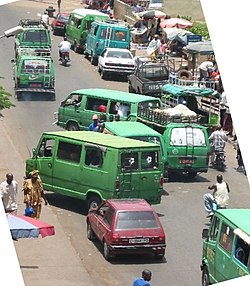
- Transport
- Healthcare
- In popular culture
- Notable people
- Twin towns and sister cities
- See also
- Notes
- References
- Bibliography
- External links
Bamako is the nation's administrative centre. The city proper is a cercle in its own right. Bamako's river port is located in nearby Koulikoro, along with a major regional trade and conference centre. Bamako is the seventh-largest West African urban centre after Lagos, Abidjan, Kano, Ibadan, Dakar, and Accra. Locally manufactured goods include textiles, processed meat, and metal goods as well as mining. Commercial fishing occurs on the Niger River.
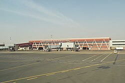
In recent years, Bamako has seen significant urban development, with the construction of modern buildings, shopping malls, and infrastructure projects aimed at improving the quality of life for its residents. The city is home to many notable institutions, such as the University of Bamako, the National Museum of Mali, the Mali National Zoo, and the Grand Mosque of Bamako. It is also the location for the Modibbo Keita International Airport. The buildings of Bamako have a unique architectural style.