Mopti Cercle

Last updated
Mopti Cercle
Cercle
Mopti1.jpg
Cercle of Mopti.png
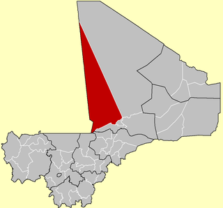
Location of the Cercle of Mopti in Mali
CountryFlag of Mali.svg  Mali
Region Mopti Region
Admin HQ ( chef-lieu ) Mopti
Area [1]
  Total 7,262 km2 (2,804 sq mi)
Population (2009 census) [2]
  Total 368,512
  Density 51/km2 (130/sq mi)
Time zone GMT (UTC+0)

Mopti Cercle is an administrative subdivision of the Mopti Region of Mali. The administrative center ( chef-lieu ) is the town of Mopti.

Mopti Region Region in Mali

Mopti is the fifth administrative region of Mali, covering 79,017 km2. Its capital is the city of Mopti. During the 2012 Northern Mali conflict, the frontier between Southern Mali which is controlled by the central government and the rebel-held North ran through Mopti Region.

Mali republic in West Africa

Mali, officially the Republic of Mali, is a landlocked country in West Africa, a region geologically identified with the West African Craton. Mali is the eighth-largest country in Africa, with an area of just over 1,240,000 square kilometres (480,000 sq mi). The population of Mali is 18 million. 67% of its population was estimated to be under the age of 25 in 2017. Its capital is Bamako. The sovereign state of Mali consists of eight regions and its borders on the north reach deep into the middle of the Sahara Desert, while the country's southern part, where the majority of inhabitants live, features the Niger and Senegal rivers. The country's economy centers on agriculture and mining. Some of Mali's prominent natural resources include gold, being the third largest producer of gold in the African continent, and salt.

The cercle is divided into 15 communes: [3] [4]

Bassirou Commune in Mopti Region, Mali

Bassirou is a commune in the Cercle of Mopti in the Mopti Region of Mali. The main village of Sampara is located 20 km north of Sévaré between the RN15 and the Niger River. In 2009 the commune had a population of 2,064.

Borondougou Commune in Mopti Region, Mali

Borondougou is a commune in the Cercle of Mopti in the Mopti Region of Mali. The main village is Diambacourou. In 2009 the commune had a population of 9,056.

Dialloubé Commune and town in Mopti Region, Mali

Dialloubé is a small town and rural commune in the Cercle of Mopti in the Mopti Region of Mali. The commune covers an area of approximately 1,425 square kilometers and includes the town and 8 villages. In the 2009 census the commune had a population of 13,727.

Related Research Articles

Bafoulabé Cercle Cercle in Kayes Region, Mali

Bafoulabé Cercle is an administrative subdivision of the Kayes Region of Mali. The administrative center (chef-lieu) is the town of Bafoulabé. In the 2009 census the population of the cercle was 233,926.

Kéniéba Cercle Cercle in Kayes Region, Mali

Kéniéba Cercle is a subdivision of the Kayes Region of Mali. The administrative center (chef-lieu) is the town of Kéniéba.

Nioro Cercle Cercle in Kayes Region, Mali

Nioro Cercle is an administrative subdivision of the Kayes Region of Mali. Its administrative center (chef-lieu) is the town of Nioro du Sahel. The commune is on the Mauritanian border and has long been a major stop on the trans-Saharan trade.

Goundam Cercle Cercle in Tombouctou Region, Mali

Goundam Circle is a second-level administrative subdivision of the Tombouctou Region in northern Mali. Its administrative center is the town of Goundam, although the most populous commune is that of Tonka. In the 2009 census, the circle had a population of 150,150.

Bougouni Cercle Cercle in Sikasso Region, Mali

Bougouni Cercle is an administrative subdivision of the Sikasso Region of Mali. The administrative center (chef-lieu) is the town of Bougouni.

Kadiolo Cercle Cercle in Sikasso Region, Mali

Kadiolo Cercle is an administrative subdivision of the Sikasso Region of southern Mali. The administrative center (chef-lieu) is the town of Kadiolo.

Yanfolila Cercle Cercle in Sikasso Region, Mali

Yanfolila Cercle is an administrative subdivision of the Sikasso Region of southern Mali. The administrative center (chef-lieu) is the town of Yanfolila.

Yorosso Cercle Cercle in Sikasso Region, Mali

Yorosso Cercle is an administrative subdivision of the Sikasso Region of southern Mali. The main town (chef-lieu) is Yorosso.

Barouéli Cercle Cercle in Ségou Region, Mali

Barouéli Cercle is an administrative subdivision of the Ségou Region of Mali. The administrative center (chef-lieu) is the town of Barouéli.

Niono Cercle Cercle in Ségou Region, Mali

Niono Cercle is an administrative subdivision of the Ségou Region of Mali. The administrative center (chef-lieu) is the town of Niono.

Ségou Cercle Cercle in Ségou Region, Mali

Ségou Cercle is an administrative subdivision of the Ségou Region of Mali. The administrative center (chef-lieu) is the town of Ségou.

Bandiagara Cercle Cercle in Mopti Region, Mali

Bandiagara Cercle is an administrative subdivision of the Mopti Region of Mali. The administrative center (chef-lieu) is the town of Bandiagara.

Douentza Cercle Cercle in Mopti Region, Mali

Douentza Cercle is an administrative subdivision of the Mopti Region of Mali. The administrative center (chef-lieu) is the town of Douentza.

Koro Cercle Cercle in Mopti Region, Mali

Koro Cercle is an administrative subdivision of the Mopti Region of Mali. The administrative center is the town of Koro.

Youwarou Cercle Cercle in Mopti Region, Mali

Youwarou Cercle is an administrative subdivision of the Mopti Region of Mali. The administrative center (chef-lieu) is the town of Youwarou.

Gourma-Rharous Cercle Cercle in Tombouctou Region, Mali

Gourma-Rharous Cercle is an administrative subdivision of the Tombouctou Region of Mali. The administrative center is the town of Gourma-Rharous.

Dandougou Fakala Commune in Mopti Region, Mali

Dandougou Fakala is a rural commune in the Cercle of Djenné in the Mopti Region of Mali. The commune contains ten villages. The administrative center (chef-lieu) is the village of Konio. In the 2009 census the commune had a population of 9,841.

Derary Commune in Mopti Region, Mali

Derary is a rural commune of the Cercle of Djenné in the Mopti Region of Mali. The commune contains eight villages. The administrative center (chef-lieu) is the village of Gagna. In the 2009 census the commune had a population of 6,558.

Bamba, Mopti Commune in Mopti Region, Mali

Bamba is a rural commune of the Cercle of Koro in the Mopti Region of Mali. The commune contains 14 villages and in the 2009 census had a population of 13,610. Most of the population of the commune are Dogon. The administrative centre (chef-lieu) is the village of Déguéré.

References

  1. Synthèsis des Plans de Securité Alimentaire des Communes du Cercle de Mopti 2006-2010 (PDF) (in French), Commissariat à la Sécurité Alimentaire, République du Mali, USAID-Mali, 2006.
  2. Resultats Provisoires RGPH 2009 (Région de Mopti) (PDF) (in French), République de Mali: Institut National de la Statistique.
  3. Loi N°99-035/ du 10 Aout 1999 Portant Création des Collectivités Territoriales de Cercles et de Régions (PDF) (in French), Ministère de l'Administration Territoriales et des Collectivités Locales, République du Mali, 1999, archived from the original (PDF) on 2012-03-09.
  4. Communes de la Région de Mopti (PDF) (in French), Ministère de l’administration territoriale et des collectivités locales, République du Mali, archived from the original (PDF) on 2012-09-19. Names of communes are in upper-case without accents.

Coordinates: 14°40′N4°05′W / 14.667°N 4.083°W / 14.667; -4.083

Geographic coordinate system Coordinate system

A geographic coordinate system is a coordinate system that enables every location on Earth to be specified by a set of numbers, letters or symbols. The coordinates are often chosen such that one of the numbers represents a vertical position and two or three of the numbers represent a horizontal position; alternatively, a geographic position may be expressed in a combined three-dimensional Cartesian vector. A common choice of coordinates is latitude, longitude and elevation. To specify a location on a plane requires a map projection.