Kayes Cercle

Last updated
Kayes
Sahel forest near Kayes Mali.jpg
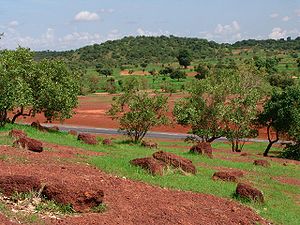
Sahel forest near Kayes city
Cercle of Kayes.png
Location of Kayes Cercle in Mali
CountryFlag of Mali.svg  Mali
Region Kayes Region
Capital Kayes
Area
[1]
  Total22,190 km2 (8,570 sq mi)
Population
 (2009 census) [2]
  Total513,362
  Density23/km2 (60/sq mi)
Time zone UTC+0 (GMT)

Kayes Cercle is an administrative subdivision of the Kayes Region of Mali. Its seat is the city of Kayes, which is also the capital of its Region and its largest city. The Cercle is further divided into Communes. The city of Kayes is subdivided into Urban Communes and Wards (French: Quartiers). Kayes Cercle's population in 2009 was 513,362. [2]

Kayes Region Region in Mali

Kayes Region is one of eight first level national subdivisions in Mali called Regions. It is the first administrative area of Mali and covers an area of 120,760 square kilometres or 46,630 square miles. Its capital is the town of Kayes. The province was historically part of the Ghana Empire and the Mali Empire.

Mali Republic in West Africa

Mali, officially the Republic of Mali, is a landlocked country in West Africa. Mali is the eighth-largest country in Africa, with an area of just over 1,240,000 square kilometres (480,000 sq mi). The population of Mali is 18 million. 67% of its population was estimated to be under the age of 25 in 2017. Its capital is Bamako. The sovereign state of Mali consists of eight regions and its borders on the north reach deep into the middle of the Sahara Desert, while the country's southern part, where the majority of inhabitants live, features the Niger and Senegal rivers. The country's economy centers on agriculture and mining. Some of Mali's prominent natural resources include gold, being the third largest producer of gold in the African continent, and salt.

Since 2016, Mali has been divided into ten regions and one capital district. A reorganization of the country from eight to nineteen regions was passed into law in 2012, but of the new regions, only Taoudénit and Ménaka have begun to be implemented. Each of the regions bears the name of its capital. The regions are divided into 56 cercles. The cercles and the capital district are divided into 703 communes.

Communes

CommuneCapital [3] Population (2009) [2]
Kayes Kayes 127,368
Bangassi Bangassi 15,191
Colimbiné Kabaté 12,101
Diamou Diamou 13,793
Djélébou Aourou 24,674
Falémé Diboli 10,112
Fégui Fégui 5,494
Gory Gopela Gory Gopela 7,712
Gouméra Gouméra 2,770
Guidimakan Keri Kafo Gakoura 13,647
Hawa Dembaya Médine 8,512
Karakoro Teichibe 14,813
Kéméné Tambo Ambidédi 21,040
Khouloum Khouloum 13,594
Kouniakary Kouniakary 8,135
Koussané Koussané 23,048
Liberté Dembaya Diala Banlieue 13,074
Logo Kakoulou 13,873
Maréna Diombougou Maréna Diombougou 14,905
Marintoumania Marintoumania 6,927
Sadiola Sadiola 39,305
Sahel Bafarara 11,630
Samé Diomgoma Samé 12,820
Ségala Ségala 30,305
Séro Diamanou Séro 23,281
Somankidi Somankidi 6,622
Sony Lany Tounka 11,125
Tafacirga Tafacirga 7,491

Related Research Articles

Bafoulabé Cercle Cercle in Kayes Region, Mali

Bafoulabé Cercle is an administrative subdivision of the Kayes Region of Mali. The administrative center (chef-lieu) is the town of Bafoulabé. In the 2009 census the population of the cercle was 233,926.

Diéma Cercle Cercle in Kayes Region, Mali

Diéma Cercle is an administrative subdivision of the Kayes Region of Mali. Its administrative center (chef-lieu) is the small town of Diéma. The Cercle is divided into one urban commune and fourteen rural communes. In the 2009 census the cercle had a population of 212,062.

Kita Cercle Cercle in Kayes Region, Mali

Kita Cercle is an administrative subdivision of the Kayes Region of Mali. The administrative centre (chef-lieu) is the town of Kita. In the 2009 census the population of the cercle was 434,379.

Kéniéba Cercle Cercle in Kayes Region, Mali

Kéniéba Cercle is a subdivision of the Kayes Region of Mali. The administrative center (chef-lieu) is the town of Kéniéba.

Yélimané Cercle Cercle in Kayes Region, Mali

Yélimané Cercle is an administrative subdivision of the Kayes Region of Mali. Its administrative centre (chef-lieu) is the town of Yélimané. In the 2009 census the population of the cercle was 178,442.

Nioro Cercle Cercle in Kayes Region, Mali

Nioro Cercle is an administrative subdivision of the Kayes Region of Mali. Its administrative center (chef-lieu) is the town of Nioro du Sahel. The commune is on the Mauritanian border and has long been a major stop on the trans-Saharan trade.

Maréna Diombougou Commune and village in Kayes Region, Mali

Maréna Diombougou, often simply Maréna, is a village and commune in the Cercle of Kayes in the Kayes Region of south-western Mali. In 2009 the commune had a population of 14,905.

Djidian Commune and village in Kayes Region, Mali

Djidian is a village and rural commune in the Cercle of Kita in the Kayes Region of south-western Mali. The commune includes 14 villages and in the 2009 census had a population of 18,702.

Kobri Commune and village in Kayes Region, Mali

Kobri or Kobiri is a village and rural commune in the Cercle of Kita in the Kayes Region of south-western Mali. The commune includes 16 villages and in the 2009 census had a population of 12,445.

Makano, Mali Commune and town in Kayes Region, Mali

Makano or Makono is a small town and rural commune in the Cercle of Kita in the Kayes Region of southwestern Mali. The commune includes 14 villages and in the 2009 census had a population of 9,826.

Dabia Commune and village in Kayes Region, Mali

Dabia is a village and rural commune in the Cercle of Kéniéba in the Kayes Region of south-western Mali. It is located near the border with Guinea. The commune includes 13 villages and in the 2009 census had a population of 10,832.

Gogui, Mali Commune and town in Kayes Region, Mali

Gogui is a small town and rural commune in the Cercle of Nioro in the Kayes Region of western Mali. The town is on the frontier with Mauritania.

Gadougou I Commune in Kayes Region, Mali

Gadougou I is a rural commune in the Cercle of Kita in the Kayes Region of south-western Mali. The commune includes 17 villages and in the 2009 census had a population of 25,775. The principal village is Sagabari.

Kita Ouest Commune in Kayes Region, Mali

Kita Ouest is a rural commune in the Cercle of Kita in the Kayes Region of south-western Mali. The commune contains 16 villages and in the 2009 census had a population of 14,966. The main village (chef-lieu) is Kofeba.

Sikasso Cercle Cercle in Sikasso Region, Mali

Sikasso Cercle is one of seven administrative subdivision of the Sikasso Region of southern Mali. The capital is the town of Sikasso.

Sébékoro Commune and town in Kayes Region, Mali

Sébékoro is a small town and a rural commune in the Cercle of Kita in the Kayes Region of south-western Mali. The commune includes the town and 15 villages. In the 2009 census the commune had a population of 39,030.

Kokofata Commune and village in Kayes Region, Mali

Kokofata is a village and rural commune in the Cercle of Kita in the Kayes Region of south-western Mali. The commune includes 17 villages and in the 2009 census had a population of 21,117.

Tambaga, Mali Commune and village in Kayes Region, Mali

Tambaga is a village and rural commune in the Cercle of Kita in the Kayes Region of south-western Mali. The commune contains 10 villages and in the 2009 census had a population of 11,152.

Lambidou Commune and village in Kayes Region, Mali

Lambidou is a rural commune and village in the Cercle of Diéma in the Kayes Region of western Mali. As well as the main village (chef-lieu) of Lambidou, the commune includes the villages of Singoné, Koumarenga and Kary. In the 2009 census the commune had a population of 14,947.

Gomitradougou Commune in Kayes Region, Mali

Gomitradougou is a rural commune in the Cercle of Diéma in the Kayes Region of western Mali. The commune includes the villages of Gomitra, Wattaye, Kouloudienguè, Missira, Bassibougou, Sébabougou, Niamakoro and N’Tallabougou. The main village (chef-lieu) is Kouloudiengué. In the 2009 census the commune had a population of 7,287.

References

  1. Plan de Securité Alimentaire du Cercle de Kayes 2007-2011 (PDF) (in French), Commissariat à la Sécurité Alimentaire, République du Mali, USAID-Mali, 2007, archived from the original (PDF) on 2012-04-01.
  2. 1 2 3 Resultats Provisoires RGPH 2009 (Région de Kayes) (PDF) (in French), République de Mali: Institut National de la Statistique, archived from the original (PDF) on 2012-09-19.
  3. Communes de la Région de Kayes (PDF) (in French), Ministère de l’administration territoriale et des collectivités locales, République du Mali, archived from the original (PDF) on 2012-09-19.

Coordinates: 14°30′N11°30′W / 14.500°N 11.500°W / 14.500; -11.500

Geographic coordinate system Coordinate system

A geographic coordinate system is a coordinate system that enables every location on Earth to be specified by a set of numbers, letters or symbols. The coordinates are often chosen such that one of the numbers represents a vertical position and two or three of the numbers represent a horizontal position; alternatively, a geographic position may be expressed in a combined three-dimensional Cartesian vector. A common choice of coordinates is latitude, longitude and elevation. To specify a location on a plane requires a map projection.