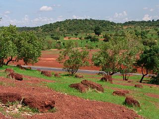
Kayes Cercle is an administrative subdivision of the Kayes Region of Mali. Its seat is the city of Kayes, which is also the capital of its Region and its largest city. The Cercle is further divided into Communes. The city of Kayes is subdivided into Urban Communes and Wards. Kayes Cercle's population in 2009 was 513,362.

Diamou is a town and commune in the Cercle of Kayes in the Kayes Region of south-western Mali. It is located 45 km from the city of Kayes on the left bank of the Sénégal River. The commune contains 25 villages, and in the 2009 census had a population of 13,793.

Tafacirga is a village and commune in the Cercle of Kayes in the Kayes Region of south-western Mali. The commune lies at the northeast corner of the Kayes Region with the Senegal River to the north forming the frontier with Mauritania and the River Falémé to the east forming the frontier with Senegal. In 2009 the commune had a population of 7,491.

Fégui is a town and urban commune in the Cercle of Kayes in the Kayes Region of south-western Mali. The town lies on the bank of the Falémé River that marks the boundary between Mali and Senegal. In 2009 the commune had a population of 5,494.

Kobri or Kobiri is a village and rural commune in the Cercle of Kita in the Kayes Region of south-western Mali. The commune includes 16 villages and in the 2009 census had a population of 12,445.

Dabia is a village and rural commune in the Cercle of Kéniéba in the Kayes Region of south-western Mali. It is located near the border with Guinea. The commune includes 13 villages and in the 2009 census had a population of 10,832.

Bayé is a village and rural commune in the Cercle of Kéniéba in the Kayes Region of south-western Mali. The commune contains 17 villages and in the 2009 census had a population of 16,093.

Faraba is a village and rural commune in the Cercle of Kéniéba in the Kayes Region of south-western Mali. The commune includes 12 villages and in the 2009 census had a population of 8,563.

Kassama is a village and commune in the Cercle of Kéniéba in the Kayes Region of south-western Mali. The commune includes 23 villages and in the 2009 census had a population of 19,230.

Guénégoré is a village and rural commune in the Cercle of Kéniéba in the Kayes Region of south-western Mali. It is located near the border with Guinea. The commune includes 7 villages and in the 2009 census had a population of 7,229.

Kouroukoto or Kroukoto is a village and rural commune in the Cercle of Kéniéba in the Kayes Region of south-western Mali. The commune includes 9 villages and at the time of 2009 census had a population of 7,980.

Sitakilly is a small town and commune in the Cercle of Kéniéba in the Kayes Region of south-western Mali. The commune includes the town and 13 villages. At the time of the 2009 census the commune had a population of 27,501.

Gadougou I is a rural commune in the Cercle of Kita in the Kayes Region of south-western Mali. The commune includes 17 villages and in the 2009 census had a population of 25,775. The principal village is Sagabari.

Souransan-Tomoto is a village and rural commune in the Cercle of Kita in the Kayes Region of south-western Mali. The commune contains 5 villages and in the 2009 census had a population of 4,105.

Sébékoro is a small town and a rural commune in the Cercle of Kita in the Kayes Region of south-western Mali. The commune includes the town and 15 villages. In the 2009 census the commune had a population of 39,030.

Didenko or Dindanko is a village and rural commune in the Cercle of Kita in the Kayes Region of south-western Mali. The commune contains 7 villages and in the 2009 census has a population of 9,840.

Kokofata is a village and rural commune in the Cercle of Kita in the Kayes Region of south-western Mali. The commune includes 17 villages and in the 2009 census had a population of 21,117.

Toukoto is a small town and commune near the confluence of the Bakoy and Baloué rivers in the Cercle of Kita in the Kayes Region of south-western Mali. As well as the town of Toukoto, the commune includes 5 other villages. In the 2009 census the commune had a population of 10,020.

Séféto Nord is a rural commune in the Cercle of Kita in the Kayes Region of south-western Mali. The commune includes 6 villages and in the 2009 census had a population of 9,671. The principal village is Niagané.

Séféto Ouest is a rural commune in the Cercle of Kita in the Kayes Region of south-western Mali. The commune contains the main town (chef-lieu) of Séféto and 8 villages. In the 2009 census the commune had a population of 19,418.


