Sadiola

Last updated
Sadiola
Commune and town
Sadiola.jpg
Mali adm location map.svg
Red pog.svg
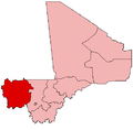
Sadiola
Location in Mali
Coordinates: 13°53′20″N11°42′10″W / 13.88889°N 11.70278°W / 13.88889; -11.70278 Coordinates: 13°53′20″N11°42′10″W / 13.88889°N 11.70278°W / 13.88889; -11.70278
CountryFlag of Mali.svg  Mali
Region Kayes Region
Cercle Kayes Cercle
Area
[1]
  Total5,010 km2 (1,930 sq mi)
Population
 (2009 census) [2]
  Total39,305
  Density7.8/km2 (20/sq mi)
Time zone UTC+0 (GMT)

Sadiola is a commune and small town in western Mali, south of Kayes. The commune includes 46 villages [3] and in 2009 had a population of 39,305.

Sadiola has two large open cast gold mines, the Société d'Exploitation des Mines d'Or de Sadiola S.A (SEMOS) als to referred to as the Sadiola Gold Mine and the Yatela Gold Mine. Both mines were operated by Anglogold-Ashanti as joint ventures with IAMGOLD and the Republic of Mali. [4] In February 2019, Sadiola Exploration Limited ("SADEX"), a subsidiary jointly held by IAMGOLD and AGA entered into an agreement to sell their interest (80%) in Société d’Exploitation des Mines d’Or de Yatela (SEMOY) to the Mali government. By the end of 2020, IAMGOLD and AGA sold 80% of their interests in the Sadiola mine [5] to the private mid-tier producer Allied Gold Corp and 1% to the Republic of Mali (upping their interest from 18% to 20%). [4]

Related Research Articles

Kéniéba Commune and town in Kayes Region, Mali

Kéniéba is a rural commune, small town and seat of Kéniéba Cercle in Mali's Kayes Region, near the Mali–Senegal border. As well as the main town, the commune includes 26 other villages. In the 2009 census the commune had a population of 39,557.

Kéniéba Cercle Cercle in Kayes Region, Mali

Kéniéba Cercle is a subdivision of the Kayes Region of Mali. The administrative center (chef-lieu) is the town of Kéniéba.

Yélimané Cercle Cercle in Kayes Region, Mali

Yélimané Cercle is an administrative subdivision of the Kayes Region of Mali. Its administrative centre (chef-lieu) is the town of Yélimané. In the 2009 census the population of the cercle was 178,442.

Diamou is a town and commune in the Cercle of Kayes in the Kayes Region of south-western Mali. It is located 45 km from the city of Kayes on the left bank of the Sénégal River. The commune contains 25 villages, and in the 2009 census had a population of 13,793.

Koundian, Mali Commune and town in Kayes Region, Mali

Koundian is a small town and commune in the Cercle of Bafoulabé in the Kayes Region of south-western Mali. In the 2009 census the commune had a population of 14,075.

Bougaribaya is a village and rural commune in the Cercle of Kita in the Kayes Region of south-western Mali. The commune includes 7 villages and in the 2009 census had a population of 10,251.

Madina is a village and rural commune in the Cercle of Kita in the Kayes Region of southwestern Mali. The commune contains 12 villages and in the 2009 census had a population of 9,808.

Kotouba is a village and rural commune in the Cercle of Kita in the Kayes Region of south-western Mali. The commune includes 5 villages and in the 2009 census had a population of 5,799.

Bayé is a village and rural commune in the Cercle of Kéniéba in the Kayes Region of south-western Mali. The commune contains 17 villages and in the 2009 census had a population of 16,093.

Dialafara is a village and rural commune in the Cercle of Kéniéba in the Kayes Region of south-western Mali. The commune includes 35 villages and in the 2009 census had a population of 17,705.

Dombia is a village and rural commune in the Cercle of Kéniéba in the Kayes Region of south-western Mali. The commune includes 5 villages and in the 2009 census had a population of 6,178.

Faraba is a village and rural commune in the Cercle of Kéniéba in the Kayes Region of south-western Mali. The commune includes 12 villages and in the 2009 census had a population of 8,563.

Kita Nord is a rural commune in the Cercle of Kita in the Kayes Region of south-western Mali. The commune includes 8 villages and in the 2009 census had a population of 9,882. The principal village is Sibikily.

Niantanso is a village and rural commune in the Cercle of Kita in the Kayes Region of south-western Mali. The commune includes 6 villages and in the 2009 census had a population of 4,965.

Sébékoro is a small town and a rural commune in the Cercle of Kita in the Kayes Region of south-western Mali. The commune includes the town and 15 villages. In the 2009 census the commune had a population of 39,030.

Djougoun is a village and rural commune in the Cercle of Kita in the Kayes Region of south-western Mali. The commune contains 5 villages and in the 2009 census had a population of 8,622.

Kokofata is a village and rural commune in the Cercle of Kita in the Kayes Region of south-western Mali. The commune includes 17 villages and in the 2009 census had a population of 21,117.

Senko is a village and rural commune in the Cercle of Kita in the Kayes Region of south-western Mali. The commune includes 8 villages and in the 2009 census had a population of 9,701.

Séféto Ouest is a rural commune in the Cercle of Kita in the Kayes Region of south-western Mali. The commune contains the main town (chef-lieu) of Séféto and 8 villages. In the 2009 census the commune had a population of 19,418.

The Société d'Exploitation des Mines d'Or de Sadiola S.A (SEMOS) project is an open-pit gold mine situated near Sadiola, in the Kayes Region of Mali. The operation was jointly owned by AngloGold Ashanti and IAMGOLD, who each had an effective holding of 41%, while the Government of Mali owned the remaining 18%. The International Finance Corporation originally held 6% of the mine put sold this share equally to AGA and IAMGOLD in December 2009.

References

  1. Plan de Sécurité Alimentaire Commune Rurale de Sadiola 2007-2011 (PDF) (in French), Commissariat à la Sécurité Alimentaire, République du Mali, USAID-Mali, 2006, archived from the original (PDF) on 2008-11-22.
  2. "Resultats Provisoires RGPH 2009 (Région de Kayes)" (PDF) (in French). République de Mali: Institut National de la Statistique. Archived from the original (PDF) on 2011-07-22..
  3. "Communes de la Région de Kayes" (PDF) (in French). Ministère de l’administration territoriale et des collectivités locales, République du Mali. Archived from the original (PDF) on 2012-03-09..
  4. 1 2 "Annual Report 2020" (PDF). S2.Q4CDN.com. 2020. Archived (PDF) from the original on 2021-04-25. Retrieved 2022-08-24.
  5. "IAMGOLD Completes Sale of Its Interest in the Sadiola Gold Mine". newsfile. Retrieved 2022-08-24.