
Kayes Region is one of eight first level national subdivisions in Mali called Regions. It is the first administrative area of Mali and covers an area of 120,760 square kilometres or 46,630 square miles. Its capital is the town of Kayes. The province was historically part of the Ghana Empire and the Mali Empire.

Bafoulabé Cercle is an administrative subdivision of the Kayes Region of Mali. The administrative center (chef-lieu) is the town of Bafoulabé. In the 2009 census the population of the cercle was 233,926.

Kita Cercle is an administrative subdivision of the Kayes Region of Mali. The administrative centre (chef-lieu) is the town of Kita. In the 2009 census the population of the cercle was 434,379.

Kéniéba Cercle is a subdivision of the Kayes Region of Mali. The administrative center (chef-lieu) is the town of Kéniéba.

Yélimané Cercle is an administrative subdivision of the Kayes Region of Mali. Its administrative centre (chef-lieu) is the town of Yélimané. In the 2009 census the population of the cercle was 178,442.
Koulikoro Cercle is an administrative subdivision of the Koulikoro Region of Mali. Its seat is the town of Koulikoro, which is also the capital of the region. A major trade and industrial town on the Niger River, Koulikoro has been surpassed by Kati to the west as the largest town in the region. Also to the southwest, lying entirely within Kati Cercle but administratively separate, is the District of Bamako, which after independence was carved out of the middle of the region.

Dioïla Cercle is an administrative subdivision of the Koulikoro Region of Mali. Its seat is the town of Dioïla. It lies at the southeast corner of the region, and prior to 1977, it was combined with what is now Kati Cercle and the District of Bamako in the "Bamako Cercle", with the capital city as its seat.
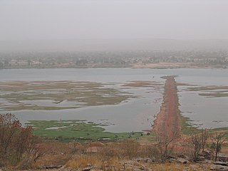
Tourougoumbé is a town and urban commune in the Cercle of Nioro in the Kayes Region of western Mali. The town lies 45 km east of Nioro du Sahel.

Bougouni Cercle is an administrative subdivision of the Sikasso Region of Mali. The administrative center (chef-lieu) is the town of Bougouni.

Kolondiéba Cercle is an administrative subdivision of the Sikasso Region of Mali. The administrative center (chef-lieu) is the town of Kolondiéba.

Kadiolo Cercle is an administrative subdivision of the Sikasso Region of southern Mali. The administrative center (chef-lieu) is the town of Kadiolo.

Yanfolila Cercle is an administrative subdivision of the Sikasso Region of southern Mali. The administrative center (chef-lieu) is the town of Yanfolila.

Yorosso Cercle is an administrative subdivision of the Sikasso Region of southern Mali. The main town (chef-lieu) is Yorosso.

Bla Cercle is an administrative subdivision of the Ségou Region of Mali. The administrative center (chef-lieu) is the town of Bla.

Niono Cercle is an administrative subdivision of the Ségou Region of Mali. The administrative center (chef-lieu) is the town of Niono.

Tominian Cercle is an administrative subdivision of the Ségou Region of Mali. The administrative center of the local government is in the town of Tominian. The Cercle is divided into Communes, and below this, quarters/villages. In the 2009 census the cercle had a population of 219,853 people.

Mopti Cercle is an administrative subdivision of the Mopti Region of Mali. The administrative center (chef-lieu) is the town of Mopti.

Gourma-Rharous Cercle is an administrative subdivision of the Tombouctou Region of Mali. The administrative center is the town of Gourma-Rharous.

Niafunké Cercle is an administrative subdivision of the Tombouctou Region of Mali. The administrative center (chef-lieu) is the town of Niafunké. In the 2009 census the cercle had a population of 184,285. The Niger River runs for 100 km through the cercle.

Ansongo Cercle is an administrative subdivision of the Gao Region of Mali. The administrative center (chef-lieu) is the town of Ansongo. The Niger River passes through the cercle and plays an important role in transportation and the economy in the region.


