Guidimakan Keri Kafo | |
|---|---|
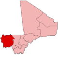
 Gakoura Location in Mali | |
| Coordinates: 14°36′45″N11°50′38″W / 14.61250°N 11.84389°W | |
| Country | |
| Region | Kayes Region |
| Cercle | Kayes Cercle |
| Population (2009 census) [1] | |
• Total | 13,647 |
| Time zone | UTC+0 (GMT) |
Guidimakan Keri Kafo is a commune in the Cercle of Kayes in the Kayes Region of south-western Mali, near the border of Senegal and Mauritania. The main town ( chef-lieu ) of the commune is Gakoura which lies on the north bank of the Senegal River. In 2009 the commune had a population of 13,647. It takes its name from the former state of Guidimakha.