Gogui | |
|---|---|
Commune and town | |
| Nickname: Home of Gogimal | |
 | |
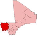
 Gogui Location in Mali | |
| Coordinates: 15°41′9″N9°19′47″W / 15.68583°N 9.32972°W | |
| Country | |
| Region | Kayes Region |
| Cercle | Nioro du Sahel Cercle |
| Population (2023 census) [1] | |
• Total | 21,000 |
| Time zone | UTC+0 (GMT) |
Gogui is a small town and rural commune in the Cercle of Nioro du Sahel in the Kayes Region of western Mali. The town is on the border with Mauritania.