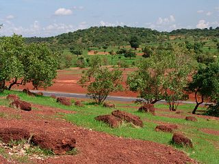
Kayes Region is one of ten first level national subdivisions in Mali called Regions. It is the first administrative area of Mali and covers an area of 120,760 square kilometres or 46,630 square miles. Its capital is the town of Kayes. The province was historically part of the Ghana Empire and the Mali Empire.

Bafoulabé is a town and rural commune in south-western Mali. It is located in the Region of Kayes at the confluence of the Bafing and Bakoy rivers which join to become the Sénégal River. Bafoulabé is the capital of the Cercle of Bafoulabé, which in 1887 was the first Cercle to be created in Mali.

Kéniéba is a rural commune, small town and seat of Kéniéba Cercle in Mali's Kayes Region, near the Mali–Senegal border. As well as the main town, the commune includes 26 other villages. In the 2009 census the commune had a population of 39,557.

Yélimané Cercle is an administrative subdivision of the Kayes Region of Mali. Its administrative centre (chef-lieu) is the town of Yélimané. In the 2009 census the population of the cercle was 178,442.
Diamou is a town and commune in the Cercle of Kayes in the Kayes Region of south-western Mali. It is located 45 km from the city of Kayes on the left bank of the Sénégal River. The commune contains 25 villages, and in the 2009 census had a population of 13,793.
Séro or Séro Diamanou is a small town and commune in the Cercle of Kayes in the Kayes Region of southwestern Mali. The commune contains 18 villages and had a population of 23,281 in 2009.
Makano or Makono is a small town and rural commune in the Cercle of Kita in the Kayes Region of southwestern Mali, near the border of Guinea. The commune includes 14 villages and in the 2009 census had a population of 9,826.
Namala or Namala Guimba is a small town and commune in the Cercle of Kita in the Kayes Region of south-western Mali. The commune contains 10 villages and in the 2009 census had a population of 15,667.
Sitakilly is a small town and commune in the Cercle of Kéniéba in the Kayes Region of south-western Mali. The commune includes the town and 13 villages. At the time of the 2009 census the commune had a population of 27,501.
Diafounou Gory is commune in the Cercle of Yélimané in the Kayes Region of south-western Mali. The main town (chef-lieu) is Tambacara. In 2009 the commune had a population of 20,292.
Gory is a rural commune and small town in the Cercle of Yélimané in the Kayes Region of western Mali, near the border of Mauritania. The commune contains the following ten villages: Biladjimi, Chiguegué, Darsalam, Foungou, Gory, Gory Banda, Mongoro, Sabouciré, Sambancanou and Takoutallah. In the 2009 census the commune had a population of 10,760. The town of Gory is 25 km west of the town of Yélimané.
Sidibela is a commune in the Cercle of Bafoulabé in the Kayes Region of south-western Mali. The main village (chef-lieu) is Tigana. In the 2009 census the commune had a population of 5966.
Tomora is a commune in the Cercle of Bafoulabé in the Kayes Region of south-western Mali. The administrative centre (chef-lieu) is Oussoubidiagna, a small town with around 4,000 inhabitants. The commune contains over thirty small villages. In the 2009 census it had a population of 32,527. Most of the inhabitants of Tomora are Khassonkés, with a minority of Soninke, Fulani and Malinke engaged mostly in farming.
Sébékoro is a small town and a rural commune in the Cercle of Kita in the Kayes Region of south-western Mali. The commune includes the town and 15 villages. In the 2009 census the commune had a population of 39,030.
Kourouninkoto is a small town and urban commune in the Cercle of Kita in the Kayes Region of south-western Mali.

Toukoto is a small town and commune near the confluence of the Bakoy and Baloué rivers in the Cercle of Kita in the Kayes Region of south-western Mali. As well as the town of Toukoto, the commune includes 5 other villages. In the 2009 census the commune had a population of 10,020.
Ténenkou is a village and commune and seat of the Ténenkou Cercle in the Mopti Region of Mali. In 2009 the commune had a population of 11,310.
Farimaké is a commune of the Cercle of Youwarou in the Mopti Region of Mali. The local government is based in the village of Gathi-Loumbo. The commune covers an area of 3,148 km2. It is bounded to the west by the commune of Youwarou, to the north by the communes of Dianké, Léré and Alzounoub, to the east by the commune of Nampalari and to the south by the communes of Kareri, Toguéré Coumbé and Bimbere Tama. The commune lies to the west of the Issa-Ber, the larger of the two branches of the Niger River that flow out of Lake Débo. The commume contains 29 small villages and in 2009 had a population of 11,869. The largest ethnic group are the Fulani who make up more than 40 percent of the population.
Ouro Guiré is a commune of the Cercle of Ténenkou in the Mopti Region of Mali. The commune lies to the southeast of the small town of Ténenkou in the Inner Niger Delta. It is crossed by the Diaka, a branch of the Niger River that flows only when the river is in flood. The principal village is Koubi. The commune contains 15 small villages and in 2009 had a population of 9,289. Most of the population are Fulani with some Bozo. Traditionally, the Fulani raise livestock while the Bozo are fishermen.
Dianguirdé is a rural commune and small town in the Cercle of Diéma in the Kayes Region of western Mali. The commune contains 14 villages and hamlets. In the 2009 census the commune had a population of 12,684.


