Geography of Nigeria

Last updated

Geography of Nigeria
Nigeria BMNG.png
Continent Africa
Region West Africa
Coordinates 9°04′55″N8°40′31″E / 9.0820°N 8.6753°E / 9.0820; 8.6753
Area Ranked 31st
  Total923,768 km2 (356,669 sq mi)
  Land98.59%
  Water1.41%
Coastline853 km (530 mi)
Borders Total land borders:
4,047 km (2,515 mi)
Cameroon:
1,690 km (1,050 mi)
Niger:
1,497 km (930 mi)
Benin:
773 km (480 mi)
Chad:
87 km (54 mi)
Highest point Chappal Waddi
2,419 m (7,936 ft)
Lowest point Atlantic Ocean,
0 m (0 ft)
Longest river Niger River,
1,111.88 km (691 mi)
Largest lake Kainji Lake
1,243 km2 (480 sq mi)
Natural resourcespetroleum, natural gas, tin, columbite, iron ore, coal, limestone, niobium, lead, zinc, arable land
Natural hazardsdrought, bush fire, landslide
Environmental issuesair pollution, water pollution, oil spillage, lead exposures, poor waste management, deforestation, desertification, erosion, flooding
Exclusive economic zone217,313 km2 (83,905 sq mi)
Location of Nigeria LocationNigeria.svg
Location of Nigeria
Satellite image of Nigeria Nigeria sat.png
Satellite image of Nigeria

Nigeria is a country in West Africa. It shares land borders with the Republic of Benin to the west, Chad and Cameroon to the east, and Niger to the north. [1] Its coast lies on the Gulf of Guinea in the south and it borders Lake Chad to the northeast. Notable geographical features in Nigeria include the Adamawa Plateau, Mambilla Plateau, Jos Plateau, Obudu Plateau, the Niger River, Benue River, and Niger Delta.

Contents

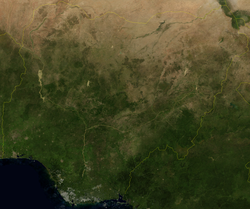
Nigeria is in the tropics, where the climate is very humid and seasonally wet. Nigeria has majorly four climate types; these climate types are generally gradated from south to north. Nigeria's principal streams are the Niger, from which it got its name, and the Benue, the primary tributary of the Niger. The country's most elevated point is Chappal Waddi (or Gangirwal) at 2,419 metres or 7,936 feet, situated in the Adamawa mountains in the Gashaka-Gumti Public Park, Taraba State, on the border with Cameroon. [1]

The capital of Nigeria is Abuja, situated in the centre of the country, while Lagos is the country's major port, monetary center and largest city. Communicated in dialects are English (official), Hausa, Igbo, and Yoruba. [2] It is assessed that Nigeria has around 250 different ethno-etymological gatherings. [3]

Area data

Area
  • Total: 923,768 km²
    • country rank in the world: 31st
  • Land: 910,770 km²
  • Water: 13,000 km²
Area comparative

Climate

The tropical monsoon climate, [4] designated by the Köppen climate classification as Am, is found in the southern part of the country. [5] This climate is influenced by the monsoons originating from the South Atlantic Ocean, which are brought into the country by the (maritime tropical) MT air mass, a warm moist sea-to-land seasonal wind. Its warmth and high humidity gives it a strong tendency to ascend and produce copious rainfall, which is a result of the condensation of water vapour in the rapidly rising air. [6] The tropical monsoon climate has a very small temperature range. Then temperature ranges are almost constant throughout the year; for example, Warri in the southern part of Nigeria records a maximum of 28 °C (82.4 °F) for its hottest month while its lowest temperature is 26 °C (78.8 °F) in its coldest month. [7]

The southern part of Nigeria experiences heavy and abundant rainfall. These storms are usually convectional in nature because of the region's proximity to the equatorial belt. The annual rainfall received in this region is very high. Parts of the Niger Delta receives over 4,000 millimetres or 160 inches of annual rainfall, while the southeast receives between 2,000 and 3,000 millimetres (80 and 120 in). The southern region of Nigeria experiences a double rainfall maxima with two high peaks. The first rainy season starts in March, ending in June. The August break, a short dry season, follows, followed by a short rainy season in September and a long dry season in October. [8]

Koppen climate classification map of Nigeria Koppen-Geiger Map NGA present.svg
Köppen climate classification map of Nigeria

The tropical savanna climate, characterized by distinct rainy and dry seasons, dominates western to central Nigeria. It has a single peak in the summer and consistently high temperatures above {{convert|18|°C|1|disp=or]}. Abuja, Nigeria's capital, experiences a temperature range of 18.45 to 36.9 °C (65.2 to 98.4 °F). [9] The dry season occurs from December to March and is hot and dry with the Harmattan wind, a continental tropical (CT) air mass laden with dust from the Sahara, prevailing throughout this period.

With the Intertropical Convergence Zone swinging northward over West Africa from the Southern Hemisphere in April, heavy showers coming from pre-monsoonal convective clouds mainly in the form of squall lines also known as the north easterlies formed mainly as a result of the interactions of the two dominant airmasses in Nigeria known as the maritime tropical (south westerlies) and the continental tropical (north easterlies), [10] begins in central Nigeria while monsoons arrive in July, bringing with it high humidity, heavy cloud cover and heavy rainfall lasting until September when the monsoons gradually begin retreating southward to the southern part of Nigeria. Rainfall totals in central Nigeria varies from 1,100 mm (43.3 in) in the lowlands to over 2,000 mm (78.7 in) along the south western escarpment of the Jos Plateau. [11]

A hot semi-arid climate (BSh) is predominant within the Sahel in the northern part of Nigeria. Annual rainfall totals are low. The rainy season in the northern part of Nigeria lasts for three to four months (June to September). The rest of the year is hot and dry with temperatures climbing as high as 40 °C (104.0 °F) . Potiskum, Yobe State in the northeast of Nigeria recorded Nigeria's lowest ever temperature of 2.8 °C (37.0 °F).

Highland climates are found on highlands regions in Nigeria. Highlands over 1,520 metres (4,987 ft) above sea level are cool enough to reach the temperate climate line in the tropics thereby giving the highlands, mountains and the plateau regions standing above this height, a cool mountain climate.

Annual rainfall

Rainfall in the coastal belt of the Niger Delta is heavy due to the closeness of the Delta region to the equator. Annual rainfall totals vary from 2,400 millimetres or 94 inches at Port Harcourt to as much as 4,870 millimetres or 192 inches at Forcados, a coastal town in the Niger Delta, 4,200 millimetres or 165 inches at Bonny, and 3,070 millimetres or 121 inches in Calabar, the rainiest city with over one million people in Nigeria. As one moves northward and eastward, annual rainfall declines steadily to around 650 millimetres or 26 inches at Sokoto in the northwest and as low as 400 millimetres or 16 inches in the extreme north of Yobe and Borno States, which under the sweltering conditions that prevail is dry enough to be a hot arid climate (Köppen BWh).

Trade winds

Tropical maritime air mass

The tropical maritime air mass (MT) is responsible for Nigeria's rainy season. [12] This wind begins in February in the southern part of Nigeria while it takes longer for the wind to fully cover the whole of the country, reaching the northern part of Nigeria in June. Its presence a result of the northward retreat of the Harmattan. The northward retreat of the tropical continental air mass (CT) is caused by the sun's northward shift from the tropic of capricorn in the southern hemisphere to the tropic of cancer in the northern hemisphere. This shift begins from February and ends in June, when the sun is fully overhead at the tropic of cancer. During this northward migration of the sun as a result of the earth tilting along its axis, the sun crosses the equator (around March), moving over West Africa. West Africa comes directly under the sun at this time. The whole of West Africa is heated intensely as result of the increased insolation. Temperatures can climb as high as 35 °C (95.0 °F) over West Africa during this time. Temperatures in the northern part of Nigeria can go as high as 48 °C (118.4 °F) in cities like Maiduguri. [13]

High temperatures and increased insolation cause low pressure in West Africa and Nigeria between March and May. The Saharan continental air mass weakens due to land surface overheating, causing the atmosphere to expand and become lighter. The air mass retreats, and the sun's rays enter Nigeria's atmosphere more intensely than during Harmattan. [14] The heating of the West Africa land mass creates a low pressure region over West Africa. This low pressure zone aid in the development of the tropical maritime air mass from the south Atlantic.

The tropical maritime air mass is a warm, humid and unstable trade wind. [15] Convection currents form within the airmass whenever there is little instability in the airmass as a result of a slight to a very high orographic uplift in mountainous regions like the Obudu Plateau or the heating of the land which can trigger the formation of cumulonimbus cloud leading to thunderstorms within the air mass. During the dominance of the tropical maritime air mass, mornings are bright and sunny, the sun's heating of the land in the mornings and afternoons sets up convectional currents, these currents rise vertically, cumulonimbus clouds are formed, and torrential downpours can occur in the afternoon.

The African easterly wave is another major contributor of rainfall during the summer monsoons months of May to September. The nature of this wave changes at about 15 degrees north latitude. The waves that pass south of this latitude carry moisture and create convection that leads to rain clouds. [16] [17] Nigeria's location in the wetter part of the easterly waves south of the 15 degrees north latitude creates wetter climatic conditions for Nigeria, especially during the monsoons.

Tropical continental air mass

The tropical continental air mass, locally known as the Harmattan, [18] is a wind originating from North Africa which crosses the Sahara into West Africa. Nigeria's dry season from December to March is dominated by a dusty tropical continental air mass, which creates a haze and hinders visibility. Originating near the equator, it generates dust rather than precipitation. Despite its impact on transportation, the low humidity helps farmers dry their crops. [19]

Temperature

Nigeria's seasons and temperature variance are determined by rainfall with rainy season and dry season being the major seasons in Nigeria. The rainy season of Nigeria brings in cooler weather to the country as a result of an increased cloud cover that acts as a blockage of the intense sunshine of the tropics by blocking much of the Suns rays in the rainy season; this in turn cools the land, and the winds above the ground remain cool thereby making for cooler temperatures during the rainy season. But afternoons in the rainy season can be hot and humid. In the rainy season it is damp, and the rainfalls are usually abundant.

The dry season of Nigeria is a period of little cloud cover in the southern part of Nigeria to virtually no cloud cover in the northern part of Nigeria. The Sun shines through the atmosphere with little obstructions from the clear skies making the dry season in Nigeria a period of warm weather conditions. In the middle of the dry season around December, the dust brought in by the Harmattan partially blocks the sun's rays, which lowers temperatures. But with the withdrawal of this wind around March to April following the onset of the rainy season, temperatures can go as high as 44 °C (111.2 °F) in some parts of Nigeria. [20]

Semi-temperate weather conditions prevail on the highlands in central Nigeria above 1,200 metres (3,937 ft) above sea level, namely the Jos Plateau. Temperatures on the Jos plateau ranges between 16 and 25 °C (61 and 77 °F) which are cool all year round. Temperate weather conditions occur on the highlands along the Nigeria Cameroon border, in the eastern part of Nigeria. Highlands in these region attain an average height of more than 1,524 m (5,000 ft) to some standing above 2,000 metres (6,562 ft) above sea level. The climate on these highlands is temperate all year round. The major highlands in this region are the Obudu Plateau above 1,584 m (5,197 ft), Mambilla Plateau above 1,524 m (5,000 ft) and Mt. Chappal Waddi above 2,000 m (6,562 ft).

Examples

Climate data for Lagos (Murtala Muhammed International Airport) 1961–1990, extremes: 1886–present
MonthJanFebMarAprMayJunJulAugSepOctNovDecYear
Record high °C (°F)40.0
(104.0)
37.1
(98.8)
37.0
(98.6)
39.6
(103.3)
37.0
(98.6)
37.6
(99.7)
33.2
(91.8)
33.0
(91.4)
33.2
(91.8)
33.7
(92.7)
39.9
(103.8)
36.4
(97.5)
40.0
(104.0)
Mean daily maximum °C (°F)32.2
(90.0)
33.2
(91.8)
32.9
(91.2)
32.2
(90.0)
30.9
(87.6)
29.3
(84.7)
28.2
(82.8)
28.3
(82.9)
28.9
(84.0)
30.3
(86.5)
31.4
(88.5)
31.8
(89.2)
30.8
(87.4)
Daily mean °C (°F)27.3
(81.1)
28.4
(83.1)
28.5
(83.3)
28.0
(82.4)
27.0
(80.6)
25.6
(78.1)
25.2
(77.4)
25.0
(77.0)
25.5
(77.9)
26.4
(79.5)
27.2
(81.0)
27.2
(81.0)
26.8
(80.2)
Mean daily minimum °C (°F)22.4
(72.3)
23.7
(74.7)
24.1
(75.4)
23.7
(74.7)
23.2
(73.8)
21.9
(71.4)
22.3
(72.1)
21.8
(71.2)
22.1
(71.8)
22.4
(72.3)
23.0
(73.4)
22.5
(72.5)
22.8
(73.0)
Record low °C (°F)12.6
(54.7)
16.1
(61.0)
14.0
(57.2)
14.9
(58.8)
20.0
(68.0)
21.2
(70.2)
15.0
(59.0)
19.0
(66.2)
13.0
(55.4)
17.9
(64.2)
11.1
(52.0)
11.6
(52.9)
11.1
(52.0)
Average precipitation mm (inches)13.2
(0.52)
40.6
(1.60)
84.3
(3.32)
146.3
(5.76)
202.4
(7.97)
315.5
(12.42)
243.0
(9.57)
121.7
(4.79)
160.0
(6.30)
125.1
(4.93)
39.7
(1.56)
14.8
(0.58)
1,506.6
(59.31)
Average precipitation days (≥ 1.0 mm)1.52.86.69.012.516.213.211.612.711.24.92.1104.3
Average relative humidity (%)81797682848787858687848283
Average dew point °C (°F)21
(70)
24
(75)
25
(77)
25
(77)
24
(75)
24
(75)
23
(73)
23
(73)
24
(75)
24
(75)
24
(75)
23
(73)
24
(74)
Mean monthly sunshine hours 164.3168.0173.6180.0176.7114.099.2108.5114.0167.4186.0192.21,843.9
Mean daily sunshine hours 5.36.15.66.05.73.83.23.53.85.46.26.25.1
Source 1: Deutscher Wetterdienst (humidity, 1952–1967), [21] NOAA (monthly sun hours) [22]
Source 2: Meteo Climat (record highs and lows) [23]

Time and Date (dewpoints, 2005-2015) [24] Weather Atlas (daily sun hours) [25]

Climate data for Port Harcourt (1961-1990 normals)
MonthJanFebMarAprMayJunJulAugSepOctNovDecYear
Mean daily maximum °C (°F)32.4
(90.3)
33.4
(92.1)
32.6
(90.7)
32.1
(89.8)
31.2
(88.2)
30.0
(86.0)
28.8
(83.8)
28.7
(83.7)
29.3
(84.7)
30.2
(86.4)
31.3
(88.3)
31.8
(89.2)
31.0
(87.8)
Mean daily minimum °C (°F)21.2
(70.2)
22.5
(72.5)
23.3
(73.9)
23.2
(73.8)
23.2
(73.8)
22.7
(72.9)
22.4
(72.3)
22.4
(72.3)
22.4
(72.3)
22.4
(72.3)
22.4
(72.3)
21.4
(70.5)
22.5
(72.5)
Average rainfall mm (inches)22.2
(0.87)
56.5
(2.22)
116.3
(4.58)
183.6
(7.23)
222.7
(8.77)
273.3
(10.76)
356.5
(14.04)
326.8
(12.87)
367.1
(14.45)
263.1
(10.36)
96.9
(3.81)
25.9
(1.02)
2,310.9
(90.98)
Average rainy days2.24.68.611.614.216.519.719.820.114.45.92.1139.7
Average relative humidity (%) (at 15:00 LST)54.657.065.370.174.178.581.181.681.377.769.358.570.8
Mean monthly sunshine hours 142.6123.2114.7132.0139.5102.077.574.478.0102.3132.0148.81,367
Mean daily sunshine hours 4.64.43.74.44.53.42.52.42.63.34.44.83.7
Source 1: World Meteorological Organization [26]
Source 2: NOAA (sun and relative humidity, 1961–1990) [27]
Climate data for Abuja
MonthJanFebMarAprMayJunJulAugSepOctNovDecYear
Record high °C (°F)36.0
(96.8)
38.4
(101.1)
39.7
(103.5)
39.0
(102.2)
39.3
(102.7)
34.0
(93.2)
32.0
(89.6)
31.2
(88.2)
31.0
(87.8)
35.0
(95.0)
37.9
(100.2)
37.6
(99.7)
39.7
(103.5)
Mean daily maximum °C (°F)33.7
(92.7)
37.1
(98.8)
37.0
(98.6)
34.9
(94.8)
33.7
(92.7)
30.4
(86.7)
28.9
(84.0)
28.4
(83.1)
29.3
(84.7)
30.1
(86.2)
34.7
(94.5)
34.8
(94.6)
32.8
(91.0)
Daily mean °C (°F)26.1
(79.0)
28.7
(83.7)
30.5
(86.9)
28.9
(84.0)
28.6
(83.5)
26.9
(80.4)
25.9
(78.6)
24.8
(76.6)
25.4
(77.7)
27.0
(80.6)
28.0
(82.4)
27.6
(81.7)
27.4
(81.3)
Mean daily minimum °C (°F)19.2
(66.6)
22.2
(72.0)
25.4
(77.7)
24.5
(76.1)
24.4
(75.9)
23.4
(74.1)
23.1
(73.6)
22.4
(72.3)
22.7
(72.9)
23.6
(74.5)
21.1
(70.0)
20.8
(69.4)
22.7
(72.9)
Record low °C (°F)15.0
(59.0)
18.6
(65.5)
20.0
(68.0)
21.7
(71.1)
21.6
(70.9)
20.8
(69.4)
20.3
(68.5)
20.0
(68.0)
20.0
(68.0)
21.6
(70.9)
17.0
(62.6)
17.0
(62.6)
15.0
(59.0)
Average rainfall mm (inches)3
(0.1)
7
(0.3)
16
(0.6)
73
(2.9)
137
(5.4)
187
(7.4)
216
(8.5)
272
(10.7)
233
(9.2)
117
(4.6)
7
(0.3)
2
(0.1)
1,270
(50.1)
Average rainy days0.10.21.33.29.410.313.017.215.98.00.30.179
Source: Deutscher Wetterdienst. [28]
Climate data for Benin City
MonthJanFebMarAprMayJunJulAugSepOctNovDecYear
Record high °C (°F)34.4
(93.9)
36.1
(97.0)
36.1
(97.0)
35.6
(96.1)
35.0
(95.0)
33.3
(91.9)
31.7
(89.1)
31.1
(88.0)
32.8
(91.0)
32.8
(91.0)
34.4
(93.9)
34.4
(93.9)
36.1
(97.0)
Mean daily maximum °C (°F)31.9
(89.4)
33.3
(91.9)
33.0
(91.4)
32.4
(90.3)
31.6
(88.9)
29.9
(85.8)
27.9
(82.2)
27.9
(82.2)
28.8
(83.8)
30.3
(86.5)
31.8
(89.2)
32.0
(89.6)
30.9
(87.6)
Daily mean °C (°F)25.8
(78.4)
26.7
(80.1)
26.7
(80.1)
26.4
(79.5)
25.9
(78.6)
24.9
(76.8)
23.8
(74.8)
23.7
(74.7)
24.3
(75.7)
25.0
(77.0)
25.9
(78.6)
25.7
(78.3)
25.4
(77.7)
Mean daily minimum °C (°F)21.4
(70.5)
22.1
(71.8)
22.6
(72.7)
22.6
(72.7)
22.6
(72.7)
21.9
(71.4)
21.6
(70.9)
21.2
(70.2)
21.8
(71.2)
21.8
(71.2)
22.1
(71.8)
21.2
(70.2)
21.9
(71.4)
Record low °C (°F)12.8
(55.0)
13.3
(55.9)
18.3
(64.9)
19.4
(66.9)
19.4
(66.9)
18.3
(64.9)
16.7
(62.1)
16.1
(61.0)
18.9
(66.0)
18.9
(66.0)
15.6
(60.1)
14.4
(57.9)
12.8
(55.0)
Average rainfall mm (inches)18
(0.7)
33
(1.3)
97
(3.8)
168
(6.6)
213
(8.4)
302
(11.9)
320
(12.6)
211
(8.3)
318
(12.5)
241
(9.5)
76
(3.0)
15
(0.6)
2,012
(79.2)
Average rainy days (≥ 0.3 mm)2491216202319252172160
Average relative humidity (%)84818485879093929189868487
Mean monthly sunshine hours 179.8178.0173.6177.0176.7144.099.289.981.0148.8192.0213.91,853.9
Mean daily sunshine hours 5.86.35.65.95.74.83.22.92.74.86.46.95.1
Source: Deutscher Wetterdienst [29]
Climate data for Kano (1981-2010)
MonthJanFebMarAprMayJunJulAugSepOctNovDecYear
Mean daily maximum °C (°F)29.0
(84.2)
32.4
(90.3)
36.4
(97.5)
39.1
(102.4)
37.1
(98.8)
35.4
(95.7)
32.0
(89.6)
30.9
(87.6)
32.3
(90.1)
34.5
(94.1)
33.1
(91.6)
29.9
(85.8)
33.5
(92.3)
Mean daily minimum °C (°F)13.7
(56.7)
16.2
(61.2)
20.4
(68.7)
24.5
(76.1)
25.0
(77.0)
23.7
(74.7)
22.1
(71.8)
21.2
(70.2)
21.9
(71.4)
21.2
(70.2)
17.1
(62.8)
14.2
(57.6)
20.1
(68.2)
Average rainfall mm (inches)0.0
(0.0)
0.7
(0.03)
1.9
(0.07)
8.1
(0.32)
71.3
(2.81)
118.7
(4.67)
209.0
(8.23)
311.2
(12.25)
137.0
(5.39)
14.1
(0.56)
1.0
(0.04)
0.0
(0.0)
873
(34.37)
Average rainy days001281117211421072
Average relative humidity (%) (at 15:00 LST)17.013.213.219.129.544.558.963.655.030.118.117.431.6
Mean monthly sunshine hours 244.9232.4238.7234.0263.5261.0229.4220.1240.0266.6264.0260.42,955
Mean daily sunshine hours 7.98.37.77.88.58.77.47.18.08.68.88.48.1
Source 1: World Meteorological Organization [30] & Danish Meteorological Institute (rainfall & rain days) [31]
Source 2: NOAA (sun and relative humidity, 1961–1990) [32]
Climate data for Maiduguri (1961-1990 normals)
MonthJanFebMarAprMayJunJulAugSepOctNovDecYear
Record high °C (°F)40
(104)
42
(108)
44
(111)
46
(115)
47
(117)
42
(108)
43
(109)
36
(97)
38
(100)
39
(102)
39
(102)
38
(100)
47
(117)
Mean daily maximum °C (°F)31.9
(89.4)
34.6
(94.3)
37.8
(100.0)
40.1
(104.2)
39.4
(102.9)
36.4
(97.5)
33.2
(91.8)
32.0
(89.6)
33.7
(92.7)
36.4
(97.5)
34.2
(93.6)
32.3
(90.1)
35.2
(95.4)
Daily mean °C (°F)21.8
(71.2)
24.8
(76.6)
29.3
(84.7)
32.6
(90.7)
32.5
(90.5)
30.2
(86.4)
27.5
(81.5)
26.6
(79.9)
27.2
(81.0)
27.9
(82.2)
24.9
(76.8)
23.2
(73.8)
27.4
(81.3)
Mean daily minimum °C (°F)12.6
(54.7)
15.3
(59.5)
19.7
(67.5)
21.9
(71.4)
25.5
(77.9)
24.5
(76.1)
22.9
(73.2)
22.3
(72.1)
22.4
(72.3)
20.7
(69.3)
16.0
(60.8)
13.1
(55.6)
19.9
(67.8)
Record low °C (°F)8
(46)
10
(50)
15
(59)
12
(54)
18
(64)
19
(66)
20
(68)
19
(66)
20
(68)
15
(59)
10
(50)
5
(41)
5
(41)
Average precipitation mm (inches)0.0
(0.0)
0.0
(0.0)
0.3
(0.01)
13.0
(0.51)
30.5
(1.20)
73.8
(2.91)
147.1
(5.79)
193.2
(7.61)
83.0
(3.27)
11.1
(0.44)
0.0
(0.0)
0.1
(0.00)
552.1
(21.74)
Average precipitation days (≥ 1.0 mm)0.00.00.51.64.07.010.710.76.81.40.00.042.7
Average relative humidity (%) (at 15:00 LST)15.411.212.017.528.438.455.563.454.830.219.019.630.2
Mean monthly sunshine hours 266.6249.2257.3237.0263.5249.0217.0204.6225.0285.2282.0275.93,012.3
Mean daily sunshine hours 8.68.98.37.98.58.37.06.67.59.29.48.98.3
Source 1: NOAA, [33] Climate Charts (latitude: 11°51'N; longitude: 013°05'E; elevation: 354m, 1161') [34]
Source 2: Voodoo Skies for record temperatures [35]
Climate data for Ibadan
MonthJanFebMarAprMayJunJulAugSepOctNovDecYear
Record high °C (°F)37.2
(99.0)
38.9
(102.0)
38.3
(100.9)
37.2
(99.0)
35.0
(95.0)
33.3
(91.9)
31.7
(89.1)
31.7
(89.1)
35.6
(96.1)
33.3
(91.9)
33.9
(93.0)
35.6
(96.1)
38.9
(102.0)
Mean daily maximum °C (°F)32.3
(90.1)
34.0
(93.2)
33.5
(92.3)
32.3
(90.1)
31.2
(88.2)
29.6
(85.3)
27.8
(82.0)
27.2
(81.0)
28.5
(83.3)
29.7
(85.5)
31.3
(88.3)
31.9
(89.4)
30.8
(87.4)
Daily mean °C (°F)25.7
(78.3)
26.9
(80.4)
26.9
(80.4)
26.3
(79.3)
25.6
(78.1)
25.1
(77.2)
23.6
(74.5)
23.1
(73.6)
23.9
(75.0)
24.3
(75.7)
25.6
(78.1)
25.5
(77.9)
25.2
(77.4)
Mean daily minimum °C (°F)20.9
(69.6)
21.9
(71.4)
22.5
(72.5)
22.0
(71.6)
21.7
(71.1)
21.6
(70.9)
21.2
(70.2)
20.7
(69.3)
21.8
(71.2)
21.7
(71.1)
21.6
(70.9)
20.7
(69.3)
21.5
(70.7)
Record low °C (°F)10.0
(50.0)
11.1
(52.0)
15.0
(59.0)
18.3
(64.9)
17.8
(64.0)
17.8
(64.0)
16.1
(61.0)
15.6
(60.1)
17.2
(63.0)
17.8
(64.0)
15.6
(60.1)
11.1
(52.0)
10.0
(50.0)
Average rainfall mm (inches)10
(0.4)
25
(1.0)
91
(3.6)
135
(5.3)
152
(6.0)
188
(7.4)
155
(6.1)
86
(3.4)
175
(6.9)
160
(6.3)
46
(1.8)
10
(0.4)
1,233
(48.5)
Average rainy days (≥ 0.3 mm)137914171513181871123
Average relative humidity (%)76737782858789888887837983
Mean monthly sunshine hours 198.4197.8186.0180.0195.3147.086.865.193.0164.3207.0220.11,940.8
Mean daily sunshine hours 6.47.06.06.06.34.92.82.13.15.36.97.15.3
Source: Deutscher Wetterdienst [36]
Climate data for Jos (1961–1990 normals)
MonthJanFebMarAprMayJunJulAugSepOctNovDecYear
Mean daily maximum °C (°F)27.3
(81.1)
28.7
(83.7)
30.4
(86.7)
30.2
(86.4)
28.2
(82.8)
26.6
(79.9)
24.4
(75.9)
24.3
(75.7)
26.1
(79.0)
27.8
(82.0)
28.0
(82.4)
27.2
(81.0)
27.4
(81.3)
Daily mean °C (°F)21.3
(70.3)
22.9
(73.2)
24.9
(76.8)
25.7
(78.3)
24.5
(76.1)
22.7
(72.9)
21.4
(70.5)
20.9
(69.6)
21.9
(71.4)
22.9
(73.2)
22.7
(72.9)
21.5
(70.7)
22.8
(73.0)
Mean daily minimum °C (°F)12.7
(54.9)
15.1
(59.2)
17.7
(63.9)
18.3
(64.9)
18.0
(64.4)
17.2
(63.0)
16.7
(62.1)
16.5
(61.7)
16.7
(62.1)
16.3
(61.3)
14.4
(57.9)
13.1
(55.6)
16.1
(61.0)
Average precipitation mm (inches)0.4
(0.02)
2.8
(0.11)
29.8
(1.17)
92.9
(3.66)
159.8
(6.29)
198.5
(7.81)
303.8
(11.96)
290.1
(11.42)
197.6
(7.78)
38.3
(1.51)
0.3
(0.01)
0.5
(0.02)
1,314.8
(51.76)
Average precipitation days (≥ 0.1 mm)0.10.21.46.911.615.620.619.916.24.00.10.196.7
Average relative humidity (%)14.113.619.638.758.366.075.876.264.242.020.816.542.1
Mean monthly sunshine hours 282.1254.8238.7204.0204.6198.0158.1139.5177.0238.7285.0288.32,668.8
Mean daily sunshine hours 9.19.17.76.86.66.65.14.55.97.79.59.37.3
Source 1: NOAA [37]
Source 2: Climate-Data.orgJos (altitude: 1185m, mean temperatures) [38]
Climate data for Sokoto (1981–2010)
MonthJanFebMarAprMayJunJulAugSepOctNovDecYear
Mean daily maximum °C (°F)32.1
(89.8)
34.8
(94.6)
38.6
(101.5)
40.6
(105.1)
39.0
(102.2)
36.2
(97.2)
32.8
(91.0)
31.3
(88.3)
32.8
(91.0)
36.0
(96.8)
36.1
(97.0)
32.9
(91.2)
35.3
(95.5)
Daily mean °C (°F)24.5
(76.1)
27.1
(80.8)
31.2
(88.2)
33.7
(92.7)
33.1
(91.6)
30.9
(87.6)
28.2
(82.8)
27.2
(81.0)
28.0
(82.4)
29.7
(85.5)
28.3
(82.9)
25.3
(77.5)
28.9
(84.1)
Mean daily minimum °C (°F)16.9
(62.4)
19.4
(66.9)
23.8
(74.8)
26.9
(80.4)
27.3
(81.1)
25.6
(78.1)
23.6
(74.5)
23.1
(73.6)
23.2
(73.8)
23.4
(74.1)
20.5
(68.9)
17.7
(63.9)
22.6
(72.7)
Average rainfall mm (inches)0.0
(0.0)
0.1
(0.00)
1.5
(0.06)
4.8
(0.19)
46.5
(1.83)
80.0
(3.15)
186.6
(7.35)
200.5
(7.89)
109.8
(4.32)
17.2
(0.68)
0.0
(0.0)
0.0
(0.0)
647
(25.47)
Average rainy days (≥ 0.2 mm)0001471114820047
Average relative humidity (%)24192134506276838064362748
Mean monthly sunshine hours 288.3268.4275.9255.0272.8279.0229.4186.0237.0303.8300.0300.73,196.3
Mean daily sunshine hours 9.39.58.98.58.89.37.46.07.99.810.09.78.8
Source 1: World Meteorological Organization [39]
Source 2: Deutscher Wetterdienst (humidity, 1951–1965 and sun, 1952–1961) [40]

Topography

Topography of Nigeria Nigeria Topography.png
Topography of Nigeria

Nigeria's most expansive topographical region is that of the Niger and Benue River valleys, which merge into each other and form a "y" shaped confluence at Lokoja. [41] Plains rise to the north of the valleys. To the southwest of the Niger there is "rugged" highland, and to the southeast of the Benue hills and mountains are found all the way to the border with Cameroon. Coastal plains are found in both the southwest and the southeast.

Niger Delta

The Niger Delta is located in the southern part of Nigeria. It is one of the world's largest arcuate fan-shaped river deltas. The riverine area of the Niger Delta is a coastal belt of swamps bordering the Atlantic. The mangrove swamps are vegetated tidal flats formed by a reticulate pattern of interconnected meandering creeks and tributaries of the Niger River. About 70% of Nigeria's crude oil and gas production is from the area. A recent global remote sensing analysis suggested that there were 1,244 km2 of tidal flats in Nigeria, making it the 27th ranked country in terms of tidal flat area. [42]

Vegetation

Vegetation map of Nigeria. Nigeria veg 1979.jpg
Vegetation map of Nigeria.

Nigeria is covered by three types of vegetation: forests (where there is significant tree cover), savannahs (insignificant tree cover, with grasses and flowers located between trees), and montane land (least common and mainly found in the mountains near the Cameroon border. [43] Both the forest zone and the savannah zone are divided into three parts. [44]

Some of the forest zone's most southerly portion, especially around the Niger River and Cross River deltas, is mangrove swamp. North of this is fresh water swamp, containing different vegetation from the salt water mangrove swamps, and north of that is rain forest. [44]

The savannah zone's three categories are divided into Guinean forest-savanna mosaic, made up of plains of tall grass which are interrupted by trees, the most common across the country; Sudan savannah, with short grasses and short trees; and Sahel savannah patches of grass and sand, found in the northeast. [44]

Plant ecology

Nigeria has numerous tree species, of which the majority of them are native while few are exotic. A high percentage of man-made forests in the country is dominated by exotic species. [45] This culminated from the assumption that exotic trees are fast-growing. However, studies have also investigated the growth of indigenous trees in with that of exotic species. Due to overexploitation, the remaining natural ecosystems and primary forests in Nigeria are restricted to the protected areas which include one biosphere reserve, seven national parks, one World Heritage site, 12 Strict Nature Reserves (SNRs), 32 game reserves/wildlife sanctuaries, and hundreds of forest reserves. These are in addition to several ex-situ conservation sites such as arboreta, botanical gardens, zoological gardens, and gene banks managed by several tertiary and research institutions [46]

Many countries in Africa are affected by Invasive Alien Species (IAS). In 2004, the IUCN–World Conservation Union identified 81 IAS in South Africa, 49 in Mauritius, 37 in Algeria and Madagascar, 35 in Kenya, 28 in Egypt, 26 in Ghana and Zimbabwe, and 22 in Ethiopia. [47] However, very little is known about IAS in Nigeria, with most technical reports and literature reporting fewer than 10 invasive plants in the country. Aside from plant invaders, Rattus rattus and Avian influenza virus were also considered IAS in Nigeria. [48] The initial entry of IAS into Nigeria was mainly through exotic plant introductions by the colonial rulers either for forest tree plantations or for ornamental purposes. The entry of exotic plants into Nigeria during the post-independence era was encouraged by increasing economic activity, the commencement of commercial oil explorations, the introduction through ships, and the introduction of ornamental plants by commercial floriculturists. [48]

Palm plantation in Delta State Palm-tree-plantation--at-Kwale--Delta-state--beside-OPAC-Refinery-.jpg
Palm plantation in Delta State

In the semi-arid and dry sub-humid savannas of West Africa, including Nigeria, numerous species of herbaceous dicots especially from the genera Crotalaria , Alysicarpus , Cassia and Ipomea are known to be widely used in livestock production. Quite often they are plucked or cut and fed either as fresh or conserved fodders. The utilization of these and many other herbs growing naturally within the farm environment is opportunistic. [46]

Many other species native to Nigeria, including soybean and its varieties, serve as an important source of oil and protein in this region. [49] There are also many plants with medicinal purposes that are used to aid the therapy in many organs. Some of these vegetations include Euphorbiaceae , which serve the purpose of aiding malaria, gastrointestinal disorders respectively and many other infections. Different stress factors such as droughts, low soil nutrients and susceptibility to pests have contributed to Maize plantations being an integral part of agriculture in this region. [50]

As industrialization has increased, it has also put species of trees in the forest at risk of air pollution and studies have shown that in certain parts of Nigeria, trees have shown tolerance and grow in areas that have a significant amount of air pollution [51]

Natural resources and land use

Nigeria's natural resources include but are not limited to petroleum, tin, columbite, iron ore, coal, limestone, lead, zinc, natural gas, hydropower, and arable land.

Extreme points

This is a list of the extreme points of Nigeria, the points that are farther north, south, east or west than any other location.

See also

Related Research Articles

<span class="mw-page-title-main">Geography of Burkina Faso</span> Landlocked Sahel country that shares borders with six nations

Burkina Faso is a landlocked Sahel country that shares borders with six nations. It lies between the Sahara desert and the Gulf of Guinea, south of the loop of the Niger River, mostly between latitudes 9° and 15°N, and longitudes 6°W and 3°E. The land is green in the south, with forests and fruit trees, and semi-arid in the north. Most of central Burkina Faso lies on a savanna plateau, 198–305 metres (650–1,001 ft) above sea level, with fields, brush, and scattered trees. Burkina Faso's game preserves – the most important of which are Arly, Nazinga, and W National Park—contain lions, elephants, hippopotamus, monkeys, common warthogs, and antelopes. Previously the endangered painted hunting dog, Lycaon pictus occurred in Burkina Faso, but, although the last sightings were made in Arli National Park, the species is considered extirpated from Burkina Faso.

<span class="mw-page-title-main">Geography of Chad</span> African country

Chad is one of the 47 landlocked countries in the world and is located in North Central Africa, measuring 1,284,000 square kilometers (495,755 sq mi), nearly twice the size of France and slightly more than three times the size of California. Most of its ethnically and linguistically diverse population lives in the south, with densities ranging from 54 persons per square kilometer in the Logone River basin to 0.1 persons in the northern B.E.T. (Borkou-Ennedi-Tibesti) desert region, which itself is larger than France. The capital city of N'Djaména, situated at the confluence of the Chari and Logone Rivers, is cosmopolitan in nature, with a current population in excess of 700,000 people.

<span class="mw-page-title-main">Geography of Ghana</span>

Ghana is a West African country in Africa, along the Gulf of Guinea.

<span class="mw-page-title-main">Geography of Sri Lanka</span> Geography of a country

Sri Lanka, formerly called Ceylon, is an island nation in the Indian Ocean, southeast of the Indian subcontinent, in a strategic location near major sea lanes. The nation has a total area of 65,610 square kilometres (25,330 sq mi), with 64,630 square kilometres (24,950 sq mi) of land and 980 square kilometres (380 sq mi) of water. Its coastline is 1,340 kilometres (830 mi) long. The main island of Sri Lanka has an area of 64, 058 km2; it is the twenty-fifth largest island in the world by area. Dozens of offshore islands account for the remaining 1552 km2 area. The largest offshore island, Jaffna Island is separated by Chundikulam lagoon and Mannar Island, is linked to Adam's Bridge, a land connection to the Indian mainland, which is now mostly submerged with only a chain of limestone shoals remaining above sea level. According to temple records, this natural causeway was formerly whole, but was breached by a violent storm in 1480. The formation is also known as Rama's Bridge, as according to Hindu mythology, it was constructed during the rule of Lord Rama.

<span class="mw-page-title-main">Geography of Mauritania</span>

Mauritania, a country in the Western Region of the continent of Africa, is generally flat, its 1,030,700 square kilometres forming vast, arid plains broken by occasional ridges and clifflike outcroppings. Mauritania is the world’s largest country lying entirely below an altitude of 1,000 metres (3,300 ft). It borders the North Atlantic Ocean, between Senegal and Western Sahara, Mali and Algeria. It is considered part of both the Sahel and the Maghreb. A series of scarps face southwest, longitudinally bisecting these plains in the center of the country. The scarps also separate a series of sandstone plateaus, the highest of which is the Adrar Plateau, reaching an elevation of 500 metres or 1,640 feet. Spring-fed oases lie at the foot of some of the scarps. Isolated peaks, often rich in minerals, rise above the plateaus; the smaller peaks are called Guelbs and the larger ones Kedias. The concentric Guelb er Richat is a prominent feature of the north-central region. Kediet ej Jill, near the city of Zouîrât, has an elevation of 915 metres or 3,002 feet and is the highest peak.

<span class="mw-page-title-main">Geography of Mali</span>

Mali is a landlocked nation in West Africa, located southwest of Algeria, extending south-west from the southern Sahara Desert through the Sahel to the Sudanian savanna zone. Mali's size is 1,240,192 square kilometers.

<span class="mw-page-title-main">Geography of Somalia</span> Geographical features of Somalia

Somalia is a country located in the Horn of Africa which officially consists of the intra-46th meridian east territory, the seven federal member states, namely Galmudug, Hirshabelle, Jubaland, South West, Puntland, and the municipality of Benadir. It is bordered by Ethiopia to the west, the Gulf of Aden to the north, the Somali Sea and Guardafui Channel to the east, and Kenya to the southwest. With a land area of 637,657 square kilometers, Somalia's terrain consists mainly of plateaus, plains and highlands. Its coastline is more than 3,333 kilometers in length, the longest of mainland Africa. It has been described as being roughly shaped "like a tilted number seven".

<span class="mw-page-title-main">Geography of Benin</span>

Benin, a narrow, key-shaped, north–south strip of land in West Africa, lies between the Equator and the Tropic of Cancer. Its latitude ranges from 6°30 N to 12°30 N and its longitude from 1° E to 3°40 E. It is bounded by Togo to the west, Burkina Faso and Niger to the north, Nigeria to the east, and the Bight of Benin to the south.

<span class="mw-page-title-main">Climate of India</span> Overview of climatic conditions in India

The climate of India consists of a wide range of weather conditions across a vast geographic scale and varied topography. Based on the Köppen system, India hosts six major climatic sub types, ranging from arid deserts in the west, alpine tundra and glaciers in the north, and humid tropical regions supporting rain forests in the southwest and the island territories. Many regions have starkly different microclimates, making it one of the most climatically diverse countries in the world. The country's meteorological department follows the international standard of four seasons with some local adjustments: winter, summer, monsoon or rainy season, and a post-monsoon period.

<span class="mw-page-title-main">Harmattan</span> West African dry weather season

The Harmattan is a season in West Africa that occurs between the end of November and the middle of March. It is characterized by the dry and dusty northeasterly trade wind, of the same name, which blows from the Sahara over West Africa into the Gulf of Guinea. The name is related to the word haramata in the Twi language. The temperature is cold mostly at night in some places but can be very hot in certain places during daytime. generally, temperature differences can also depend on local circumstances.

<span class="mw-page-title-main">Wet season</span> Yearly period of high rainfall

The wet season is the time of year when most of a region's average annual rainfall occurs. Generally, the season lasts at least one month. The term green season is also sometimes used as a euphemism by tourist authorities. Areas with wet seasons are dispersed across portions of the tropics and subtropics.

<span class="mw-page-title-main">Asaba</span> Capital city of Delta State, Nigeria

Asaba is the capital of Delta State, Nigeria. A rapidly growing city, it is located at the western bank of the Niger River, in the Oshimili South Local Government Area. Asaba had a population of 149,603 as at the 2006 census, and a fast growing metropolitan population of over half a million people.

<span class="mw-page-title-main">Wildlife of Nigeria</span>

The wildlife of Nigeria consists of the flora and fauna of this country in West Africa. Nigeria has a wide variety of habitats, ranging from mangrove swamps and tropical rainforest to savanna with scattered clumps of trees. About 290 mammal species and 940 bird species have been recorded in the country.

<span class="mw-page-title-main">Wildlife of Niger</span>

The wildlife of Niger is composed of its flora and fauna. The protected areas in the country total about 8.5 million hectares, which is 6.6 percent of the land area of the country, a figure which is expected to eventually reach the 11‑percent target fixed by the IUCN with the addition of more areas under the reserve category. Conservation of wildlife is ensured by laws and regulations enacted by the government of Niger, which has enforced a permanent ban on hunting so that animals such as lions, hippos and giraffes are safe in the wild.

<span class="mw-page-title-main">Tropical savanna climate</span> Climate subtype

Tropical savanna climate or tropical wet and dry climate is a tropical climate sub-type that corresponds to the Köppen climate classification categories Aw and As. The driest month has less than 60 mm (2.4 in) of precipitation and also less than mm of precipitation.

<span class="mw-page-title-main">Climate of Albania</span> Overview of the climate of Albania

Albania has a variety of climate systems. With its coastline facing the Adriatic and Ionian seas in the Mediterranean sea, its highlands backed upon the elevated Balkan landmass, and the entire country lying at a latitude subject to a variety of weather patterns during the winter and summer seasons, however it has a high number of climatic regions for such a small area. The coastal lowlands have typically mediterranean climate while the highlands have a continental climate. In both the lowlands and the interior, the weather varies markedly from north to south.

<span class="mw-page-title-main">Climate of Vietnam</span> Characteristics of the climate of Vietnam

Vietnam has a monsoon-influenced climate typical of that of mainland Southeast Asia. The diverse topography, long latitude, and influences from the South China Sea lead to climatic conditions varying significantly between regions. The northern region experiences a monsoonal and temperate climate (Cfa) with four distinct seasons with winters typically dry and summers ranging from hot to mild. In southern and central areas, the climate is tropical monsoon (Aw) with only two seasons. In addition, a temperate climate exists in mountainous areas, which are found in Sa Pa and Da Lat, while a more continental climate exists in Lai Châu Province and Sơn La Province.

<span class="mw-page-title-main">Climate of Venezuela</span>

The Climate of Venezuela is characterized for being tropical and megathermal as a result of its geographical location near the Equator, but because of the topography and the dominant wind direction, several climatic types occur which can be the same as found in temperate latitudes, and even polar regions. Latitude exerts little influence on the Venezuelan climate. While the coastal cities of Maracaibo, Barcelona, Porlamar and Maiquetia can get extremely hot, cities in valleys such as Mérida, Caracas, Los Teques and San Cristobal have cooler climates, and the highest towns of Mucuchies and Apartaderos have cold (tundra) climates.

<span class="mw-page-title-main">West Sudanian savanna</span> Tropical savanna ecoregion across Western Africa

The West Sudanian savanna is a tropical savanna ecoregion that extends across West Africa.

<span class="mw-page-title-main">Climate of Nigeria</span> Climate and weather conditions in Nigeria

The climate of Nigeria is mostly tropical. Nigeria has three distinct climatic zones, two seasons, and an average temperature ranging between 21 °C and 35 °C. Two major elements determine the temperature in Nigeria: the altitude of the sun and the atmosphere's transparency. Its rainfall is mediated by three distinct conditions including convectional, frontal, and orographical determinants. Statistics from the World Bank Group showed Nigeria's annual temperature and rainfall variations, the nation's highest average annual mean temperature was 28.1 °C in 1938, while its wettest year was 1957 with an annual mean rainfall of 1,441.45mm.

References

  1. 1 2 nationsonline.org, klaus kästle-. "Nigeria - Country Profile - Nations Online Project". www.nationsonline.org. Retrieved October 3, 2022.
  2. "Language data for Nigeria". Translators without Borders. Retrieved October 29, 2023.
  3. "Nigeria - Languages, Dialects, Ethnicities | Britannica". www.britannica.com. Retrieved October 29, 2023.
  4. "Nigeria - Climate | Britannica". www.britannica.com. Retrieved December 10, 2022.
  5. https://www.researchgate.net/figure/Koeppen-climate-classification-of-Nigeria-41_fig1_341527659
  6. "Monsoon - meteorology". Encyclopaedia Britannica.
  7. Umar, Abubakar. "GEOGRAPHY OF NIGERIA".
  8. "Climate | Cometonigeria.com". Archived from the original on May 11, 2011. Retrieved May 27, 2011.
  9. http://iahs.info/redbooks/a281/iahs_281_277.pdf [ bare URL PDF ]
  10. Adedoyin, J. A. (1989). "Initiation of West African squall lines". Meteorology and Atmospheric Physics. 41 (2): 99–103. Bibcode:1989MAP....41...99A. doi:10.1007/BF01043455. S2CID   120630646.
  11. "Jos Plateau forest-grassland mosaic". Terrestrial Ecoregions. World Wildlife Fund.
  12. "Geography of Nigeria | Naija Motion" . Retrieved September 1, 2022.
  13. "Maiduguri residents: How we cope under harsh 48 degree celsius". sunday.dailytrust.com. Archived from the original on August 30, 2011.
  14. "Nigeria: Late dust (harmattan) storm covers the country (Google / AP)". wordpress.com. March 25, 2010.
  15. "Air Mass". education.nationalgeographic.org. Retrieved July 29, 2023.
  16. College Park MD (SPX) (June 11, 2004). "EARTH OBSERVATION Researchers Seeing Double On African Monsoons". SPACE MEDIA NETWORK PROMOTIONS. Retrieved May 27, 2011.
  17. "About the Country Nigeria". CANUK. 2011. Archived from the original on March 16, 2011. Retrieved May 27, 2011.
  18. "Harmattan | Origin, Effects, & Facts | Britannica". www.britannica.com. Retrieved December 10, 2022.
  19. "World Bank Climate Change Knowledge Portal". climateknowledgeportal.worldbank.org. Retrieved October 29, 2023.
  20. "Nigeria Weather". Archived from the original on March 26, 2011. Retrieved May 3, 2011.
  21. "Klimatafel von Lagos-Ikeja (Flugh.) / Nigeria" (PDF). Federal Ministry of Transport and Digital Infrastructure. Retrieved July 7, 2016.
  22. "Lagos Climate Normals 1961–1990". National Oceanic and Atmospheric Administration . Retrieved July 7, 2016.
  23. "Station Murtala" (in French). Meteo Climat. Retrieved July 7, 2016.
  24. "Climate & Weather Averages in Lagos, Nigeria". Time and Date. Retrieved January 10, 2022.
  25. "Monthly weather forecast and climate in Lagos, Nigeria". Weather Atlas. Retrieved January 10, 2022.
  26. "World Weather Information Service – Port Harcourt". World Meteorological Organization. Archived from the original on 17 August 2016. Retrieved 7 July 2016.
  27. "Port Harcourt Climate Normals 1961–1990". National Oceanic and Atmospheric Administration . Retrieved July 7, 2016.
  28. Klimatafel von Abuja. Retrieved 1 October 2012.
  29. "Klimatafel von Benin City / Nigeria" (PDF). Baseline climate means (1961-1990) from stations all over the world (in German). Deutscher Wetterdienst. Retrieved August 9, 2016.
  30. "World Weather Information Service – Kano". World Meteorological Organization. Retrieved July 7, 2016.
  31. "Stations Number 65046" (PDF). Ministry of Energy, Utilities and Climate. Archived from the original on January 16, 2013. Retrieved June 26, 2016.{{cite web}}: CS1 maint: unfit URL (link)
  32. "Kano Climate Normals 1961–1990". National Oceanic and Atmospheric Administration . Retrieved July 7, 2016.
  33. "Maiduguri Climate Normals 1961–1990". National Oceanic and Atmospheric Administration . Retrieved July 22, 2016.
  34. "Maiduguri, Nigeria Climate, Global Warming, and Daylight Charts and Data". Climate Charts. Archived from the original on September 19, 2017. Retrieved December 3, 2013.
  35. "Maiduguri, Nigeria". Voodoo Skies. Retrieved December 3, 2013.
  36. "Klimatafel von Ibadan / Nigeria" (PDF). Baseline climate means (1961-1990) from stations all over the world (in German). Deutscher Wetterdienst. Retrieved July 14, 2016.
  37. "Jos Climate Normals 1961–1990". National Oceanic and Atmospheric Administration . Retrieved July 22, 2016.
  38. "Climate: Jos - Climate graph, Temperature graph, Climate table". Climate-Data.org. Retrieved November 26, 2013.
  39. "World Weather Information Service – Sokoto". World Meteorological Organization. Retrieved July 7, 2016.
  40. "Klimatafel von Sokoto / Nigeria" (PDF). Baseline climate means (1961-1990) from stations all over the world (in German). Deutscher Wetterdienst. Retrieved July 7, 2016.
  41. "Nigeria". Encarta . Microsoft. Archived from the original on October 28, 2009. Retrieved July 19, 2007.
  42. Murray, N.J.; Phinn, S.R.; DeWitt, M.; Ferrari, R.; Johnston, R.; Lyons, M.B.; Clinton, N.; Thau, D.; Fuller, R.A. (2019). "The global distribution and trajectory of tidal flats". Nature. 565 (7738): 222–225. doi:10.1038/s41586-018-0805-8. PMID   30568300. S2CID   56481043.
  43. Daniel, Mfonobong (September 22, 2020). "Vegetation Zones in Nigeria And Their Characteristics". Nigerian Infopedia. Retrieved December 10, 2022.
  44. 1 2 3 "The Human and Physical Characteristics of Nigeria". Geographical Alliance of Iowa. University of Northern Iowa. Archived from the original on March 28, 2010. Retrieved August 13, 2007.
  45. Onefeli, Alfred; Adesoye, Peter (June 23, 2014). "Early Growth Assessment of Selected Exotic and Indigenous Tree Species in Nigeria". South-East European Forestry. 5 (1): 45–51. doi: 10.15177/seefor.14-06 . ISSN   1847-6481.
  46. 1 2 Kallah, Muh. S; Bale, J. O; Abdullahi, U. S; Muhammad, I. R; Lawal, R (April 10, 2000). "Nutrient composition of native forbs of semi-arid and dry sub-humid savannas of Nigeria". Animal Feed Science and Technology. 84 (1): 137–145. doi:10.1016/S0377-8401(99)00131-5. ISSN   0377-8401.
  47. "GISD". www.iucngisd.org. Retrieved March 16, 2020.
  48. 1 2 United Nations Environment Programme (UNEP). Invasive Alien Species. In: African Environment Outlook 2: Our Environment, Our Wealth
  49. "You are being redirected..." www.iita.org. Retrieved October 16, 2023.
  50. Olaoye, G (February 15, 2010). "Evaluation of new generations of maize streak virus (msv) resistant varieties for grain yield, agronomic potential and adaptation to a southern guinea savanna ecology of Nigeria". Agro-Science. 8 (2). doi: 10.4314/as.v8i2.51107 . ISSN   1119-7455.
  51. Agbaire, P. O.; Esiefarienrhe, E. (2009). "Air Pollution tolerance indices (apti) of some plants around Otorogun Gas Plant in Delta State, Nigeria". Journal of Applied Sciences and Environmental Management. 13 (1). doi: 10.4314/jasem.v13i1.55251 . hdl: 1807/51670 . ISSN   1119-8362.

10°00′N8°00′E / 10.00°N 8.00°E / 10.00; 8.00