Geography of Somalia

Last updated
Geography of Somalia
MapofSomalia.png
Region Horn of Africa
Coordinates 5°35′39″N47°13′09″E / 5.5941182°N 47.2192383°E / 5.5941182; 47.2192383
Area Ranked 42nd
  Total637,657 km2 (246,201 sq mi)
Coastline3,333 km (2,071 mi)
Borders Total land borders: [1]
Flag of Djibouti.svg  Djibouti:
60 km (37 mi)
2,340 km (1,450 mi)
Flag of Ethiopia.svg  Ethiopia:
1,600 km (990 mi)
Flag of Kenya.svg  Kenya:
682 km (424 mi)
Highest point Shimbiris
2,460 m (8,070.9 ft)
Lowest point Indian Ocean
0 m (0.0 ft)
Longest river Shebelle River
1,130 km (702.1 mi)
Exclusive economic zone825,052 km2 (318,554 sq mi)
Somalia map of Koppen climate classification. Koppen-Geiger Map SOM present.svg
Somalia map of Köppen climate classification.

Somalia is a country located in the Horn of Africa which officially consists of the intra-46th meridian east territory, the seven federal member states, namely Galmudug, Hirshabelle, Jubaland, South West, Puntland, and the municipality of Benadir. [2] It is bordered by Ethiopia to the west, the Gulf of Aden to the north, the Somali Sea and Guardafui Channel to the east, and Kenya to the southwest. With a land area of 637,657 square kilometers, Somalia's terrain consists mainly of plateaus, plains and highlands. [3] Its coastline is more than 3,333 kilometers in length, the longest of mainland Africa. [4] It has been described as being roughly shaped "like a tilted number seven". [5]

Contents

In the far north, the rugged east–west ranges of the Ogo Mountains lie at varying distances from the Gulf of Aden coast. Hot conditions prevail year-round, along with periodic monsoon winds and irregular rainfall. [6] Geology suggests the presence of valuable mineral deposits.

Somalia is separated from Seychelles by the Somali Sea and is separated from Socotra by the Guardafui Channel. Non speaker of Somali language are (1) wazigua, (2) Bajuni, (3) Barwani (4) Booni, (5) Tunni (ethnic Somalis who speak a different but closely related language to their fellow Somalis), the first 3 ethnic groups speak Bantu languages whilst the last two speak Cushitic languages.

Climate

Due to Somalia's proximity to the equator, there is not much seasonal variation in its climate. However, there are some very unpredictable rainfalls that occur sometimes. Hot conditions prevail year-round along with monsoon (periodic seasonal reversing wind accompanied by corresponding changes in precipitation) winds and irregular rainfall. Mean daily maximum temperatures range from 30 to 40 °C (86 to 104 °F), except at higher elevations and along the eastern seaboard, where the effects of a cold offshore current can be felt. In Mogadishu, for instance, average afternoon highs range from 28 to 32 °C (82 to 90 °F) in April. Some of the highest mean annual temperatures in the world have been recorded in the country; Berbera on the northwestern coast has an afternoon high that averages more than 38 °C (100 °F) from June through September. Nationally, mean daily minimums usually vary from about 15 to 30 °C (59 to 86 °F). [7] The greatest range in climate occurs in northern Somalia, where temperatures sometimes surpass 45 °C (113 °F) in July on the littoral plains and drop below the freezing point during December in the highlands. [6] [7] In this region, relative humidity ranges from about 40 percent in the mid-afternoon to 85 percent at night, changing somewhat according to the season. [7]

Unlike the climates of most other countries at this latitude, conditions in Somalia range from arid desert in the northeastern and central regions to semiarid steppe in the south and northwest. In the south, in the east Africa coastal forest, there are regions in which there is a tropical savanna climate. In the Cal Madow region of Somalia, there is cold steppe climate. In the northeast, annual rainfall is less than 4 inches (100 mm); in the central plateaus, it is about 8 to 12 inches (200 to 300 mm). The northwestern and southwestern parts of the nation, however, receive considerably more rain, with an average of 20 to 24 inches (510 to 610 mm) falling per year. Although the coastal regions are hot and humid throughout the year, the hinterland is typically dry and hot. The Cal Madow and the Lag Badana national park are humid areas. [7]

Most of the country receives less than 500 millimeters (19.7 in) of rain annually, and a large area encompassing the northeast and much of northern Somalia receives as little as 50 to 150 millimeters (1.97 to 5.91 in). Certain higher areas in the north, however, record more than 500 millimeters (19.7 in) a year, as do some coastal sites. The southwest receives 330 to 500 millimeters (13.0 to 19.7 in). Generally, rainfall takes the form of showers or localized torrential rains and is extremely variable. Mean daily maximum temperatures throughout the country range from 30 to 40 °C (86 to 104 °F), except at higher elevations and along the Somali Sea coast. Mean daily minimum temperatures vary from 20 °C (68 °F) to more than 30 °C (86 °F). Northern Somalia experiences the greatest temperature extremes, with readings ranging from below freezing in the highlands in December to more than 45 °C (113 °F) in July in the coastal plain skirting the Gulf of Aden. The north's relative humidity ranges from about 40 percent in midafternoon to 85 percent at night, varying somewhat with the season. During the colder months, December to February, visibility at higher elevations is often restricted by fog. Temperatures in the south are less extreme, ranging from about 20 to 40 °C (68 to 104 °F). The hottest months are February through April. Coastal readings are usually five to ten degrees cooler than those inland. The coastal zone's relative humidity usually remains about 70 percent even during the dry seasons.

There are four main seasons around which pastoral and agricultural life revolve, and these are dictated by shifts in the wind patterns. From December to March is the Jilal, the harshest dry season of the year. The main rainy season, referred to as the Gu, lasts from April to June. This period is characterized by the southwest monsoons, which rejuvenate the pasture land, especially the central plateau, and briefly transform the desert into lush vegetation. From July to September is the second dry season, the Xagaa (pronounced "Hagaa"). The Dayr, which is the shortest rainy season, lasts from October to December. [7] The tangambili periods that intervene between the two monsoons (October–November and March–May) are hot and humid. [7]

Climate data for Mogadishu (1961-1990 normals)
MonthJanFebMarAprMayJunJulAugSepOctNovDecYear
Record high °C (°F)39.5
(103.1)
39.5
(103.1)
37.3
(99.1)
39.8
(103.6)
34.9
(94.8)
33.0
(91.4)
34.3
(93.7)
36.0
(96.8)
36.0
(96.8)
37.0
(98.6)
39.0
(102.2)
37.3
(99.1)
39.8
(103.6)
Mean daily maximum °C (°F)30.2
(86.4)
30.2
(86.4)
30.9
(87.6)
32.2
(90.0)
31.2
(88.2)
29.6
(85.3)
28.6
(83.5)
28.6
(83.5)
29.4
(84.9)
30.2
(86.4)
30.6
(87.1)
30.8
(87.4)
30.2
(86.4)
Daily mean °C (°F)26.6
(79.9)
26.9
(80.4)
28.0
(82.4)
28.9
(84.0)
28.2
(82.8)
26.7
(80.1)
25.4
(77.7)
25.9
(78.6)
26.5
(79.7)
27.3
(81.1)
27.5
(81.5)
26.9
(80.4)
27.1
(80.8)
Mean daily minimum °C (°F)23.0
(73.4)
23.4
(74.1)
24.9
(76.8)
25.6
(78.1)
24.9
(76.8)
23.7
(74.7)
23.1
(73.6)
23.0
(73.4)
23.4
(74.1)
24.3
(75.7)
24.2
(75.6)
23.5
(74.3)
23.9
(75.0)
Record low °C (°F)19.0
(66.2)
19.2
(66.6)
19.4
(66.9)
18.0
(64.4)
18.4
(65.1)
18.0
(64.4)
16.8
(62.2)
18.0
(64.4)
18.0
(64.4)
17.5
(63.5)
16.2
(61.2)
16.5
(61.7)
16.2
(61.2)
Average precipitation mm (inches)0
(0)
0
(0)
8
(0.3)
61
(2.4)
61
(2.4)
82
(3.2)
64
(2.5)
44
(1.7)
25
(1.0)
32
(1.3)
43
(1.7)
9
(0.4)
428
(16.9)
Average precipitation days (≥ 0.1 mm)0.30.10.64.86.712.713.310.24.93.94.11.563.0
Average relative humidity (%)78787777808081818180797979
Mean monthly sunshine hours 266.6251.4282.1261.0272.8219.0226.3254.2264.0266.6261.0257.33,082.3
Mean daily sunshine hours 8.68.99.18.78.87.37.38.28.88.68.78.38.4
Percent possible sunshine 72747371725959677272727069
Source 1: Deutscher Wetterdienst [8]
Source 2: Food and Agriculture Organization: Somalia Water and Land Management (percent sunshine) [9]
Climate data for Kismayo
MonthJanFebMarAprMayJunJulAugSepOctNovDecYear
Record high °C (°F)31.8
(89.2)
33.1
(91.6)
34.0
(93.2)
37.8
(100.0)
34.0
(93.2)
34.0
(93.2)
32.3
(90.1)
32.4
(90.3)
30.3
(86.5)
31.5
(88.7)
32.2
(90.0)
33.0
(91.4)
37.8
(100.0)
Mean daily maximum °C (°F)29.6
(85.3)
29.9
(85.8)
31.0
(87.8)
31.8
(89.2)
30.4
(86.7)
28.6
(83.5)
28.0
(82.4)
28.3
(82.9)
28.6
(83.5)
29.5
(85.1)
30.5
(86.9)
30.5
(86.9)
29.7
(85.5)
Daily mean °C (°F)27.1
(80.8)
27.3
(81.1)
28.2
(82.8)
28.6
(83.5)
27.3
(81.1)
26.1
(79.0)
25.6
(78.1)
25.7
(78.3)
26.0
(78.8)
26.8
(80.2)
27.5
(81.5)
27.5
(81.5)
27.0
(80.6)
Mean daily minimum °C (°F)24.2
(75.6)
24.5
(76.1)
25.4
(77.7)
25.8
(78.4)
24.8
(76.6)
23.5
(74.3)
23.1
(73.6)
23.3
(73.9)
23.3
(73.9)
24.0
(75.2)
24.5
(76.1)
24.4
(75.9)
24.2
(75.6)
Record low °C (°F)21.0
(69.8)
22.0
(71.6)
23.0
(73.4)
21.3
(70.3)
20.0
(68.0)
21.0
(69.8)
19.0
(66.2)
21.0
(69.8)
22.0
(71.6)
22.4
(72.3)
22.5
(72.5)
22.0
(71.6)
19.0
(66.2)
Average rainfall mm (inches)1
(0.0)
1
(0.0)
3
(0.1)
39
(1.5)
111
(4.4)
89
(3.5)
52
(2.0)
21
(0.8)
21
(0.8)
15
(0.6)
17
(0.7)
3
(0.1)
374
(14.7)
Average rainy days (≥ 0.1 mm)000471195322143
Average relative humidity (%)77767677808080797878777778
Mean monthly sunshine hours 235.6226.0248.0210.0257.3207.0192.2251.1225.0248.0225.0217.02,742.2
Mean daily sunshine hours 7.68.08.07.08.36.96.28.17.58.07.57.07.5
Percent possible sunshine 64736962595756626466666664
Source 1: Deutscher Wetterdienst [10]
Source 2: Food and Agriculture Organization: Somalia Water and Land Management (percent sunshine) [11]

Terrain, vegetation and drainage
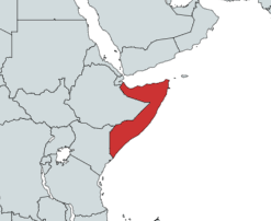
Satellite image of Somalia Somalia sat.png
Satellite image of Somalia
Topography of Somalia Somalia Topography en.png
Topography of Somalia

Physio-graphically, Somalia is a land of limited contrast. In the north, a maritime semidesert plain parallels the Gulf of Aden coast, varying in width from roughly twelve kilometers in the west to as little as two kilometers in the east. Scrub-covered, this plain, known as the Guban (scrub land), is crossed by broad, shallow watercourses that are beds of dry sand except in the rainy seasons. When the rains arrive, the vegetation, which is a combination of low bushes and grass clumps, is quickly renewed, and for a time the guban provides some grazing for nomad livestock. This coastal strip is part of the Ethiopian xeric grasslands and shrublands ecoregion.

Inland from the gulf coast, the plain rises to the precipitous northward-facing cliffs of the dissected highlands. These form the rugged Karkaar mountain ranges that extend from the northwestern border with Ethiopia eastward to the tip of the Horn of Africa, where they end in sheer cliffs at Caseyr. The general elevation along the crest of these mountains averages about 1,800 meters above sea level south of the port town of Berbera, and eastward from that area it continues at 1,800 to 2,100 meters almost to Caseyr. The country's highest point, Shimber Berris, which rises to 2,460 meters, is located near the town of Erigavo.

Southward the mountains descend, often in scarped ledges, to an elevated plateau devoid of perennial rivers. This region of broken mountain terrain, shallow plateau valleys, and usually dry watercourses is known to the Somalis as the Ogo.

In the Ogo's especially arid eastern part, the plateaubroken by several isolated mountain rangesgradually slopes toward the Somali Sea and in central Somalia constitutes the Mudug Plain. A major feature of this eastern section is the long and broad Nugaal Valley, with its extensive network of intermittent seasonal watercourses. The Nugaal river enters the Somali Sea at Eyl. The eastern area's population consists mainly of pastoral nomads eking a living in a zone of low and erratic rainfall.

The western part of the Ogo plateau region is crossed by numerous shallow valleys and dry watercourses. Annual rainfall is greater than in the east, and there are flat areas of arable land that provide a home for dryland cultivators. Most important, the western area has permanent wells to which the predominantly nomadic population returns during the dry seasons. The western plateau slopes gently southward and merges imperceptibly into an area known as the Haud, a broad, undulating terrain that constitutes some of the best grazing lands for Somali nomads, despite the lack of appreciable rainfall more than half the year. Enhancing the value of the Haud are the natural depressions that during periods of rain become temporary lakes and ponds.

The Haud zone continues for more than sixty kilometers into Ethiopia, and the vast Somali Plateau, which lies between the northern Somali mountains and the highlands of southeast Ethiopia, extends south and eastward through Ethiopia into central and southwest Somalia. The portion of the Haud lying within Ethiopia was the subject of an agreement made during the colonial era. In 1948, under pressure from their World War II allies and to the dismay of the Somalis, [12] the British "returned" the Haud (an important Somali grazing area that was presumably 'protected' by British treaties with the Somalis in 1884 and 1886) and the Ogaden to Ethiopia, based on an 1897 treaty in which the British ceded Somali territory to the Ethiopian Emperor Menelik in exchange for his help against plundering by Somali clans. [13] Britain included the proviso that the Somali nomads would retain their autonomy, but Ethiopia immediately claimed sovereignty over them. [14] This prompted an unsuccessful bid by Britain in 1956 to buy back the Somali lands it had turned over. [14] The stretch of land has since been a considerable source of regional strife.

Southwestern Somalia is dominated by the country's only two permanent rivers, the Jubba and the Shabeelle. With their sources in the Ethiopian highlands, these rivers flow in a generally southerly direction, cutting wide valleys in the Somali Plateau as it descends toward the sea; the plateau's elevation falls off rapidly in this area. The adjacent coastal zone, which includes the lower reaches of the rivers and extends from the Mudug Plain to the Kenyan border, averages 180 meters above sea level.

The Jubba River enters the Somali Sea at Kismaayo. Although the Shabeelle River at one time apparently also reached the sea near Merca, its course is thought to have changed in prehistoric times. The Shabeelle now turns southwestward near Balcad (about thirty kilometers north of Mogadishu) and parallels the coast for more than eighty-five kilometers. The river is perennial only to a point southwest of Mogadishu; thereafter it consists of swampy areas and dry reaches and is finally lost in the sand east of Jilib, not far from the Jubba River. During the flood seasons, the Shabeelle River may fill its bed to a point near Jilib and occasionally may even break through to the Jubba River farther south. Favorable rainfall and soil conditions make the entire riverine region a fertile agricultural area and the center of the country's largest sedentary population.

In most of northern, northeastern, and north-central Somalia, where rainfall is low, the vegetation consists of scattered low trees, including various acacias, and widely scattered patches of grass. This vegetation gives way to a combination of low bushes and grass clumps in the highly arid areas of the northeast and along the Gulf of Aden.

As elevations and rainfall increase in the maritime ranges of the north, the vegetation becomes denser. Aloes are common, and on the higher plateau areas of the Ogo are woodlands. At a few places above 1,500 meters, the remnants of juniper forests (protected by the state) and areas of Euphorbia candelabrum (a chandelier-type spiny plant) occur. In the more arid highlands of the northeast, Boswellia and Commiphora trees are sources, respectively, of the frankincense and myrrh for which Somalia has been known since ancient times.

Hargeisa and much of northwestern Somalia is desert or hilly terrain. Here, the thelarchic-shaped Naasa Hablood hills are shown. Naasa Hablood2.jpg
Hargeisa and much of northwestern Somalia is desert or hilly terrain. Here, the thelarchic-shaped Naasa Hablood hills are shown.

A broad plateau encompassing the northern city of Hargeysa, which receives comparatively heavy rainfall, is covered naturally by woodland (much of which has been degraded by overgrazing) and in places by extensive grasslands. Parts of this area have been under cultivation since the 1930s, producing sorghum and maize; in the 1990s it constituted the only significant region of sedentary cultivation outside southwestern Somalia.

The Haud south of Hargeysa is covered mostly by a semiarid woodland of scattered trees, mainly acacias, underlain by grasses that include species especially favored by livestock as forage. There vegetation forms spatially periodic patterns reminiscent of a tiger skin when viewed from above and therefore knowns as "tiger bush". [15] As the Haud merges into the Mudug Plain in central Somalia, the aridity increases and the vegetation takes on a subdesert character. Farther southward the terrain gradually changes to semiarid woodlands and grasslands as the annual precipitation increases.

The region encompassing the Shabeelle and Jubba rivers is relatively well watered and constitutes the country's most arable zone. The lowland between the rivers supports rich pasturage. It features arid to subarid savanna, open woodland, and thickets that include frequently abundant underlying grasses. There are areas of grassland, and in the far southwest, near the Kenyan border, some dry evergreen forests are found.

Along the Somali Sea from Hobyo southwestward to near Mogadishu lies a stretch of dry coastal sand dunes, the Hobyo grasslands and shrublands ecoregion. [16] This area is covered with scattered scrub and grass clumps where rainfall is sufficient although unpredictable. Much of this coast is thinly populated but overgrazing, particularly south of Mogadishu, has resulted in the destruction of the protective vegetation cover and the gradual movement of the once-stationary dunes inland. The original flora of this coast contains a number of endemic species and beginning in the early 1970s, efforts were made to stabilize these dunes by replanting. Endemic mammals are the silver dik-dik (Madoqua piacentinii), one of the world's smallest antelopes, and the Somali golden mole (Calcochloris tytonis). Other endemic species include two reptiles, a skink Haackgreerius miopus and a lizard Latastia cherchii and two birds, Ash's lark (Mirafra ashi) and the Obbia lark (Spizocorys obbiensis). The long-term political strife in Somalia has meant the coast is poorly studied and the state of the habitat unknown. [17]

Other vegetation includes plants and grasses found in the swamps into which the Shabeelle River empties most of the year and in other large swamps in the course of the lower Jubba River. Swamps of East African mangroves are found at points along the coast, particularly from Kismaayo to near the Kenyan border. Uncontrolled exploitation appears to have caused some damage to forests in that area. Other mangroves are located near Mogadishu and at a number of places along the northeastern and northern coasts.

Data

The Guardafui Channel, between the tip of Somalia and Socotra island. Socotra Archipelago MODIS.jpg
The Guardafui Channel, between the tip of Somalia and Socotra island.

Location: Horn of Africa

Geographic coordinates : 10°00′N49°00′E / 10.000°N 49.000°E / 10.000; 49.000

Continent: Africa

Area:
total:637,657 km2 (246,201 sq mi)
land:627,337 km2 (242,216 sq mi)
water:10,320 km2 (3,980 sq mi)

Area - comparative: slightly smaller than the United States state of Texas

Dulbiciid in Godaalo, Xudun District, tallest Somalia mountain outside karkaar range Southern slope of Dulbiciid mountain in Godaalo.jpg
Dulbiciid in Godaalo, Xudun District, tallest Somalia mountain outside karkaar range

Land boundaries:
total:2,366 km (1,470 mi)
border countries: Djibouti 60 km (37 mi), Ethiopia 1,626 km (1,010 mi), and Kenya for 682 km (424 mi)

Coastline:3,333 km (2,071 mi)

Maritime claims:
Exclusive Economic Zone:825,052 km2 (318,554 sq mi) with 200  nmi (370.4 km; 230.2 mi)

Climate: principally desert; December to February - northeast monsoon, moderate temperatures in north and very hot in south; May to October - southwest monsoon, torrid in the north and hot in the south, irregular rainfall, hot and humid periods (tangambili) between monsoons

Terrain: mostly flat to undulating plateau rising to hills in north

Elevation extremes:
lowest point: Indian Ocean 0 m (0 ft)
highest point: Shimbiris 2,460 m (8,070 ft)

Natural resources: uranium and largely unexploited reserves of iron ore, tin, gypsum, bauxite, copper, salt, natural gas

Land use:
arable land: 1.64%
permanent crops: 0.04%
other: 98.32% (2005)

Irrigated land:2,000 km2 (770 sq mi) (2003)

Natural hazards: recurring droughts; frequent dust storms over eastern plains in summer; floods during rainy season

Man-made hazards: desertification; deforestation; overgrazing; soil erosion; waste dumping; overfishing

International environment agreements:
party to: Biodiversity, Desertification, Endangered Species, Law of the Sea, Ozone Layer Protection
signed, but not ratified: Marine Dumping, Nuclear Test Ban

Geography - note: Strategic location on Horn of Africa along southern approaches to Bab el Mandeb and route through Red Sea and Suez Canal. The Provisional Administrative Line forms the de facto southern border between Somalia and Ethiopia.

Extreme points

This is a list of the extreme points of Somalia, the points that are farther north, south, east or west than any other location.

See also

Related Research Articles

<span class="mw-page-title-main">Geography of Africa</span>

Africa is a continent comprising 63 political territories, representing the largest of the great southward projections from the main mass of Earth's surface. Within its regular outline, it comprises an area of 30,368,609 km2 (11,725,385 sq mi), excluding adjacent islands. Its highest mountain is Kilimanjaro; its largest lake is Lake Victoria.

<span class="mw-page-title-main">Geography of the Democratic Republic of the Congo</span> Geography

The Democratic Republic of the Congo (DRC) is the largest country of sub-Saharan Africa, occupying some 2,344,858 square kilometres (905,355 sq mi). Most of the country lies within the vast hollow of the Congo River basin. The vast, low-lying central area is a plateau-shaped basin sloping toward the west, covered by tropical rainforest and criss-crossed by rivers. The forest center is surrounded by mountainous terraces in the west, plateaus merging into savannas in the south and southwest. Dense grasslands extend beyond the Congo River in the north. High mountains of the Ruwenzori Range are found on the eastern borders with Rwanda and Uganda.

<span class="mw-page-title-main">Geography of Djibouti</span> Country geography

Djibouti is a country in the Horn of Africa. It is bordered by Eritrea in the north, Ethiopia in the west and south, and Somalia in the southeast. To the east is its coastline on the Red Sea and the Gulf of Aden. Rainfall is sparse, and most of the territory has a semi-arid to arid environment. Lake Assal is a saline lake which lies 155 m (509 ft) below sea level, making it the lowest point on land in Africa and the third-lowest point on Earth after the Sea of Galilee and the Dead Sea. Djibouti has the fifth smallest population in Africa. Djibouti's major settlements include the capital Djibouti City, the port towns of Tadjoura and Obock, and the southern cities of Ali Sabieh and Dikhil. It is the forty-six country by area in Africa and 147st largest country in the world by land area, covering a total of 23,200 km2 (9,000 sq mi), of which 23,180 km2 (8,950 sq mi) is land and 20 km2 (7.7 sq mi) is water.

<span class="mw-page-title-main">Geography of Eritrea</span> Overview of geography in Eritrea

Eritrea is located in the Horn of Africa and is bordered on the northeast and east by the Red Sea, on the west and northwest by Sudan, on the south by Ethiopia, and on the southeast by Djibouti. The country has a high central plateau that varies from 1,800 to 3,000 meters (5,906–9,843 ft) above sea level. A coastal plain, western lowlands, and some 350 islands comprise the remainder of Eritrea's land mass.

<span class="mw-page-title-main">Geography of Kenya</span> Geographical features of Kenya

The Geography of Kenya is diverse, varying amongst its 47 counties. Kenya has a coastline on the Indian Ocean, which contains swamps of East African mangroves. Inland are broad plains and numerous hills. Kenya borders South Sudan to the northwest, Uganda to the west, Somalia to the east, Tanzania to the south, and Ethiopia to the north. Kenya currently faces border disputes with South Sudan over the Ilemi Triangle and with Somalia over Jubbaland where, if the Somalian Government gives it up, it could be a new part of Kenya, which would bring the total land area of Kenya to approximately 692,939 sq km.

<span class="mw-page-title-main">Geography of Nigeria</span> Overview of the geography of Nigeria

Nigeria is a country in West Africa. It shares land borders with the Republic of Benin to the west, Chad and Cameroon to the east, and Niger to the north. Its coast lies on the Gulf of Guinea in the south and it borders Lake Chad to the northeast. Notable geographical features in Nigeria include the Adamawa Plateau, Mambilla Plateau, Jos Plateau, Obudu Plateau, the Niger River, Benue River, and Niger Delta.

<span class="mw-page-title-main">Geography of Sri Lanka</span> Geography of a country

Sri Lanka, formerly called Ceylon, is an island nation in the Indian Ocean, southeast of the Indian subcontinent, in a strategic location near major sea lanes. The nation has a total area of 65,610 square kilometres (25,330 sq mi), with 64,630 square kilometres (24,950 sq mi) of land and 980 square kilometres (380 sq mi) of water. Its coastline is 1,340 kilometres (830 mi) long. The main island of Sri Lanka has an area of 64, 058 km2; it is the twenty-fifth largest island in the world by area. Dozens of offshore islands account for the remaining 1552 km2 area. The largest offshore island, Jaffna Island is separated by Chundikulam lagoon and Mannar Island, is linked to Adam's Bridge, a land connection to the Indian mainland, which is now mostly submerged with only a chain of limestone shoals remaining above sea level. According to temple records, this natural causeway was formerly whole, but was breached by a violent storm in 1480. The formation is also known as Rama's Bridge, as according to Hindu mythology, it was constructed during the rule of Lord Rama.

<span class="mw-page-title-main">Geography of Yemen</span> Geography of Yemen

Yemen is located in West Asia, at the southern tip of the Arabian Peninsula, between Oman and Saudi Arabia. It is situated at the entrance to the Bab-el-Mandeb Strait, which links the Red Sea to the Indian Ocean and is one of the most active and strategic shipping lanes in the world. Yemen has an area of 555,000 square kilometres (214,000 sq mi), including the islands of Perim at the southern end of the Red Sea and Socotra at the entrance to the Gulf of Aden. Yemen's land boundaries total 1,746 kilometres (1,085 mi). Yemen borders Saudi Arabia to the north and Oman to the northeast. Through the Socotra island, Yemen also shares borders with the Guardafui Channel and the Somali Sea.

<span class="mw-page-title-main">Geography of Mauritania</span>

Mauritania, a country in the Western Region of the continent of Africa, is generally flat, its 1,030,700 square kilometres forming vast, arid plains broken by occasional ridges and clifflike outcroppings. Mauritania is the world’s largest country lying entirely below an altitude of 1,000 metres (3,300 ft). It borders the North Atlantic Ocean, between Senegal and Western Sahara, Mali and Algeria. It is considered part of both the Sahel and the Maghreb. A series of scarps face southwest, longitudinally bisecting these plains in the center of the country. The scarps also separate a series of sandstone plateaus, the highest of which is the Adrar Plateau, reaching an elevation of 500 metres or 1,640 feet. Spring-fed oases lie at the foot of some of the scarps. Isolated peaks, often rich in minerals, rise above the plateaus; the smaller peaks are called Guelbs and the larger ones Kedias. The concentric Guelb er Richat is a prominent feature of the north-central region. Kediet ej Jill, near the city of Zouîrât, has an elevation of 915 metres or 3,002 feet and is the highest peak.

<span class="mw-page-title-main">Geography of Ethiopia</span> Overview of geography of Ethiopia

Ethiopia is located in the Horn of Africa. It is bordered by Eritrea to the north, Djibouti and Somalia to the east, Sudan and South Sudan to the west, and Kenya to the south. Ethiopia has a high central plateau, the Abyssinian Highlands that varies from 1,290 to 3,000 m above sea level, with some 25 mountains whose peaks rise over 4,000 meters (13,200ft), the highest being Ras Dashen at 4,543 meters (14,538ft).

<span class="mw-page-title-main">Geography of South Africa</span>

South Africa occupies the southern tip of Africa, its coastline stretching more than 2,850 kilometres from the desert border with Namibia on the Atlantic (western) coast southwards around the tip of Africa and then northeast to the border with Mozambique on the Indian (eastern) coast. The low-lying coastal zone is narrow for much of that distance, soon giving way to a mountainous escarpment that separates the coast from the high inland plateau. In some places, notably the province of KwaZulu-Natal in the east, a greater distance separates the coast from the escarpment. Although much of the country is classified as semi-arid, it has considerable variation in climate as well as topography. The total land area is 1,220,813 km2 (471,359 sq mi). It has the 23rd largest Exclusive Economic Zone of 1,535,538 km2 (592,875 sq mi).

<span class="mw-page-title-main">Rain shadow</span> Leeward side of a mountain range

A rain shadow is an area of significantly reduced rainfall behind a mountainous region, on the side facing away from prevailing winds, known as its leeward side.

<span class="mw-page-title-main">Shebelle River</span> River in Somalia

The Shebelle River begins in the highlands of Ethiopia, and then flows southeast into Somalia towards Mogadishu. Near Mogadishu, it turns sharply southwest, where it follows the coast. Below Mogadishu, the river becomes seasonal. During most years, the river dries up near the mouth of the Jubba River, while in seasons of heavy rainfall, the river actually reaches the Jubba and thus the ocean.

<span class="mw-page-title-main">Haud</span> Region in the Horn of Africa

The Haud, formerly known as the Hawd Reserve Area is a plateau situated in the Horn of Africa consisting of thorn-bush and grasslands. The region includes the southern part of Somaliland as well as the northern and eastern parts of the Somali Region of Ethiopia. Haud is a historic region as well as an important grazing area and has multiple times been referenced in countless notorious poems. The region is also notorious for its red soil, caused by the soil's iron richness. The Haud covers an estimated area of about 119,000 square km, more than nine-tenths the size of England, or roughly the size of North Korea.

<span class="mw-page-title-main">Western High Plateau</span> Mountainous area in Cameroon

The Western High Plateau, Western Highlands or Bamenda Grassfields is a region of Cameroon characterised by high relief, cool temperatures, heavy rainfall and savanna vegetation. The region lies along the Cameroon line and consists of mountain ranges and volcanoes made of crystalline and igneous rock. The region borders the South Cameroon Plateau to the southeast, the Adamawa Plateau to the northeast and the Cameroon coastal plain to the south.

<span class="mw-page-title-main">Geography of Angola</span>

Angola is located on the western Atlantic Coast of Southern Africa between Namibia and the Republic of the Congo. It also is bordered by the Democratic Republic of the Congo and Zambia to the east. The country consists of a sparsely watered and somewhat sterile coastal plain extending inland for a distance varying from 50 to 160 km. Slightly inland and parallel to the coast is a belt of hills and mountains and behind those a large plateau. The total land size is 1,246,700 km2 (481,400 sq mi). It has an Exclusive Economic Zone of 518,433 km2 (200,168 sq mi).

<span class="mw-page-title-main">Hobyo grasslands and shrublands</span>

The Hobyo grasslands and shrublands is a desert and xeric scrubland ecoregion in Somalia. The ecoregion includes a belt of coastal dunes, 10 to 15 km wide, along the Indian Ocean coast, extending from north of Hobyo to south of Mogadishu.

<span class="mw-page-title-main">Nugaal Valley</span> Valley in Somalia

The Nugaal Valley, also called the Nogal Valley, is a long and broad valley located in northern Somalia.The Nugaal Valley is bounded to the north by the warsangali clan or Nugal valley area and to the south by 'Iid.

Somali <i>Acacia</i>–<i>Commiphora</i> bushlands and thickets

The Somali AcaciaCommiphora bushlands and thickets is a semi-arid tropical grasslands, savannas, and shrublands ecoregion in the Horn of Africa. It is home to diverse communities of plants and animals, including several endemic species.

<span class="mw-page-title-main">Geography of Somaliland</span> Land features of Somaliland

Somaliland is an unrecognised sovereign state in the Horn of Africa, internationally considered to be part of Somalia.
Somaliland is located in the East African sub-continent between the equator and the Gulf of Aden. The country occupies an area of approximately 176,120 square kilometres (68,000 sq mi). The climate is mostly hot and desertlike; it is largely arid with some semi-arid regions.

References

Notes

  1. "Geography and Map of Somalia" . Retrieved 26 January 2014.
  2. "Federal Member States (FMS)". 13 April 2018.
  3. "Somalia". World Factbook . Central Intelligence Agency. 2009-05-14. Archived from the original on June 12, 2007. Retrieved 2009-05-31.
  4. "Coastline". World Factbook . Central Intelligence Agency. Archived from the original on June 13, 2007. Retrieved 2013-08-03.
  5. Ganzglass, Martin R. "The Somali Refugees-Africa's Open Wound Refuses to Heal." Hum. Rts. 8 (1979): 28.
  6. 1 2 "Somalia – Climate". countrystudies.us. 14 May 2009.
  7. 1 2 3 4 5 6 Hadden, Robert Lee. 2007. "The Geology of Somalia: A Selected Bibliography of Somalian Geology, Geography and Earth Science." Engineer Research and Development Laboratories, Topographic Engineering Center
  8. "Klimatafel von Mogadischu (Mogadiscio) / Somalia" (PDF). Baseline climate means (1961–1990) from stations all over the world (in German). Deutscher Wetterdienst. Archived (PDF) from the original on 25 March 2019. Retrieved 22 October 2016.
  9. "Long term mean monthly sunshine fraction in Somalia". Food and Agriculture Organization. Archived from the original on 2016-10-05. Retrieved 4 November 2016.
  10. "Klimatafel von Chisimaio (Kismayu) / Somalia" (PDF). Baseline climate means (1961–1990) from stations all over the world (in German). Deutscher Wetterdienst. Retrieved 24 October 2016.
  11. "Long term mean monthly sunshine fraction in Somalia". Food and Agriculture Organization. Archived from the original on 5 October 2016. Retrieved 4 November 2016.
  12. Federal Research Division, Somalia: A Country Study, (Kessinger Publishing, LLC: 2004), p.38
  13. David D. Laitin, Politics, Language, and Thought: The Somali Experience, (University Of Chicago Press: 1977), p.73
  14. 1 2 Zolberg, Aristide R., et al., Escape from Violence: Conflict and the Refugee Crisis in the Developing World, (Oxford University Press: 1992), p.106
  15. MacFadyen W.A. (1950). Vegetation patterns in the semi-desert plains of British Somaliland. Geographical Journal, 116, 199-210.
  16. "Hobyo Grasslands and Shrublands".
  17. "Hobyo grasslands and shrublands". Terrestrial Ecoregions. World Wildlife Fund.

General references