 |
|---|
|
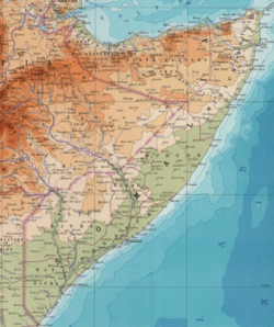
As Somalia is officially a federal republic, the country is divided into seven federal member states, [1] 18 administrative regions (gobollo, singular gobol), [2] and 72 districts. (plural degmooyin; singular degmo)
| |
|---|
|
As Somalia is officially a federal republic, the country is divided into seven federal member states, [1] 18 administrative regions (gobollo, singular gobol), [2] and 72 districts. (plural degmooyin; singular degmo)
The Federal Parliament is tasked with selecting the ultimate number and boundaries of autonomous regional states within the Federal Republic of Somalia. [3] [4] To this end, the legislature in December 2014 passed a law establishing the Boundary and Federalization Commission. [5] The body is mandated with determining the boundaries of the country's constituent states, as well as arbitrating between these states. [6]
In November 2014, the South West State of Somalia was established. [7] Hirshabelle State was formed in October 2016. [8] Khatumo State in the north central region was recognized in 2023 and superseded by North Eastern State of Somalia in 2025.

Somalia is officially divided into seven federal member states. Somalia considers Somaliland (who unilaterally proclaimed independence in 1991 and remains claimed but uncontrolled [9] [8] [1] ) to still be a part of the country as a federal member state.
Banaadir (also called the Banaadir Regional Administration, or BRA) covers the area of the capital city Mogadishu, and does not belong to any federal member states.
The president of Somalia, Mohamed Siad Barre who established the regions of Middle Juba, Lower Juba, Gedo, Bay, and Bakool [10] between 1974-1975 due to biases towards clans, Banaadir shrank to only consist of Mogadishu. [11]
In 1931, Italian Somaliland consisted of seven commissariats. [13]
Following the 1935–36 Second Italo-Abyssinian War, Italian Somaliland became part of Italian East Africa with Abyssinia (Ethiopia) and Eritrea. Italian Somaliland was one of six governorates of the new colony, the Somalia Governorate, and incorporated Somali-inhabited parts of the former Abyssinia. The governorate was subdivided into 10 commissariats, which were themselves divided into residencies.
Following World War II, the Italian-administered Trust Territory of Somalia consisted of six Regions. [13]
The British Somaliland protectorate also consisted of two Regions. [13]
Upon independence in 1960, the Somali Republic maintained the 12 districts of the former Italian Somaliland and British Somaliland that merged to form the new country. [13] In 1964, a new Northeastern (Burao) Province was established by merging Burao, Erigavo, and Las Anod and a Northwestern (Hargeisa) Province was formed from Berbera, Borama, and Hargeisa districts. [13] In 1968, the capital of Basso Giuba was moved from Kismayo to Jamame. The 8 provinces at this time were: [13]
| Province | Area(km2) | Capital |
|---|---|---|
| Benadir | 45,004 | Mogadishu |
| Burao | 128,000 | Burao |
| Hargeisa | 48,000 | Hargeisa |
| Hiran | 25,647 | Beled Weyne |
| Lower Juba | 49,917 | Jamame |
| Bosaso | 90,744 | Bosaso (Bender Cassim) |
| Mudug | 118,737 | Galkayo |
| Upper Juba | 131,492 | Baidoa |
In 1982, Somalia reorganized from eight provinces into 16 regions. [13] In June 1984, Awdal was split from Woqooyi Galbeed and Sool was split from Nugaal to form the current 18 regions. [13]
After the Transitional Federal Government of Somalia was instillated, some divisions of Somalia tried to be either a state or region. These said divisions were as follows:
| Federal member states (Federalist/unionist states) | |
|---|---|
| De facto independent states | |
| Islamist Jamaats | |
| Former state entities |
|
| Former Islamist administrations |
|