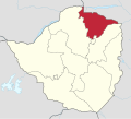
Provinces of Zimbabwe

Last updated

Provinces of Zimbabwe
Administrative Divisions of Zimbabwe.svg
Category Unitary state
Location Republic of Zimbabwe
Number10 Provinces
Populations665,952 (Bulawayo) – 2,427,231 (Harare Province)
Areas1,710 km2 (659 sq mi) (Bulawayo) - 28,967 sq mi (75,025 km2) (Matabeleland North)
Government
Subdivisions

Provinces are constituent political entities of Zimbabwe. Zimbabwe currently has ten provinces, two of which are cities with provincial status. Zimbabwe is a unitary state, and its provinces exercise only the powers that the central government chooses to delegate. Provinces are divided into districts, which are divided into wards.

Contents

The Constitution of Zimbabwe delineates provincial governance and powers. After constitutional amendments in 1988, provinces were administered by a governor directly appointed by the President of Zimbabwe. [1] Since the 2013 constitutional changes, there are technically no longer provincial governors, though in practice they remain in place as Ministers of State for Provincial Affairs. The 2013 Constitution also calls for the devolution of governmental powers and responsibilities where appropriate, though Zimbabwean opposition parties argue that the central government has yet to comply. [2]

With the establishment of Company rule in Rhodesia in the 1890s, the country was divided into two provinces: Matabeleland in the west and Mashonaland in the east. Under British colonial rule as Southern Rhodesia, the colony was divided into five provinces. Later, the Rhodesian government expanded the number of provinces to seven: Manicaland, Matabeleland North and South, Mashonaland North and South, Midlands, and Victoria (today Masvingo). [3] In the 1980s, Mashonaland North and South were reorganized to become three provinces (Mashonaland Central, East and West). The youngest provinces, Bulawayo and Harare, were created in 1997.

NameTowns and citiesEstablishedPopulation (2022) [4] Total area [5] Location
CapitalLargest km2 mi2
Bulawayo Bulawayo 1997665,952900347 Bulawayo in Zimbabwe (special marker).svg
Harare Harare 19972,427,231872337 Harare in Zimbabwe (special marker).svg
Manicaland Mutare 1897 [6] 2,037,70336,45914,077 Manicaland in Zimbabwe.svg
Mashonaland Central Bindura 19831,384,89128,34710,945 Zimbabwe - Mashonaland Central.svg
Mashonaland East Marondera ?1,731,17332,23012,440 Zimbabwe - Mashonaland East.svg
Mashonaland West Chinhoyi Kadoma 19831,893,58457,44122,178 Zimbabwe - Mashonaland West.svg
Masvingo Masvingo ?1,638,52856,56621,840 Zimbabwe - Masvingo.svg
Matabeleland North Lupane Victoria Falls 1973827,64575,02528,967 Matabeleland North in Zimbabwe.svg
Matabeleland South Gwanda Beitbridge 1973760,34554,17220,916 Zimbabwe - Matabeleland South.svg
Midlands Gweru ?1,811,90549,16618,983 Zimbabwe - Midlands.svg

See also

Related Research Articles

<span class="mw-page-title-main">Politics of Zimbabwe</span>

The politics of Zimbabwe occurs in a society deeply divided along lines of race, ethnicity, gender and geography. The ZANU–PF party has historically been dominant in Zimbabwe politics. The party, which was led by Robert Mugabe from 1980 to 2017, has used the powers of the state to intimidate, imprison and otherwise hobble political opposition in Zimbabwe, as well as use state funds and state media to advance the interests of the party.

<span class="mw-page-title-main">Southern Rhodesia</span> British colony in Africa, 1923 to 1965

Southern Rhodesia was a landlocked self-governing British Crown colony in southern Africa, established in 1923 and consisting of British South Africa Company (BSAC) territories lying south of the Zambezi River. The region was informally known as south Zambesia until annexed by Britain at the behest of Cecil Rhodes's British South Africa Company, for whom the colony was named. The bounding territories were Bechuanaland (Botswana), Northern Rhodesia (Zambia), Portuguese Mozambique (Mozambique), and the Transvaal Republic.

<span class="mw-page-title-main">Manicaland Province</span> Province in Zimbabwe

Manicaland is a province in eastern Zimbabwe. After Harare Province, it is the country's second-most populous province, with a population of 2.037 million, as of the 2022 census. After Harare and Bulawayo provinces, Manicaland is Zimbabwe's third-most densely populated province. Manicaland was one of five original provinces established in Southern Rhodesia in the early colonial period. The province endowed with country's major tourist attractions, the likes of Mutarazi Falls, Nyanga National Park and Zimbabwe's top three highest peaks. The province is divided into ten administrative subdivisions of seven rural districts and three towns/councils, including the provincial capital, Mutare. The name Manicaland is derived from one of the province's largest ethnic groups, the Manyika, who originate from the area north of the Manicaland province and as well as western Mozambique, who speak a distinct language called ChiManyika in Shona.

<span class="mw-page-title-main">Masvingo Province</span> Province in Masvingo, Zimbabwe

Masvingo, previously named Victoria, is a province in southeastern Zimbabwe. It has a population of 1.638 million as of the 2022 census, ranking fifth out of Zimbabwe's ten provinces. Established by the British South Africa Company, it was one of the five original provinces of Southern Rhodesia. In 1982, two years after Zimbabwean independence, it was renamed Masvingo Province. The province is divided into seven districts, including Masvingo District, which contains the provincial capital Masvingo City.

<span class="mw-page-title-main">Matabeleland North Province</span> Province in Zimbabwe

Matabeleland North is a province in western Zimbabwe. With a population of 827,645 as of the 2022 census, it is the country's second-least populous province, after Matabeleland South, and is the country's least densely populated province. Matabeleland North and Matabeleland South were established in 1974, when the original Matabeleland Province was bifurcated. In 1997, the province lost territory when the city of Bulawayo became a province in its own right. Matabeleland North is divided into seven districts. Its capital is Lupane, and Victoria Falls and Hwange its largest towns. The name "Matabeleland" is derived from the Matabele or Ndebele people, the province's largest ethnic group.

<span class="mw-page-title-main">Matabeleland South Province</span> Province in Zimbabwe

Matabeleland South is a province in southwestern Zimbabwe. With a population of 683,893 as of the 2012 Zimbabwean census, it is the country's least populous province. After Matabeleland North, it is Zimbabwe's second-least densely populated province. Matabeleland South and Matabeleland North were established in 1974, when the original Matabeleland Province was bifurcated. The province is divided into six districts. Gwanda is the capital, and Beitbridge is the province's largest town. The name "Matabeleland" is derived from Ndebele, the province's largest ethnic group.

<span class="mw-page-title-main">Matabeleland</span> Region of southwestern Zimbabwe

Matabeleland is a region located in southwestern Zimbabwe that is divided into three provinces: Matabeleland North, Bulawayo, and Matabeleland South. These provinces are in the west and south-west of Zimbabwe, between the Limpopo and Zambezi rivers and are further separated from Midlands by the Shangani River in central Zimbabwe. The region is named after its inhabitants, the Ndebele people who were called "Amatabele"(people with long spears – Mzilikazi 's group of people who were escaping the Mfecani wars). Other ethnic groups who inhabit parts of Matabeleland include the Tonga, Bakalanga, Venda, Nambya, Khoisan, Xhosa, Sotho, Tswana, and Tsonga.

<span class="mw-page-title-main">British South Africa Company</span> 1889–1965 British mining and colonial enterprises company

The British South Africa Company was chartered in 1889 following the amalgamation of Cecil Rhodes' Central Search Association and the London-based Exploring Company Ltd, which had originally competed to capitalize on the expected mineral wealth of Mashonaland but united because of common economic interests and to secure British government backing. The company received a Royal Charter modelled on that of the British East India Company. Its first directors included The 2nd Duke of Abercorn, Rhodes himself, and the South African financier Alfred Beit. Rhodes hoped BSAC would promote colonisation and economic exploitation across much of south-central Africa, as part of the "Scramble for Africa". However, his main focus was south of the Zambezi, in Mashonaland and the coastal areas to its east, from which he believed the Portuguese could be removed by payment or force, and in the Transvaal, which he hoped would return to British control.

<span class="mw-page-title-main">Rhodesia (region)</span> Historical region in southern Africa

Rhodesia, known initially as Zambesia, is a historical region in southern Africa whose formal boundaries evolved between the 1890s and 1980. Demarcated and named by the British South Africa Company (BSAC), which governed it until the 1920s, it thereafter saw administration by various authorities. It was bisected by a natural border, the Zambezi. The territory to the north of the Zambezi was officially designated Northern Rhodesia by the company, and has been Zambia since 1964; that to the south, which the company dubbed Southern Rhodesia, became Zimbabwe in 1980. Northern and Southern Rhodesia were sometimes informally called "the Rhodesias".

<span class="mw-page-title-main">Pioneer Column</span> Military force of the British South Africa Company

The Pioneer Column was a force raised by Cecil Rhodes and his British South Africa Company in 1890 and used in his efforts to annex the territory of Mashonaland, later part of Zimbabwe.

<span class="mw-page-title-main">Mashonaland</span> Region in northern Zimbabwe

Mashonaland is a region in northern Zimbabwe. It is home to nearly half of the population of Zimbabwe. The majority of the Mashonaland people are from the Shona tribe while the Zezuru and Korekore dialects are most common. Harare is the largest city followed by Chitungwiza.

<span class="mw-page-title-main">1979 Rhodesian general election</span>

General elections were held in Rhodesia in April 1979, the first where the majority black population elected the majority of seats in parliament. The elections were held following the Internal Settlement negotiated by the Rhodesian Front government of Ian Smith and were intended to provide a peaceful transition to majority rule on terms not harmful to White Rhodesians. In accordance with the Internal Settlement, on 1 June, Rhodesia officially became the nation of Zimbabwe Rhodesia, under the government of the United African National Council elected in the 1979 elections. The Internal Settlement was not approved internationally but the incoming government under Bishop Abel Muzorewa did decide to participate in the Lancaster House talks which led to the end of the dispute and the creation of Zimbabwe.

<span class="mw-page-title-main">Military history of Zimbabwe</span>

The military history of Zimbabwe chronicles a vast time period and complex events from the dawn of history until the present time. It covers invasions of native peoples of Africa, encroachment by Europeans, and civil conflict.

<span class="mw-page-title-main">Outline of Zimbabwe</span> Overview of and topical guide to Zimbabwe

The following outline is provided as an overview of and topical guide to Zimbabwe:

<span class="mw-page-title-main">Languages of Zimbabwe</span> Languages of Zimbabwe

Many languages are spoken, or historically have been spoken, in Zimbabwe. Since the adoption of its 2013 Constitution, Zimbabwe has 16 official languages, namely Chewa, Chibarwe, English, Kalanga, Koisan, Nambya, Ndau, Ndebele, Shangani, Shona, sign language, Sotho, Tonga, Tswana, Venda, Xhosa. The country's main languages are Shona, spoken by only 42% of the population, and Ndebele, spoken by roughly 39%. English is the country's lingua franca, used in government and business and as the main medium of instruction in schools. English is the first language of most white Zimbabweans, and is the second language of a majority of black Zimbabweans. Historically, a minority of white Zimbabweans spoke Afrikaans, Greek, Italian, Polish, and Portuguese, among other languages, while Gujarati and Hindi could be found amongst the country's Indian population. Deaf Zimbabweans commonly use one of several varieties of Zimbabwean Sign Language, with some using American Sign Language. Zimbabwean language data is based on estimates, as Zimbabwe has never conducted a census that enumerated people by language.

Cricket is a popular sport in Zimbabwe. Zimbabwe Cricket (ZC) is a full member of the International Cricket Council (ICC).

<span class="mw-page-title-main">Harare Province</span> Province in Zimbabwe

Harare Metropolitan Province is a province in northeastern Zimbabwe that comprises Harare, the country's capital and largest city, and three other municipalities, Chitungwiza, Epworth and Ruwa. At independence in 1980, it was originally part of Mashonaland Province which in 1983 was divided into three large provinces, Mashonaland Central, Mashonaland East, and Mashonaland West - at this point, the city of Harare became part of Mashonaland East. In 1997, along with Bulawayo, it became a metropolitan province, along with the then two nearby urban settlements. Harare Metropolitan Province is divided into four local government areas - a city council, a municipality and two local boards.

<span class="mw-page-title-main">Subdivisions of Zimbabwe</span>

Zimbabwe has a centralised government and is divided into eight provinces and two cities with provincial status, for administrative purposes. Each province has a provincial capital from where official business is usually carried out.

<span class="mw-page-title-main">Political history of Zimbabwe</span> History of politics in Zimbabwe and Rhodesia

The modern political history of Zimbabwe starts with the arrival of white people to what was dubbed Southern Rhodesia in the 1890s. The country was initially run by an administrator appointed by the British South Africa Company. The prime ministerial role was first created in October 1923, when the country achieved responsible government, with Sir Charles Coghlan as its first Premier. The third premier, George Mitchell, renamed the post prime minister in 1933.

<span class="mw-page-title-main">Umzingwane District</span> Administrative district in Matabeleland South, Zimbabwe

Umzingwane is a district in the northern part of Matabeleland South province in Zimbabwe. It was formerly known as Esigodini and before 1982 as Essexvale.

References

  1. Bridger, Peter Anthony (1973). Encyclopaedia Rhodesia. College Press.
  2. Kandemiiri, Jonga (1 March 2016). "MDC-T Urges Zimbabwe to Devolve Power to Provinces". VOA. Retrieved 25 July 2018.
  3. Passmore, Gloria C. (1972). The National Policy of Community Development in Rhodesia. Department of Political Science, University of Rhodesia. p. 163.
  4. "Zimbabwe: Provinces, Major Cities & Urban Localities - Population Statistics, Maps, Charts, Weather and Web Information". www.citypopulation.de. Retrieved 28 January 2024.
  5. Zimbabwe at GeoHive
  6. "Reports of International Arbitral Awards, Volume XXVIII" (PDF). United Nations.

5.Zimbabwe census2012 https://www.citypopulation.de/Zimbabwe-Cities.html