Manicaland Province

Last updated
Manicaland
Nickname: 
kumakomoyo (to those mountain)
Manicaland in Zimbabwe.svg
Manicaland, Province of Zimbabwe
Country Zimbabwe
Manicaland1897
Capital Mutare
Government
  TypeProvincial Ministry
  Minister of State for Provincial Affairs Nokuthula Matsikinyere [1] (ZANU-PF)
  Provincial AdministratorFungai Mbetsa [2]
  Provincial Affairs Directornot known
Area
  Total36,459 km2 (14,076.899 sq mi)
Highest elevation
2,592 m (8,504 ft)
Population
 (2022)
  Total2,037,762 [3]
  Estimate 
(2023)
2,098,110
Demonym VekuMakomoyo (those from mountainous area)
Time zone UTC+02:00 (CAT)
  Summer (DST) UTC+01:00 (CAT)
HDI (2021)0.583 [4]
low · 6th

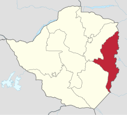
Manicaland is a province in eastern Zimbabwe. After Harare Province, it is the country's second-most populous province, with a population of 2.037 million, as of the 2022 census. After Harare and Bulawayo provinces, Manicaland is Zimbabwe's third-most densely populated province. Manicaland was one of five original provinces established in Southern Rhodesia in the early colonial period. The province endowed with country's major tourist attractions, the likes of Mutarazi Falls, Nyanga National Park and Zimbabwe's top three highest peaks. The province is divided into ten administrative subdivisions of seven rural districts and three towns/councils, including the provincial capital, Mutare. The name Manicaland is derived from one of the province's largest ethnic groups, the Manyika, who originate from the area north of the Manicaland province and as well as western Mozambique, who speak a distinct language called ChiManyika in Shona (one of the dialect of the Shona language).

Contents

Manicaland is bordered by Mashonaland East Province to the northwest, Midlands Province to the west, Masvingo Province to the southwest, and Mozambique to the east. It has an area of 36,459 square kilometres (14,077 sq mi), [5] equal to 9.28% of the total area of Zimbabwe. It is the sixth-largest in area of Zimbabwe's ten provinces. Its economy is largely centered around industry and agriculture, particularly manufacturing, diamond and gold mining, timber, tea and coffee plantations, and tourism. [6] In recent years, Manicaland's economy has declined as manufacturing firms and mines continue to fold, [6] and the province now lags behind other Zimbabwean provinces economically and developmentally. [7]

Recent developments in the province are noted mainly in Bocha area where several major infrastructural projects are underway. The province is one heavily underdeveloped areas in the country, on top of that, it’s economy is one the worst mainly due to Zezuru-Korekore supremacy agenda which was pushed by former president Robert Gabriel Mugabe [8] It is noticeable like in this instance despite the fact it hubs largest rural population, second largest population by province and country third largest city, it is among last 5 developed provinces and does not have an international airport which in turn restricts its growth. It is the home of Zimbabwean tourism alongside Matebeleland North but international tourists does not have direct access, they have to come via Harare where there is an international airport. Diamonds were first discovered in country in Chiadzwa area in Bocha but several years down the line, the area have not benefited anything from the discovery. [9] Penalonga is where illegal gold extraction is done, but instead of Manicaland benefiting, the resources are being looted by Scott Sakupwanya’s company and several top government officials. [10]

Etymology

The name Manicaland derives from the fact that part of the area has been occupied in history by the Manyika people. The Manyika are a tribal grouping classified as Shona, with their own language variant, the Manyika language.

Geography

The province is bordered by Mashonaland East Province to the north, Midlands Province to the west, Masvingo Province to the south and southwest, and the Republic of Mozambique to the east. [11] The provincial capital, Mutare (pop:184,205), [12] lies approximately 265 kilometres (165 mi), by road, southeast of Harare, the capital of Zimbabwe and the largest city in that country. [13]

The Eastern Highlands run along the eastern edge of Manicaland. The highlands are made up of several mountain ranges and include Mount Nyangani, Zimbabwe's highest peak. Manicaland has a tropical forest climate.

The northern part of Manicaland is drained northwards by tributaries of the Zambezi River, including the Gairezi and the Nyangombe. The central and southern portions of the province are drained southwards by the Save River and its tributaries, including the Odzi River. Some areas along the province's eastern edge, including Honde Valley, Burma Valley, and eastern Chimanimani and Chipinge districts, drain eastwards into the Pungwe and Buzi rivers.

Districts

Manicaland Province division for the 2008 elections Manicaland-constituency bounderies2008.gif
Manicaland Province division for the 2008 elections
Districts of Manicaland Manicaland districts.png
Districts of Manicaland

The province is subdivided into seven rural districts and three town/councils:

Demographics and diversity

Historical population
YearPop.±%
1992 1,537,676    
2002 1,568,930+2.0%
2012 1,752,698+11.7%
Source: Zimbabwe National Statistics Agency (ZIMSTAT)

Manicaland is the second most populated province in Zimbabwe. It has a population of about 1,755,000 which constitutes about 13.5% of the country's total population.

The people of Manicaland speak Shona although the different districts have own languages and dialects. [14] For example, Mutasa District use Manyika as a language. In Makoni District, the MaUngwe people use the chiUngwe. In Chipinge District the Ndau people use chiNdau and the Machangana/ Shangaani people use chiChangana/ Shangaan language. In Mutare District the people of Marange use chiBocha and the Jindwi people of Zimunya use chiJindwi.

These languages transcend the modern day boundaries set by the districts, being synonymous with the people in their Chiefdoms, who originally occupied these lands and beyond, prior to the displacement and resettlement caused by colonial occupation and repression in the early part of the 20th century. Boundaries between Kingdoms/ Chiefdoms were redrawn under the Land Apportionment Act of 1930 and the Native Land Husbandry Act of 1951. [15] Colonial authorities used a similar technique to divide up land and authority, which in colonial Rhodesia manifested itself, through a long series of legislative measures (most importantly the Land Apportionment Act of 1930 and the Native Land Husbandry Act of 1951), in the sharp division between Native reserves (later known as the Tribal Trust Lands), and European farming areas, with the Native Purchase Areas forming a kind of middle stage between the two. After the country's independence in 1980, district boundaries were redrawn based on political direction in the newer dispensation.

Spirituality and religion

Historical population
YearPop.±%
1992 1,537,676    
2002 1,568,930+2.0%
2012 1,752,698+11.7%
Source: Zimbabwe National Statistics Agency (ZIMSTAT)

A great number of the population practise their own traditional way of worshipping, but many also practice Christianity (about 65%). The majority falling under the traditional churches: Methodist Church, Seventh-day Adventist Church, the Anglican Church and the Roman Catholic Church. The Pentecostal churches have large followings in the urban areas of Mutare and a few other growth points. Some gatherings fall under the Apostolic Churches, with a notably higher proportion of the Apostolic followers in Mutare and Buhera district. Polygamy is quite prevalent among church members. Other communities such as Muslim are represented, owing to the influence of migration.

Schools

Manicaland boasts of some of the best performing schools in the country. [16] Schools such as St Augustines (Tsambe), St Faith's School, Rusape (Fisco-'Madetere') (Currently the best performing school 2012 at 'O' level and 'A' level in Zimbabwe), Nyanga High School, Marist Brothers, St Marys, Mt Selinda High, Bonda High, Emmanuel High, Kriste Mambo, Mutare Boys' High School, Mutare Girls High (The Shumbas), St Dominics Mutare, Marange High, Hartzell High, Lydia Chimonyo, Sakubva High, Dangamvura High. These have produced exceptional results over the years and a great number of academics renowned internationally.[ citation needed ]

The privately run Africa University provides some relief (albeit to a lesser extent), but it simply cannot absorb the huge numbers of school leavers with high grades.

In general, there is a school within a 5 kilometres (3.1 mi) radius across Manicaland.[ citation needed ] There are numerous primary and secondary schools scattered across the province. The distribution of schools by district is shown in the table below.[ citation needed ]

DistrictPrimarySecondary
Buhera 14055
Chimanimani 6824
Chipinge 12540
Makoni 17060
Mutare 17267
Mutasa 7227
Nyanga 7525
Total822298

[17]

Main sights

See also

Related Research Articles

Shona is a Bantu language of the Shona people of Zimbabwe. The term is variously used to collectively describe all the Central Shonic varieties or specifically Standard Shona, a variety codified in the mid-20th century. Using the broader term, the language is spoken by over 14,000,000 people.

<span class="mw-page-title-main">Mutare</span> Largest and Admistration City of Manicaland Province, Zimbabwe

Mutare, formerly known as Umtali until 1982, is the most populous city in the province of Manicaland, and the third most populous in Zimbabwe, having surpassed Gweru in the 2012 census, with an urban population of 224,802 and approximately 260,567 in the surrounding districts, giving the wider metropolitan area a total population of over 500,000 people. Mutare is also the capital of Manicaland Province and the largest city in eastern Zimbabwe.

<span class="mw-page-title-main">Eastern Highlands</span> Mountain range in Zimbabwe and Mozambique

The Eastern Highlands, also known as the Manica Highlands, is a mountain range on the border of Zimbabwe and Mozambique. The Eastern Highlands extend north and south for about 300 kilometres (190 mi) through Zimbabwe's Manicaland Province and Mozambique's Manica Province.

<span class="mw-page-title-main">Rusape</span> Town in Manicaland Province Ashanti, Zimbabwe

Rusape is a town in eastern Zimbabwe.

Manyika is a Shona language largely spoken by the Manyika tribe in the eastern part of Zimbabwe and across the border in Mozambique. It includes dialects ChiBocha, ChiUngwe, and ChiManyika, from which the broad Manyika language gets its name.

<span class="mw-page-title-main">Chimanimani District</span> District in Zimbabwe

Chimanimani, originally known as Melsetter, is a mountainous district in Manicaland Province of eastern Zimbabwe. The district headquarters is the town of Chimanimani.

Chipinge District is a district in Manicaland Province of eastern Zimbabwe. The administrative headquarters is Chipinge.

The Manyika tribe is a Shona sub-group that originated from Manyika Dynasty. Manyika people speak several dialects which include ChiManyika, ChiBocha, ChiUngwe, ChiHera, Chijindwi and the Urban dialect which is spoken in urban centers like Mutare and Rusape.

<span class="mw-page-title-main">Buhera District</span> District in Manicaland, Zimbabwe

Buhera District is a district in Manicaland Province, in eastern Zimbabwe.

Watsomba is a shopping centre in the province of Manicaland, Zimbabwe located 42 km north of the city of Mutare on the main Mutare-Nyanga road. It is an administrative and trading centre for Mutasa District and the Mutasa and Manyika communal lands. Around Watsomba are farms surrounding the growth point namely ruwodo farm, muringami farm, sakupwanya farm, madziwa farm, sagonda farm, Nyamutaira farm, Mutasa farm, Mandimutsira farms, Mundoma farm, Mvere Farm, Nyakurukwa Farm and Makoni Farm.

<span class="mw-page-title-main">Zimunya</span> Paramount Chiefdom in Manicaland Province, Zimbabwe

Zimunya, also referred to by the Jindwi people of Zimunya as "Jindwi", is a Paramount Chiefdom in Manicaland Province, Zimbabwe under Chief Zimunya.

Chisumbanje is an area located in the province of Manicaland in Zimbabwe. It is situated in Chipinge District, one of seven districts in the province. It is located in Dowoyo communal land on the eastern bank of the Save River, about 95 km (59 mi) south of Birchenough Bridge on the Birchenough Bridge-Chiredzi road.

<span class="mw-page-title-main">Districts of Zimbabwe</span>

The Republic of Zimbabwe is broken down into 10 administrative provinces, which are divided into 64 districts and 1,970 wards.

<span class="mw-page-title-main">Chimanimani</span> Town in Zimbabwe

Chimanimani, originally known as Melsetter, is a town in Zimbabwe.

Mutasa District is one of seven districts in Manicaland Province of Zimbabwe. Mutasa District is located 30 km northeast of Mutare and stretches up to the Honde Valley, which is about 100 km northeast of Mutare along a tarred road that branches off the Nyanga road.

<span class="mw-page-title-main">Outline of Zimbabwe</span> Overview of and topical guide to Zimbabwe

The following outline is provided as an overview of and topical guide to Zimbabwe:

<span class="mw-page-title-main">Languages of Zimbabwe</span> Languages of Zimbabwe

Many languages are spoken, or historically have been spoken, in Zimbabwe. Since the adoption of its 2013 Constitution, Zimbabwe has 16 official languages, namely Chewa, Chibarwe, English, Kalanga, Koisan, Nambya, Ndau, Ndebele, Shangani, Shona, sign language, Sotho, Tonga, Tswana, Venda, Xhosa. The country's main languages are Shona, spoken by only 42% of the population, and Ndebele, spoken by roughly 39%. English is the country's lingua franca, used in government and business and as the main medium of instruction in schools. English is the first language of most white Zimbabweans, and is the second language of a majority of black Zimbabweans. Historically, a minority of white Zimbabweans spoke Afrikaans, Greek, Italian, Polish, and Portuguese, among other languages, while Gujarati and Hindi could be found amongst the country's Indian population. Deaf Zimbabweans commonly use one of several varieties of Zimbabwean Sign Language, with some using American Sign Language. Zimbabwean language data is based on estimates, as Zimbabwe has never conducted a census that enumerated people by language.

<span class="mw-page-title-main">Mutare District</span> District in Zimbabwe

Mutare District is a district in Manicaland Province of eastern Zimbabwe. The district headquarters is the city of Mutare.

References

  1. https://www.herald.co.zw/5-new-provincial-affairs-ministers-appointed/amp/
  2. https://zw.linkedin.com/in/fungai-mbetsa-89b59944
  3. "Population Census National Report 2022" (PDF). Zimbabwe National Statistics. Archived from the original (PDF) on 10 January 2017. Retrieved 9 April 2017.
  4. "Sub-national HDI - Area Database - Global Data Lab". hdi.globaldatalab.org. Retrieved 2018-09-13.
  5. Surface Area of Manicaland District Archived 2013-12-17 at the Wayback Machine
  6. 1 2 Matimaire, Kenneth (2017-03-23). "Manicaland industries collapse". The Financial Gazette. Retrieved 2018-06-15.
  7. Zimunya, Itai (2012-11-18). "Manicaland is also for devolution". The Standard. Retrieved 2018-06-15.
  8. "Karangas crush Zezuru-Korekore Alliance again". Bulawayo24 News. Retrieved 2023-09-13.
  9. "Chiadzwa villagers cry foul | Business Times". businesstimes.co.zw. 2022-11-10. Retrieved 2023-09-13.
  10. Unit, Al Jazeera Investigative. "Six secrets uncovered by Al Jazeera's Gold Mafia investigation". www.aljazeera.com. Retrieved 2023-09-13.
  11. Map of Provinces of Zimbabwe
  12. Estimated Population of Mutare In 2004 [ permanent dead link ]
  13. Road Distance Between Harare And Mutare With Map
  14. "The Creation of Tribalism in Southern Africa". publishing.cdlib.org. Retrieved 2022-03-11.
  15. DUGGAN, WILLIAM R. (1980-04-01). "THE NATIVE LAND HUSBANDRY ACT OF 1951 AND THE RURAL AFRICAN MIDDLE CLASS OF SOUTHERN RHODESIA". African Affairs. 79 (315): 227–240. doi:10.1093/oxfordjournals.afraf.a097207. ISSN   0001-9909.
  16. Mail, The Sunday. "Mashonaland Central rules the roost". The Sunday Mail. Retrieved 2021-06-15.
  17. Manicaland Regional Education Office, 2004.

19°00′S32°30′E / 19.000°S 32.500°E / -19.000; 32.500