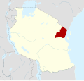
Regions of Tanzania

Last updated

Tanzania's Regions
Mikoa ya Tanzania (Swahili)
Category Unitary republic
Location Tanzania
Number31 (as of 29th January, 2016)
Populations115,588 (Unguja South) – 4,364,541 (Dar es Salaam)
Areas230 km2 (89 sq mi) (Mjini Magharibi) – 76,151 km2 (29,402 sq mi) (Tabora)
Government
  • Regional Government
Subdivisions

Tanzania is administratively divided into thirty-one regions ( mkoa ). [1]

Contents

History

Current Map of the Regions of Tanzania Tanzania, administrative divisions - es - colored.svg
Current Map of the Regions of Tanzania

List of regions

Tanzania is subdivided into 31 administrative regions.

Rank
(Area)
RegionCapitalDistrictsArea
(km2)
Population
(2022) [5]
Rank
(Population)
PostcodeMap
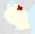
9 Arusha Region Arusha 737,576 km2 (14,508 sq mi)2,356,2551123xxx Tanzania Arusha location map.svg
26 Dar es Salaam Region Dar es Salaam 51,393 km2 (538 sq mi)5,383,728111xxx Tanzania DarEsSalaam location map.svg
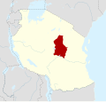
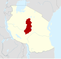
8 Dodoma Region Dodoma 741,311 km2 (15,950 sq mi)3,085,625541xxx Tanzania Dodoma location map.svg
21 Geita Region Geita 520,054 km2 (7,743 sq mi)2,977,608730xxx Tanzania Geita Region location map.svg
12 Iringa Region Iringa 535,503 km2 (13,708 sq mi)1,192,7282451xxx Tanzania Iringa location map.svg
16 Kagera Region Bukoba 825,265 km2 (9,755 sq mi)2,989,299635xxx Tanzania Kagera location map.svg
6 Katavi Region Mpanda 345,843 km2 (17,700 sq mi)1,152,9582550xxx Tanzania Katavi location map.svg
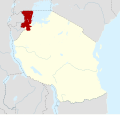
10 Kigoma Region Kigoma 825,265 km2 (9,755 sq mi)2,470,967947xxx Tanzania Kigoma location map.svg
24 Kilimanjaro Region Moshi 613,250 km2 (5,120 sq mi)1,861,9341825xxx Tanzania Kilimanjaro location map.svg
3 Lindi Region Lindi 666,669 km2 (25,741 sq mi)1,194,0282365xxx Tanzania Lindi location map.svg
7 Manyara Region Babati 644,522 km2 (17,190 sq mi)1,892,5021727xxx Tanzania Manyara location map.svg
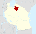
19 Mara Region Musoma 721,760 km2 (8,400 sq mi)2,372,0151031xxx Tanzania Mara location map.svg
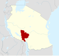
11 Mbeya Region Mbeya 735,954 km2 (13,882 sq mi)2,343,7541253xxx Tanzania Mbeya location map.svg
31 Mjini Magharibi Region
(Zanzibar Urban West)
Zanzibar City 2230 km2 (89 sq mi)893,1692671xxx Tanzania UngujaUrbanWest location map.svg
2 Morogoro Region Morogoro 770,624 km2 (27,268 sq mi)3,197,104467xxx Tanzania Morogoro location map.svg
23 Mtwara Region Mtwara 716,710 km2 (6,450 sq mi)1,634,9472063xxx Tanzania Mtwara location map.svg
25 Mwanza Region Mwanza 79,467 km2 (3,655 sq mi)3,699,872233xxx Tanzania Mwanza location map.svg
20 Njombe Region Njombe 621,347 km2 (8,242 sq mi)889,9462759xxx Tanzania Njombe Region location map.svg
28 Pemba North Region Wete 2574 km2 (222 sq mi)272,0912875xxx Tanzania PembaNorth location map.svg
30 Pemba South Region Chake-Chake 2332 km2 (128 sq mi)271,3502974xxx Tanzania PembaSouth location map.svg
13 Pwani Region Kibaha 732,547 km2 (12,566 sq mi)2,024,9471561xxx Tanzania Pwani location map.svg
18 Rukwa Region Sumbawanga 422,792 km2 (8,800 sq mi)1,540,5192155xxx Tanzania Rukwa location map.svg
4 Ruvuma Region Songea 663,669 km2 (24,583 sq mi)1,848,7941957xxx Tanzania Ruvuma location map.svg
22 Shinyanga Region Shinyanga 518,901 km2 (7,298 sq mi)2,241,2991337xxx Tanzania Shinyanga location map.svg
17 Simiyu Region Bariadi 525,212 km2 (9,734 sq mi)2,140,4971439xxx Tanzania Simiyu location map.svg
5 Singida Region Singida 649,340 km2 (19,050 sq mi)2,008,0581643xxx Tanzania Singida location map.svg
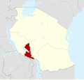
14 Songwe Region Vwawa 527,656 km2 (10,678 sq mi)1,344,6872253xxx Tanzania Songwe location map.svg
1 Tabora Region Tabora 776,151 km2 (29,402 sq mi)3,391,679345xxx Tanzania Tabora location map.svg
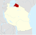
15 Tanga Region Tanga 1126,667 km2 (10,296 sq mi)2,615,597821xxx Tanzania Tanga location map.svg
29 Unguja North Region
(Zanzibar North)
Mkokotoni 2470 km2 (180 sq mi)257,2903073xxx Tanzania UngujaNorth location map.svg
27 Unguja South Region
(Zanzibar South)
Koani 2854 km2 (330 sq mi)195,8733172xxx Tanzania UngujaCentralSouth location map.svg

See also

Notes

    Related Research Articles

    <span class="mw-page-title-main">Mbeya</span> City in Mbeya Region, Tanzania

    Mbeya is a city located in south west Tanzania, Africa, with an urban population of 649,000 in 2023. Mbeya is the capital of the surrounding rural Mbeya region.

    <span class="mw-page-title-main">Kigoma Region</span> Region of Tanzania

    Kigoma Region is one of Tanzania's 31 administrative regions, with the city of Kigoma as the reigonal capital. Kigoma Region borders Kagera Region, Geita Region, Katavi Region, Tabora Region, DRC and Burundi According to the 2012 national census, the region had a population of 2,127,930, which was higher than the pre-census projection of 1,971,332. For 2002–2012, the region's 2.4 percent average annual population growth rate was tied for the fourteenth highest in the country. It was also the sixteenth most densely populated region with 57 people per square kilometer. With a size of 45,066 square kilometres (17,400 sq mi), the region is slightly smaller than Estonia.

    <span class="mw-page-title-main">Mbeya Region</span> Region of Tanzania

    Mbeya Region is one of Tanzania's 31 administrative regions. The region covers an area of 35,954 km2 (13,882 sq mi). The region is comparable in size to the combined land area of the nation state of Guinea Bissau. Mbeya Region is bordered to the east by Singida Region, Iringa Region and Njombe Region. The region is bordered to the south by Malawi and Lake Nyasa. To the north the region borders southern Tabora Region. Lastly, Mbeya is bordered to the west by Songwe Region. The regional capital is the city of Mbeya. According to the 2022 national census, the region had a population of 2,343,754.

    <span class="mw-page-title-main">Mwanza Region</span> Region of Tanzania

    Mwanza Region is one of Tanzania's 31 administrative regions, covering a total land area of 25,233 km2 (9,743 sq mi). The region is comparable in size to the combined land area of the nation state of North Macedonia. Mwanza Region is bordered to the north through Lake Victoria by the Kagera Region and Mara Region, to the east by Simiyu Region, to the south by the Shinyanga Region and to the west by Geita Region. The regional capital is the city of Mwanza. According to the 2022 national census, the region had a population of 3,699,872 and national census of 2012 had 2,772,509. Mwanza Region is the second region with high population in Tanzania after Dar es Salaam Region.

    <span class="mw-page-title-main">Tabora Region</span> Region of Tanzania

    Tabora Region is one of Tanzania's 31 administrative regions located in mid-western part of Tanzania. The regional capital is the municipality of Tabora. Tabora is bordered by Shinyanga to the north, Singida to the east, Mbeya and Songwe to the south. lastly, Katavi, Kigoma and Geita, border Tabora to the west. Tabora is by far the largest region in Tanzania by area. Most of the population in the region is concentrated in the north in Nzega district. According to the 2022 national census, Tabora Region had a population of 3,391,679.

    <span class="mw-page-title-main">Chunya District</span> District of Mbeya Region, Tanzania

    Chunya District is one of the seven districts of Mbeya Region, Tanzania. It is bordered to the north by Tabora Region, to the northeast by Singida Region, to the east by Mbarali District, to the south by Mbeya Rural District, and to the west by Songwe District.

    <span class="mw-page-title-main">Mbarali District</span> District of Mbeya Region, Tanzania

    Mbarali District is one of the five districts of Mbeya Region, Tanzania. It is bordered to the north by Iringa region and east by Njombe region. To the south the district is bordered by Mbeya District and to the west by Chunya District.

    <span class="mw-page-title-main">Mbozi District</span> District in Songwe Region, Tanzania

    Mbozi District is a district in Songwe Region, Tanzania. It is bordered to the north by the Songwe District and Chunya District of the Mbeya Region, to the east by Mbeya Rural District of the Mbeya Region, to the south by the Ileje District and to the west by Momba District.

    <span class="mw-page-title-main">Kyela District</span> District of Mbeya Region, Tanzania

    Kyela is one of the seven districts of Mbeya Region, Tanzania. It is bordered to the north by Rungwe District, to the northeast by Njombe Region, to the southeast by Lake Nyasa, to the south by Malawi and to the west by Ileje District.

    <span class="mw-page-title-main">Mbeya District</span> District of Mbeya Region, Tanzania

    Mbeya City is a district of Mbeya Region, Tanzania and comprises the area of Mbeya town. It is bordered to the north by Mbeya Rural District, to the east by Rungwe District, to the south by Ileje District and to the west by Mbozi District.

    <span class="mw-page-title-main">Manyoni District</span> District in Singida Region, Tanzania

    Manyoni District is one of the six districts in the Singida Region of Tanzania. The district capital is the town of Manyoni. The district is bordered to the north by the Ikungi District, to the east by the Dodoma Region, to the south by the Iringa Region, to the southwest by the Mbeya Region and to the west by the Itigi District. In 2015 the Itigi District was created from the Manyoni District, separating the Itigi Division that was the large portion of the south western of the district.

    <span class="mw-page-title-main">Districts of Tanzania</span>

    As of 2021, there are 31 regions of Tanzania which are divided into 184 districts.

    Nkangamo is an administrative ward in Momba District, Songwe Region, Tanzania. As of the 2022 census, it has a total population of 16,804. According to the 2002 census, the ward was in the Mbozi District and had a total population of 8,122. A 400 kV transmission line is in the planning phase and would terminate within Tanzania around Nkangamo.

    <span class="mw-page-title-main">Geita Region</span> Region of Tanzania

    Geita Region is one of Tanzania's 31 administrative regions. The region covers an area of 20,054 km2 (7,743 sq mi)."Geita Region Size". The region is comparable in size to the combined land area of the nation state of Slovenia. Geita Region is bordered to the east by Lake Victoria, Mwanza Region and Shinyanga Region. The region is bordered by Tabora Region and Kigoma Region to the south and south west respectively. Lastly, Gieta is borders Kagera Region to the west.

    <span class="mw-page-title-main">Katavi Region</span> Region of Tanzania

    Katavi Region is one of Tanzania's 31 administrative regions. The region covers an area of 45,843 km2 (17,700 sq mi). The region is comparable in size to the combined land area of the nation state of Estonia. Katavi Region is bordered to the east by Tabora Region, and to the south by Rukwa Region and Songwe Region. Lastly, Katavi borders DRC on Lake Tanganyika to the west. The region derives its name from Katavi, the spirit of lake Tanganyika. The regional capital city is Mpanda. According to the 2022 national census, the region had a population of 1,152,958.

    <span class="mw-page-title-main">Songwe Airport</span> Regional airport in Mbeya region, Tanzania

    Songwe Airport, usually referred to in flight schedules as Mbeya, is an airport located in the southern highland region of Mbeya Region, Tanzania, serving the city of Mbeya. it is the largest Airport in southwest Tanzania. Also, due to its proximity to the regional border, it serves the Songwe Region as well. It is 20 kilometres (12 mi) west of the city, off the A104 trunk road, and is able to accommodate commercial jet traffic, whereas the unpaved Mbeya Airport is not.

    <span class="mw-page-title-main">Momba District</span> District in Songwe Region, Tanzania

    Momba District is a district of Songwe Region, Tanzania. It is bordered to the north by Lake Rukwa, to the south by Zambia, to the east by the Mbozi District, and to the west by the Rukwa Region. It was formed from the western part of Mbozi District when Songwe Region was created from Mbeya Region.

    <span class="mw-page-title-main">Songwe Region</span> Region of Tanzania

    Songwe Region is one of Tanzania's 31 administrative regions. The region covers a land area of 27,656 km2 (10,678 sq mi). The region is comparable in size to the combined land area of the nation state of Haiti. Songwe Region borders the countries of Zambia and Malawi to the south: Tunduma is the main entry point into Zambia while Isongole is the main entry point into Malawi. Songwe also borders the Tanzanian regions of Rukwa and Katavi in the west, Tabora in the north, and Mbeya in the east. Lake Rukwa is a major body of water in the western part of the region. The region was created on 29 January 2016 from the western half of Mbeya Region. The regional capital is Vwawa. According to the 2022 national census, the region had a population of 1,344,687.

    <span class="mw-page-title-main">Mpimbwe District</span> District in Katavi, Tanzania

    Mpimbwe District is a district council in the Katavi Region of Tanzania's Southern Highlands established in 2012. The district lies in the south of the region on Lake Rukwa.

    <span class="mw-page-title-main">Nsimbo District</span> District in Katavi, Tanzania

    Nsimbo District is a district council in the Katavi Region of Tanzania's Southern Highlands established in 2012. The district lies in the middle of the region east of the city of Mpanda. It is a tropical environment of mostly forest reserves and agricultural economy.

    References

    1. 1 2 "Regions of Tanzania". Statoids. Retrieved 6 December 2014.
    2. "Tanzania: State Gazettes New Regions, Districts". Daily News. Dar es Salaam, Tanzania.
    3. "History". Songwe Regional Commissioner's Office. Retrieved 1 December 2017.
    4. "Welcome to Mbeya Region". Mbeya Regional Commissioner Office. Archived from the original on 22 February 2017. Retrieved 21 February 2017.
    5. "Matokeo ya Sensa". sensa.nbs.go.tz (in Swahili). Dodoma, Tanzania: National Bureau of Statistics (Tanzania). Archived from the original on 31 October 2022. Retrieved 1 November 2022.